Hawaii’s ocean is a working hazard, not a backdrop. The state averages roughly 60 to 70 drownings a year, with visitors dying at roughly 10 times the rate of residents on a per-capita basis. Rip currents drive a significant share of those numbers, especially at unpatrolled breaks where no one is watching the horizon for a swimmer being pulled seaward.
Ocean Safety Honolulu and its neighbor-island counterparts run one of the most trained lifeguard forces in the country, with a color-coded flag system, posted-hazard signs, and towers staffed from mid-morning through late afternoon at the busiest beaches. Newcomers researching a move — or a first trip — often underestimate how narrow the window of safe swimming actually is on any given day.
This article catalogs the flag colors, the escape technique every lifeguard teaches, the historically deadliest breaks on each island, the physical location of guard towers, and the numeric gap between guarded and unpatrolled outcomes. It closes with a packing card and answers to the questions most first-time researchers ask.
Why the ocean is Hawaii’s most consequential hazard
The Hawaii Department of Health tracks drowning as the leading cause of injury death for visitors, ahead of vehicle crashes and falls combined. Roughly two-thirds of visitor drownings happen while the person is snorkeling, wading, or standing in knee-to-chest water — not attempting to swim across a bay. Rip currents pull the unaware into deeper water before they realize the shore is receding.
Residents drown too, but at a very different rate and in different circumstances. Locals more often die in freediving or spearfishing incidents at depth, while visitors typically die close to shore, often within their first 72 hours of arrival. The three-day window is well documented, which is why every hotel concierge should — and many do — hand out a printed ocean-safety card at check-in.
Two structural factors magnify the risk. First, Hawaii sits alone in the middle of the North Pacific with no continental shelf to blunt incoming swell, so wave energy that traveled 2,000 miles arrives with full force. Second, the reef geometry along many beaches funnels retreating water through narrow channels — the exact recipe for a rip current.
How rip currents form on Hawaiian shores
A rip is a river of water flowing away from shore, typically 15 to 30 feet wide, carrying a swimmer at 1 to 3 feet per second — faster than an Olympic freestyler on the return leg. Under swell heights above 4 feet, rip velocities can exceed 5 feet per second in short bursts, faster than any human can swim against.
Three formations are common statewide. Fixed rips run through permanent reef channels — Ke’e Beach on Kauai is a classic example, with a rip that flows out through the reef gap year-round. Flash rips appear on sandy beaches after sustained swell piles water inside a sandbar; they can vanish and re-form within hours. Structural rips form beside jetties, groins, and rocky headlands.
Recognizing a rip from the sand is a skill. Watch for a darker, calmer strip cutting perpendicular to breaking waves. That is not the safe channel — that is the exit. Foam, seaweed, or discolored water moving offshore is another tell. On a day with defined breakers on either side of a flat lane, the flat lane is almost always the rip.
Swell direction and season matter
North-facing shores get their large swell from October through April; south-facing shores get theirs June through September. East (windward) shores see year-round tradewind swell that rarely stops. Anyone tracking the Hawaii surf season pattern can predict which coasts will produce rip-heavy conditions week to week.
The National Weather Service Honolulu office issues a High Surf Advisory when faces exceed 6 to 8 feet on the north shores or 4 to 6 feet on the south. A High Surf Warning kicks in above 15 to 25 feet depending on shore aspect. Rip generation scales roughly with the square of wave height, so a Warning-level day is exponentially, not linearly, more dangerous.
The Ocean Safety colored-flag system decoded
The City and County of Honolulu, the County of Maui, Kauai County, and Hawaii County all use the same four-color flag scheme at staffed lifeguard towers. The color signals hazard, not a rule, but ignoring a red or purple flag at a guarded break is functionally an invitation for a rescue.
| Flag color | What it means | Typical conditions | Recommended action |
|---|---|---|---|
| Green | Low hazard | Waves under 2 ft, no rip forecast | Swim within guarded zone; stay aware |
| Yellow | Medium hazard | Waves 2 to 4 ft, moderate currents | Strong swimmers only; check with lifeguard |
| Red | High hazard | Waves 4 to 8 ft, active rip currents | Do not enter above the knee |
| Double red | Water closed | Waves over 8 ft or dangerous shorebreak | Do not enter the water at all |
| Purple | Marine life hazard | Box jellyfish, man-of-war, or shark sightings | Avoid water until raised |
Purple flags are frequently raised on the 8-to-10-day box jellyfish cycle following each full moon at Waikiki, Ala Moana, and Hanauma Bay. A purple flag does not override a red or double red — a beach can fly both, meaning both the current and the marine life are hostile that day.
Posted signs at every state beach park additionally list specific hazards: Strong Current, Sharp Coral, Sudden Drop-off, Dangerous Shorebreak, and High Surf. Each sign is legally required under Hawaii Administrative Rules Title 13, and each is tied to a documented incident history at that specific break.
The single escape technique that saves lives
Every ocean safety officer in Hawaii teaches the same protocol for a swimmer caught in a rip: do not fight the current back to shore. The current is stronger than any human, and exhaustion causes almost every drowning attributed to rips. Instead, swim parallel to shore — typically 30 to 50 yards — until the current releases, then angle back to the beach on the breaking waves.
The parallel distance matters. Rips are narrow rivers. Once outside the channel, the water outside is often calmer than what a panicked swimmer sees. The direction to swim is not fixed: watch which side has smaller waves, or which side is closer to a lifeguard tower, and go that way.
If exhaustion is closing in before escape, float on the back, raise one arm straight up, and wave slowly. This is the universal distress signal recognized by every Ocean Safety lifeguard from Ka’anapali to Poipu. Panic swimming vertical is what causes secondary drowning — the swimmer inhales water while thrashing.
What to teach children before they ever hit the sand
- Never turn your back to the ocean, even when knee-deep.
- If the sand pulls under your feet, get out and reset.
- Wave one arm and shout “help” if you cannot touch bottom.
- Always swim in front of a lifeguard tower, never past a red flag.
- Never dive head-first into unknown water — necks break in shorebreak.
Top drowning breaks by island
Data from the Hawaii Drowning and Aquatic Injury Prevention Advisory Committee tracks fatalities by beach going back to 1970. Civil Beat and state health researchers have flagged a short list of breaks that accounts for a wildly disproportionate share of deaths across five decades — the same names appear year after year.
| Beach | Island | Documented fatalities 1970 to 2024 | Primary hazard |
|---|---|---|---|
| Hanakapiai Beach | Kauai | 85+ | Rip current, no lifeguard, remote |
| Sandy Beach | Oahu | 60+ | Shorebreak, neck injuries, strong rips |
| Makena (Big Beach) | Maui | 40+ | Shorebreak, undertow, rip current |
| Queen’s Bath | Kauai | 30+ | Sneaker waves, rocky exit |
| Kaena Point | Oahu | 20+ | Extreme surf, isolated, no cell service |
| Ke’e Beach | Kauai | 15+ | Reef-channel rip, winter closure period |
Oahu: Sandy Beach and the Ka Iwi coast
Sandy Beach on the southeast Ka Iwi coast is Oahu’s most dangerous body-surfing break and a documented magnet for neck and spinal injuries. The shorebreak lands directly on hard-packed sand, and rip currents pull sideways along the base of Makapu’u toward the point. The Sandy shorebreak lifeguard post covers the break daily, but experienced local bodysurfers are the ones who make it look survivable.
Nearby Makapu’u, Halona Cove (Eternity Beach), and Yokohama Bay on the leeward tip also see multiple rescues a year. Ala Moana Beach Park by contrast, though inside a reef-protected channel, still averages 2 to 3 drownings a year — usually from swimmers caught in the exit channel near Magic Island.
Maui: Makena and the south coast
Makena’s Big Beach carries some of the most powerful shorebreak in the state, with wave faces regularly hitting 8 to 12 feet on south swells between June and September. The single lifeguard tower opened in 2007 after a spate of paralysis injuries. Little Beach next door is technically safer but nearly always unpatrolled, and Oneloa’s neighboring point rips can pull swimmers past the headland.
The May-through-September south-swell pattern affects Maui identically. Ho’okipa on the north shore sees winter rescues on windswell rips, and Ka’anapali’s rip current at Black Rock (Pu’u Keka’a) is a chronic pull-over spot for snorkelers who drift past the point without noticing.
Kauai: Hanakapiai and the Na Pali coast
Hanakapiai Beach at the two-mile mark of the Kalalau Trail carries the grim distinction of the highest documented drowning count of any Hawaii beach. A sign at the trailhead currently lists over 85 deaths. There is no lifeguard, no cell service, and the beach is a mile from any road. Rip currents form on almost any day of swell, and the closest rescue asset is a fire department helicopter.
Ke’e Beach at the end of Kuhio Highway sits inside a reef with a well-defined channel rip — safe inside the reef, dangerous the moment a swimmer crosses. Queen’s Bath in Princeville has claimed 30-plus lives to sneaker waves that overtop the lava shelf. Poipu on the south shore is comparatively benign but still fires a rip on summer south swells.
Big Island: Hapuna and Kua Bay
The Kohala coast beaches of Hapuna and Kua Bay carry a steep drop-off within 20 to 30 feet of shore, which sets up powerful shorebreak and pull-out rips. Hapuna’s north end has claimed roughly a dozen swimmers since 2000. Kua Bay is fully unpatrolled and closes to swimming when its 6-foot shorebreak fires.
On the east side, the black sand beaches of Punalu’u and Kehena have moderate documented rips, and Kehena in particular has no lifeguard tower. Anyone considering the move to a neighbor island should factor in the smaller lifeguard staffing on the Big Island — fewer towers per mile than Oahu.
Lifeguard-post directory by island
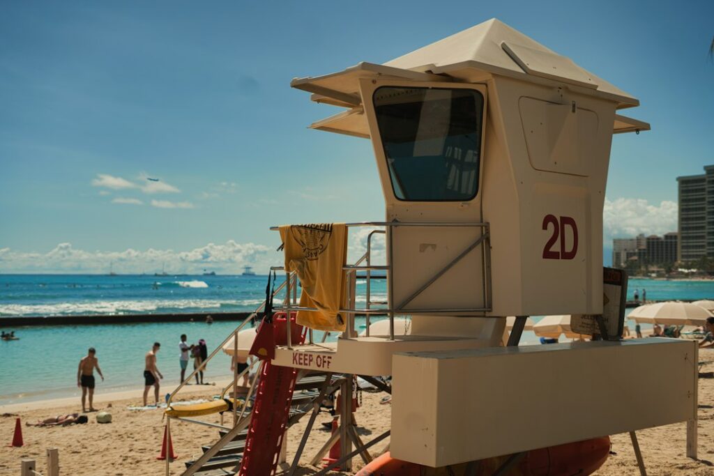
Ocean Safety towers are staffed roughly 9 a.m. to 5:30 p.m., seven days a week, subject to weather and staffing. Some Oahu towers open at 8 a.m. in summer. The neighbor islands operate a leaner network, meaning long stretches of coast are functionally unpatrolled outside a handful of parks.
Oahu lifeguard towers (43 total)
- South shore: Ala Moana, Kaimana, Kuhio, Waikiki, Diamond Head, Hanauma Bay.
- Southeast: Sandy Beach, Makapu’u, Waimanalo Bay, Bellows.
- Windward: Kailua, Kualoa, Ka’a’awa, Punalu’u, Hau’ula, Malaekahana.
- North Shore: Sunset, Ehukai (Pipeline), Waimea Bay, Haleiwa, Chun’s Reef.
- Leeward: Ko Olina, Ma’ili, Nanakuli, Makaha, Keawa’ula (Yokohama).
Maui lifeguard towers (11 total)
- West side: DT Fleming, Hanaka’o’o (Canoe Beach), Ka’anapali.
- South: Kama’ole III, Makena Big Beach, Wailea rotating tower.
- North: Ho’okipa (winter staffing), Baldwin Beach.
- Hana coast: only Hana Bay is patrolled seasonally.
Kauai lifeguard towers (10 total)
- South: Poipu, Salt Pond, Kekaha.
- East: Lydgate, Kealia, Hanamaulu.
- North: Hanalei, Ha’ena (near Ke’e), Anini (seasonal), Kapa’a.
Big Island lifeguard towers (9 total)
- Kona side: Hapuna, Magic Sands (La’aloa), Spencer Park, Kahalu’u.
- Hilo side: Honoli’i, Richardson, Onekahakaha.
- Kau: Punalu’u (seasonal), Whittington Park.
The safety gap between guarded and unpatrolled water
The clearest statistic in Hawaii ocean safety research: at guarded beaches, the drowning rate is roughly 1 per 18 million visits. At unpatrolled beaches, the rate is roughly 1 per 4.5 million visits — four times higher, and the number climbs steeply on remote coasts with no signal, no signage, and no bystander who has ever seen a rescue attempted.
| Location type | Approximate drowning rate | Rescue response time | Cell coverage |
|---|---|---|---|
| Guarded main-park beach | 1 per 18 million visits | Under 60 seconds | Full |
| Unpatrolled roadside beach | 1 per 4.5 million visits | 10 to 20 minutes (EMS) | Partial |
| Remote hike-in beach | 1 per 800,000 hikers (Hanakapiai) | 45 to 90 minutes (helicopter) | None |
The Hawaii News Now archives regularly cover incidents at exactly the beaches above, and the pattern is stubborn: a visitor unfamiliar with the break, no lifeguard, and a swell that had not looked dangerous from the sand. Households researching relocation should factor beach location into where they end up living, especially with kids.
Reading the ocean before entering
Every ocean safety training program stresses a 5- to 10-minute observation period before the first entry of the day. Wave sets in Hawaii arrive in groups every 12 to 18 seconds, and the largest set of the hour can be 40 percent taller than the average. Watching only two or three sets can badly underestimate the day’s peak.
Cues to watch for during observation:
- Wave face height at the point of break, not the horizon.
- Whitewater direction — hooking sideways or straight in?
- Foam or debris drifting seaward through a quiet lane.
- Where surfers or bodyboarders are drifting between sets.
- Position and posture of the lifeguard — standing usually means alert.
The National Weather Service Honolulu forecast, updated four times daily, publishes surf heights by shore aspect and rip-current risk categories from low to high. Checking that forecast before leaving lodging is a five-minute investment that materially changes the outcome of a beach day.
Water temperature and cold shock
Hawaii ocean temperatures range from roughly 74°F in February to 81°F in September. That is warm enough to remove cold-shock risk for most adults, but a swimmer treading water for 30 minutes at 74°F still loses core temperature faster than expected. Children under 10 and adults over 65 lose heat 2 to 3 times faster than a fit adult, per state EMS training material.
Packing card and pre-entry checklist
A minimal ocean safety kit costs roughly $60 to $120 and fits in a beach bag. It is not overkill; it is what the Ocean Safety officers themselves would want a first-timer to carry.
| Item | Approx. cost | Why it matters |
|---|---|---|
| Reef-safe SPF 50 mineral sunscreen | $18 | Legal requirement; prevents burn-driven exit |
| Rash guard (long sleeve) | $28 | Sun protection, minor jellyfish shield |
| Reef shoes or Vibram-sole sandals | $40 | Volcanic rock cuts sever tendons quickly |
| Waterproof phone pouch with lanyard | $15 | Keeps 911 reachable at wet parks |
| Bright cap or hat (spotter visibility) | $20 | Makes head visible in white water |
| 1 L water bottle per person | $0 refill | Cramps kill more swimmers than sharks |
Pack a printed hazard card too, especially for kids or older parents visiting. The card should list the flag colors, the parallel-swim escape, and the fact that any raised arm and shout is a distress signal — not a wave hello.
Pre-entry checklist for every beach day
- Check the NWS surf and rip forecast that morning.
- Confirm the beach is patrolled today and note tower hours.
- Observe waves for 10 minutes before entry.
- Identify the closest rip lane and avoid it.
- Tell a companion where you are entering and swimming to.
- Never swim alone at an unfamiliar break.
Special situations: hikes, snorkel, and shore fishing
Rips do not only catch swimmers. Snorkelers are the single largest visitor drowning category, often carried offshore by a channel current while looking down at reef. Fatigue and mask panic follow within minutes. Any snorkel trip beyond the inner reef — including Turtle Town at Maluaka — should be planned with a companion and an inflatable safety float.
Shore fishermen die at outsized rates on the Big Island and Kauai from sneaker waves washing them off basalt shelves. Ka Lae (South Point), Ma’alaea, and the entire Na Pali cliff base are notorious. If a shelf is wet, a wave has already reached it in the last 30 minutes.
Kayakers and paddleboarders should never launch on a red flag day. The Mokoli’i paddle from Kualoa is straightforward in flat water but genuinely dangerous when tradewinds gust above 20 knots, which happens most afternoons between May and September.
When lifeguards raise the double red
Double red means the water is closed. Ocean Safety officers can and do cite violators under city and county ordinances — $500 fines have been issued at Waimea Bay during 30-foot swell days. On days like the Eddie Aikau invitational trigger threshold (40-foot faces), even shorebreak beaches such as Makapu’u and Sandy will fly double red for compression risk.
The City and County of Honolulu and county emergency management offices publish real-time closures during major swell events, cross-posted to the Ocean Safety social feeds and county alert systems. Anyone signed up for county emergency alerts will get a text when a beach closure is issued.
Understanding wave-height math
Hawaiian wave measurement often uses a backside convention, meaning a wave called 10 feet locally has a face height of roughly 15 to 20 feet from trough to crest. National Weather Service forecasts use face height, so an NWS 8-foot high surf advisory is not the same as a local surfer saying it is 4 feet Hawaiian. Newcomers should assume face height for safety planning.
Special seasonal patterns to plan around
Winter (November to March) puts the largest and most dangerous swell on the north-facing shores of every island. The Honolulu Star-Advertiser tracks these events closely, and this is when Kauai’s north shore closes toward Ke’e Beach and Waimea Bay on Oahu can go weeks without a safe swim day. Summer shifts hazard to south-facing shores, including Waikiki on high south swells.
Shoulder seasons (April to May, October) tend to have the calmest overall conditions, but the ocean can still fire on any given day. Planning around the best time to visit each island is as much about ocean access as it is about accommodation cost.
Households doing inter-island travel should also match itinerary to swell forecast — moving from Oahu to Kauai during a large north swell moves the family from one closed north shore to another, whereas moving to Maui’s south side puts them in far calmer water.
Frequently asked questions
Are Hawaii rip currents worse than mainland ones?
They are typically stronger because of open-ocean swell and reef geometry, but not fundamentally different in mechanics. The parallel-swim escape works identically. What differs is the lack of a continental shelf, which means Hawaiian rips can pull a swimmer into 50 feet of water within 100 yards of shore, faster than in Florida or California.
What color flag means the beach is closed?
Double red means the water is closed and entering it can result in a citation. Purple means a marine-life hazard such as box jellyfish or a shark sighting. A beach can fly both simultaneously. Green means low hazard but still requires attention, and yellow means medium hazard where only strong swimmers should enter the water.
Which Hawaii beach has recorded the most drownings?
Hanakapiai Beach on Kauai’s Na Pali coast has the highest documented count, with the trailhead sign listing over 85 fatalities. The beach is a two-mile hike with no lifeguard, no cell service, and a rip current that fires on almost any swell. Rescue response requires a fire department helicopter, which takes 45 to 90 minutes.
Can a strong swimmer beat a rip current?
No swimmer, regardless of fitness, can outswim a moderate rip current in a straight line back to shore. Rip velocity of 3 to 5 feet per second exceeds Olympic-caliber freestyle sprint speed on a sustained basis. The only reliable escape is to swim perpendicular to the current — parallel to the beach — for 30 to 50 yards until released.
What should someone do if a family member is caught in a rip?
Do not enter the water to attempt a rescue without a flotation device — bystander drownings are common. Immediately alert the nearest lifeguard, dial 911 if none is present, and throw a floatable object (cooler lid, boogie board, empty water bottle). Keep visual contact and shout instructions to swim parallel to shore rather than fighting back.
Are Waikiki and Ala Moana safe for beginner swimmers?
Waikiki’s reef-protected inner lagoon is one of the safest patrolled swim zones in Hawaii, though summer south swells can push waves over the reef. Ala Moana is generally calm inside the reef but has a documented exit-channel rip near Magic Island that produces multiple rescues per year. Both beaches are heavily lifeguarded during daylight hours.
Do lifeguards patrol Hawaii beaches all year?
Yes at main parks — Ocean Safety towers staff daily year-round, typically 9 a.m. to 5:30 p.m., with summer extensions at some Oahu locations to 8 a.m. Certain seasonal towers such as Anini on Kauai and Ho’okipa on Maui operate only during peak swell seasons. Neighbor islands have fewer towers than Oahu, so many stretches of coast are unpatrolled entirely.
Where can households find real-time beach hazard information?
The Hawaii Beach Safety website, run by the University of Hawaii and Ocean Safety, publishes current flag status, hazards, and wave forecasts for every patrolled beach. The National Weather Service Honolulu office issues rip-current outlooks four times daily. County emergency alert signup provides text notifications for double-red closures at any staffed beach.