Sandy Beach Park sits along Oahu’s Ka Iwi shoreline about 10 miles east of Waikiki, at the point where Kalanianaole Highway curves past Koko Head Crater and drops down toward Makapuu. The park has a reputation ocean safety officials have tried to publicize for decades. Its shorebreak concentrates wave energy over a shallow sandbar and produces plunging closeouts that fold onto the sand with startling force.
Local bodyboarders and shore-break specialists regard Sandys as one of the finest waves of its kind in the state. Emergency medical crews regard the same stretch as a chronic source of spinal cord and neck trauma. Both descriptions are accurate. The wave rewards technique and punishes hesitation, and the difference between a clean ride and a hospital visit can amount to a half-second of miscalculation on the takeoff.
This guide describes how the shorebreak forms, why the injury rate stays high, where the lifeguard towers sit, how the red and yellow flag system works, and what a first-time visitor from the mainland should understand before stepping onto the sand. It also covers the drive from Waikiki, parking realities on weekends, and a substantially calmer alternative at Waimanalo six miles further east.
Where Sandy Beach sits on the Ka Iwi coast
The Ka Iwi shoreline runs from Koko Head to Makapuu Point along the southeastern corner of Oahu. It is a treeless, wind-scoured coast of black lava headlands and short pocket beaches, protected as a state scenic shoreline since 1984. Sandy Beach Park occupies roughly half a mile of the run, between the Halona Blowhole pullout and the Makapuu Lookout.
The beach itself is a narrow crescent of coarse tan sand backed by low dunes and a paved parking area. Behind it rises the caldera wall of Koko Crater, which channels northeast trade winds down and across the sand toward the water. That geometry is not incidental — it helps produce the offshore breeze that keeps Sandys’ waves standing up and hollow rather than crumbling.
Water depth drops from ankle deep to shoulder deep within a distance a swimmer can cross in three strides. The sand bar sits close enough to shore that swells feel the bottom and pitch forward almost on the beach itself. That geometry is the entire story of the shorebreak and, by extension, the entire story of why the park’s injury log runs so long.
Coordinates and elevation
Sandy Beach Park is located at approximately 21.286° N, 157.673° W. The beach face sits essentially at sea level, but the parking lot rises about 15 feet above the sand. The park entrance from Kalanianaole Highway is at mile marker 15. Two lookouts flank the park — Halona to the west, Makapuu to the east — each about 1.5 driving miles away.
The wave physics that make Sandys dangerous
Shorebreak forms when swell energy that has traveled thousands of miles across open ocean encounters a steeply rising bottom close to shore. The wave’s base slows abruptly while its crest keeps moving forward, so the face pitches vertical and then throws — a plunging break rather than a spilling one. At Sandys the plunge lands in one to three feet of water directly onto packed sand.
Ocean Safety and University of Hawaii coastal researchers have measured typical Sandys wave faces at 3–6 feet on a summer south swell and 4–8 feet during winter south combinations. Wave periods run 8 to 14 seconds. The shore-normal orientation and the shallow bank mean nearly every wave closes out along the full length of the beach rather than peeling in one direction.
A closeout is a wave that breaks all at once instead of forming a shoulder that a rider can angle across. Experienced bodyboarders exit closeout barrels by rolling out the back or diving through the face; inexperienced swimmers get pile-driven headfirst into the sandbar.
That single dynamic — full-length closeout landing on shallow sand — is what separates Sandy Beach from most other Oahu breaks. For seasonal context on when swells arrive, the Hawaii surf season guide maps the swell calendar around the islands.
Why the shorebreak stays consistent
The Ka Iwi coast faces east-southeast into open ocean. It has no reef offshore to filter or refract incoming swells, and no protective headland north or south of the beach itself. Swell energy arrives essentially unmodified from either the North Pacific during winter or the Southern Hemisphere during summer. There is almost no season when Sandys goes flat for more than a few days.
The dune backshore also amplifies the effect. Water that surges up the beach face has nowhere to dissipate — it stalls, drains back through the sand, and meets the incoming wave in a strong backwash. That backwash lifts and steepens the following wave, which is why Sandys often feels more powerful than raw swell size would predict.
The following table summarizes typical wave conditions logged at Sandy Beach across a calendar year.
| Season | Face height | Period | Primary swell | Closeout share |
|---|---|---|---|---|
| Winter (Nov–Mar) | 4–8 ft | 10–14 sec | NW wrap + local SE | 85% of sets |
| Spring (Apr–May) | 2–4 ft | 8–11 sec | South-southeast | 70% of sets |
| Summer (Jun–Sep) | 3–6 ft | 10–14 sec | Southern Hemisphere | 80% of sets |
| Fall (Oct) | 2–5 ft | 9–12 sec | Mixed swell trains | 75% of sets |
Injury statistics reported by Ocean Safety
The Honolulu Emergency Services Department, which runs Ocean Safety and Lifeguard Services under the City and County of Honolulu, publishes annual rescue and incident totals for each patrolled beach. Sandy Beach consistently ranks in the top three Oahu parks for spinal-injury calls, despite drawing fewer total visitors than Waikiki or Ala Moana.
Ocean Safety’s multi-year figures place Sandy Beach at roughly 30 to 50 documented neck and spine incidents per year, with rescues totaling well over 400 annually. The Hawaii State Department of Health has repeatedly identified shorebreak-related trauma as one of the state’s leading preventable-injury categories among visitors, and Sandy Beach carries the largest share of those cases.
The injury pattern is remarkably consistent. Victims are usually male, usually between 18 and 45, usually first-time visitors to the beach, and usually swimming rather than bodyboarding. Impact almost always occurs when a wave picks the swimmer up and drives them down onto the shallow sandbar, compressing the cervical spine.
Rescue crews and hospital reports available through the Hawaii Department of Health confirm the pattern year after year. Public awareness campaigns, translated warning signs, and lifeguard verbal warnings have reduced the rate somewhat over the past decade but have not eliminated it.
What “spinal injury” actually means here
The reported injuries range from bruised vertebrae and stinger neck syndrome to complete quadriplegia. Ocean Safety records at least one to three catastrophic spinal cord injuries per year at Sandy Beach, with additional less severe cases that still require ambulance transport and days of hospitalization. Local news outlets including the Honolulu Star-Advertiser have covered the pattern extensively.
The mechanism is worth understanding because it feels counterintuitive. Swimmers assume a 4-foot wave in 2 feet of water is safer than a 4-foot wave in 20 feet of water. The opposite is true — the shallow water is what turns the wave from a rolling body of water into a percussive impact against the sand bottom.
Lifeguard tower placement and staffing
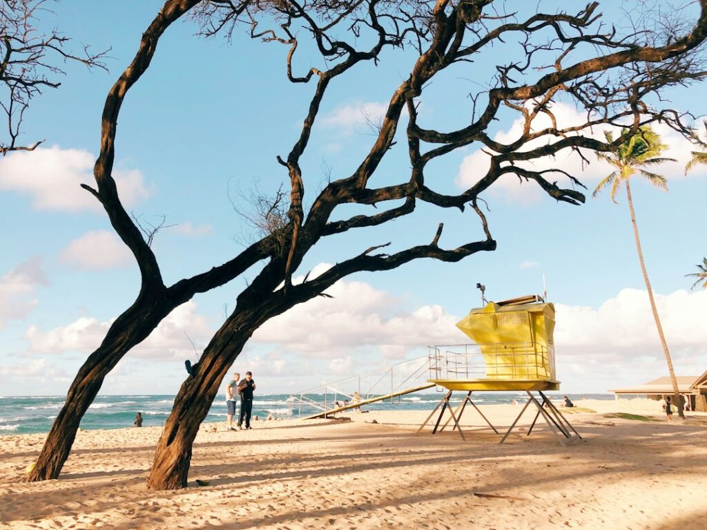
Sandy Beach Park is staffed with two primary lifeguard towers plus a mobile ATV response unit. Tower 1B sits at the west end of the beach near the pavilion, and Tower 2B sits toward the east end near the volleyball courts. A third seasonal tower is sometimes deployed during peak summer weekends when crowds exceed roughly 800 people on the sand.
Standard staffed hours run 9 a.m. to 5:30 p.m., seven days a week, year-round. Response times from tower spot to waterline generally fall under 30 seconds thanks to elevated sightlines and the beach’s linear layout. Ocean Safety crews at Sandy Beach also carry cervical collars and backboards on-tower rather than in a distant supply shed, given the site’s injury profile.
Guards at Sandys are typically drawn from the more experienced ranks of Ocean Safety. Many rotate through from the North Shore during the summer months when Sunset and Pipeline see fewer crowds. Local surf and lifeguard heritage feature prominently in island media, from documentaries to films — a topic explored in the Hawaiian pidgin in pop culture piece on the site.
What guards actually shout
Whistles and hand signals at Sandys carry specific meanings. One short blast usually means “move over” or “look here.” Two blasts means “get out of the water now.” A long continuous blast signals an active rescue in progress and asks other swimmers to clear the area. Ignoring a two-blast whistle is the fastest way to be surf-checked out of the water for the day.
Flag system and daily posted protocol
Ocean Safety uses a color-coded flag system posted on each lifeguard tower and at the beach entrance. The flag reflects the guard’s real-time reading of shorebreak conditions, current, wind, and observed injury frequency in the previous hour or two. Beachgoers who ignore posted flags rarely receive a second warning before being ordered out of the water.
The system is straightforward once decoded. Green means normal caution — waves are running but conditions match average visitor ability. Yellow means moderate hazard — swimmers should stay in ankle-deep water only. Red means high hazard, no swimming, no bodyboarding, and shoreline entry only for experienced water users at their own risk.
A black flag occasionally appears when the water is fully closed to public entry — this is rare but does happen during major south swells or after shark incidents. When black flies at Sandys, guards physically clear the beach and post at the waterline until conditions ease.
| Flag color | Meaning | Typical wave face | Recommended activity |
|---|---|---|---|
| Green | Normal caution | Under 3 ft | All swimming and bodyboarding |
| Yellow | Moderate hazard | 3–5 ft | Wading and shorebreak experts only |
| Red | High hazard | 5–8 ft | No swimming; experts at own risk |
| Black | Water closed | 8+ ft or emergency | Beach cleared, no entry |
The posted warning signs
Permanent signage at every beach entrance and along the paved walk explicitly warns of spinal injury risk from shorebreak. The signs use pictograms, English, Japanese, Korean, and simplified Chinese, reflecting the visitor demographics that arrive daily. First-time visitors who read only the pictograms sometimes miss the specific wording about broken necks — which is why the warnings appear in multiple languages.
The 10-mile drive from Waikiki via Kalanianaole Highway
The drive from Waikiki to Sandy Beach covers roughly 10 miles and takes 22 to 45 minutes depending on traffic. Route 72, better known as Kalanianaole Highway, exits Waikiki through Kapahulu, passes Diamond Head and Kahala, then hugs the coastline through Aina Haina, Niu Valley, Hawaii Kai, and up over Koko Head Regional Park.
Traffic timing matters. Weekday mornings between 6 a.m. and 8:30 a.m. see heavy inbound commuter volume, so an outbound drive to Sandys is usually clear. Sunday mid-morning is the most congested outbound window as families and church groups head to the eastside beaches. Hawaii Department of Transportation live traffic feeds are available at the state DOT site.
Rental cars from Honolulu airport should budget an additional 25 minutes for the segment from the airport out through downtown before joining Kalanianaole. Anyone comparing Oahu lodging tradeoffs — proximity to eastside beaches versus resort clusters west of the airport — can find that analysis in the Waikiki vs Ko Olina stay comparison.
Key waypoints along the drive
The route strings together landmarks that most rental drivers will recognize by name. In order from Waikiki outbound: Diamond Head Road turnoff, Kahala Mall, Aina Haina Shopping Center, Koko Marina, Hanauma Bay entrance, Halona Blowhole pullout, then Sandy Beach itself. From Sandys the road climbs to Makapuu Lookout and drops toward Waimanalo on the windward side.
- Waikiki to Diamond Head Road: 2.2 miles, 8 min average
- Diamond Head to Hawaii Kai: 6.5 miles, 15 min average
- Hawaii Kai to Hanauma Bay: 1.4 miles, 4 min
- Hanauma Bay to Halona Blowhole: 1.1 miles, 3 min
- Halona Blowhole to Sandy Beach: 0.9 miles, 2 min
- Sandy Beach to Makapuu Lookout: 1.8 miles, 4 min
- Makapuu Lookout to Waimanalo Beach: 3.2 miles, 7 min
Parking, restrooms, and beach facilities
Sandy Beach Park has three paved parking areas totaling roughly 180 marked stalls. The main lot at the west entrance holds about 100 vehicles, the center lot around 50, and the east overflow lot near the volleyball courts about 30. Additional roadside pullouts along Kalanianaole can fit another 40 or so cars but require careful shoulder parking.
On weekends between 10 a.m. and 3 p.m., all three lots typically fill by mid-morning. Arrival before 9 a.m. or after 3:30 p.m. is the reliable strategy for a marked stall. Weekday mornings usually have open parking except during summer break and school holidays, when local families arrive earlier.
Facilities on-site include restrooms with cold outdoor showers, a covered pavilion at the west end, picnic tables, and a paved walking path along the top of the dune line. There is no food concession on-site — the nearest food is 4 miles west at Hawaii Kai, where a cluster of eateries operates around Koko Marina Center. Vehicle food options across the island are covered in the best food trucks on Oahu guide.
| Lot | Stalls | Weekday fill | Weekend fill | Notes |
|---|---|---|---|---|
| Main west lot | ~100 | 11:00 a.m. | 9:30 a.m. | Nearest to pavilion |
| Center lot | ~50 | 12:00 p.m. | 10:00 a.m. | Direct beach access |
| East volleyball lot | ~30 | 1:00 p.m. | 11:00 a.m. | Closest to east tower |
| Kalanianaole shoulder | ~40 | Not restricted | Not restricted | Highway pullout only |
Fees, hours, and closures
Sandy Beach Park is free to enter and free to park — no fees apply for either residents or visitors, unlike Hanauma Bay just west. Gates are open from sunrise until 10 p.m. year-round, though most beachgoers leave by sunset. The park occasionally closes for scheduled events like the Sandy Beach Rough Water Swim, held annually each August.
Visitor versus local usage split
The user mix at Sandy Beach tilts more heavily local than most other easily accessible Oahu beaches. Estimates from Ocean Safety and University of Hawaii recreation surveys place daily use at roughly 60 to 70 percent local residents and 30 to 40 percent out-of-state visitors, compared with Waikiki’s overwhelmingly visitor-dominated mix.
Locals cluster around the east end of the beach near the volleyball courts and the primary bodyboarding takeoff zone. Visitors more often plant beach chairs at the west end near the pavilion and the main parking lot. This informal segregation is not enforced but reflects wave knowledge — the eastern takeoff is where the cleanest hollow shore-break forms on typical swells.
The split matters for safety. Local water users know when to sit out a set, when to duck, and when to abandon a wave and swim for the flats. Visiting swimmers often do not, and the injury pattern reflects that gap. Ocean Safety publications note that a disproportionate share of serious injuries occur among users whose first Hawaii beach day is at Sandys.
Bodyboarding, skimboarding, and sponging culture
Sandy Beach is one of the epicenters of Oahu bodyboarding, and the sport has produced generations of local competitors. On any weekday afternoon a rotating cast of teenagers and twenty-somethings works the takeoff zone with flippered kicks, drop-knee turns, and inverted rolls. Skimboarders operate at the shore’s edge on the wash, catching backwash rebounds rather than direct shorebreak.
Etiquette follows a strict but unspoken pecking order. Regulars ride nearer the peak; visitors and dropped-in riders are expected to give way. Cutting off a local rider — dropping in on their wave — draws sharp verbal correction. First-time visitors are welcomed if they stay wide and watch before joining the lineup.
Safer swim alternative at Waimanalo six miles east
For beachgoers who arrive at Sandy Beach and take one look at the shorebreak before deciding it is not for them, the good news is that a substantially calmer alternative sits six road-miles further east. Waimanalo Bay Beach Park stretches for nearly three miles along the windward coast with a gently sloping bottom, small ankle-slapping waves on most days, and full lifeguard coverage.
The drive from Sandy Beach to Waimanalo takes 12 to 18 minutes over Makapuu Head and past Sea Life Park. The road climbs from sea level to about 500 feet at the pass, then descends into the flat coastal plain of Waimanalo town. Total distance from Sandy Beach parking to Waimanalo Beach Park parking runs approximately 6.2 miles.
Waimanalo has the same warm 76–80°F water year-round but almost none of the shorebreak hazard. It is the beach where Honolulu families take their toddlers, and where visitors who want to actually swim without pile-driving into sand should go instead. The nearby town of Kailua and its beaches sit a few miles further up the coast — profiled in the best neighborhoods in Kailua guide.
Comparing Sandy Beach and Waimanalo
| Feature | Sandy Beach | Waimanalo Bay |
|---|---|---|
| Wave face typical | 3–6 ft plunging | 1–2 ft rolling |
| Bottom profile | Steep shallow bar | Gently sloping |
| Water temp | 76–80°F | 76–80°F |
| Lifeguard towers | 2 primary | 2 primary |
| Best for | Bodyboarding experts | All-ages swimming |
| Drive from Waikiki | 10 miles, 25 min | 16 miles, 40 min |
| Annual spinal injuries | 30–50 reported | Under 5 reported |
Other nearby swimming alternatives
Between Sandy Beach and Waimanalo, several smaller pocket beaches accept safer entry. Makapuu Beach at the base of Makapuu Head is protected on most swells and often has better swimming than Sandys, though currents can be strong when north swells wrap. The full ranked list of the island’s beaches appears in the 12 best beaches on Oahu guide.
- Makapuu Beach: 1.5 miles east, protected pocket
- Kaupo Beach Park: 3 miles east, small keiki pool
- Waimanalo Bay Beach Park: 6.2 miles east, three miles of sand
- Bellows Field Beach Park: 8 miles east, open weekends only
- Kailua Beach Park: 11 miles north, wider bay
Practical preparation for a visit
What visitors bring makes a real difference at Sandys. Reef-safe sunscreen matters — Hawaii banned oxybenzone and octinoxate in 2021, and enforcement is active. A rash guard cuts sunburn dramatically given the treeless coastline and lack of natural shade. Water shoes are optional at Sandys itself since the entry is sand, not reef.
Cash matters less than at many Oahu beaches because parking is free, but a fully charged phone in a waterproof pouch is worth carrying. Cell service on the Ka Iwi coast is generally strong on all three major carriers. There are no public locker facilities, so leaving valuables in a locked car trunk is standard practice.
Wind at Sandys blows offshore on typical northeast trades, which is why the wave stands up. That same wind sandblasts unattended towels and hats — anchor loose gear or expect to chase it into the parking lot.
What to pack
- Reef-safe sunscreen SPF 30 or higher, reapplied hourly
- Rash guard or UV shirt for long shore time
- Two liters of water per person minimum
- Wide-brim hat or cap secured with a chin cord
- Waterproof phone pouch on a neck lanyard
- Cash or card for food at Hawaii Kai on the return
- Small first aid kit including saline for sand-in-eye rinse
Weather, wind, and best time windows
Ka Iwi coastal weather runs 75–88°F air temperature year-round with 60–75 percent humidity. Rainfall is low — the leeward Koolau slopes shelter the coast — averaging under 20 inches per year at the parking lot. The wettest months are November through February, and even those rarely deliver more than a passing shower before trades push the clouds through.
Trade winds blow 10–25 mph from the east-northeast on 250 or so days per year, arriving offshore at Sandys and standing the wave up. When Kona winds reverse and blow from the southwest, the wave face gets choppy and the beach can shut down as a bodyboarding spot within a few hours.
The best time windows for visitors who want to watch the shorebreak without swimming are early morning (7–9 a.m.) or late afternoon (4–6 p.m.). Both windows offer softer light for photography, lighter crowds, and slightly smaller wave faces before the afternoon swell peak.
Cultural and historical context
Ka Iwi means “the bone” in Hawaiian, referring both to the exposed lava ridges of the coast and to older traditions about the passage of souls along this shoreline. The area held significant cultural importance to native Hawaiians for centuries before Honolulu’s suburban sprawl reached this far east. The coast has been the subject of multiple preservation efforts since the 1970s.
The paved highway that now delivers rental cars to Sandys was extended around the point in the 1930s. Before that, reaching this stretch required a horseback ride or a boat from Waikiki. Sandy Beach was informally used by local fishermen and surfers for decades before receiving official park designation in the 1960s.
Ocean access along the Ka Iwi coast remains a live political issue. State and county governments continue to negotiate parcel purchases from private owners to keep the shoreline undeveloped. Coverage of these disputes appears regularly in Honolulu Civil Beat and other local outlets, alongside broader Oahu land-use reporting.
When to skip Sandy Beach entirely
Certain days and certain visitor profiles simply should not be at Sandy Beach. Red-flag days close the beach to swimming outright, and even watching from the sand can involve sand-blast wind and occasional beach walkovers by lifeguards clearing the water. Small children under about eight years old should not be at Sandys in a swimming role under any conditions.
Recent surgery patients, people with pre-existing spinal or shoulder injuries, pregnant visitors, and anyone who cannot confidently swim 100 yards in open water should treat Sandys as a photo stop rather than a swim beach. Alternatives exist within a 15-minute drive in either direction along the coast.
The Halona Blowhole pullout just to the west offers coastal photography without water hazard. Makapuu Lookout to the east offers whale watching from December through April. Longer scenic drives around the eastern side connect to the windward coast — coverage of the tunnel-through-the-mountains alternative appears in the Oahu H-3 freeway windward drive piece.
Frequently asked questions
Is Sandy Beach safe for swimming?
Sandy Beach is unsafe for typical swimming and is not recommended for anyone without shorebreak experience. The plunging waves land in one to three feet of water directly onto packed sand, producing 30–50 documented spinal injuries per year. Ocean Safety consistently ranks it among the most hazardous Oahu beaches for visitors. Waimanalo Bay six miles east offers a calmer swim alternative.
How far is Sandy Beach from Waikiki?
Sandy Beach Park sits approximately 10 miles east of Waikiki via Kalanianaole Highway (Route 72). Drive time runs 22 to 45 minutes depending on traffic. The route passes Diamond Head, Kahala, Hawaii Kai, Hanauma Bay, and the Halona Blowhole before reaching the beach entrance at mile marker 15. Sunday mid-mornings are the most congested outbound driving window.
What do the red and yellow flags at Sandy Beach mean?
Yellow flags indicate moderate hazard with waves of 3–5 feet — wading only, no swimming. Red flags mean high hazard with waves of 5–8 feet and no water entry recommended except by experienced shorebreak experts at their own risk. A black flag means the beach is closed and lifeguards will actively clear the water. Green flags indicate normal caution.
Where are the lifeguard towers at Sandy Beach?
Two primary Ocean Safety towers cover Sandy Beach — Tower 1B at the west end near the pavilion and Tower 2B at the east end near the volleyball courts. A third seasonal tower deploys during peak summer weekends. Guards operate 9 a.m. to 5:30 p.m. daily year-round and carry cervical collars and backboards on-tower given the site’s spinal injury profile.
Is there parking at Sandy Beach and does it fill up?
Sandy Beach Park has three paved lots holding roughly 180 total vehicles, plus about 40 highway shoulder spaces. On weekends the lots fill between 9:30 a.m. and 11:00 a.m. Weekday mornings usually have open stalls except during school breaks. Parking is free with no time limits. Gates open at sunrise and close at 10 p.m. year-round.
What is the difference between Sandy Beach and Waimanalo Beach?
Sandy Beach has 3–6 foot plunging shorebreak on a steep sandbar and produces frequent spinal injuries. Waimanalo Bay six miles east has 1–2 foot rolling waves on a gently sloping bottom and reports under five spinal injuries per year. Both have similar water temperatures of 76–80°F and both have lifeguard coverage, but they serve completely different swimming ability levels.
When is the best time of year to visit Sandy Beach?
Sandy Beach has surf almost year-round because the Ka Iwi coast faces open ocean with no offshore reef. Spring months (April and May) offer the smallest average wave faces at 2–4 feet. Winter (November through March) delivers the largest surf at 4–8 feet from combined swells. Weekday mornings between 7 and 9 a.m. offer the lightest crowds regardless of season.