Kīlauea is erupting in episodes rather than continuously, so the honest answer to “is Kīlauea erupting today?” changes from one day to the next. The status box at the top of this page shows the U.S. Geological Survey’s current Volcano Alert Level for Kīlauea and quotes the latest update from the Hawaiian Volcano Observatory (HVO), refreshed hourly. When HVO announces that a lava fountaining episode has started or ended, it appears there within the hour.
Below that: how the current summit eruption works, what each alert level means for a visit to Hawaiʻi Volcanoes National Park, and what to check before you drive up. For where and when to watch, see our Hawaii volcano viewing guide.
How the current Kīlauea eruption works
The current eruption began on December 23, 2024, inside Halemaʻumaʻu crater at Kīlauea’s summit. Rather than one continuous outpouring, it has played out as a long series of numbered lava fountaining episodes, separated by pauses of days to weeks. Episode 54, for example, began around 10:30 a.m. HST on August 25, 2026 and ended at 7:33 p.m. the same day, after about nine hours of continuous lava fountaining.
Each cycle shows up in HVO’s notices as the same three stages:
- Pause. Fountaining stops and the summit slowly re-inflates. After episode 54 ended, HVO lowered the Volcano Alert Level from WATCH to ADVISORY and the Aviation Color Code from ORANGE to YELLOW.
- Precursory activity. As the next episode approaches, the vents produce low-level activity such as spatter bursts and short lava flows. HVO raised Kīlauea back to WATCH and ORANGE on September 7, 2026, when precursory activity ahead of episode 55 began, and had counted 104 short precursory flows by September 13.
- Fountaining episode. HVO issues a Volcano Activity Notification when an episode begins and another when it ends. Episodes are short, which is why the status on the day matters more than any forecast made a week out.
HVO can suggest a window for the next episode from how fast the summit is inflating, but those windows move. On September 14, 2026, HVO reported that summit inflation had stalled, “further delaying the onset of episode 55 fountaining.” Treat any forecast date as a guide and confirm with the live status before you go.
Understanding the USGS HVO alert-level scale
HVO uses a two-track notification system that has been standard across all U.S. volcanoes since 2006. The ground-based scale runs Normal, Advisory, Watch, Warning. The aviation scale runs Green, Yellow, Orange, Red. The two often move together but not always — a summit lava lake can be steady enough to sit at Watch/Orange while producing no ash column tall enough to trigger Red. Both codes appear at the top of every HVO daily update.
Alongside the alert level, HVO publishes ground deformation charts, seismic counts (typically 20 to 200 daily during an eruption), SO2 emission rates in tonnes per day, and vent effusion volumes when measurable. This raw data set is dense but reveals texture the alert level cannot. A drop in emissions paired with rising seismicity, for example, can hint at an impending pause.
A USGS webcam trained on the Halemaumau vent updates every minute and remains the fastest way to confirm visible lava.
| Ground-based level | Aviation color | What it means | Traveler implication |
|---|---|---|---|
| Normal | Green | Background, non-eruptive state | Full park access; no lava viewing |
| Advisory | Yellow | Elevated unrest above known background | Increased earthquake swarms possible |
| Watch | Orange | Heightened unrest with eruption potential, or eruption underway with limited hazard | Active summit glow likely; partial closures |
| Warning | Red | Hazardous eruption imminent, underway, or suspected | Broad closures, ashfall or SO2 spikes |
Normal (Green)
Between eruptions, HVO drops the volcano to Normal. Seismicity holds near background — typically fewer than 20 shallow earthquakes per day beneath the summit — and SO2 emissions fall below 100 tonnes per day, a level the DOH classifies as good on the vog scale. Visitors get full access to the Kilauea Visitor Center, Jaggar Museum overlook alternatives, and every overlook along the rim, but there is no incandescent lava to photograph after dark.
Advisory (Yellow)
Advisory reflects unrest above background: rising seismicity, ground deformation, or gas output climbing from 100 to 1,000 tonnes per day. Nothing has erupted yet, but HVO’s inflation-deflation tiltmeter data has flipped upward. Park operations continue normally. Trip planners should note that Advisory sometimes lingers for weeks and other times jumps to Watch within 24 hours. Air-quality effects at this stage remain minor beyond the immediate summit downwind fetch.
Watch (Orange)
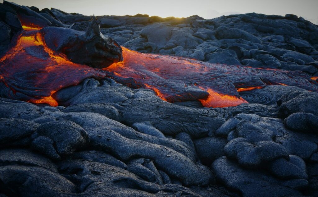
Watch is the level most travelers actually care about. It typically means an eruption is either imminent within days or already underway in a confined area — usually a lava lake inside Halemaumau, contained by the pit walls. This is when caldera glow returns to nighttime overlooks and when tour operators begin promoting sunset viewing. SO2 emissions during recent Watch-level summit eruptions have averaged 15,000 to 65,000 tonnes per day, powering thick vog banks over the leeward Kona coast.
Warning (Red)
Warning is rare, and rarer still for a purely summit event. It signals hazardous activity threatening people or property — the 2018 lower East Rift Zone lava flows that consumed 700 homes in Leilani Estates ran under Warning for months. During Warning, the National Park Service typically closes large portions of Hawaii Volcanoes National Park, evacuates residents downwind, and shuts affected highways. Travel bookings inside the impact zone should be canceled or moved to a different island altogether.
Summit versus East Rift Zone: two very different eruption modes
Kilauea has two primary vent systems, and confusing them wastes trip planning. The summit caldera sits at 4,000 feet elevation inside the national park, ringed by paved overlooks and lodge properties. The East Rift Zone extends 40 miles east-southeast toward the ocean through remote terrain, subdivisions like Leilani Estates, and the Pu’u O’o vent field that erupted continuously from 1983 to 2018. Any given alert-level status can apply to one, the other, or both.
A summit-only eruption is a traveler-friendly scenario. Lava is confined inside the Halemaumau pit crater, the plume vents from a single fixed point, and overlooks along the caldera rim provide direct visual access. A lower East Rift Zone eruption is a different story — flows can cross highways, destroy homes, and force multi-week road closures. The volcano viewing guide covers where to legally observe each mode.
| Attribute | Summit (Halemaumau) | Lower East Rift Zone |
|---|---|---|
| Elevation | 4,000 ft | 200–2,000 ft |
| Typical visitor access | Paved rim overlooks inside NP | None — private/closed land |
| Air temp overnight | 48–58°F | 68–75°F |
| SO2 output during eruption | 15,000–65,000 t/day | Up to 200,000 t/day (2018) |
| Distance from Kona | 96 miles | 120 miles |
| Distance from Hilo | 28 miles | 25 miles |
| Last major event | Multiple 2020–2025 | May–Aug 2018 |
Why the summit is the default target
Since December 2020, all published Kilauea eruptions have been summit events inside Halemaumau. Episodes typically last hours to weeks, then pause. Between episodes the crater floor cools to a black crust, and glow disappears within 24 to 48 hours. This makes real-time HVO status essential — a Watch/Orange listing does not guarantee visible lava at the moment of a visitor’s overlook trip, only that an eruption is either happening or expected within days.
What East Rift signals to watch
Persistent seismic swarms migrating downrift, sudden ground deformation along the middle East Rift, or renewed activity at Pu’u O’o would flip East Rift readings toward Watch or Warning. The Civil Beat and Hawaii News Now newsrooms track HVO briefings closely and often publish plainer summaries than the technical daily update. Anyone booking near Puna or the Hilo side should monitor those outlets in the 30 days before travel.
Recent eruption episodes at a glance
Kilauea’s post-2020 rhythm has featured multiple short-duration summit episodes lasting days to weeks. The December 2020–May 2021 episode produced a stable lava lake reaching 748 feet deep at maximum. September 2021 through December 2022 saw another sustained lake episode. January 2023 and June 2023 events lasted under two weeks each. Late 2024 and 2025 saw a return to short-cycle fountain episodes lasting hours, separated by pauses of days. This cadence favors travelers who can shift arrival by 24–48 hours.
NPS closures and their ripple effects
The National Park Service manages access to Halemaumau under a standing closure order for the pit crater floor itself, layered with dynamic closures triggered by HVO status. During eruptions, hazard zones extend 800 to 1,600 feet back from the caldera edge. Roads and trails within those zones close automatically when a Watch elevates or when SO2 exceeds 5 parts per million at any monitored overlook.
Crater Rim Drive
Crater Rim Drive once formed an 11-mile loop encircling the caldera. The 2018 collapse permanently closed a 3-mile western section from Jaggar Museum past Uwekahuna Bluff, because the caldera floor dropped roughly 1,600 feet and undermined the roadbed. The eastern half — from park headquarters to Keanakakoi Overlook — remains open outside active eruption alerts. During Watch-level summit activity, the NPS often reopens select overlooks, including Kilauea Overlook, for supervised nighttime viewing of the Halemaumau caldera glow.
Chain of Craters Road
Chain of Craters Road runs 19 miles south-southeast from Crater Rim Drive down to the coast, dropping from 3,700 feet to sea level in about 45 minutes of driving. It is the primary way to see the flow-buried coastal plain and the remaining Puu Loa petroglyph field. The full overlook route breakdown details the stops. Chain of Craters closes below Mau Loa o Mauna Ulu when active flows threaten coastal terrain, and full closures happen when SO2 downwind spikes.
Because the road is a dead-end, there is no gas along its 38-mile round trip. Anyone attempting a rim-to-sea drive should top off in Volcano Village or Naalehu first — the fuel plan for the roadway lists the closest pumps and their opening hours. During a Watch-level summit event, expect the parking area at the coastal end near Puu Loa to fill by 4:00 p.m. as sunset viewers stage.
Trail closures inside the caldera
The 4-mile Kilauea Iki Trail is the classic crater-floor hike, dropping 400 feet into a 1959 pit crater. That trail typically stays open at all alert levels because it is upwind of Halemaumau under standard trade winds. The Kilauea Iki loop grade guide covers the descent. Halemaumau Trail itself has been closed indefinitely — the pre-2018 crater floor no longer exists as it was.
Reading the vog forecast via VMAP
Vog — volcanic smog — is a photochemical haze produced when SO2 reacts with sunlight, oxygen, and moisture to form sulfate aerosols. The Vog Measurement and Prediction Program (VMAP) at the University of Hawaii runs a numerical model updated at 6 a.m., 12 p.m., 6 p.m., and midnight local time. Its output shows SO2 and sulfate aerosol concentration projections over 60 hours across every island, color-coded from good to hazardous.
Reading the model well means matching wind direction to island geography. Standard northeast trade winds (blowing 8 to 20 mph roughly 70% of days May through October) push vog down the west coast toward Kona, Kealakekua, and South Point. Kona winds — light southwest or variable flow — trap vog against the Kohala mountains and send it toward Hilo and the windward slopes. The trade wind and vog direction chart lays out the seasonal split.
VMAP color bands and what to do
- Green (0–100 µg/m³ SO2): unrestricted outdoor activity for healthy visitors.
- Yellow (101–200): sensitive groups notice throat irritation after 30 minutes outside.
- Orange (201–1,000): hikes above 3,000 ft feel labored; asthma-prone travelers should retreat indoors.
- Red (>1,000): everyone should stay indoors with windows closed; N95 masks help for essential outdoor travel.
The DOH runs a parallel sensor network with real-time SO2 and PM2.5 data at approximately 15 fixed monitoring stations, from Pahala on the southern flank up to Ocean View and Kailua-Kona. The SO2 advisory levels breakdown matches ppb readings to health guidance. Travelers with asthma, COPD, or cardiac issues should check both VMAP forecasts and current sensor readings the morning of any outdoor activity above 2,000 feet.
SO2 and vog: what the numbers actually mean
SO2 is measured in parts per billion (ppb) at ground level and in tonnes per day at the vent. Ambient SO2 above 200 ppb triggers a DOH short-term advisory. During the 2018 lower East Rift Zone eruption, monitoring stations in Pahala recorded peaks above 5,000 ppb, and Ocean View residents reported paint pitting on cars from acid rain. Ordinary Watch-level summit eruptions produce far lower community exposure, usually 20 to 400 ppb downwind.
Two secondary hazards matter for a rim visit. Pele’s hair — thin volcanic glass fibers spun from lava splatter — can drift several miles downwind and irritate skin and eyes. Vog also strips visibility fast; readings above 15 miles from a rim overlook can drop to 3 miles within an hour when the plume backs up. Photographers plan around this by shooting glow against the still-visible caldera walls in the first 20 minutes after full dark.
Packing for a possible glow-viewing visit
A summit viewing trip pairs subtropical daytime weather with alpine-adjacent overnight cold and industrial-grade air pollution. Standard beach-vacation packing fails on all three counts. The essentials list below assumes a 6 p.m. arrival at Kilauea Overlook, three hours on the rim, and a 10 p.m. return drive.
| Item | Spec | Approx cost | Why it matters |
|---|---|---|---|
| N95 respirator | NIOSH-approved, snug fit | $2–$4 each | Filters PM2.5 and reduces SO2 aerosol exposure |
| Headlamp | 200+ lumens, red-light mode | $18–$45 | Overlooks unlit; red light preserves night vision |
| Insulated jacket | Puffy or fleece, 400+ fill | $60–$180 | Rim temps drop to 48°F even in July |
| Beanie + gloves | Wool or fleece | $15–$40 combined | Wind chill at rim exceeds valley reports by 8°F |
| Long pants | Non-cotton hiking pants | $50–$120 | Rain and mist come in fast; cotton stays wet |
| Water | 1L per person minimum | $1–$3 | No water stations at overlooks |
| Rain shell | Waterproof, hooded | $60–$200 | Volcano Village receives 100+ inches rain/year |
N95 mask logic
SO2 is a gas, not a particle, so an N95 does not fully block it. However, most sulfate aerosols formed downwind are particulate and do respond to N95 filtration. Combined with brief exposure limits — under 90 minutes at a single overlook — an N95 meaningfully reduces the health toll for asthma-prone visitors. A KN95 or elastomeric half-mask with acid-gas cartridges works better for anyone with severe respiratory issues planning multiple rim visits.
Headlamp and red-light mode
Overlook parking areas have no ambient lighting after sunset — the park deliberately keeps them dark to preserve glow visibility. A phone flashlight burns 5% battery per minute in cold weather and wrecks night adaptation for anyone within 30 feet. A dedicated headlamp with a red-light mode allows walking without ruining others’ viewing. Bring extra AAA batteries; cold cuts headlamp runtime roughly 40% at 50°F.
Warm layer for the 4,000-foot rim
Kilauea’s summit sits at 4,000 feet elevation, which corresponds to a lapse rate roughly 15°F cooler than sea level. Overnight lows at Kilauea Overlook run 48–58°F in July and August, dropping to 40–48°F December through February. Add 10-mph rim winds and the effective wind chill often falls into the low 40s even in summer. Cotton hoodies fail once damp; a synthetic puffy or wool fleece is the correct insulating layer.
Additional useful gear
A compact camp chair or foam pad turns three hours on cold concrete into an actual experience. Long-exposure photography requires a lightweight tripod — handheld shots at 1/2 second and above blur consistently. Hand warmers ($1–$2 each, activated by opening the packet) stay warm for 6 to 8 hours and fit inside gloves. Insect repellent is optional at 4,000 feet — mosquitoes largely disappear above 3,000 feet elevation. A thermos of coffee or tea makes the wait notably more pleasant.
Timing your visit against alert-level updates
HVO publishes a daily status update at approximately 9 a.m. Hawaii Standard Time (11 a.m. Pacific, 2 p.m. Eastern). During active eruptions, HVO issues supplemental notifications any time seismic activity, tilt data, or vent behavior changes materially. Travelers within 72 hours of a planned rim visit should refresh the HVO Kilauea page every 12 hours and check VMAP within 6 hours of departing for the overlook.
Seasonal windows to consider
Eruption activity does not track seasons — Kilauea’s magma supply is roughly steady. But traveler comfort does. The best time to visit the Big Island month-by-month shows how late April through early June and September through mid-November offer drier rim weather with lower nightly lodging rates than the December through March high season. Combining a Watch-level status with those shoulder windows minimizes both cost and vog exposure.
| Month | Rim overnight low (avg) | Rim daytime high (avg) | Rain days |
|---|---|---|---|
| January | 42°F | 63°F | 16 |
| April | 46°F | 67°F | 15 |
| July | 52°F | 72°F | 13 |
| October | 50°F | 70°F | 13 |
| December | 44°F | 65°F | 17 |
Sunset arrival window
Peak glow visibility begins about 45 minutes after sunset — the caldera walls dim enough for incandescence to dominate the frame. Sunset at Volcano falls between 5:48 p.m. in December and 7:13 p.m. in June. Plan on being parked and at the overlook 30 minutes before sunset, since parking at Kilauea Overlook typically fills within 15 minutes of that. Arrive by 5:15 p.m. in winter and by 6:30 p.m. in summer to be safe.
Alternative viewing and safety fallbacks
Not every trip aligns with active glow. When HVO status sits at Advisory or Normal — no eruption underway — the Big Island still offers volcanic learning experiences worth building a day around. The Thurston (Nahuku) lava tube stays open at nearly all alert levels, and the Kilauea Iki floor walk takes 2 to 3 hours through a 1959 eruption zone. Steam vents along the caldera rim remain a compelling stop.
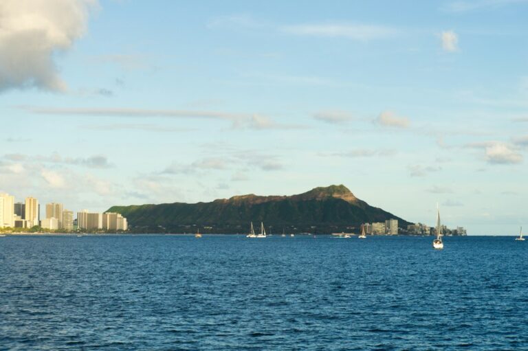
When Warning-level alerts prompt closures inside the park, travelers already on-island often pivot to Maui or Oahu. Maui offers Haleakala’s dormant summit at 10,023 feet for a very different volcanic experience, plus the coastal Piilani Highway return loop around old lava fields. Oahu’s Diamond Head Crater summit ascent is an accessible predawn hike through a 300,000-year-old tuff cone. None of these replace an active Kilauea glow, but they salvage a trip.
Kauai and the older shield volcanoes
Kauai holds no active volcanism — its shield is roughly 5 million years old and heavily eroded. Any traveler with volcanism as the primary motivation should focus the trip on the Big Island. That said, the Kilauea Point Lighthouse seabird refuge on Kauai’s north shore takes its name from the same Hawaiian word (meaning “spewing”) and provides some geologic context on the island chain’s east-to-west aging progression.
Data sources and daily checks before travel
Reliable status monitoring requires cycling through five distinct feeds. HVO’s daily update is authoritative for alert level and vent behavior. The Hawaii Department of Health maintains the interagency sensor network showing real-time SO2 and PM2.5. VMAP provides forward-looking vog dispersion forecasts. The Honolulu Star-Advertiser and Hawaii News Now publish plain-language summaries. The National Park Service’s Hawaii Volcanoes NP alerts page confirms closures and reopenings within hours of HVO reclassifications.
Cost of vog on daily life
For those researching a move rather than a visit, the recurring cost of vog shows up in medical bills, air conditioning power draw, and cleaning frequency. Hawaii’s residential electricity averaged 42 cents per kWh in 2024 per EIA data — running window AC units 10 hours daily during a vog event can add $60–$90 to a monthly bill. Household expenses in Honolulu also run about 87% above the U.S. urban average per BLS Honolulu CPI figures.
Access permits, tours, and staying legal at overlooks
Hawaii Volcanoes National Park entry costs $30 per vehicle for a 7-day pass or is covered by the $80 America the Beautiful annual pass. Night access to Kilauea Overlook is permitted only when the parking area is open. Off-trail hiking on cooled lava is illegal and dangerous — surfaces above active flows can be 2 inches thick over molten rock. Rangers issue citations for anyone crossing closure barriers, with fines starting around $175.
Guided tours vs self-guided rim visits
Commercial glow-viewing tours from Kona run $180–$260 per person including transportation, dinner, and headlamp rental. Total round-trip time is 10 to 12 hours, since the drive from Kona covers 96 miles each way and includes a 5,000-foot elevation gain via the Saddle Road. Self-driving cuts costs to fuel plus park entry — roughly $25–$40 per vehicle — but shifts fatigue and vog-forecast decision-making onto the driver.
Gas on the Big Island runs among the highest per-gallon prices in the country. National EIA gasoline data shows Hawaii averaging roughly 30% above the national mean. A rim round trip from Kona uses 8 to 10 gallons in a mid-size SUV, so budget $45 to $65 for fuel alone. Naalehu holds the closest 24-hour pump south of the park; Volcano Village’s single station keeps limited hours.
Cancellation policies and refund windows
Most major tour operators offer full refunds only when the NPS closes access on the day of the tour. If a scheduled tour proceeds but glow visibility fails due to weather or a crusted-over crater floor, refunds are rarely offered — the operator delivered the transportation and access as advertised. Travel insurance policies with “trip interruption for volcanic activity” clauses can fill this gap; premiums typically add $30–$60 to a $200 tour price.
Frequently asked questions
How often does the USGS HVO update Kilauea’s alert level?
HVO posts a daily update at roughly 9 a.m. Hawaii Standard Time and issues supplemental notifications any time seismic activity, tilt data, or vent behavior changes significantly. During active eruptions, updates can appear every few hours. The alert level itself changes less frequently — often days or weeks apart — but the daily update always shows the current classification alongside gas emission rates and lava lake behavior descriptions.
Does Watch-level status guarantee visible lava that night?
No. Watch means an eruption is either imminent within days or already underway, but Kilauea’s summit eruptions cycle through active fountaining phases and quiet crusted-over phases within a single episode. The crater floor cools quickly once fountaining pauses. Cross-check the HVO daily update, the USGS Kilauea webcam feed, and recent visitor reports from the current 24 hours before assuming glow will be visible on any specific night.
Is it safe to visit Hawaii Volcanoes National Park during an eruption?
Yes for summit-only eruptions at Watch level, provided visitors stay on designated overlooks, wear an N95 mask if downwind, and check DOH SO2 readings before extended outdoor time. The NPS actively manages viewing access and closes overlooks when SO2 spikes past health thresholds. Warning-level events, especially any renewed East Rift Zone activity, prompt broader closures and typically make the park unsuitable for casual visits until conditions stabilize.
What is the difference between vog and volcanic ash?
Vog is a chemical haze of SO2 gas and sulfate aerosol particles produced when volcanic gases react with sunlight and moisture. Ash consists of pulverized rock and volcanic glass ejected during explosive eruptions. Kilauea’s summit eruptions since 2020 have produced almost entirely vog, not ash — the Halemaumau vent lacks the explosive violence of stratovolcanoes. Ash last dusted downwind communities during the May 2018 summit collapse phase.
Can visitors reach Halemaumau or the caldera floor?
No. Halemaumau’s floor and the caldera walls immediately around the vent have been permanently closed to public access since the 2018 collapse dramatically altered the terrain. Old access trails no longer exist as they were mapped, and unstable overhangs make any approach dangerous. The closest legal viewing point is Kilauea Overlook or Uwekahuna Bluff, both perched on the caldera rim at roughly 4,000 feet with direct sightlines into Halemaumau.
How does vog affect flights and inter-island travel?
Vog rarely disrupts commercial aviation because SO2 dissipates below cruise altitude within a few hours. Ashfall from a full explosive eruption would trigger the aviation Red code and ground flights, but that scenario has not applied to Kilauea’s recent summit activity. Inter-island ferry service between the main islands does not exist for passengers — travelers pivot via Hawaiian Airlines or Southwest, which continue normal operations during standard Watch-level eruptions.
Should sensitive travelers avoid the Big Island during Watch-level status?
Not necessarily. Vog concentrations vary dramatically by wind direction and island location. Under standard northeast trade winds, the north Kohala coast, Waimea, and Hilo often stay clear while Kona sits in heavy vog. During Kona wind reversals, that geography flips. Travelers with severe asthma, cardiac conditions, or pregnancy should consult a physician and confirm accommodation locations upwind of expected vog trajectories using VMAP forecasts before final booking decisions.