The Kilauea Iki loop sits at the front door of Hawai’i Volcanoes National Park, and for many mainland households scouting a Big Island relocation it becomes the first hike that reframes what “walking on lava” actually means. The path drops from a shaded ohia rim, crosses the still-warm 1959 eruption floor, and climbs back through native rainforest, all inside a 4-mile circuit that most healthy adults finish in 2 to 3 hours.
What separates this trail from a casual overlook stroll is the 400-foot vertical drop onto a lava lake that erupted less than 70 years ago, plus a paved tie-in to Nahuku (Thurston Lava Tube) that adds cultural and geological context most rim-only visitors miss. The grade is short but sustained, the surface is unforgiving, and the parking situation punishes late arrivals.
This research digest lays out descent angles, clockwise versus counterclockwise trade-offs, footwear thresholds tested against the packing-card fit rule, National Park Service parking fill-times, closure history since the 2018 summit collapse, and how the $30 entry fee interacts with the America the Beautiful pass. Numbers come from NPS trail data, USGS Hawaiian Volcano Observatory monitoring, and state transportation records.
Trail specs at a glance
The Kilauea Iki loop is officially measured at 3.3 miles by the National Park Service, though most GPS watches record 3.9 to 4.2 miles once the Nahuku spur is added. Elevation swings from 3,874 feet at the Puu Puai overlook down to roughly 3,470 feet on the crater floor, a net loss and regain of about 400 feet. The floor itself stretches 1 mile end to end.
Trail composition changes sharply at each transition. The rim segment is packed dirt under closed rainforest canopy. The descent switchbacks are loose volcanic gravel over basalt bedrock. The floor is a fractured pahoehoe sheet with ropey folds, cracks, and pressure ridges. The return climb on the eastern wall mixes stone stairs with root-braided dirt.
| Metric | Value | Source |
|---|---|---|
| Loop distance (NPS) | 3.3 miles | NPS trail map |
| Loop with Nahuku spur | 3.9–4.2 miles | GPS averages |
| Elevation change | 400 feet | USGS quadrangle |
| Rim elevation | 3,874 feet | Puu Puai overlook |
| Crater floor elevation | 3,470 feet | NPS survey |
| Floor crossing length | 1.0 mile | NPS trail map |
| Average finish time | 2–3 hours | NPS trail guide |
| Trailhead lot capacity | ~40 vehicles | NPS parking data |
Households comparing this hike to other island descents will find the vertical drop modest compared with the Waipio Valley descent on the Hamakua coast, which loses about 800 feet in less than a mile. Kilauea Iki spreads its drop over roughly 0.8 miles, keeping the average grade near 10 percent.
The 400-foot descent grade explained
The Puu Puai side of the loop drops 404 feet in roughly 0.8 trail miles, producing an average grade near 9.5 percent. Individual switchback pitches touch 18 to 22 percent on the steepest gravel ramps. That is enough to load knees and ankles on the way down, particularly for hikers carrying camera bags or toddler backpacks.
The Byron Ledge return climb is gentler in profile but longer, spread over about 1.1 miles with several stair sequences carved into basalt. The park service placed handrails at only a handful of exposed edges, so most descent management relies on trekking pole use, deliberate foot placement, and a willingness to shorten stride length.
Grade compared with other HVNP trails
| Trail | Distance | Elevation change | Average grade |
|---|---|---|---|
| Kilauea Iki loop | 3.3 miles | 400 feet | 9.5% descent |
| Devastation Trail | 1.0 mile | 60 feet | 2% flat |
| Halemaumau Trail (partial) | 1.8 miles | 425 feet | 11% descent |
| Napau Crater | 14.0 miles | 900 feet | 3% rolling |
| Mauna Iki Trail | 1.6 miles | 120 feet | 3% flat |
Comparable descents on other islands include the 560-foot Diamond Head crater summit climb on Oahu and the Puu Poa cliff descent to Hideaways cove on Kauai. Both are shorter but steeper per mile, and both punish poor footwear far more quickly than Kilauea Iki does.
Clockwise vs counterclockwise direction
The loop can be walked either direction from the main Kilauea Iki Overlook parking lot. Counterclockwise sends hikers down the Puu Puai side first, then across the floor, and back up the shaded Byron Ledge segment past Nahuku. Clockwise reverses that sequence, climbing Byron Ledge briefly before dropping the eastern wall and finishing with an uphill floor exit.
Why counterclockwise dominates traffic
NPS interpretive rangers report that roughly 70 to 80 percent of hikers travel counterclockwise. The reasons are practical: the Puu Puai descent is the steeper of the two walls, and most knees prefer to take steep grades going down rather than up. The counterclockwise finish also lands hikers near Nahuku with legs still cooperative for the lava tube stairs.
When clockwise makes sense
- Sunrise starts benefit from morning shade on the Byron Ledge climb.
- Hikers with knee issues often prefer climbing the steeper Puu Puai side.
- Photographers want mid-morning light hitting the western wall.
- Families adding Nahuku early avoid tour-bus congestion after 10 a.m.
The counterclockwise flow also spaces hikers out along the 1-mile floor crossing, since most groups descend at similar cadences and then spread laterally on the flat. Clockwise walkers meeting oncoming traffic near the eastern wall junction sometimes stack up at narrow stair segments.
Floor conditions on the 1959 lava lake
The crater floor visitors cross today is the frozen surface of a lava lake that formed during a 36-day eruption starting November 14, 1959. Fountains from the south vent reached 1,900 feet, the tallest recorded in Hawaiian history. The final lake depth measured 414 feet. Steam still vents from surface cracks, and USGS instruments confirm subsurface temperatures remain elevated more than 65 years later.
What “still warm” actually means
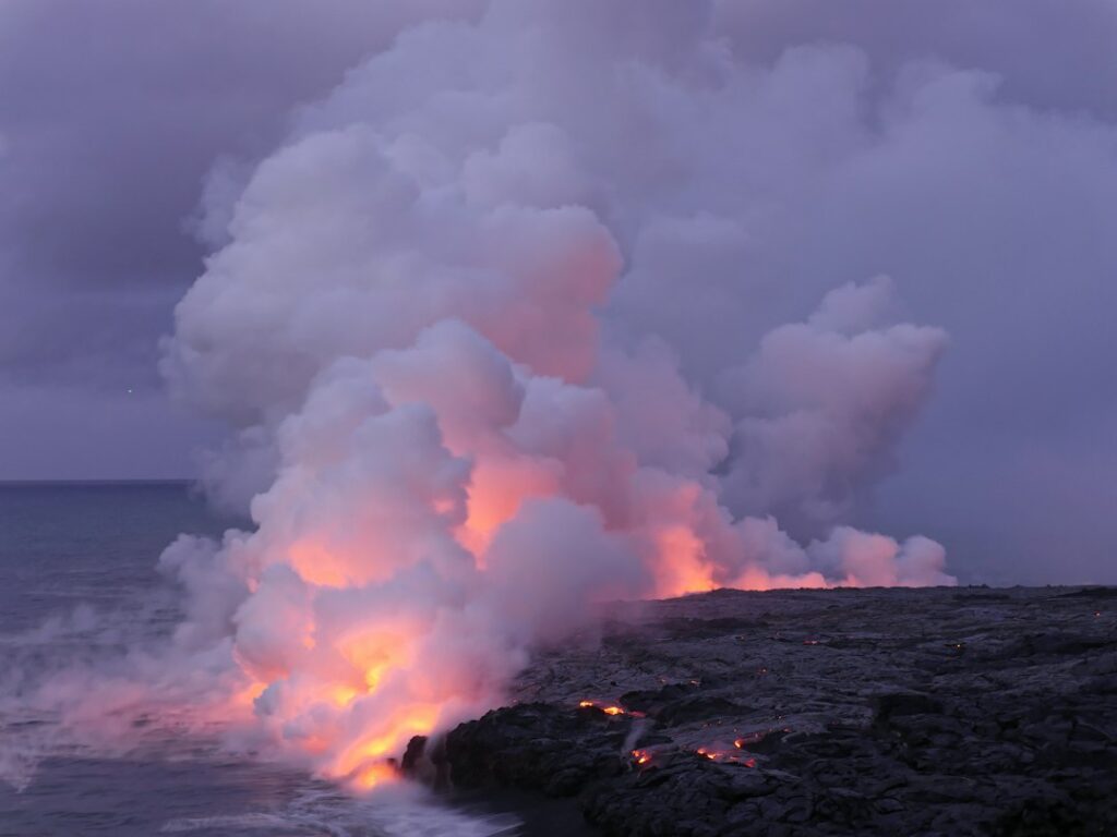
Hikers should not expect molten rock or dangerously hot surfaces. The pahoehoe underfoot registers ambient temperature. What visitors notice is warm, humid air rising from fumaroles along the western and southern edges of the floor. On cool mornings between December and February, the steam is dramatic enough to obscure the far crater wall entirely.
Surface texture on the floor varies from smooth ropey pahoehoe to jagged pressure ridges up to 4 feet tall. The National Park Service marks the trail with stacked rock cairns (ahu) at roughly 100-foot intervals. Straying from the cairn line is discouraged both for cultural reasons and because thin crust over hollow gas pockets exists in isolated areas.
| 1959 eruption fact | Measurement |
|---|---|
| Eruption start | November 14, 1959 |
| Eruption duration | 36 days |
| Peak fountain height | 1,900 feet |
| Final lava lake depth | 414 feet |
| Estimated lava volume | 36.8 million cubic yards |
| Vent location | South wall (Puu Puai) |
| Puu Puai cinder cone height | Over 400 feet |
Cultural respect on the floor
The state health department and NPS ask hikers not to stack new rock piles or disturb existing ahu. In Hawaiian tradition, the crater is the home of Pele, and visitors are asked to treat the floor as a sacred site rather than a photo prop. Removing rocks from the park is a federal offense with fines up to $5,000.
Nahuku (Thurston Lava Tube) tie-in
Nahuku sits about 0.4 miles east of the Kilauea Iki Overlook parking lot along Crater Rim Drive, and a paved connector trail lets hikers add it to the loop without moving the car. The tube is a 600-foot lava conduit formed roughly 500 years ago when flowing lava drained beneath a hardened crust, leaving a cave-like cylinder.
Only the first 400 feet are lit for public access. The remaining 200 feet can be entered with a flashlight but require crouching and produce claustrophobic conditions for many walkers. The floor is uneven basalt with several drainage puddles after rain. Ceiling clearance ranges from about 6 feet to nearly 20 feet.
Adding Nahuku to the loop
- Counterclockwise finishers reach the Nahuku spur near mile 3.0.
- Clockwise starters can hit Nahuku in the first 30 minutes before crowds.
- The spur adds about 0.5 miles round-trip on paved surface.
- Tour buses fill the Nahuku lot between 9:30 a.m. and 2:00 p.m.
- The lit interior stays around 65°F year-round.
Families who want the geology without the elevation loss sometimes park at the Nahuku lot and walk only the tube plus a short section of Byron Ledge to peer down at the crater floor. That option covers roughly 1 mile total and skips the 400-foot descent entirely.
Footwear and traction: the packing-card fit test
Kilauea Iki is not a trail where flip-flops or Vibram-soled slides belong. The crater floor’s pahoehoe surface can slice thin rubber, and the descent gravel eats through soft foam. NPS ranger observations catalog a steady stream of turned ankles, cut shins, and abandoned attempts by hikers wearing beach footwear.
The packing-card fit rule
Households packing from the mainland can screen shoes with a simple test. Slide a standard credit card between the toe box and the front interior of the shoe with the foot inserted. If the card jams tight against the toes, the shoe is too small for a 400-foot descent that jams feet forward on switchbacks. Aim for 0.4 to 0.6 inches of clearance.
| Footwear type | Suitability | Notes |
|---|---|---|
| Trail runners (grippy sole) | Recommended | Best for average hikers |
| Mid-height hiking boots | Recommended | Ankle support on gravel |
| Approach shoes | Recommended | Sticky rubber grips basalt |
| Basic sneakers | Marginal | Adequate in dry weather only |
| Chacos or sport sandals | Not recommended | Basalt cuts, no toe protection |
| Flip-flops or slides | Unsafe | Turn-back rate above 40% |
| Water shoes | Unsafe | Thin sole punctures easily |
Muddy conditions after Hilo-side rain change the equation. When the rim segment is wet, sole tread depth matters more than ankle support. Hikers who bring only sneakers should compare traction expectations against the footwear guidance for Oahu’s Manoa Falls rainforest trail, which faces even wetter conditions year-round.
Traction accessories
Trekking poles reduce knee load on the Puu Puai descent by an estimated 20 to 25 percent according to trail research. Microspikes are unnecessary; the surface is never icy at this elevation, even during December cold snaps that push rim temperatures into the mid-40s Fahrenheit. Gaiters help keep volcanic grit out of low-cut shoes.
NPS parking lot fill-times
The Kilauea Iki Overlook parking area holds about 40 vehicles across two connected loops. There is no reservation system and no overflow lot. Once the lot fills, arriving drivers must circle back to Devastation Trail parking (about 0.5 miles south) or park along Crater Rim Drive shoulder in designated areas.
Typical fill sequence
- 7:00 a.m.: 20–30% full, mostly sunrise photographers
- 8:30 a.m.: 60% full, early hiker groups arriving
- 9:30 a.m.: 90% full, tour vans arrive from Kona
- 10:30 a.m.: full or overflow spillover
- 2:00 p.m.: gradual thinning as morning hikers depart
- 3:30 p.m.: 40–50%, last afternoon starters
Weekend mornings between June and August, plus the December 20 to January 5 holiday window, see the lot fill by 9:00 a.m. Rangers do not enforce time limits, but courtesy expects most hikers to vacate spots within 3 to 4 hours. Vehicles left overnight without a backcountry permit may be ticketed.
Backup parking options
| Lot | Distance to trailhead | Capacity |
|---|---|---|
| Kilauea Iki Overlook | 0 feet (trailhead) | ~40 vehicles |
| Nahuku (Thurston) lot | 0.4 miles east | ~50 vehicles |
| Devastation Trail lot | 0.5 miles south | ~35 vehicles |
| Puu Puai Overlook | 0.7 miles west | ~20 vehicles |
| Kilauea Visitor Center | 1.4 miles north | ~120 vehicles |
Starting from the visitor center adds about 2.8 miles of walking round-trip on the Earthquake Trail plus Crater Rim, which is paved and gentle. That option can add 60 to 90 minutes but sidesteps parking anxiety entirely on peak weekends when even the Chain of Craters Road overlook drive pulls displaced tour traffic back toward the summit.
Closure history since the 2018 collapse
The May to August 2018 summit collapse of Kilauea reshaped the caldera and forced HVNP to close for 134 days, the longest continuous closure since the park’s 1916 establishment. When staff reopened access in late September 2018, roughly 60 percent of trails came back online. Kilauea Iki reopened in stages, with the full loop restored by late 2019 after crack surveys and trail rebuilds.
Post-2018 monitoring changes
USGS Hawaiian Volcano Observatory maintains a dense sensor grid around the crater rim. During the September to December 2021 eruption at Halemaumau, and again during smaller 2023 and 2024 events, Kilauea Iki itself remained open even when parts of Crater Rim Drive closed for sulfur dioxide readings. The Honolulu Star-Advertiser and Honolulu Civil Beat track closure notices in near-real time.
Closure triggers going forward
- SO2 readings above 5 parts per million at Jaggar Museum trigger review.
- Ashfall from Halemaumau reaching the rim closes the descent trail.
- Elevated seismicity above M4.5 pauses floor access.
- Weather-driven rockfall risk closes the Byron Ledge switchbacks.
The park’s air quality data feed integrates with state agriculture air quality readings and NPS in-park monitors. Households planning a hike should check the park’s alerts page the morning of the trip; closures often lift by mid-afternoon once trade winds clear vog from the caldera.
| Closure event | Duration | Kilauea Iki impact |
|---|---|---|
| 2018 summit collapse | May–Sept 2018 (134 days) | Full loop closed |
| Post-collapse rebuild | Sept 2018–late 2019 | Phased reopening |
| 2021 Halemaumau eruption | Sept 2021–May 2023 | Loop remained open |
| 2023 September eruption | ~6 days | Brief SO2 closures |
| 2024 June eruption | ~5 days | No loop closure |
HVNP entry fee and pass acceptance
Entry to Hawai’i Volcanoes National Park runs $30 per private vehicle, $25 per motorcycle, or $15 per person on foot or bicycle, valid for 7 consecutive days. The fee covers all occupants of one vehicle and grants unlimited re-entry during that window. Annual HVNP-specific passes cost $55 and cover the primary vehicle plus family members in it.
America the Beautiful pass
The federal America the Beautiful Interagency Annual Pass costs $80 and is fully accepted at HVNP entrances. The pass covers the pass holder plus up to 3 additional adults age 16 and older in the same vehicle. Children 15 and under enter free at all national parks regardless. Seniors 62 and older can purchase the lifetime Senior Pass for $80 or the annual version for $20.
| Pass type | Cost | Coverage | Best for |
|---|---|---|---|
| Single vehicle 7-day | $30 | 1 vehicle, 7 days | Short visits |
| HVNP annual | $55 | 1 vehicle, 12 months | Big Island residents |
| America the Beautiful | $80 | All national parks, 12 months | Multi-park travelers |
| Senior Annual (62+) | $20 | All national parks, 12 months | Older visitors |
| Senior Lifetime (62+) | $80 | All national parks, lifetime | Retirees |
| 4th Grade Pass | Free | All national parks, school year | Families with 4th graders |
| Access Pass (disability) | Free | All national parks, lifetime | Documented disability |
| Military Pass | Free | All national parks, 12 months | Active duty and dependents |
Households relocating to Hawaii who plan repeat park visits generally break even on the annual HVNP pass after two entries. Those planning mainland national park travel within the same 12 months should default to America the Beautiful, which also covers access constraints near Papakolea green sand beach in adjoining Ka’u district federal lands.
Weather and seasonal timing
Rim elevation at 3,874 feet produces conditions markedly different from Kona or Hilo shoreline weather. Average daytime highs range from 63°F in January to 71°F in August. Nighttime lows dip to 47°F in the coldest months. Rainfall is heaviest between November and March, averaging 8 to 12 inches per month on the Hilo-facing rim.
Best months for the loop
April through June and September through mid-November offer the driest trail conditions and clearest crater views. The June to August peak tourist window brings warmer temperatures but heavier crowds and 30-minute waits at Nahuku. December to February visits reward flexible schedulers with dramatic steam plumes and lower ranger-station lines but demand rain layers.
| Month | Avg high (°F) | Avg low (°F) | Rain (inches) | Crowd level |
|---|---|---|---|---|
| January | 63 | 47 | 9.8 | High (holiday) |
| March | 65 | 48 | 9.2 | Moderate |
| May | 68 | 51 | 4.6 | Moderate |
| July | 71 | 54 | 4.1 | Peak |
| September | 71 | 53 | 3.8 | Moderate |
| November | 66 | 50 | 7.4 | Rising |
Fog on the rim is common between 4:00 p.m. and 8:00 a.m. year-round. Hikers finishing the loop after 3:30 p.m. should carry a headlamp; the eastern wall stairs become disorienting when clouds lower onto the ohia canopy. Kilauea’s summit weather does not track well with island-wide forecasts, so parkspecific bulletins are more reliable.
Getting to the trailhead
The Kilauea Iki Overlook lot sits about 45 minutes by car from Hilo International Airport (ITO) and roughly 2 hours 15 minutes from Kona International Airport (KOA). Highway 11 is the only paved access route to the park’s main entrance, and state transportation records show occasional single-lane closures for repaving between mile markers 30 and 38 south of Volcano village.
Coming from Hilo
Highway 11 climbs steadily from sea level to 4,000 feet over 30 miles. The route passes through Kurtistown, Mountain View, and Glenwood, with fuel available at each. Households often combine the drive with a Wednesday morning stop at the Hilo Farmers Market vendor rotation before heading upslope.
Coming from Kona
The Kona-side approach runs 96 miles via Highway 11 South through Captain Cook, Ocean View, and Naalehu. Fuel costs at Ocean View typically run 25 to 40 cents per gallon above Kona pump prices; the Energy Information Administration fuel data tracks Hawaii’s regular unleaded near $4.75 to $5.10 per gallon depending on the month.
Combining the loop with nearby stops
Hikers with a full day at the park can extend beyond Kilauea Iki without racing the clock. Chain of Craters Road drops 3,700 feet over 19 miles to sea level at the Holei Sea Arch, a 90-minute round-trip drive with multiple pull-outs. The route passes lava fields from 1969 to 1974 Mauna Ulu eruptions.
Suggested full-day sequence
- 7:30 a.m.: arrive Kilauea Visitor Center, orient with rangers
- 8:00 a.m.: start Kilauea Iki loop counterclockwise
- 10:30 a.m.: exit loop, tour Nahuku lava tube
- 11:15 a.m.: lunch at Volcano House or picnic areas
- 12:30 p.m.: drive Chain of Craters Road to sea arch
- 3:00 p.m.: return via Puu Loa petroglyphs stop
- 5:30 p.m.: sunset at Halemaumau overlook
Households wanting a comparable full-day nature circuit on other islands can look at the Haleakala downhill bike descent on Maui or the Mahaulepu heritage coastal walk near Poipu on Kauai. Neither replaces the volcanic geology of Kilauea Iki, but both compete for the “one big outdoor day” slot in a shortened itinerary.
Practical logistics and gear checklist
The rim has no potable water on the trail itself. Visitor Center restrooms provide the last reliable water fill before the loop. Cell service on the crater floor is spotty; AT&T tends to work at rim overlooks, while Verizon fades on the Puu Puai descent. Bringing 1 to 2 liters of water per hiker is standard for the 2 to 3 hour circuit.
What to pack
- 1–2 liters water per person minimum
- Trail snacks with 300–500 calories total
- Sun hat and SPF 50 sunscreen for floor exposure
- Light rain shell or windbreaker for rim segments
- Headlamp if finishing after 4:00 p.m.
- Trekking poles for descent knee protection
- Small first-aid kit for scrapes on basalt
What to skip
- Heavy DSLR rigs unless photography is the primary goal
- Large backpacks that unbalance descent footing
- Cotton base layers that hold sweat at 3,800 feet
- Drones (banned throughout HVNP without special permit)
- Rock collection bags (removing rocks is a federal offense)
Hikers planning multi-day stays often bundle Volcano village lodging with the loop hike. Cabins at Volcano House inside the park run $250 to $400 per night, while nearby bed-and-breakfast options in Volcano village start around $130 per night. The Hawaii Tourism Authority destination site lists licensed operators.
Comparing Kilauea Iki with other island landmarks
Households scouting Hawaii often ask how the Kilauea Iki experience stacks against other flagship island hikes. The loop offers unique geology, but it is not the highest, the longest, or the most technical option available. Its edge lies in accessibility: 4 miles, 400 feet down, and 2 to 3 hours on a well-marked route without permits or reservations.
| Hike | Island | Length | Difficulty | Reservation? |
|---|---|---|---|---|
| Kilauea Iki loop | Big Island | 3.3 mi | Moderate | No |
| Diamond Head | Oahu | 1.6 mi | Moderate | Yes, non-resident |
| Waipio Valley | Big Island | 1.5 mi | Strenuous | Access restricted |
| Napali Kalalau | Kauai | 22 mi | Very strenuous | Yes, permit |
| Haleakala Sliding Sands | Maui | 11 mi | Strenuous | Sunrise only |
Coastal alternatives with less elevation include the Kapalua Bay reef swim on West Maui, the Kahekili reef entry near Airport Beach, or the Hulopoe Cove ladder entry on Lanai. None replace the volcanic setting of Kilauea Iki, but they diversify a Hawaii scouting itinerary that risks trail fatigue.
Cost breakdown for a Kilauea Iki visit
A single-vehicle day trip focused on the loop, Nahuku, and one Chain of Craters overlook stretches modestly on the wallet if fuel and lodging are already accounted for. Households making a full weekend of it should budget for the park pass, gas, meals, and one lodging night, particularly if coming from Kona or accessing via inter-island transit connections.
| Cost line | Low estimate | Mid estimate | High estimate |
|---|---|---|---|
| Park entry (vehicle) | $30 | $30 | $80 (annual pass) |
| Fuel from Hilo (round-trip) | $14 | $18 | $22 |
| Fuel from Kona (round-trip) | $42 | $52 | $65 |
| Lunch for two | $25 | $45 | $80 |
| Overnight lodging | $130 | $220 | $400 |
| Trekking pole rental | $0 | $15 | $25 |
Consumer price data from the Honolulu CPI report and Census QuickFacts for Hawaii confirm that Big Island lodging within 20 miles of the park sits roughly 12 to 18 percent below Honolulu equivalents, though restaurant meals track similar mainland pricing plus a 4.712 percent general excise tax reported by the Hawaii Department of Taxation.
Safety and emergency awareness
Rangers respond to 40 to 60 Kilauea Iki incidents per year, most involving twisted ankles or heat-related distress on the floor. Actual life-threatening emergencies are rare but occur, typically involving cardiac events on the Byron Ledge climb. The nearest hospital is Hilo Medical Center, roughly 30 miles and 45 minutes away by ambulance.
SO2 and vog exposure
Sulfur dioxide from Halemaumau can push into the Kilauea Iki basin under southerly winds, particularly between 4:00 a.m. and 9:00 a.m. Readings above 5 parts per million trigger closure. Households with asthma, COPD, or infant lung sensitivity should check the park’s air quality bulletin before descending and consider a rim-only walk on high-SO2 days.
Wildlife and hazards
- Nene (Hawaiian goose) crossings on Crater Rim Drive: slow to 15 mph
- Feral pig activity on Byron Ledge: rare but reported
- Ohia bark shedding: watch head clearance on switchbacks
- Vog inversion layers: worst before trade winds resume
Frequently asked questions
How long does the Kilauea Iki crater floor hike take?
Most hikers finish the 3.3-mile loop in 2 to 3 hours, depending on pace, stops for photos on the floor, and whether the Nahuku lava tube spur is added. Slower groups or families with young children should budget 3.5 to 4 hours. Sunrise starts allow a leisurely finish before the parking lot fills near 10:00 a.m.
Is the crater floor actually still hot?
Surface temperatures on the pahoehoe are ambient, so hikers do not walk on hot rock. However, USGS monitoring confirms subsurface heat remains from the 1959 eruption, and steam vents along the western and southern edges release warm humid air. Visible steam plumes are dramatic on cool mornings between December and February.
Do I need reservations for the Kilauea Iki loop?
No reservations are required to hike Kilauea Iki. Access is first-come, first-served, and only limited by the roughly 40-vehicle parking capacity at the trailhead. This differs from Diamond Head State Monument on Oahu, which requires non-resident booking. Arriving before 8:30 a.m. reliably secures a parking spot even during summer peak weekends.
Does the America the Beautiful pass work at HVNP?
Yes. The America the Beautiful Interagency Annual Pass costs $80 and is fully accepted at Hawai’i Volcanoes National Park entrances. It covers the pass holder plus up to 3 additional adults age 16 and older in the same vehicle, and children under 16 always enter free. Senior, military, and disability variants are also accepted.
Should I hike clockwise or counterclockwise?
Counterclockwise is the standard direction, used by 70 to 80 percent of hikers. It descends the steeper Puu Puai wall first when legs are fresh, crosses the floor in the middle of the loop, and finishes with the gentler Byron Ledge climb near Nahuku. Clockwise suits hikers with knee issues who prefer climbing steeper grades.
What footwear should I wear on the crater floor?
Trail runners with grippy soles, approach shoes, or mid-height hiking boots all work well. Basic sneakers are marginal on dry days and risky when the rim is muddy. Flip-flops, water shoes, and thin sandals are unsafe because sharp basalt cuts through soft rubber. Use the packing-card fit test to confirm adequate toe box space.
Was Kilauea Iki closed after the 2018 eruption?
Yes. The May to August 2018 summit collapse closed all of HVNP for 134 days. Kilauea Iki reopened in phases starting in late 2018, with the full loop fully restored by late 2019 after trail rebuilds and rockfall surveys. Subsequent smaller eruptions in 2021, 2023, and 2024 did not close the loop for extended periods.
Is Nahuku (Thurston Lava Tube) worth adding to the loop?
For most first-time visitors, yes. The 0.5-mile round-trip paved spur adds 15 to 25 minutes and showcases a 500-year-old lava conduit lit for 400 feet. Counterclockwise hikers reach it near the end of the loop, when the geological context of the crater floor is fresh. Tour buses fill the Nahuku lot between 9:30 a.m. and 2:00 p.m.
What months are best for hiking Kilauea Iki?
April through June and September through mid-November offer the driest conditions with average highs of 65°F to 71°F. Rainfall is heaviest between November and March, with 8 to 12 inches per month on the Hilo-facing rim. December to February visits reward flexible schedulers with dramatic steam plumes but require rain shells and cold-tolerant layers.