The status box at the top of this page lists the most recent earthquakes of magnitude 2.5 and above recorded in Hawaii by the U.S. Geological Survey, refreshed every hour. If you felt shaking and want to know what it was, that is the quickest answer on this page. For the official record, including smaller quakes and a “Did You Feel It?” report form, go to the USGS earthquake map for Hawaii.
Below: why Hawaii, and the Big Island in particular, has so many earthquakes, which ones are routine and which are not, the one rule that matters for tsunamis, and what residents and visitors should actually do when the ground moves. For the wider picture, see our guides to Hawaii’s natural disasters, tsunami warnings and the current Kīlauea eruption.
Why Hawaii has so many earthquakes
Hawaii is not on a plate boundary, so its earthquakes have a different cause from California’s or Japan’s. Almost all of them are tied to the volcanoes. The USGS Hawaiian Volcano Observatory records thousands of earthquakes a year, the overwhelming majority of them too small to feel, and most of them under or around the Island of Hawaiʻi. They fall into a few families:
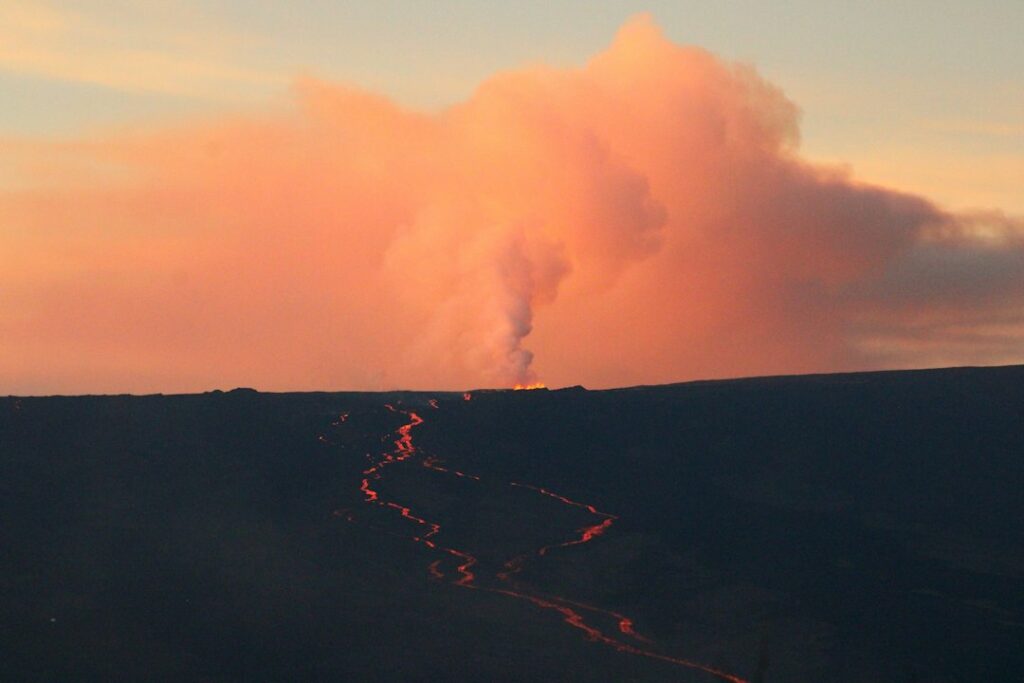
- Magma movement. Swarms of small, shallow earthquakes under Kīlauea or Mauna Loa as magma pushes into the rift zones or the summit. These are how HVO reads an eruption coming; the run-up to Mauna Loa’s November 2022 eruption was a months-long increase in small quakes.
- The Pāhala swarm. A persistent cluster of earthquakes roughly 20 to 40 km (12 to 25 miles) deep beneath the Pāhala area on the Big Island’s south coast, where magma is thought to be moving in the deep plumbing that feeds the volcanoes. It produces a steady supply of magnitude 2 to 4 quakes and is the source of many of the “south of Pāhala” entries in the box above.
- Flank movement. Kīlauea’s entire south flank slides slowly seaward along a fault at the base of the volcano. That is where Hawaii’s largest earthquakes come from, including the magnitude 7.7 Kalapana earthquake of 1975 and the magnitude 6.9 earthquake of May 4, 2018.
- Bending of the crust. The weight of the islands flexes the ocean floor beneath them, and that stress releases in deeper earthquakes away from the active volcanoes, such as the magnitude 6.7 Kīholo Bay earthquake off the Kona coast in October 2006.
What counts as normal
A useful rule of thumb for reading the box above:
| Magnitude | How often in Hawaii | What it typically means |
|---|---|---|
| Below 2.5 | Many every day | Not felt. Routine volcanic and tectonic background. |
| 2.5 to 3.9 | Several a week | Sometimes felt close to the epicenter, especially the shallow ones. No damage. |
| 4.0 to 4.9 | A few a year | Felt widely on the Big Island, occasionally on Maui. Light shaking; damage rare. |
| 5.0 to 5.9 | Roughly once a year or less | Strong shaking near the epicenter. Items fall; minor damage possible. |
| 6.0 and above | A few per decade | Damaging. Local tsunami possible if it is shallow and under or near the coast. |
Frequency matters more than any single number. A magnitude 3 quake under Pāhala is ordinary. A sudden increase in the number of earthquakes under a volcano’s summit or rift zone is what HVO watches for, and it is the reason the alert level in our Kīlauea status can change before any lava appears.
Hawaii’s largest earthquakes
| Date | Magnitude | Where | What happened |
|---|---|---|---|
| April 2, 1868 | About 7.9 | Kaʻū, south flank of Mauna Loa | The largest earthquake in Hawaii’s recorded history. It triggered a landslide and a local tsunami that together killed dozens of people along the Kaʻū coast. |
| November 29, 1975 | 7.7 | Kalapana, Kīlauea’s south flank | Generated a local tsunami within minutes that killed two people camping at Halapē, and caused damage across the island. |
| October 15, 2006 | 6.7 | Kīholo Bay, off the Kona coast | Damaged roads, buildings and historic structures in North Kona and Kohala and knocked out power on Oʻahu. No deaths. |
| May 4, 2018 | 6.9 | Kīlauea south flank | The largest since 1975, during the opening days of the 2018 lower Puna eruption. Widely felt across the state; a small, non-damaging tsunami was recorded. |
The one rule: a strong earthquake at the coast is a tsunami warning
Hawaii’s tsunami warning system gives hours of notice for waves from distant earthquakes. A large local earthquake is different. In 1975 the first wave reached the Kalapana coast within minutes of the shaking, before any alert could go out. So the rule every coastal resident is taught is:
If you are near the shore and feel an earthquake strong enough that it is hard to stand, or that lasts a long time, move inland or to high ground immediately. Do not wait for a siren or a phone alert.
Once you are safe, the official word comes from tsunami.gov. Our Hawaii tsunami warning guide covers evacuation zones, sirens and what each alert level means.
What to do during and after an earthquake
- Drop, cover and hold on. Get under a sturdy table or desk, cover your head and neck, and hold on until the shaking stops. Doorways are not safer than the rest of a modern building.
- If you are outdoors, move away from buildings, trees and power lines. On a lava-rock coast or a cliff trail, watch for rockfall.
- If you are driving, pull over away from overpasses and power lines and stay in the car until the shaking stops.
- At the coast, apply the tsunami rule above as soon as the shaking allows you to move.
- Afterwards, check for gas smells, damaged wiring and cracked water lines, and expect aftershocks. A quake large enough to damage a home can also shift a solar water heater or catchment tank; check them before the next rain.
- Report what you felt. USGS “Did You Feel It?” reports help HVO map shaking across the islands.
Earthquakes and Hawaii homeowners
Standard homeowners policies in Hawaii generally exclude earthquake damage; it is a separate endorsement or policy, and the price depends heavily on where the house is. Homes in Kīlauea’s lava zones 1 and 2 face a related but distinct problem, described in our guide to insurance in the lava zones. If you are buying on the Big Island, ask specifically whether earthquake coverage is included and at what deductible; it is one of the questions that gets skipped most often.
Frequently Asked Questions
Was there an earthquake in Hawaii today?
The status box at the top of this page shows the most recent magnitude 2.5+ earthquakes recorded by the USGS in Hawaii, updated hourly. Smaller quakes, and anything in the last few minutes, appear first on the USGS earthquake map.
Why does the Big Island have so many earthquakes?
Because it has the active volcanoes. Magma moving beneath Kīlauea and Mauna Loa, the deep Pāhala swarm, and the slow seaward slide of Kīlauea’s south flank all generate earthquakes, most of them too small to feel.
Do earthquakes in Hawaii cause tsunamis?
Rarely, but the ones that do arrive within minutes. Large, shallow earthquakes on Kīlauea’s south flank caused local tsunamis in 1868 and 1975. Treat any strong or long earthquake at the coast as a signal to move to high ground.
Can you feel earthquakes on Oʻahu, Maui or Kauaʻi?
Big Island earthquakes of magnitude 5 or above are often felt on Maui and occasionally on Oʻahu; the 2006 Kīholo Bay and 2018 Kīlauea earthquakes were felt statewide. Earthquakes centered under the other islands are much less common.
Does an earthquake mean Kīlauea or Mauna Loa is about to erupt?
A single earthquake, no. A sustained increase in small, shallow earthquakes under a volcano, combined with ground inflation, is what HVO uses to raise the alert level. Check the current level in our Kīlauea status guide.
Bottom line
Feeling a small earthquake on the Big Island is part of living on an active volcano, and the box above will usually show you a routine magnitude 2 or 3 near Pāhala or Volcano. The two things worth remembering are how to react in a strong one, and that at the coast a strong earthquake is its own tsunami warning.