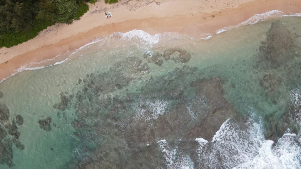
Chain of Craters Road is the paved dead-end that drops from the summit caldera of Hawai’i Volcanoes National Park down 3,700 vertical feet to the Pacific in 19 one-way miles. The route ends abruptly at a lava-buried barrier near Holei Sea Arch, and every returning vehicle must climb the same grade back up to the rim. That out-and-back geometry is the single fact that shapes every trip decision — fuel, water, timing, and gate closure.
The road has no fuel, no snack shop, no cell coverage past the third mile, and no reliable water beyond the visitor center. It also has no lights, so park rangers close the gate near the Kīlauea Overlook once daylight fades and turn every downhill vehicle around. Households treating this as a casual scenic drive routinely run the fuel light on the climb back, or miss the closure by minutes and end up backing out uphill in the dark.
This planner treats the road as a two-hour minimum round trip from the summit visitor center, doubles that estimate when the goal is Pu’u Loa petroglyphs or sunset at Holei Sea Arch, and flags the exact fuel and daylight buffers a household needs before descending. A separate rim tour of the same road with an emphasis on overlook stops handles the geology narrative in more depth.
Road Profile from Rim to Sea
Chain of Craters Road begins near the Kīlauea caldera rim at roughly 3,700 feet and terminates at roughly sea level near the East Rift Zone coast. The 19-mile paved segment falls at an average grade of nearly 4 percent, with steeper sustained runs between Kealakomo and Muliwai a Pele. Rental sedans, minivans, and small SUVs handle it comfortably in normal weather — the challenge is not the pavement but the elevation change on the return climb.
Elevation profile
Descending drivers pass through three loosely defined bands. The first four miles remove roughly 500 feet of altitude through ohia forest with sporadic craters just off the shoulder. Between miles 5 and 12 the road cuts across the East Rift Zone lava fields and sheds the bulk of altitude to about 1,000 feet. From mile 12 to the coast, gentler grades roll across recent 1969–1974 Mauna Ulu flows and older 1990s Kalapana pahoehoe.
Surface and shoulders
The National Park Service repaved the upper segment in the mid-2010s and continues to patch the lower stretch as new hairline cracks appear across settled lava benches. Shoulders are narrow to non-existent for the final six miles; passing a slow vehicle safely means waiting for a signed pullout. Roadside cinder is loose in several places, particularly near Kealakomo, and pulling a low-clearance rental fully off pavement can rip a bumper.
The Zero-Gas Corridor: Fuel Planning
Once a vehicle passes the Kīlauea entrance station, no fuel is available inside the park. The nearest working pumps are 1.5 miles outside the gate in Volcano Village, another 22 miles up in Kurtistown, or 30 miles into central Hilo. That reality flips the mental model that mainland drivers bring to a national park loop; on Chain of Craters, the round-trip fuel starts at the last Volcano Village station and does not top up again until the return.
The gasoline load has to cover roughly 38 driving miles inside the park plus whatever getting-there mileage the household already used. A crossover SUV rated at 28 mpg burns about 1.7 gallons on the paved segment alone. Add 2 to 3 gallons for round-trip driving from a Hilo base or 6 to 8 gallons from a Kailua-Kona base, and the day consumes 5 to 12 gallons total. Households on a 1/4 tank buffer are not comfortably above that.
Nearest gas stations to the entrance
| Station location | Distance from park entrance | Drive time | Notes |
|---|---|---|---|
| Volcano Village (Highway 11) | 1.5 miles | 3 minutes | Highest gas prices on the island; open until roughly 9 p.m. |
| Kurtistown | 22 miles | 28 minutes | One 24-hour option; better pricing than Volcano |
| Kea’au junction | 25 miles | 32 minutes | Multiple brands; final option before Hilo |
| Hilo (Puainako St.) | 30 miles | 42 minutes | Costco pricing tier; membership-free stations nearby |
| Nā’ālehu (west, toward Kona) | 56 miles | 68 minutes | Only option if returning westbound to the Kona side |
According to weekly U.S. Energy Information Administration data, Hawai’i typically posts the highest average retail gasoline price of any state — often $1 or more per gallon above the West Coast average tracked in the EIA gasoline and diesel report. Volcano Village stations sit at the top of that already-high band because the tanker haul from Hilo is 30 miles up a mountain grade.
Fuel math for the descent
| Vehicle class | Rated mpg | Gallons for 38-mile round trip | Extra gallons vs level road |
|---|---|---|---|
| Compact sedan (Corolla, Sentra) | 32 mpg | 1.2 | ≈0.2 gallon |
| Midsize sedan (Camry, Accord) | 29 mpg | 1.3 | ≈0.3 gallon |
| Compact SUV (RAV4, CR-V) | 28 mpg | 1.4 | ≈0.3 gallon |
| Midsize SUV (Highlander, Pilot) | 22 mpg | 1.7 | ≈0.4 gallon |
| Full-size van (Odyssey, Sienna) | 21 mpg | 1.8 | ≈0.4 gallon |
| Hybrid or plug-in EV (Prius, Bolt) | 52 mpg | 0.7 | Regenerative offset on descent |
The climb back adds meaningful load. A vehicle rated for 28 mpg on flat highway will consume closer to 22 mpg on the sustained uphill return, which is why the table separates the extra half-gallon from the flat-road baseline. Drivers renting hybrid or plug-in EVs recover a slice of that energy through regenerative braking on the way down but still see net loss on the return. Planning against the worst mpg number in the household fleet is the safe move.
Households familiar with the Hana Highway fuel cadence on Maui already understand the mainland shock — Chain of Craters is a similar “top off before you go, do not assume anything past the trailhead” corridor, only shorter and steeper.
A Realistic Two-Hour Time Budget
The National Park Service posts 90 minutes as a minimum round-trip driving time from the summit visitor center to Holei Sea Arch and back, assuming no stops. Real households almost never hit that number. Between required pullouts for restrooms, safety scans of the crumbling coastal cliffs, and the pull of Pu’u Loa petroglyphs, two hours is the realistic floor and three-plus hours is standard for a first visit.
| Activity block | Time (one-way share) | Cumulative |
|---|---|---|
| Visitor center to Mauna Ulu trailhead pullout | 10 min drive + 5 min stop | 0:15 |
| Mauna Ulu to Kealakomo overlook | 18 min drive + 10 min view | 0:43 |
| Kealakomo to Pu’u Loa petroglyph trailhead | 15 min drive + 45 min walk | 1:43 |
| Pu’u Loa to Holei Sea Arch parking | 10 min drive + 20 min at arch | 2:13 |
| Return climb to summit (no stops) | 45 min continuous drive | 2:58 |
| Total for full itinerary | — | ≈3:00 hours |
Households that add lunch at the vehicle, extra photo stops at the Muliwai a Pele lava-fall pullout, or a walk out onto the 1974 Mauna Ulu flow can push the day past four hours easily. That budget then has to be laid against the sunset closure at the top of the road, which becomes the binding constraint in winter months when daylight is shortest.
Pullouts and Overlooks Worth the Stop
Chain of Craters Road has more than 20 signed pullouts. Not all are worth the extra vehicle exposure and heat load. The four covered below are the ones that repeatedly justify parking, walking a few hundred feet, and getting back into a hot rental interior.
Mauna Ulu shield and 1969 flows (mile 3.5)
The Mauna Ulu turnout leaves the main road for a short spur to the parking area for the Nāpau trail. Even without hiking, walking 200 yards to the interpretive overlook lets travelers see the vent that fed the 1969–1974 eruption. This is the highest-elevation of the coastal-descent stops and often 8 to 12°F cooler than Holei Sea Arch at the same hour.
Kealakomo overlook (mile 10)
Kealakomo is the road’s signature midpoint view, cantilevered on the flank of the Hōlei Pali cliff at roughly 2,000 feet. A covered picnic shelter provides the only real shade until the coast. The overlook has vault toilets, no water, and no fuel — it is the last public restroom before the coastal pullouts nine miles down. On clear afternoons, the Pacific horizon stretches roughly 55 miles from this bench.
Muliwai a Pele lava fall (mile 12)
An unmarked pullout on the makai (ocean) side lets drivers see where the 1974 Mauna Ulu flow poured over the Hōlei Pali cliff in braided lobes. The frozen “lava fall” is a photograph favorite; the visual makes the vertical drop from the caldera rim obvious in a way the road itself hides. Two vehicles fit comfortably; parking on the shoulder blocks emergency access and rangers do issue warnings.
Pu’u Loa petroglyphs (mile 16.5)
The Pu’u Loa trailhead sits at a small paved lot with a vault toilet. A 0.7-mile one-way boardwalk crosses pahoehoe to the largest known petroglyph field in Hawai’i — an estimated 23,000 images pecked into the crust by 700 years of Native Hawaiian families who traveled here to place a piko, the umbilical stump, of a newborn into a small drilled hole. The site is spiritually active. Rangers ask visitors to stay strictly on the boardwalk.
Trip planners should budget 45 minutes for the flat but exposed walk. Midday surface temperatures on the black pahoehoe run 20°F higher than air readings — meaning a 78°F afternoon feels like 98°F on the boards. Households with young children or heat-sensitive travelers do this stop in the morning shift or before 4 p.m. on the return.
Holei Sea Arch (mile 19)
The road ends at a paved loop where a short walk leads to the fenced overlook above the 90-foot basalt arch carved by the Pacific into cliffs of columnar lava. The arch itself is not stable in the long run; sea cliffs here retreat at roughly 1 to 2 feet per year, and rangers move the viewing fence back as the lip crumbles. The paved lot has vault toilets and interpretive signage, no drinking water.
Sunset Closure and Gate Timing
The park gate at the top of Chain of Craters Road closes to descending traffic at nightfall. There is no fixed time posted year-round; rangers set the closure based on the day’s actual sunset. In practice, closure to new downhill traffic begins about 30 to 45 minutes before official sunset. Vehicles already on the road may exit until the road is fully cleared.
Monthly closure timing
| Month | Sunset (Volcano) | Effective gate close | Last safe descent start |
|---|---|---|---|
| January | 6:03 p.m. | 5:30 p.m. | 2:30 p.m. |
| March | 6:35 p.m. | 6:00 p.m. | 3:00 p.m. |
| May | 6:59 p.m. | 6:25 p.m. | 3:25 p.m. |
| July | 7:10 p.m. | 6:35 p.m. | 3:35 p.m. |
| September | 6:38 p.m. | 6:05 p.m. | 3:05 p.m. |
| November | 5:53 p.m. | 5:20 p.m. | 2:20 p.m. |
The “last safe descent start” column subtracts three hours from the gate close: 45 minutes down, 90 minutes of stops, and 45 minutes back up. Households that intend to walk Pu’u Loa should subtract another 45 minutes and start descending four hours before the effective close. Sunset at the coast itself is roughly 3 to 4 minutes later than the summit reading, and the road’s east-facing slopes go dark 30 minutes earlier than the west-facing rim.
After-hours permits
The park does issue after-hours access permits, but they are aimed at qualified researchers, photographers with a permitted commercial shoot, and Native Hawaiian cultural practitioners. Casual visitors are not eligible. Households hoping to shoot sunset from Holei should plan to be on-road well before the closure, take the arch shots as the sun drops, then drive up under headlights during the exit window rangers allow for vehicles already inside.
Combining with Crater Rim Drive West
A rim-and-sea day pairs the Chain of Craters descent with the western half of the Crater Rim Drive, which loops the summit caldera edge for roughly 4 miles from the visitor center to the Uēkahuna vista. The full west-rim segment adds about 30 to 45 minutes to a Chain of Craters loop and covers the Steaming Bluff, Sulphur Banks parking, and the Kīlauea Overlook viewpoint above the Halema’uma’u crater.
The most efficient sequence for a household staying overnight in Volcano Village lodging near the HVNP entrance is to walk the summit rim in the cool morning. A break for lunch back in the village re-fuels people and cars. The Chain of Craters descent then falls in early afternoon so the return climb finishes with an hour of daylight to spare.
Travelers who added the Kīlauea Iki crater-floor loop earlier the same day should treat that hike as their primary exertion and Chain of Craters as the recovery drive — the coastal descent doesn’t require walking, but the exposed lava-field air handles harshly on already-fatigued legs.
Rental-Car Considerations
The paved surface accommodates any rental class, but three car-choice details matter. First, the return climb burns about 20 percent more fuel than a flat highway equivalent — a smaller tank means less margin. Second, roof racks and windshield-mount bike racks catch strong crosswinds at Kealakomo where the wind funnels over the Hōlei Pali cliff. Third, low-clearance sedans scrape at the two coastal viewpoints where the paved lots have shifted with the substrate.
| Rental factor | Preferred | Avoid | Rationale |
|---|---|---|---|
| Tank size | 13+ gallons | Sub-compact (~10 gal) | Buffer for climb without Volcano Village top-off |
| Transmission | Automatic | Manual, if inexperienced | Sustained 4% grade tires out a rusty stick driver |
| Ground clearance | 6+ inches | Sport sedans below 5″ | Coastal lots have raised edges and cinder |
| A/C | Working, tested at pickup | Unrepaired rentals | Coastal end runs 82–88°F afternoons |
| Fuel policy | Full-to-full | Prepaid fuel | Volcano gas is expensive; only buy what’s used |
Insurance-wise, the paved segment is not an off-road exclusion event. Standard CDW and LDW coverage remain in effect. The main peril is a shallow cinder pull-out where a fender rubs the ground; damage there is on-road and covered by standard collision insurance, unlike a Kua Bay excursion — the drive-in at Kekaha Kai State Park voids most rental agreements the moment tires leave asphalt.
Weather, Air Quality, and Vog
Climate on Chain of Craters shifts dramatically over the 19-mile run. Summit air at Volcano Village averages 60 to 68°F year-round; the coastal end averages 78 to 88°F. Windward showers at the rim can drop half an inch of rain while the coast stays dry. Households descending in short sleeves often shiver on the return climb when temperature falls two-thirds of a degree per 100 feet of elevation gain.
Vog and volcanic gas
Sulfur dioxide from ongoing Kīlauea activity concentrates in specific areas depending on trade-wind direction. When trades blow from the northeast (the dominant summer pattern), gas plumes drift southwest and can affect the upper Mauna Ulu overlook. The Hawai’i Department of Health maintains a network of SO2 monitors, and Volcanoes National Park posts current conditions at the summit visitor center each morning.
Households with asthma, COPD, heart disease, or pregnancy should treat any active vent as a real exposure event. On advisory days, the National Park Service often closes specific overlooks and re-routes traffic. Chain of Craters generally stays open through moderate vog because the road drops away from the vent — but the parking-lot air at the Kealakomo shelter can smell strongly of rotten eggs on southwest wind days.
Rain and slick pavement
The road passes through the wet windward flank of Kīlauea between miles 2 and 5, where rain squalls develop with almost no warning. Pahoehoe lava seeping fresh water can leave dark stains that look identical to oil slicks and are, in fact, similarly slippery. Reducing speed to 25 mph in a shower and adding two seconds to the following distance from the vehicle ahead handles the risk without slowing the loop meaningfully.
Wildlife, Hazards, and Coastal Cliffs
The road corridor passes through nēnē (Hawaiian goose) habitat between mile 1 and mile 4. The birds cross pavement slowly, and posted 25-mph zones exist specifically because a Hawai’i state endangered species can be killed by a distracted driver. Vehicles pay the ticket, but the population loss is what matters. Nēnē are also present in the Kealakomo parking area, where they have learned to associate humans with food; feeding them accelerates habituation and is subject to a federal citation.
Coastal cliff safety
The sea cliffs at Holei Arch and along the last mile of paved road are actively eroding. According to Honolulu Star-Advertiser reporting, the National Park Service moved the paved parking loop about 60 feet inland in 2015 after a section of cliff collapsed into the surf. Rangers do not fence the entire clifftop; travelers who step over warning signs to get a better arch photo risk a rescue call.
Sun exposure
The coastal end has no natural shade — the tree line ended miles above. Fair-skinned travelers can burn in 20 to 25 minutes at UV index 11, which the coastal section regularly hits between 10 a.m. and 3 p.m. Bring wide-brim hats, SPF 30+ mineral sunscreen (labeled reef-safe under Hawai’i’s oxybenzone and octinoxate ban), and at least a liter of water per person for the Pu’u Loa walk.
Pack List and Vehicle Prep
The pack list changes with time of day. Morning descents can be genuinely chilly at the summit — households arriving from a Kona-side condo often underestimate how cold a 55°F 6 a.m. rim can feel. Afternoon descents to the coast run the opposite risk of heat stroke on the Pu’u Loa boardwalk. A single tote covers both scenarios: a light fleece for the summit, water and hats for the coast.
- Two liters of water per person; more on midsummer descents
- Real snacks; no vending machines exist inside the park
- Light fleece or windbreaker for the rim and evening return climb
- Wide-brim hat and mineral sunscreen for coastal stops
- Sturdy closed-toe shoes for the Pu’u Loa boardwalk
- Printed park map; cell service dies past mile 3
- Downloaded offline map on the phone as a backup
- Small binoculars for Kealakomo and Muliwai a Pele viewing
- Trash bag for pack-out; no roadside garbage bins past visitor center
Vehicle prep is minimal but non-negotiable. Check tire inflation before leaving Hilo or Kona — the elevation change alone shifts pressure by roughly 2 psi. Confirm the fuel gauge shows above 3/4 tank at the entrance station. Program the destination into offline maps because signal drops before Mauna Ulu. Bring a physical copy of the park brochure in case the phone dies during a long shoulder stop.
Household Cost and Context
Beyond fuel, Chain of Craters is one of the cheaper “big” Hawai’i experiences a household can plan. The park entrance fee is $30 per private vehicle valid for seven days, which covers the entire family regardless of headcount. That single-day cost roughly equals lunch at a coastal town — a Rainbow Drive-In plate lunch in Kapahulu runs $11 to $14 per person on the Oahu side for perspective.
According to the Bureau of Labor Statistics Honolulu CPI series, transportation and gasoline in Hawai’i run substantially higher than U.S. urban averages — often 15 to 25 percent above continental readings for the same fuel grade. Households evaluating a permanent move often use a Chain of Craters day trip as a rough test of what statewide gas dependency will cost them if they end up 30 miles from a station regularly.
Official trip planning resources at the state tourism authority website emphasize the same basic advice: check current park conditions the morning of the visit, bring more water than expected, and never assume services will be present past the entrance station. Rangers repeat the same warnings at every visitor-center briefing, and they hold up because the corridor punishes assumption.
Frequently asked questions
Is there gas anywhere inside Hawai’i Volcanoes National Park?
No. The nearest working gasoline pumps sit 1.5 miles outside the entrance in Volcano Village. Descending vehicles must complete the 38-mile round trip on the fuel loaded at the entrance, plus have enough remaining to reach either Volcano Village or Hilo on the way out. A quarter-tank buffer at the entrance is not enough for larger SUVs.
How long does the full Chain of Craters Road round trip really take?
Ninety minutes covers driving only, no stops. Two hours is the realistic minimum with brief pullouts at Kealakomo and Holei Sea Arch. Add 45 minutes for the Pu’u Loa petroglyph walk and 30 minutes for a picnic lunch, and the loop pushes past three hours. Sunset closure at the top makes any late-afternoon start risky.
What time does the gate close at the top of Chain of Craters Road?
Rangers close the gate at nightfall, which shifts with the season. In late June the effective close falls near 6:35 p.m.; in December it can be as early as 5:20 p.m. New downhill traffic is turned around roughly 30 to 45 minutes before official sunset. Vehicles already below the gate are given a reasonable exit window under headlights.
Can a low-clearance rental sedan handle Chain of Craters Road?
Yes. The full 19-mile route is paved and generally in good condition. The two spots where low sedans occasionally scrape are the coastal parking loops where the substrate has settled and edges are raised. Drive slowly into parking spots and avoid loose cinder on the shoulder. Standard collision insurance covers any on-road damage from settled pavement.
Is the Holei Sea Arch worth the drive if the household is on a tight schedule?
The arch itself is a five-minute walk from paved parking and adds 40 minutes of driving each way from Kealakomo. Households with less than three hours of daylight remaining at the visitor center should skip it and turn around at Muliwai a Pele. Households with four-plus hours can comfortably reach the arch, take photos, and return before the gate closes.
Are there restrooms and drinking water along Chain of Craters Road?
Vault toilets exist at the Mauna Ulu trailhead, Kealakomo overlook, Pu’u Loa parking area, and the Holei Sea Arch loop. No drinking water is available past the Kīlauea Visitor Center at the top. Households should fill every water bottle at the summit and treat the day as an unsupported desert crossing — because the coastal section, in solar-load terms, essentially is one.
Can travelers see active lava from Chain of Craters Road?
Not currently at the road itself. Active surface flows visible from paved viewpoints have not been present since 2018, when the Pu’u O’o vent stopped erupting. The Kīlauea summit has produced periodic Halema’uma’u lake eruptions since 2020, best viewed from the summit rim rather than the coastal descent. Check current conditions at the visitor center each morning before descending.
Should households pair Chain of Craters with a Mauna Loa trip on the same day?
No. Mauna Loa Observatory Road climbs to 11,140 feet and requires a full separate half day plus significant acclimatization. Combining that ascent with the Chain of Craters descent puts a household through 15,000 feet of cumulative elevation change in one day. The Mauna Loa eruption evacuation planning guide is a better companion read than a same-day driving stack.


