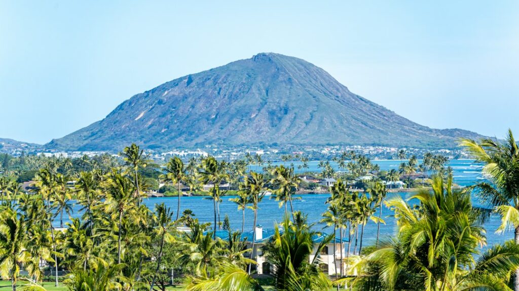
When Kilauea erupts, sulfur dioxide (SO2) mixes with sunlight and moisture to form vog. Downwind communities on Hawaii Island’s Kau district and the Kona coast see the highest exposure. The Hawaii Department of Health runs an interagency air-sensor network with USGS Hawaiian Volcano Observatory and the National Park Service that publishes real-time SO2 and PM2.5 readings.
Households relocating to Hawaii Island quickly learn that vog is not evenly distributed. Trade winds from the northeast push the plume southwest toward Ocean View and Naalehu, then wrap around to Kailua-Kona when the wind slackens. The dashboard aggregates readings from about 15 fixed monitors so residents can decide whether to open windows, run purifiers, or reschedule outdoor exercise before symptoms start.
This article walks through how the DOH-USGS-NPS network works: the Air Quality Index (AQI) breakpoints that separate a green day from a code-red event, the monitor sites that matter for Kau and Kona residents, the advisory versus warning language regulators use, and the asthma response protocol that pediatricians and DOH publish for schools and households.
The Hawaii Interagency Vog Information Dashboard
The Interagency Vog Information Dashboard is the public face of a decade-old partnership among the Hawaii Department of Health Clean Air Branch, the USGS Hawaiian Volcano Observatory, the National Park Service at Hawaii Volcanoes National Park, and the University of Hawaii at Hilo. It centralizes sensor feeds, forecast plumes, and health guidance at health.hawaii.gov and its sibling vog microsite.
Dashboard URLs follow a stable pattern. The public entry point is vog.ivhhn.org, which redirects to the Hawaii Interagency Vog Information Dashboard hosted by the International Volcanic Health Hazard Network. Sub-pages use the pattern /current-vog-conditions, /vog-faqs, and /so2-monitoring, so a bookmark set once during onboarding continues to work through eruption cycles.
State law authorizes the DOH Clean Air Branch under Hawaii Administrative Rules Chapter 11-59 to operate the monitor grid, publish threshold guidance, and coordinate school closures. The USGS Hawaiian Volcano Observatory contributes plume trajectory modeling driven by Kilauea vent emission rates measured in tonnes of SO2 per day. NPS staff at Kilauea Visitor Center relay ground-truth observations from Crater Rim Drive to the shared feed.
SO2 and PM2.5: What the Sensors Actually Measure
Sulfur dioxide (SO2) is the primary emission at the Halemaumau vent. Federal reference method sensors report SO2 in parts per billion (ppb) averaged over one hour or 24 hours. Once SO2 drifts downwind and reacts with sunlight and water vapor, sulfate aerosols form the secondary pollutant, PM2.5 — fine particulate matter smaller than 2.5 micrometers. Sensors report PM2.5 in micrograms per cubic meter (μg/m³).
The two pollutants demand different responses. SO2 spikes fast and dissipates fast — a one-hour reading of 200 ppb near Pahala can drop to background within 90 minutes if the trade winds return. PM2.5 lingers because sulfate aerosols travel farther and settle slowly, which is why Kona reports elevated PM2.5 hours after Kau reports elevated SO2. A monitor that ignores one pollutant would miss half the exposure story.
The chemistry that turns vent SO2 into ground-level PM2.5 takes 6 to 48 hours depending on humidity, sunlight, and aerosol precursors already in the atmosphere. On humid trade wind afternoons the conversion runs fast, which is why Kau residents see the sulfate haze intensify by 2:00 p.m. even when morning readings were clear. Nighttime typically slows conversion but does not stop it — sulfate concentrations often remain elevated into the following morning.
Vent output during the 2018 Lower East Rift Zone eruption reached 50,000 to 200,000 tonnes of SO2 per day, according to DOH summaries drawing on USGS gas geochemistry. For comparison, background degassing at Halemaumau since the 2020 summit resumption has averaged roughly 500 to 3,000 tonnes per day depending on lake activity. Emission rate is the single best predictor of downwind exceedances.
Reference-Grade Versus Community Sensors
The DOH grid pairs federal reference method instruments — pulsed fluorescence for SO2, beta attenuation for PM2.5 — with lower-cost community sensors from PurpleAir and clarity nodes. Reference instruments cost $25,000–$45,000 each and require quarterly calibration, while community units run $200–$300 and refresh faster but with 15–25% higher error bars. The dashboard flags which is which so residents can weight readings appropriately.
AQI Breakpoints for SO2 and PM2.5
The EPA Air Quality Index converts raw concentrations into six color-coded categories: Good, Moderate, Unhealthy for Sensitive Groups, Unhealthy, Very Unhealthy, and Hazardous. Hawaii DOH applies the same categories but uses one-hour SO2 breakpoints because vog plumes fluctuate on hour-scale timescales rather than the 24-hour scale designed for urban pollution.
| AQI Category | Color | SO2 (ppb, 1-hour) | PM2.5 (μg/m³, 24-hour) | General Guidance |
|---|---|---|---|---|
| Good | Green | 0–35 | 0–12.0 | Normal outdoor activity |
| Moderate | Yellow | 36–75 | 12.1–35.4 | Unusually sensitive individuals reduce exertion |
| Unhealthy for Sensitive Groups | Orange | 76–185 | 35.5–55.4 | Asthma, heart, lung patients limit outdoor time |
| Unhealthy | Red | 186–304 | 55.5–150.4 | Everyone reduces prolonged exertion |
| Very Unhealthy | Purple | 305–604 | 150.5–250.4 | Avoid outdoor activity; shelter with filtration |
| Hazardous | Maroon | 605+ | 250.5+ | Emergency conditions; evacuate if directed |
Sensitive groups defined by the DOH include children under 14, adults over 65, pregnant residents, and anyone with asthma, chronic obstructive pulmonary disease, or cardiovascular conditions. The site breaks down which populations are most exposed. For SO2 specifically, asthmatic children can show wheeze at 100 ppb in a single 10-minute burst, which is well below the orange threshold — a limitation of hour-averaged readings.
Monitor Sites: Kau District and Kona Corridor
Roughly 15 permanent stations feed the dashboard, but two clusters carry most of the health decisions. Kau covers the wind shadow directly southwest of the Kilauea summit; Kona covers the leeward Kohala and Kona coast where the plume wraps back onshore under weak trades. Household planning depends on knowing which station is upwind of a specific address.
| Station | District | Elevation (ft) | Primary Wind Regime | Typical Peak Month |
|---|---|---|---|---|
| Pahala | Kau | 870 | Trade winds southwest of summit | June–September |
| Ocean View | Kau | 2,600 | Southwest plume terminus | July–October |
| Naalehu | Kau | 820 | Trade wind funnel through South Point | June–September |
| Mountain View | Puna | 1,500 | Rift zone downwind under kona wind | November–February |
| Kailua-Kona | North Kona | 40 | Wraparound plume under weak trades | August–October |
| Kealakekua | South Kona | 1,400 | Slope thermal inversion | September–October |
| Kilauea Visitor Center | Volcano | 3,970 | Rim-edge summit degassing | Year-round |
Why Kau Monitors First
Pahala sits about 20 miles southwest of Halemaumau and lies squarely in the path of the trade wind plume 60–70% of the year. Historical data show one-hour SO2 exceedances at Pahala averaging 12 to 30 red-category hours per month during the 2018 eruption. The station transmits every 5 minutes, so a lag of only 15 minutes exists between vent output change and dashboard update.
Ocean View, at 2,600 feet elevation, catches the plume after it has climbed the flank of Mauna Loa. Sulfate aerosols dominate here more than raw SO2, which shifts the health burden from throat and airway irritation to fine particle deposition deeper in the lungs. Residents considering the off-grid lots in Puna and Kau should read Ocean View data before making offers.
Naalehu, at 820 feet elevation and just south of Pahala, catches plume material funneled through the South Point wind gap. During strong trade wind episodes at 20+ knots, Naalehu can register readings comparable to Pahala within 30 minutes of the summit shift. Households evaluating Naalehu as a home base should sit through at least one full summer season before committing, because the June through September stretch consistently records the year’s highest sulfate load.
Why Kona Monitors Sometimes Spike Higher
Under a kona wind (out of the southwest) or under a stagnant high-pressure ridge, the plume drifts north up the Kona coast and pools against the leeward slope. Kailua-Kona has recorded PM2.5 readings above 55 μg/m³ during 3–5 day stagnation events, which pushes AQI into the red category even though the town lies 60 miles from the vent. Wind direction, not distance, determines exposure.
The 2026 Kona cost-of-living analysis notes that HEPA replacement filters run $45–$90 twice yearly during active eruption periods, an expense buyers routinely underestimate. The full guide to living in Kona covers the microclimate reasons.
Volcano Village and the Summit Rim
Volcano Village sits about 3,970 feet elevation on the summit’s east flank, close enough to Halemaumau that a shift in wind can bring vent gas directly overhead. The Kilauea Visitor Center monitor operated by NPS reads highest of any station in the network during eruption phases. Residents there report morning-to-afternoon variability of 300 ppb in a single day. School attendance at Volcano School of Arts and Sciences fluctuates on the same schedule.
Data Latency and Gap Periods
Hardware failures, power outages, and satellite uplink glitches produce occasional data gaps in individual stations. During the 2018 event, Ocean View lost 27 hours of continuous data across three episodes, filled after the fact through reference calibration against Naalehu and Pahala. Users of the dashboard should treat a station shown as “no data” as neither safe nor dangerous — pull the nearest upwind station instead and check the emission rate posted by HVO.
Advisory Versus Warning Thresholds
DOH distinguishes three action tiers: information, advisory, and warning. Each tier triggers a different public communication and different school and workplace guidance. The distinction matters because residents new to the island often treat “advisory” as a synonym for “warning,” which produces either avoidable panic or dangerous complacency.
| Tier | Triggering Reading | Duration | Public Action |
|---|---|---|---|
| Information | SO2 approaching 75 ppb 1-hour | Any time | Sensitive groups check dashboard hourly |
| Advisory | SO2 75–185 ppb sustained 1 hour | 2–24 hours | Sensitive groups indoors; outdoor sports reduced |
| Warning | SO2 above 185 ppb or PM2.5 above 55 μg/m³ | Until reading falls | Schools consider closure; general public shelters |
| Emergency | SO2 above 605 ppb 1-hour | Rare | Evacuation guidance from Hawaii County Civil Defense |
Schools in Kau District follow a written protocol tied to these tiers. During advisory, recess moves indoors and physical education drops to walking pace. During warning, buses do not run to Volcano School of Arts and Sciences until the reading clears, and remote instruction switches on within 90 minutes. Naalehu Elementary reported 14 remote days during a 2018 stretch when PM2.5 exceeded warning thresholds for consecutive weeks.
Asthma Response Protocol Endorsed by DOH
DOH publishes a five-step asthma action plan aligned with National Heart, Lung, and Blood Institute guidance and tailored to vog exposure. Pediatricians at Kapiolani Medical Center and Hilo Medical Center distribute the plan to newly diagnosed asthmatic children, and school nurses use it to log daily peak flow readings during eruption periods. The plan is color-matched to AQI so families do not need to translate between two scales.
- Green (AQI 0–50): Baseline controller medication only; peak flow logged once daily.
- Yellow (AQI 51–100): Add short-acting bronchodilator pre-exposure; log peak flow twice.
- Orange (AQI 101–150): Move exercise indoors; increase controller dose per allergist protocol.
- Red (AQI 151–200): Remain indoors with HEPA filtration; use rescue inhaler on symptom onset.
- Purple/Maroon (AQI 201+): Call 911 for wheeze, tripod posture, or peak flow under 50% of personal best.
Where to Refill and Consult
Hilo Medical Center’s respiratory clinic keeps a walk-in vog protocol during eruption periods, and Kona Community Hospital does the same on the leeward side. Pharmacies in Pahala, Naalehu, and Captain Cook stock albuterol and Advair on emergency-restock contracts that trigger when DOH declares a warning tier. Insurance authorization for extra rescue inhalers routinely clears in 24–48 hours during declared events.
Historical Eruption-Period Exceedances
Kilauea has three distinct emission regimes in the modern monitoring record: the 1983–2018 Puu Oo effusive period, the 2018 Lower East Rift Zone (LERZ) event, and the 2020–present summit lake cycles. Each regime produced a different exceedance signature at the ground-level monitors.
| Period | Peak SO2 Emission (tonnes/day) | Pahala Red-AQI Hours/Month | Ocean View Peak PM2.5 (μg/m³) | Notable Health Response |
|---|---|---|---|---|
| Puu Oo 2008–2018 | 500–2,500 | 3–8 | 85 | Baseline school protocols established |
| LERZ May–Aug 2018 | 50,000–200,000 | 12–30 | 240 | 14 remote school days, expanded HEPA distribution |
| Summit lake Dec 2020–May 2021 | 1,000–5,000 | 4–10 | 72 | Advisory tiers on 40 days in Kau |
| Halemaumau eruption 2023 | 2,500–6,000 | 6–14 | 95 | Kona wraparound alerts 8 days |
| Post-2024 background | 200–1,500 | 1–4 | 35 | Information tier only |
The 2018 LERZ eruption remains the reference case for worst-case planning. Between May and August that year, Honolulu Civil Beat coverage documented 60 continuous days when Ocean View, Naalehu, and Pahala together spent more than 30% of hours in red or purple AQI. The Pahoa and Lower Puna relocation guide covers the parallel lava-flow displacement.
The 2018 LERZ event produced the highest SO2 emission rates ever recorded at any US volcano. Fissure 8 emitted at an estimated 50,000–200,000 tonnes per day for eight consecutive weeks, per USGS post-eruption analysis. Ocean View recorded PM2.5 readings above 240 μg/m³ on 12 occasions, requiring residents to relocate temporarily to Waimea or Kailua-Kona for several days at a time. The long-term rental site directory flagged short-term evacuation stays as a category then.
The Honolulu Star-Advertiser and Hawaii News Now both maintain vog beat coverage that consolidates DOH readings, USGS emission updates, and Civil Defense guidance into single daily wraps during active eruptions. A layered subscription of these outlets plus the dashboard covers the practical needs of most sensitive-group households.
Regulatory Framework and Federal Alignment
DOH operates under Hawaii Administrative Rules Chapter 11-59, which incorporates the federal Clean Air Act SO2 National Ambient Air Quality Standard of 75 ppb over a 1-hour average and the PM2.5 standard of 35 μg/m³ over 24 hours. The EPA reviews these standards on a five-year cycle. Hawaii submitted its most recent State Implementation Plan (SIP) update in 2022, incorporating Kilauea emission modeling that other states do not require.
The state tax department is unrelated to air quality, but the same DOH umbrella that handles vog monitoring runs the Oahu cesspool conversion timeline, DOH vital records, and the kupuna caregiver stipend. New residents who register once with DOH will find their contact record shared across programs.
County-level authority intersects the state framework. Hawaii County Civil Defense broadcasts the DOH-issued advisories via HNL Alert and Nixle text notifications, while the City and County of Honolulu maintains parallel infrastructure for Oahu vog events. Coordination happens through a joint operations center in Hilo activated when SO2 emission exceeds 5,000 tonnes per day for more than 48 hours.
How Households Use the Dashboard Day to Day
Practical use of the dashboard is a morning routine rather than a crisis tool. Long-term residents check three data points before deciding on the day: the Pahala or Kailua-Kona 1-hour SO2, the summit emission rate reported by HVO in tonnes per day, and the 72-hour trade wind forecast from the National Weather Service Honolulu forecast office. That combination predicts afternoon exposure with reasonable accuracy.
A Sample Morning Check
A Kau household might see the following at 7:00 a.m.: Pahala 1-hour SO2 at 42 ppb (yellow), summit emission at 1,800 tonnes/day, and trade winds at 12 knots from 065 degrees. The read: yellow now, likely orange by midafternoon as heating pulls the plume upslope, so schedule outdoor work before 11:00 a.m. and close windows by 2:00 p.m. Repeat the check at 1:00 p.m.
Households on Oahu can generally ignore the dashboard unless a kona wind lasts more than 48 hours. Vog plumes reach Oahu roughly 8–14 times per year, usually October through February, and Honolulu monitors rarely climb above yellow. The Honolulu CPI tracks food and housing rather than air quality, but the DOH runs three Oahu monitors reported on the same dashboard.
Filtration, Sheltering, and Household Preparation
Sheltering during a warning tier means more than closing windows. Effective indoor air management requires a HEPA-grade filter rated MERV 13 or higher on the HVAC intake, plus a portable HEPA cleaner sized to the largest occupied room. A CADR rating of 240 covers a 350-square-foot living room, and units cost $180–$450 depending on brand.
SO2 gas cannot be captured by a HEPA filter alone. Activated carbon layers, or dedicated potassium-permanganate media, are required to scrub SO2 to safe indoor levels. Combined HEPA + carbon units run $350–$650 and remain the DOH recommendation for households with severe asthma. Weatherstripping and closing bathroom vents cut indoor SO2 infiltration by roughly 40% versus a leaky envelope.
| Filter Type | Coverage | Initial Cost | Annual Replacement | SO2 Effective? |
|---|---|---|---|---|
| MERV 8 HVAC filter | Whole house | $15 | $60 (4 filters) | No |
| MERV 13 HVAC filter | Whole house | $32 | $128 (4 filters) | Partial PM2.5 |
| HEPA portable | 350 sq ft | $180–$450 | $60–$120 | PM2.5 only |
| HEPA + carbon portable | 350 sq ft | $350–$650 | $140–$220 | Yes |
| Whole-house carbon scrubber | Whole house | $1,800–$4,500 | $300–$500 | Yes |
A common Kau household stack combines a MERV 13 HVAC filter for baseline PM2.5 reduction with a HEPA+carbon portable placed in the bedroom, running only during red and purple tier events to preserve carbon life. Total first-year outlay lands at $520–$780 depending on brand, and the equipment lasts 5–7 years with routine filter swaps. Households on the long-term rental market can ask landlords to install the HVAC filter.
N95 Masks and Their Limits
N95 masks are effective against PM2.5 sulfate aerosols but do not filter SO2 gas. DOH updated its 2019 guidance to note this distinction explicitly after residents reported worsening symptoms while wearing N95s during high-SO2 low-PM2.5 conditions. For gas protection, only a fitted respirator with acid-gas cartridges rated for SO2 works, and residents rarely use these outside of Volcano village work crews.
Rain Catchment Contamination
Ocean View and much of Puna depend on rain catchment for drinking water. Sulfate deposition drops rainwater pH to 4.5 or lower during heavy vog periods, which leaches copper and lead from plumbing and dissolves galvanized roof coatings. DOH testing programs distribute free pH strips through the Kau district office and recommend a first-flush diverter that dumps the initial 2–5 gallons of a rain event.
The 2026 vog protection guide and the OSDS permit walk-through both intersect with catchment-system planning because septic siting and roof runoff share the same site plan.
Vog Preparedness in a Broader Hazard Plan
Vog is one of five recurring hazards on Hawaii Island: eruption, hurricane, tsunami, drought, and invasive species. A household plan that only addresses one hazard leaves gaps. The 48-hour hurricane warning timeline and HDOA little fire ant protocol cover parallel action plans that share the same emergency supply list and communication tree.
A shared emergency binder should include: DOH sensor bookmarks, medication list with pharmacy numbers, HEPA filter replacement schedule, emergency N95 count, and a printed AQI-to-action card taped inside the pantry door. Households that formalize this planning after moving report fewer symptom escalations during eruption cycles.
Frequently asked questions
What URL should residents bookmark for the Hawaii vog dashboard?
The public entry point is vog.ivhhn.org, which redirects to the Hawaii Interagency Vog Information Dashboard. Sub-pages include /current-vog-conditions for live SO2 and PM2.5 readings, /so2-monitoring for station history, and /vog-faqs for health guidance. DOH also maintains a mirror at health.hawaii.gov during declared events. Bookmark both.
How often do sensor readings update on the dashboard?
Most fixed stations transmit every 5 minutes, with dashboard refresh cycles running every 10–15 minutes. Kilauea Visitor Center and Pahala refresh fastest because they carry federal reference method instruments prioritized in the DOH data pipeline. Portable community sensors update less frequently, typically hourly, and are labeled as reference-grade rather than regulatory-grade on the dashboard.
Are the AQI colors on the dashboard the same as EPA national colors?
Yes. The Hawaii DOH uses the standard EPA color scheme — green, yellow, orange, red, purple, maroon — mapped to identical category names. The only Hawaii-specific twist is that SO2 breakpoints run on a one-hour scale instead of the 24-hour scale used for most urban pollution, which better matches how vog plumes rise and fall.
Can an N95 mask protect against vog?
N95s filter PM2.5 sulfate aerosols effectively but do not stop SO2 gas. During events dominated by fresh SO2 near the vent, N95 wearers can experience worse symptoms because they concentrate breathing effort. DOH recommends N95 for downwind PM2.5 events, indoor sheltering with HEPA plus activated carbon for SO2 events, and a full-face respirator only for occupational exposure.
How does a school decide to send students home during a vog warning?
Kau District schools follow a written protocol tied to DOH tiers. Advisory tier moves recess indoors; warning tier triggers remote instruction within 90 minutes and bus service suspends until readings clear. Principals coordinate directly with DOH Clean Air Branch staff by phone during declared events, and Hawaii County Civil Defense broadcasts confirmation across radio, HNL Alert, and Nixle text.
Is vog worse on the Big Island than on Oahu or Maui?
Yes, by roughly one to two orders of magnitude in exposure hours. Hawaii Island’s Kau and Kona districts record red-AQI SO2 hours during nearly every eruption month, while Oahu and Maui see red categories only during rare 3–5 day kona wind events. The Big Island month-by-month guide flags which weeks carry higher vog risk.
What should a household do the day they close on a Kau District house?
Bookmark the vog dashboard and Pahala 1-hour SO2 page immediately. Confirm the HVAC system accepts MERV 13 filters, order two spares, and price a HEPA+carbon portable unit before move-in. Register children with the school district’s asthma action plan even without a diagnosis, and file the medication list with the Kau community pharmacy for faster refills during warnings.


