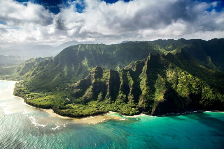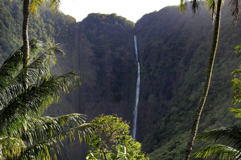
Kauai receives more rain than any other major Hawaiian island, and its trails show it. The same trail that drains in an afternoon on Oahu can stay slick for days on Kauai. Mount Waialeale, at the island’s center, averages roughly 450 inches of rain a year. Red clay, stream crossings and sudden closures are part of hiking here, not exceptions.
This guide follows the same easy, moderate and strenuous format as the site’s Maui hikes by difficulty breakdown. It covers seven of the most-hiked Kauai trails: Kuilau Ridge, Sleeping Giant (Nounou) East and West, the Canyon Trail to Waipoo Falls, the Pihea and Alakai Swamp boardwalk, Awaawapuhi, and the Kalalau Trail to Hanakapiai.
Each entry lists round-trip distance, elevation gain, typical time, mud and flash-flood exposure, and any permit or fee. Fees are those published by the Hawaii Department of Land and Natural Resources (DLNR) at the time of writing. DLNR revises them periodically, so households should confirm current rates before driving to a trailhead.
How Kauai hikes are graded in this guide
Difficulty on Kauai depends less on distance than on footing and weather. A 4-mile trail can feel harder than an 8-mile one if half of it is greasy clay on a sidehill. The tiers below weigh three factors together: total elevation gain, trail surface, and exposure to drop-offs or rising streams.
- Easy: under 800 feet of gain, wide tread, no exposed edges, suitable for most fit beginners.
- Moderate: 800 to 1,200 feet of gain, steeper pitches, some exposure or root scrambles.
- Strenuous: more than 1,200 feet of gain, long climbs on the return, stream or cliff hazards.
Several Kokee trails are “reverse” hikes. They start high on the canyon rim and descend, so the hard climbing comes on the way back, often in afternoon heat or cloud. Hikers who misjudge this tend to turn around too late. A useful rule is to budget about 60% of total trail time for the return leg.
| Trail | Tier | Round trip | Elevation gain | Typical time | Permit or fee |
|---|---|---|---|---|---|
| Kuilau Ridge | Easy | 4.2 miles | about 700 ft | 2 to 3 hours | None |
| Sleeping Giant West | Moderate | 3.0 miles | about 900 ft | 2 to 2.5 hours | None |
| Sleeping Giant East | Moderate | 3.5 miles | about 1,000 ft | 2 to 3 hours | None |
| Canyon Trail to Waipoo Falls | Moderate | 3.5 miles | about 800 ft | 2.5 to 3.5 hours | Nonresident entry and parking |
| Pihea and Alakai to Kilohana | Moderate to strenuous | about 8 miles | about 1,400 ft cumulative | 5 to 7 hours | Nonresident entry and parking |
| Awaawapuhi | Strenuous | 6.2 miles | about 1,600 ft | 4 to 5 hours | Nonresident entry and parking |
| Kalalau to Hanakapiai Beach | Moderate to strenuous | 4.0 miles | about 800 ft cumulative | 3 to 4 hours | Haena reservation |
| Kalalau to Hanakapiai Falls | Strenuous | 8.0 miles | about 1,800 ft cumulative | 6 to 8 hours | Haena reservation |
Easy: Kuilau Ridge Trail
Kuilau Ridge is the most forgiving of the well-known Kauai hikes. It starts at Keahua Arboretum, at the end of Kuamoo Road above Wailua, about 25 minutes from Lihue. The trail is a former service road, so the tread is wide and the grade is steady rather than steep.
Distance, gain and time
The trail runs about 2.1 miles one way to a footbridge where it meets the Moalepe Trail, for a 4.2-mile round trip. Gain is roughly 700 feet. A covered picnic shelter sits around 1.25 miles in, and many hikers treat it as a turnaround. Most groups finish in 2 to 3 hours.
The payoff is the view. On clear mornings the ridge looks straight at the cloud-capped Waialeale crater and the Makaleha Mountains. Clear windows tend to come early, before trade-wind clouds build over the interior around late morning.
Mud and stream risk
Mud risk is moderate. The road grade sheds water better than a footpath, but ruts hold standing puddles for days after storms. The bigger issue is getting there. The paved road to the arboretum crosses Keahua Stream at a ford, and that ford becomes impassable when the stream rises.
Drivers should never attempt the ford when water is brown or moving fast. Rental cars and low-clearance sedans are particularly vulnerable. If the crossing looks doubtful, the trailhead itself is on the near side of the stream, but parking may be limited.
Access and fees
No permit, reservation or parking fee applies. Keahua Arboretum is a state forest reserve area with free parking and portable toilets of variable condition. Break-ins at trailhead lots are reported regularly across the island, so valuables should stay out of the car entirely.
Moderate: Sleeping Giant (Nounou) East and West
Nounou Mountain, nicknamed the Sleeping Giant for its profile from Kapaa, rises to 1,241 feet above the Wailua corridor. Three trails reach the summit area: East, West, and the Kuamoo-Nounou connector. The site’s dedicated Sleeping Giant East Ridge guide covers the eastern ascent in more detail.
East Trail
The East Trail begins on Haleilio Road in the Wailua Houselots neighborhood, roughly 15 minutes from Lihue. It climbs about 1,000 feet over 1.75 miles one way, for a 3.5-mile round trip. Switchbacks are steady and exposed to the sun on the lower half, which makes early starts worthwhile.
Parking is a small lot plus residential street frontage. Neighbors have complained about blocked driveways, and enforcement occurs. Arriving before 8 a.m. on weekends usually avoids both the heat and the parking crunch.
West Trail
The West Trail starts from Lokelani Road off Kamalu Road and climbs through a shaded Norfolk and Cook Island pine forest. It is about 1.5 miles one way with roughly 900 feet of gain. The shade makes it cooler, but it also keeps roots and clay damp longer after rain.
The West Trail joins the Kuamoo-Nounou Trail, which descends about 2 miles to Kuamoo Road. Groups with two cars sometimes run a one-way traverse, which shortens the total climb.
Summit hazards
All routes converge near a picnic shelter below the summit. Beyond it, the path to the “chin” and “head” narrows to a rocky spine with sheer drops on both sides. DLNR signage advises hikers to stop at the shelter. Wet rock here is the most common cause of serious falls on Nounou.
Flash-flood risk on Nounou is low, since no stream crossings are involved. Mud risk is moderate on the East side and high on the West side for 24 to 48 hours after heavy showers.
Moderate: Canyon Trail to Waipoo Falls
The Canyon Trail sits on the east rim of Waimea Canyon and is the most popular way to see the upper tiers of Waipoo Falls. The full falls drop roughly 800 feet, though hikers reach the top pools rather than the base. The site’s Waimea Canyon trail difficulty tiers article places it alongside other Kokee options.
Distance, gain and time
The trailhead is reached via Halemanu Road, which leaves Highway 550 near mile marker 14. Halemanu Road is rutted and often requires high clearance, so most visitors park at the highway and walk in. From the highway, the round trip to the falls is about 3.5 miles with roughly 800 feet of gain.
The trail descends through koa and plum forest, crosses an exposed red-dirt ridge with canyon views, then drops to the falls area. The return climb is the hardest part. Typical time is 2.5 to 3.5 hours.
Mud and exposure
The exposed ridge section is hard-packed red clay. Dry, it grips well. Wet, it behaves like ice and sits beside steep drop-offs. The stream at the falls rises fast during upslope storms, and the pools should be avoided whenever water is cloudy. Kokee sits around 3,500 to 4,000 feet, where temperatures run 10 to 15°F cooler than the coast.
Moderate to strenuous: Pihea Trail and Alakai Swamp Boardwalk
The Pihea Trail starts at Puu o Kila Lookout, the end of Highway 550 at roughly 4,100 feet. It follows the rim of Kalalau Valley before turning inland to join the Alakai Swamp Trail. The site’s Alakai Swamp boardwalk grade article covers the highland section in depth.
Distance, gain and time
Pihea Vista sits about 1 mile in and makes a short out-and-back of 2 miles. Continuing to the Alakai junction and then on the boardwalk to Kilohana Lookout, at about 4,030 feet, brings the round trip to roughly 8 miles. Cumulative gain is about 1,400 feet because the route dips into the Kawaikoi drainage and climbs out twice.
Plan on 5 to 7 hours for Kilohana. On a rare clear day, the lookout frames Wainiha Valley and Hanalei Bay. More often it shows a white wall of cloud.
Mud and flash-flood risk
The first mile of Pihea, before the boardwalk, is among the muddiest stretches of trail in Hawaii. Ankle-deep clay is normal, and steep pitches have eroded into chutes. The boardwalk sections are slippery when wet and have missing or broken planks in places.
The trail crosses a stream in the Kawaikoi drainage near the Pihea and Alakai junction. Interior Kauai rainfall can raise it within an hour, and turning back is the correct call if the crossing looks swift.
Strenuous: Awaawapuhi Trail
Awaawapuhi is the hardest day hike in the Kokee area and the one most likely to surprise hikers. The trailhead sits near mile marker 17 on Highway 550. The trail descends about 3.1 miles one way through native forest to a narrow overlook above the Napali Coast, roughly 2,500 feet above the ocean.
Distance, gain and time
The round trip is 6.2 miles with about 1,600 feet of elevation change. All of that gain comes on the return, starting at the lowest point of the day. Typical time is 4 to 5 hours, though slower groups take 6. Carrying at least 2 liters of water per person is standard advice.
Cliff exposure and mud
The final overlook sits on a knife-edge ridge between Awaawapuhi and Nualolo valleys. A railing protects the end point, but the approach includes unfenced edges with drops of more than 2,000 feet. In cloud or wind, visibility can fall to 50 feet.
The Nualolo Trail connector, which links to Awaawapuhi via the Nualolo Cliffs, has been closed for long periods after landslides. Hikers should not assume it is open, and loop plans should be checked with DLNR Division of Forestry and Wildlife notices before starting.
Kalalau Trail to Hanakapiai
The Kalalau Trail begins at Kee Beach in Haena State Park on the North Shore. Its full length is 11 miles, but only the first 2 miles to Hanakapiai Beach, and the 2-mile spur to Hanakapiai Falls, are open to day hikers. Going past Hanakapiai Valley requires a state camping permit, covered in the site’s Kalalau Trail overnight camping guide.
To Hanakapiai Beach
The beach leg is 4 miles round trip with roughly 800 feet of cumulative gain. The trail climbs to about 400 feet above the coast, then descends to the valley mouth. Rocks are polished smooth by heavy foot traffic and become slick in any rain. Typical time is 3 to 4 hours.
Hanakapiai Beach has no lifeguard and strong rip currents for much of the year. A hand-painted sign near the shore tallies more than 80 drownings. Swimming there is widely discouraged, especially from October through April when north swells arrive.
To Hanakapiai Falls
The falls spur adds about 2 miles each way up the valley, for 8 miles round trip and roughly 1,800 feet of cumulative gain. It is less maintained than the coastal trail, with multiple stream crossings, boulder hopping and root ladders. The falls drop about 300 feet into a pool where rockfall is a known hazard.
Most hikers need 6 to 8 hours. Starting by 8 a.m. leaves time to retreat if afternoon showers start raising the stream.
The Hanakapiai stream crossing
The single biggest danger is Hanakapiai Stream, which hikers must cross to reach the beach’s west side and the falls trail. Normal flow is shin to knee deep. During flash floods it can rise several feet in minutes. A 2008 flash flood stranded more than 100 hikers, who were airlifted out by helicopter.
The guidance is simple: if the water is above the knee, brown, or louder than usual, do not cross. Waiting several hours on the near bank is far safer than attempting a crossing. Rain upstream can raise the stream even when the sky at the beach is clear.
Permits, entry and parking fees by trail
Three Kauai trails in this guide carry nonresident fees, and one requires an advance reservation. Hawaii residents with a state driver’s license or state ID are exempt from entry and parking fees at state parks. That exemption is one small, recurring benefit for households that complete their move and update their ID.
Haena State Park reservations and shuttle
Since reopening in June 2019, Haena State Park has required nonresidents to book in advance. Reservations open 30 days ahead and frequently sell out within days for summer dates. Options include parking-and-entry reservations in morning, afternoon or sunset windows, or entry-only reservations for those arriving by shuttle.
The North Shore Shuttle runs from Waipa and Princeville to Kee Beach and includes park entry. Fares in recent seasons have run roughly $35 to $45 per adult round trip, and prices change, so riders should check current rates. Walk-up entry is not permitted for nonresidents, and rangers check reservations at the gate.
Waimea Canyon and Kokee fees
Waimea Canyon and Kokee state parks charge nonresidents a per-person entry fee and a per-vehicle parking fee, paid by QR code or kiosk at the main lookouts. Recent published rates were $5 per person and $10 per vehicle. DLNR has adjusted state park fees more than once since 2021, so these figures should be verified before travel.
| Area | Trails covered | Nonresident entry | Nonresident parking | Advance reservation | Hawaii residents |
|---|---|---|---|---|---|
| Keahua Arboretum | Kuilau Ridge | $0 | $0 | No | Free |
| Nounou Forest Reserve | Sleeping Giant East and West | $0 | $0 | No | Free |
| Waimea Canyon and Kokee state parks | Canyon Trail, Pihea, Awaawapuhi | about $5 per person | about $10 per vehicle | No | Free with Hawaii ID |
| Haena State Park | Kalalau to Hanakapiai | about $5 per person | about $10 per vehicle | Yes, up to 30 days ahead | Free with Hawaii ID |
| North Shore Shuttle | Kalalau to Hanakapiai | Included in fare | Not applicable | Yes | Resident rates vary |
Mud, flash floods and which trails close after heavy rain
Kauai’s rainy season runs roughly October through April, but upslope showers fall in every month. The island holds the U.S. 24-hour rainfall record: about 49.7 inches fell near Waipa during the April 2018 floods. Those floods closed Haena State Park and the Kalalau Trail for about 14 months.
DLNR closes trails and parks when the National Weather Service issues flood warnings, and some stay closed for days after. Road closures also matter. The Hawaii Department of Transportation posts Kuhio Highway closures, which can cut off the North Shore entirely when the Hanalei Bridge or nearby sections flood.
| Trail | Mud level after rain | Flash-flood risk | Typically closed after heavy rain? | Drive from Lihue |
|---|---|---|---|---|
| Kuilau Ridge | Moderate | Moderate (road ford) | Access often cut at Keahua ford | about 25 minutes |
| Sleeping Giant East | Moderate | Low | Rarely | about 15 minutes |
| Sleeping Giant West | High | Low | Rarely | about 15 minutes |
| Canyon Trail to Waipoo Falls | High on red-clay ridge | Moderate at falls | Sometimes, during flood warnings | about 1 hour 30 minutes |
| Pihea and Alakai | Very high | Moderate at stream | Sometimes, during flood warnings | about 1 hour 45 minutes |
| Awaawapuhi | High | Low | Occasionally, for landslides | about 1 hour 35 minutes |
| Kalalau to Hanakapiai | High | Very high at stream | Yes, Haena closes during flood warnings | about 1 hour 15 minutes |
Warning signs on the trail
- Stream water turning brown or carrying leaves and branches.
- A sudden rise in water noise, even under clear local skies.
- Waterfalls on valley walls appearing where none ran an hour earlier.
- Dark clouds stacking over the mountains inland of the trail.
Local outlets including Hawaii News Now and the Honolulu Star-Advertiser report island-wide flood watches and park closures. Civil Beat has covered the policy debate around the Haena reservation system and North Shore visitor caps.
Footwear and rain gear for Kauai trails
Footwear choice has more effect on safety on Kauai than on any other island. Smooth-soled sneakers fail on red clay, and slippers fail everywhere. The same lessons that apply on muddy Oahu routes, covered in the site’s Manoa Falls muddy trail footwear guide, apply here with more intensity.
Shoes
Trail runners or light hiking shoes with deep, widely spaced lugs shed mud better than tight-tread boots. Waterproof membranes keep feet dry for the first hour, then trap water once it comes over the top. Many experienced Kauai hikers prefer fast-draining mesh shoes plus wool socks. Red clay stains permanently, so a dedicated hiking pair makes sense.
Rain gear and layers
A lightweight rain shell belongs in every pack, even on sunny coastal days. In Kokee, temperatures near 4,000 feet can fall into the 40s°F on winter nights, and wet hikers chill quickly. A thin fleece or synthetic layer adds warmth without much weight.
| Item | Why it matters on Kauai | Typical cost | Most needed on |
|---|---|---|---|
| Lugged trail shoes | Grip on red clay and wet roots | $120 to $170 | All trails |
| Ankle gaiters | Keep mud out of shoes | $25 to $45 | Pihea, Kuilau, Kalalau |
| Trekking poles | Balance on descents and crossings | $40 to $150 per pair | Awaawapuhi, Canyon Trail, Kalalau |
| Rain shell | Sudden showers and wind at elevation | $100 to $250 | Kokee trails |
| Hydration (2 to 3 liters) | Stream water is unsafe to drink untreated | $15 to $40 for bottles or bladder | Awaawapuhi, Hanakapiai Falls |
| Spare socks and dry bag | Cold, wet feet on long days | $20 to $35 | Pihea and Alakai |
Packing checklist
- Lugged shoes and wool or synthetic socks.
- Rain shell and one insulating layer for Kokee.
- At least 2 liters of water per person.
- Headlamp, since sunset falls before 6 p.m. in December.
- Small first-aid kit with waterproof bandages for cuts.
- Plastic bag or towel to protect the car’s interior from clay.
Leptospirosis and freshwater safety
Leptospirosis is a bacterial infection spread through fresh water and soil contaminated by animal urine, commonly from rats, pigs and mongoose. Hawaii has historically recorded one of the highest per-capita rates in the United States. The Hawaii State Department of Health reports cases every year, with many linked to streams and waterfall pools.
The bacteria enter through cuts, scrapes, or the eyes, nose and mouth. Several trails in this guide, including Hanakapiai, the Canyon Trail and Kuilau Ridge, involve stream contact or tempting pools. The site’s full leptospirosis on waterfall trails explainer covers exposure risk by trail type.
How to reduce exposure
- Avoid swimming or wading with open cuts or scratches.
- Keep head underwater time to zero in streams and pools.
- Never drink stream water untreated, however clear it looks.
- Cover wounds with waterproof bandages before stream crossings.
- Rinse off with clean water after contact with streams or mud.
Symptoms and timing
Symptoms usually appear 5 to 14 days after exposure, though the range runs from 2 to 30 days. They resemble the flu: fever, headache, muscle aches, chills and red eyes. Severe cases can damage the kidneys and liver. Anyone with these symptoms after hiking should tell a doctor about the freshwater exposure, since early antibiotics are effective.
Seasonal timing and planning for new residents
Summer, roughly May through September, brings the driest trail conditions and calmer north-shore water. Winter months bring more closures, shorter days and higher streams. The site’s best time to visit each Hawaiian island guide compares Kauai’s seasonal pattern with Oahu, Maui and the Big Island.
For households relocating to Kauai, trail access changes once residency is established. Free entry at Haena, Waimea Canyon and Kokee removes recurring costs and the need to book 30 days ahead. Kauai County is home to roughly 73,000 people, a small share of the state population shown in the U.S. Census QuickFacts profile for Hawaii.
Building up through the tiers
A practical progression for newcomers starts with Kuilau Ridge, moves to Sleeping Giant East or West, then the Canyon Trail. Pihea and Awaawapuhi come next, once mud handling and long return climbs feel routine. The Hanakapiai Falls spur is best saved for a dry summer stretch.
The state tourism board’s Go Hawaii site publishes general Kauai trail etiquette and safety messaging. For the wider list of island activities beyond hiking, the site’s best things to do on Kauai overview covers Napali, Waimea Canyon and Hanalei Bay.
Weekly hiking costs for visitors versus residents
A nonresident couple driving to Kokee twice and Haena once in a week would pay roughly $60 in entry and parking fees at recent rates. Using the shuttle to Haena instead could add $70 to $90 for two people. Residents with Hawaii ID pay $0 for the same three outings.
Frequently asked questions
What is the easiest of the well-known Kauai hikes?
Kuilau Ridge is the easiest of the trails covered here. It is a 4.2-mile round trip on a former service road with about 700 feet of gain and no permit or fee. Most groups finish in 2 to 3 hours. The main hazard is the Keahua Stream ford on the access road, which floods during heavy rain.
Do you need a reservation to hike the Kalalau Trail to Hanakapiai?
Nonresidents need a Haena State Park reservation, either for parking and entry or for entry via the North Shore Shuttle. Reservations open 30 days ahead and often sell out quickly in summer. Hawaii residents with a state ID enter free. Hiking beyond Hanakapiai Valley requires a separate state camping permit.
How much are the Waimea Canyon and Kokee entry fees?
At recent published rates, nonresidents paid about $5 per person for entry and $10 per vehicle for parking at Waimea Canyon and Kokee state parks. DLNR has revised state park fees several times since 2021, so visitors should confirm current amounts with DLNR before driving up Highway 550. Hawaii residents with valid state ID are exempt.
Which Kauai trails close after heavy rain?
Haena State Park and the Kalalau Trail close during flood warnings and can stay closed afterward. Kokee trails, including the Canyon Trail and Pihea, may close during warnings or after landslides. Access to Kuilau Ridge is often cut at the Keahua ford. Sleeping Giant rarely closes but becomes very slippery, especially the shaded West Trail.
Is Awaawapuhi harder than Sleeping Giant?
Yes. Awaawapuhi is a 6.2-mile round trip with about 1,600 feet of elevation change, and all of the climbing happens on the return. Sleeping Giant East is 3.5 miles with about 1,000 feet of gain, climbed at the start. Awaawapuhi also ends at an exposed cliff overlook more than 2,000 feet above the valley floor.
What shoes work best on muddy Kauai trails?
Trail runners or light hiking shoes with deep, widely spaced lugs perform best on red clay. Fast-draining mesh uppers with wool socks often outperform waterproof boots on long, wet days. Gaiters help on Pihea, Kuilau and Kalalau. Smooth-soled sneakers and slippers are a common cause of falls on Kauai trails, particularly on steep descents.
Can hikers swim at Hanakapiai Beach or the falls?
Swimming at Hanakapiai Beach is strongly discouraged because of powerful rip currents and no lifeguard; a sign near the shore tallies more than 80 drownings. At the falls, rockfall and leptospirosis are the main concerns. Anyone entering the pool should have no open cuts and keep their head above water.
How long is the drive from Lihue to the Kokee trailheads?
The drive from Lihue to the upper Kokee trailheads takes about 1 hour 30 minutes to 1 hour 45 minutes. The route follows Kaumualii Highway west to Waimea or Kekaha, then climbs Waimea Canyon Drive and Highway 550. Puu o Kila Lookout, where the Pihea Trail begins, sits at the end of the road around 4,100 feet.