Kauai’s rainfall gradient is one of the sharpest on any inhabited island in the United States. A single 35-mile drive from Poipu on the sunny south shore to Princeville on the lush north shore crosses a climatic boundary where average annual rain roughly triples — and interior peaks nearby capture more than ten times what Poipu records.
The split is not weather luck. It is a fixed pattern shaped by trade winds hitting a 5,000-foot volcanic wall, and it plays out in NOAA station data year after year. For a traveler comparing a Poipu versus Princeville lodging split, understanding those numbers is the difference between beach afternoons and porch mornings watching sheets of warm rain.
This research digest pulls together long-term averages from the National Weather Service Honolulu Forecast Office, gauge histories archived by state climate services, and packing implications drawn from published visitor guidance. Numbers cited reflect the most recent 30-year climate normals unless noted otherwise.
Why one small island has two climates
Kauai sits directly under the northeast trade wind belt for most of the year. Moist Pacific air is pushed against the island’s central shield volcano, forced upward, cooled, and squeezed out as rain on the windward (northeast) side. By the time the air spills over the ridge and descends toward the south and west coasts, it has already dropped most of its moisture.
The effect is called orographic lift, and it is why the leeward south shore stays dry while the windward north shore stays wet. Waialeale, the roughly 5,148-foot peak at the island’s center, acts as the trigger. The higher the summit and the steeper the eastern face, the more dramatic the split.
Trade wind seasonality
Trades blow from the northeast roughly 70 percent of the year, strongest from May through September at 15–25 mph. During winter, the pattern breaks more often, and Kona storms from the south or southwest can flip the usual dry-side geography — Poipu occasionally records its heaviest single-day totals during these off-pattern events.
Cloud formation heights
Trade wind cumulus forms typically between 2,000 and 4,000 feet on Kauai. Because Waialeale rises above 5,000 feet, incoming clouds are forced up through the condensation layer twice — first during trade flow, then again when subsiding air rewets over the ridge. This double lift explains why the summit records so much more than nearby coastal stations only a dozen miles away.
Poipu’s leeward numbers
Poipu, on Kauai’s south coast, averages roughly 35 inches of rain per year across long-term gauge records. That is close to Dallas or Oklahoma City totals — modest by tropical standards and remarkable given the island’s overall reputation as one of the wettest places on earth. Most of that annual total falls between November and March.
Monthly breakdown
The dry season, roughly April through September, delivers an average of only 1.5 to 2 inches per month. Summer weeks routinely pass with no measurable rain at all. Winter months push the totals — December and January can each average 4 to 5 inches, mostly in short, warm showers that pass within an hour.
Sunshine hours
Poipu records approximately 260 to 280 days per year with measurable sunshine. Daily sun exposure typically runs 8 to 10 hours in summer and 6 to 7 hours in winter. Cloud cover thickens overnight and burns off by mid-morning, a pattern that makes early-morning surf checks reliable and afternoon pool time nearly guaranteed.
The Shipwreck Beach cliff overlook and adjacent Mahaulepu coastline stay usable most days of the year, and photographers relying on golden-hour light rarely lose an evening to full overcast. Contrast this with the north shore, where afternoon showers roll in without warning during much of winter.
Princeville’s windward numbers
Princeville sits at the base of the Namolokama and Hihimanu ridges, roughly 3 miles inland from Hanalei Bay. Long-term rainfall averages for the Princeville station run 85 to 90 inches per year, with the neighboring Hanalei station often exceeding 85 inches as well. That is more than double Poipu — and more than triple the driest west-shore stations.
Winter dominance
The north shore’s rainfall is heavily concentrated in the wet season. November through March typically deliver 10 to 15 inches per month, with December often the wettest at close to 15 inches. Storms can dump 3 to 6 inches in a single night, and multi-day rain events regularly close the one-lane bridges connecting Hanalei to Wainiha and Haena.
Summer relief
Summer months are markedly drier but still humid. June and July average 3 to 4 inches of rain, most of it falling as brief predawn showers. This is the window when the Princeville resort enclave looks most like its postcard version — full sun on Hanalei Bay, calm surf, and dry hiking on the Kalalau Trail approach.
The Anini and Kalihiwai split
Even within a few miles of Princeville, rainfall varies. Anini Beach, west of Princeville along the coast, averages closer to 55 inches per year — meaningfully drier than Princeville proper because it sits slightly west of the peak orographic lift zone. Kalihiwai Bay, immediately east, records totals closer to Princeville’s average.
Mount Waialeale and the interior extremes
Behind Princeville and Wailua, the island’s interior climbs sharply to Mount Waialeale, at 5,148 feet the wettest measured point on Kauai and among the wettest on the planet. NOAA and state climate records place the summit’s long-term annual average between 425 and 460 inches per year, with the historical high approaching 683 inches.
That means the summit crater — only about 12 miles inland from Poipu — can catch more than twelve feet of rain during a single wet season while Poipu records less than three feet across the whole year. The gradient over that short distance is one of the steepest documented anywhere.
Why the summit matters to coastal weather
Waialeale’s crater feeds the Wailua, Hanalei, and Waimea Rivers, which drain in different directions and shape flood risk across the island. Heavy summit rain also feeds cloud fields that drift downwind toward the north shore, adding to the Princeville totals hours after the summit itself has already been drenched.
Comparing Kauai to other Hawaii peaks
Big Island’s Mauna Loa records under 15 inches annually at some summit stations; Maui’s Haleakala records 30 to 40 inches. Kauai’s Waialeale is uniquely wet because of its shape — a shield with an eastern face nearly perpendicular to prevailing trade winds and an elevation just below the trade inversion, which traps moist air against the mountain rather than letting it flow over.
How Kauai stations compare
NOAA cooperative observer stations, state Department of Land and Natural Resources gauges, and USGS stream gauges together give a picture of the island’s rainfall gradient. The table below shows long-term annual averages for the most commonly cited locations, rounded to the nearest inch.
| Station / area | Coast | Elevation (ft) | Annual avg (in) |
|---|---|---|---|
| Kekaha | Leeward (SW) | 10 | 20 |
| Waimea | Leeward (SW) | 15 | 22 |
| Poipu / Koloa | Leeward (S) | 40 | 35 |
| Kalaheo | Upcountry S | 760 | 50 |
| Lihue Airport | East | 150 | 46 |
| Wailua | East | 50 | 65 |
| Princeville | Windward (N) | 240 | 85 |
| Hanalei | Windward (N) | 10 | 85 |
| Kokee (upcountry) | Interior W | 3,600 | 70 |
| Mount Waialeale | Summit | 5,148 | 440 |
Two patterns stand out. First, rainfall roughly doubles from Poipu to the Wailua corridor, then doubles again from Wailua to Princeville. Second, elevation matters even on the leeward side — Kalaheo sits only a few miles upslope from Poipu, but its higher position catches noticeably more rain and cooler nights.
Month-by-month rainfall by region
Averages across the year hide seasonality. A visitor booking January is choosing a very different island than one booking August, especially on the north shore. The comparison below uses long-term monthly means, in inches.
| Month | Poipu (in) | Lihue (in) | Princeville (in) |
|---|---|---|---|
| January | 4.5 | 4.6 | 10.5 |
| February | 3.5 | 3.4 | 8.5 |
| March | 3.5 | 3.6 | 9.0 |
| April | 2.5 | 2.8 | 6.5 |
| May | 2.0 | 2.4 | 5.5 |
| June | 1.5 | 1.8 | 4.5 |
| July | 1.8 | 2.0 | 4.5 |
| August | 1.8 | 2.1 | 5.0 |
| September | 1.8 | 2.2 | 5.5 |
| October | 3.0 | 3.4 | 7.5 |
| November | 4.0 | 4.5 | 10.0 |
| December | 5.0 | 5.2 | 12.5 |
The June trough is the driest window for both coasts, and it is also the most stable — trade winds are strongest, Kona storm risk is at its lowest annual point, and morning cloud burn-off is fastest. September and early October remain reliable before the wet-season ramp begins. For a deeper look at the shoulder pattern, see notes on the May and September swell window.
Translating rainfall to dry hours
Total inches per year tells only part of the story. What matters to a visitor is how many usable dry hours the day contains. Rain in Kauai often falls in short bursts separated by clear windows, and total inches can be misleading if concentrated in overnight hours.
Poipu dry-hour math
On a typical Poipu day, rain — when it occurs — falls between roughly 2 a.m. and 7 a.m. Daytime showers are usually brief, often lasting under 15 minutes with clear sky before and after. Visitors targeting outdoor time can plan on 9 to 11 usable dry hours per day during summer and 7 to 9 during winter.
Princeville dry-hour math
Princeville flips this pattern. Even in summer, morning skies can be overcast and drizzly, clearing by 10 or 11 a.m. Afternoon showers roll off the ridge without warning. Usable dry hours run 6 to 8 in summer and can drop to 3 to 5 in winter, with entire days sometimes lost to steady rain during December and January.
The rainbow tradeoff
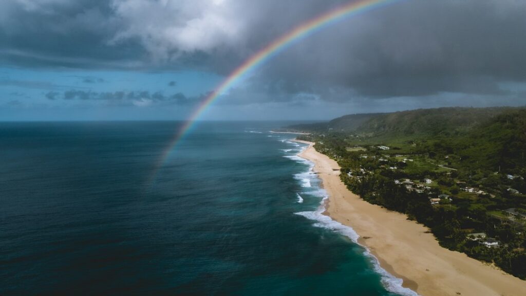
The same moisture pattern that costs the north shore dry hours delivers Kauai’s most reliable rainbows. Princeville and Hanalei Bay produce photograph-worthy rainbows several times a week during trade wind season. Poipu produces them, too, but far less frequently — perhaps 20 to 30 times per year versus 100-plus at Princeville.
Temperature and humidity beyond rain totals
Rainfall is only one axis of the Kauai climate split. Temperature and humidity differ meaningfully between Poipu and Princeville, and both influence how the rain feels on skin and how quickly outdoor gear dries between showers.
Poipu conditions
Poipu averages daytime highs of 82 to 87°F year-round and overnight lows of 65 to 72°F. Relative humidity typically runs 65 to 75 percent during the day, dropping to 55 to 65 percent when trade winds are strongest. The combination reads as warm but breathable, and towels dry between morning and evening pool sessions.
Princeville conditions
Princeville runs a few degrees cooler in both directions — daytime highs of 78 to 83°F and overnight lows of 62 to 68°F. Humidity holds at 75 to 90 percent much of the year, and cotton clothing left on a lanai overnight rarely dries fully by morning. Mildew management is a real household expense for long-term Princeville residents.
Packing implications by region
The rainfall split translates directly to what a traveler should carry. A single “Kauai packing list” is misleading — north shore and south shore visitors need different gear, and someone splitting a week between the two needs both.
Poipu packing checklist
- Light rain shell for the occasional afternoon shower — no need for full rain pants.
- Reef-safe SPF 30+ sunscreen; UV index runs 10–12 by mid-morning even in winter.
- One quick-dry hiking outfit for Mahaulepu Heritage Trail or Waimea Canyon side trips.
- Wide-brim hat; shade is scarce on south-shore beaches.
- Insulated water bottle — car interiors hit 120°F within 30 minutes of parking.
Princeville packing checklist
- Full waterproof shell with sealed seams — the plastic-poncho variety fails within a season.
- Two pairs of shoes: one dedicated wet pair for Hanalei walks and trail time.
- Waterproof phone pouch; sudden showers arrive with no warning even in July.
- Dry bag for camera gear if visiting December through March.
- Merino base layer for evenings — 68°F feels chilly in 90 percent humidity.
Lodging strategy by desired dry hours
Choosing where to base a Kauai trip is largely a rainfall decision disguised as a lodging decision. Because the north shore is a 90-minute drive from Poipu, a base on one coast is not easily swapped mid-trip during a rainy stretch.
Dry-hour maximizers
Travelers prioritizing pool time, snorkel afternoons, and reliable evening ceremony weather should base in Poipu, Koloa, or Kalaheo. Kekaha and Waimea offer even drier conditions, though with fewer resort options. A Kekaha sunset pullout stop from a Poipu base is easier than trying to catch the same view from a wet north shore.
Landscape and scenery seekers
The very rain that raises Princeville’s totals also produces the layered cliffs, waterfalls, and vivid green that define north-shore imagery. Visitors chasing those views should accept the rainfall tradeoff and consider a north-shore base during May, June, or September for the best balance of scenery and dry windows.
Hybrid strategies
Split-stay itineraries are common: three nights in Poipu for pool and south-shore snorkeling, then four nights in Princeville for hiking and Hanalei time. This structure hedges the weather bet and reduces the odds of losing a full trip to an unusual weather run.
Activity timing by rain profile
Because Poipu and Princeville run on different daily rain rhythms, activity scheduling looks different on each coast. Aligning outings to each region’s dry hours dramatically improves the trip experience and reduces the number of cancelled outdoor bookings.
Poipu daily rhythm
Morning is prime time in Poipu regardless of season. Snorkeling at Poipu Beach Park or Lawai Beach is calmest before 10 a.m., before wind picks up and afternoon chop develops. Sunset viewing runs reliably 20 to 25 evenings per month in summer and 15 to 20 in winter. Golf courses like Poipu Bay stay playable through most of the year.
Princeville daily rhythm
Princeville outdoor activity requires more flexibility. Morning showers are common but usually short, and the dry window between roughly 10 a.m. and 3 p.m. is when hikes, beach time, and helicopter flights should be scheduled. Late afternoon showers roll in nearly daily from November through March; the smart pattern is early lunch, midday activity, and indoor evening.
Micro-siting within each area
Even inside Poipu and Princeville, rainfall varies by hundreds of yards. A property backing directly onto a hillside catches noticeably more rain than one on the seaward side of the same road.
Poipu micro-variation
Old Koloa Town, roughly 2 miles inland from Poipu Beach, receives about 40 to 45 inches per year versus Poipu Beach’s 30 to 35. The Grand Hyatt and Sheraton frontages are among the driest, while properties along Poipu Road inland can pick up an additional 5 to 10 inches annually.
Princeville micro-variation
Within Princeville, oceanfront cliffside units near the Makai Golf Club catch fewer inches than units on the makai (mountain-facing) edge of the plateau. The Hanalei side of Princeville is wetter than the Anini side. Homes tucked into gulches catch more rain than those on open plateau, sometimes by 15 to 20 inches per year.
Notable rainfall records and extremes
Kauai’s rainfall history includes some of the most dramatic single-storm events in United States records. In April 2018, a stationary front dumped 49.69 inches on Waipa on the north shore in 24 hours, later confirmed by NOAA as a new national record. That single day of rain exceeded Poipu’s entire average annual total.
Storm-driven flooding closed the Kuhio Highway west of Hanalei for months, isolating Wainiha and Haena. Waialeale itself recorded 683 inches in 1982, one of the highest annual totals ever measured anywhere. Poipu’s driest year on record measured under 20 inches, occurring during a strong El Nino winter with suppressed trade rain.
El Nino and La Nina swings
Kauai’s rainfall responds strongly to ENSO. El Nino winters typically bring 20 to 30 percent below-normal rain to the wet north shore and even drier conditions on the leeward side. La Nina winters do the opposite, with Princeville sometimes recording 120 inches or more and Poipu occasionally topping 45.
Booking windows and rain probability
Rain probability shifts week by week, and hotel pricing is only loosely correlated. The best value windows for dry weather run late May through mid-June and again from late August through mid-October, when trade winds are steady and Kona storms unlikely.
| Travel window | Poipu rain risk | Princeville rain risk | Typical avg rate (resort double) |
|---|---|---|---|
| Late May – mid-June | Low | Moderate | $425 |
| July – early August | Very low | Low-moderate | $525 |
| Late August – Oct 15 | Very low | Low | $375 |
| Late Oct – Nov 20 | Low | High | $395 |
| Thanksgiving week | Moderate | Very high | $625 |
| Dec 20 – Jan 5 | Moderate | Very high | $795 |
| Jan 6 – Feb 28 | Moderate | Very high | $450 |
| March – mid-April | Low-moderate | High | $525 |
For visitors specifically targeting the north shore’s greener face without the winter deluge, the early-November pre-holiday window can work — Princeville rainfall is still climbing but has not yet peaked, and lodging pricing sits well below Thanksgiving spikes.
Sound, wildlife, and rain interplay
Higher rainfall on the north shore correlates with denser vegetation, which in turn shapes wildlife exposure at properties. Hanalei and Princeville host larger populations of coqui frogs and, in some pockets, denser feral chicken populations near dense hedges. Sleep planners tracking Kauai rooster impact by micro-area should factor rainfall regions alongside rooster densities.
Waterfalls, streams, and rain timing
Waterfall viewing on Kauai is directly tied to recent rainfall. The interior spillways feeding Wailua Falls and Opaekaa run heaviest 24 to 48 hours after a north-shore rain event. Visitors coming purely for the falls should time their trip within a day or two of measurable rain rather than during dead-dry stretches.
The highland viewpoints of Kokee State Park, including the Puu O Kila prospect over the Kalalau Valley, can be socked in for days at a time even when Poipu is sunny. Consulting the Lihue radar loop before making the two-hour drive up to Kokee is standard practice among photographers.
How the rainfall split shapes long-term residency
For research households evaluating a move to Kauai, the rainfall split matters beyond a single vacation. Homes on the north shore typically require more aggressive mold management, dehumidifier operation, and roof and gutter maintenance than comparable homes on the south side. Utility profiles also shift: south-shore homes run air conditioning harder, north-shore homes run dehumidifiers longer.
Property insurance and flood exposure differ as well. Portions of Hanalei and Wainiha carry higher flood insurance rates due to the April 2018 event, and mortgage lenders sometimes require additional coverage for homes near stream channels. South-shore properties typically face lower flood premiums but sometimes higher wind and hurricane surcharges due to proximity to open ocean.
Data sources and where to check current conditions
Rainfall averages cited above draw on multiple sources maintained by state and federal agencies. Current radar, gauge, and forecast data can be verified through the following:
- National Weather Service Honolulu — daily radar loops and 7-day forecasts by region.
- Hawaii Department of Health water quality alerts after heavy rain events.
- USGS Kauai stream gauges — flood risk indicators for the Hanalei and Wailua Rivers.
- Kauai Emergency Management notices for road and bridge closures on Kuhio Highway.
- Longer-term climate reports and Civil Beat coverage of storm impacts.
Additional context on statewide climate patterns comes from Honolulu Star-Advertiser weather reporting and quarterly climate summaries. Rainfall is one of the household-planning variables that Hawaii demographic snapshots do not directly capture, and infrastructure impacts of heavy rain events show up in Hawaii DOT road status advisories.
Frequently asked questions
How many inches of rain does Poipu get per year?
Long-term NOAA cooperative observer data places Poipu’s average annual rainfall between roughly 33 and 37 inches, with most of that total falling from November through March. The Koloa station just inland records slightly more, around 40 to 45 inches, because of the modest rise in elevation and closer proximity to the interior ridgeline.
Is Princeville really that much wetter than Poipu?
Yes. Princeville and Hanalei stations record 85 to 90 inches per year on average, roughly two and a half times Poipu’s annual total. December and January alone can exceed a full year of Poipu’s rainfall. The gap is smallest in June and largest in December, when the north shore can receive 12-plus inches while Poipu records 5.
When is the driest month for both Poipu and Princeville?
June is the driest month for both regions. Poipu averages roughly 1.5 inches and Princeville around 4.5 inches. Trade winds are strongest during June, Kona storm risk is at its lowest annual point, and morning cloud burn-off is fastest. Late May and early July run nearly as dry, forming a reliable dry-weather booking window.
Does it rain differently at the resort level within Poipu?
Yes, though the differences are modest. Beachfront properties like the Grand Hyatt and Sheraton catch roughly 30 to 35 inches per year, while resorts and condos set inland along Poipu Road pick up an extra 5 to 10 inches annually. Old Koloa Town, about two miles inland, records 40 to 45 inches per year on average.
How wet is Mount Waialeale compared to the coasts?
Waialeale’s summit records between 425 and 460 inches per year on long-term average, and its historical high approached 683 inches in 1982. That is roughly twelve to thirteen times Poipu’s annual total, despite the summit sitting only about 12 miles inland from the south shore. The gradient over that short distance is among the world’s steepest.
Should a rain-averse traveler avoid the north shore entirely?
Not necessarily. A north-shore trip in June, July, or early September delivers most of Princeville’s scenic value with 60 to 70 percent of the dry hours a Poipu visit would provide. Rain-averse travelers should avoid December through March on the north shore, when total dry hours can dip to only 3 to 5 per day.
How does elevation change rainfall on Kauai?
Rainfall generally increases with elevation on Kauai’s windward and interior faces. Kalaheo at 760 feet records around 50 inches per year despite sitting on the leeward side, while Kokee at 3,600 feet records approximately 70 inches. Elevation matters more than distance from the coast, especially once trade wind air is forced upslope against the central shield.