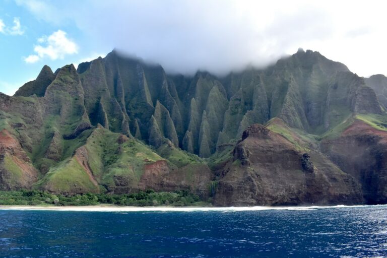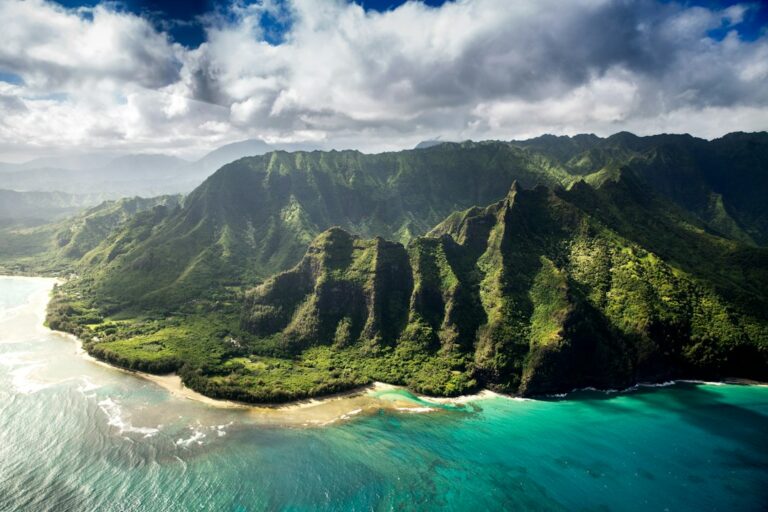
The Alakai Swamp boardwalk sits at 4,000 feet on the roof of Kauai, threading through one of the wettest ecosystems in the United States and ending at the Kilohana overlook above the Wainiha and Hanalei drainages. From the Pihea trailhead at the pavement’s end inside Kokee State Park, the round-trip covers roughly 7 miles with about 1,000 feet of cumulative elevation change once the rolling contour work is tallied.
This is not a paved nature stroll. Long stretches ride on aging wooden planks laid across peat bog, and roots, mud, and slick basalt fill the gaps between segments. The payoff is a bird corridor where endemic Kauai amakihi and apapane still call from ohia canopy, plus a cliff-edge view over the north shore that few island visitors ever reach.
The route rewards preparation. Rain falls somewhere on the trail on most days of the year, temperatures at the trailhead can sit 20°F below the coast, and the fog window that swallows the Kilohana lookout typically closes by early afternoon. What follows breaks down the drive from Kekaha, the segment profile, endemic species zones, gear that keeps a hiker upright on wet planks, and shuttle math for households without a rental truck.
Driving Highway 550 from Kekaha to the Pihea trailhead
Highway 550 climbs from sea level at Kekaha to 4,000 feet at the end of the road inside Kokee State Park. The distance from central Kekaha to the Puu O Kila lookout parking sits at 19.5 miles, and the drive typically runs 45 to 55 minutes because the switchbacks tighten above mile marker 10 and slower vehicles rarely find safe pullouts.
The road, maintained by the Hawaii Department of Transportation district crews, was resurfaced in several segments through 2022 but still shows rock scarring above 3,500 feet where winter rock-fall repairs stack up. Drivers who have not experienced continuous switchback climbs should factor in an extra 10 minutes of tentative pace.
The Pihea trailhead itself sits at the pavement’s end, past the more heavily used Kalalau lookout at mile marker 18. Parking is limited to a gravel lot with roughly 30 spaces. On dry weekends between June and September, the lot fills by 8:30 AM, and overflow spills onto the road shoulder for another quarter mile down toward the Kalalau lookout.
Fuel and provisioning below the climb
The last reliable gas station before the mountain is the Kekaha service station near Highway 50, and the last full-service grocery is the Big Save in Waimea. Neither Kokee Lodge nor the small museum stocks meaningful trail food, so households provision lunches, extra water, and electrolyte tablets before turning inland off the coast highway.
Statewide fuel prices tracked weekly by the U.S. Energy Information Administration typically run $1.50 to $2.00 per gallon above mainland averages on Kauai, which matters for the round-trip 40-mile drive from Poipu once the mountain climb is added to daily coastal running.
Households basing out of Waimea often build a stop at the Ishihara Market poke counter into the outbound drive, then eat the bowl at a lookout before starting the hike. Poke keeps cold in a soft cooler for the first three hours on the mountain.
Trail breakdown: Pihea Vista to Alakai junction to Kilohana
The full trek chains two named trails. The first mile follows the Pihea Trail along the rim of Kalalau Valley, gaining and losing about 400 feet across a muddy ridgeline to reach Pihea Vista at 4,284 feet. This segment is the roughest underfoot before the boardwalk begins in earnest.
From Pihea Vista the trail drops down a wooden ladder-staircase and rejoins the ridgeline until it meets the Alakai Swamp Trail junction near mile 1.75. Turning left onto the Alakai Swamp Trail commits the hiker to the boardwalk system for the remaining outbound distance to the Kilohana lookout, roughly 1.75 miles further into the plateau.
The Kilohana overlook sits at 4,020 feet on the pali edge above Wainiha Valley. On the clear-view days that fall roughly one morning in four, the sightline drops nearly 3,700 feet straight down to the Hanalei River delta. On fogged-in days the platform sits inside white cloud, and the payoff is the birdlife along the return walk.
Segment breakdown table
| Segment | One-way distance | Elevation change | Dominant surface |
|---|---|---|---|
| Pihea trailhead to Pihea Vista | 1.0 mile | +280 / -0 ft | Mud, roots, red clay |
| Pihea Vista to Alakai junction | 0.75 mile | -260 / +40 ft | Ladder stairs, boardwalk |
| Alakai junction to Kilohana overlook | 1.75 miles | +180 / -160 ft | Full boardwalk over bog |
| Return to trailhead | 3.5 miles | +200 / -280 ft | Same surfaces reversed |
| Round-trip total | 7.0 miles | ~1,000 ft cumulative | Mixed |
Elevation, grade, and pace planning
The cumulative 1,000 feet of elevation change is spread across rolling terrain rather than one sustained climb. There is no single grade steeper than 12 percent, and the ladder-stairs off Pihea Vista handle the sharpest drop with treated lumber steps that most hikers descend in under five minutes with poles in hand.
Because the boardwalk planks are only 12 to 16 inches wide and often warped, pace is dictated by footing rather than fitness. A conservative planning number for round-trip travel time is 5 to 6 hours moving, plus 30 to 45 minutes at the Kilohana overlook waiting for a cloud break to open across the north-shore drainages.
How pace shifts by conditions
- Dry planks after three consecutive rain-free days: 5 hours round-trip is realistic for fit hikers.
- Wet planks after morning rain: add 60 to 90 minutes for cautious footing throughout.
- Trail after multi-day storm: sections flood to ankle depth and slow pace by half.
- Groups with children under 10: budget 7 to 8 hours and turn around at the Alakai junction if needed.
- Photography-focused parties: expect an additional 45 to 90 minutes of stopped time for bird and canopy shots.
Weather and fog windows at 4,000 feet
The Alakai Swamp catches trade wind moisture forced upward by the Waialeale summit ridge just to the east. Waialeale itself averages roughly 450 inches of rain per year, one of the highest totals recorded anywhere on Earth. The swamp plateau sits in that same moisture reversal and receives approximately 150 to 180 inches annually across most stations.
Fog forms most mornings as air cools overnight, then burns off in patches between roughly 9 AM and noon before rebuilding by mid-afternoon. Hikers targeting the Kilohana view aim to be at the overlook between 10 AM and 11:30 AM for the best odds of a clear window, which typically lasts 5 to 20 minutes at a time before closing again.
Temperatures at the trailhead run 15 to 25°F cooler than at Poipu or Waimea. A 78°F coastal morning often translates to a 55 to 60°F Pihea start with wind gusts of 15 to 25 mph across the exposed ridge sections. Households used to Oahu or Maui coastal hiking underestimate this gap regularly.
Monthly climate table at Kokee (4,000 ft)
| Month | Avg high °F | Avg low °F | Rainy days | Fog frequency |
|---|---|---|---|---|
| January | 63 | 44 | 18 | High |
| April | 66 | 48 | 14 | Medium |
| June | 72 | 54 | 10 | Low |
| August | 74 | 56 | 11 | Low |
| October | 71 | 52 | 13 | Medium |
| November | 67 | 49 | 17 | High |
Households planning a shoulder-season trip should read the seasonal rainfall notes in the November Kauai trip breakdown before locking a November boardwalk day into the itinerary. The month posts the lowest odds of a clear Kilohana window between the summer dry season and the following spring.
Boardwalk condition and bog-plank slickness
The plank system through the Alakai Swamp was rebuilt in phases between 2007 and 2014, and Hawaii’s Division of State Parks maintains it with periodic replacements. Most planks are pressure-treated Douglas fir or local ohia, sunk on posts into the peat. Individual boards span 8 to 12 feet with narrow gaps at each joint that catch trekking-pole tips.
The slick surface comes from a persistent algae and lichen film that grows in the wet mist. Even on dry-looking mornings the film keeps the top of each plank slippery, particularly on shaded downhill segments. Chicken-wire mesh has been stapled to some sections for grip, but coverage is inconsistent and older mesh has rusted through in places.
Off-boardwalk falls are the primary injury source on the trail. The peat below the planks can be knee-deep or waist-deep in spots, and pulling a boot out of the mud without spraining an ankle takes practice. Sticking to the center of each plank and avoiding a rushed pace after rain matters more than any specific footwear choice.
What to check the day before the hike
- Overnight rain totals from the Kokee weather station on the National Weather Service Honolulu page.
- Wind forecast for the 4,000 ft level, since exposed segments get gusty above 25 mph.
- Kokee State Park alert page for closures after washouts or downed trees.
- Sunset time, then back off 3 hours to set a strict turnaround.
- Any news of trail rescues reported in the Honolulu Star-Advertiser during the prior week.
Endemic bird zones and the native plant corridor
The Alakai Swamp is one of the last strongholds for several Hawaiian forest birds that have lost habitat elsewhere. Mosquitoes carrying avian malaria have historically been limited to elevations below roughly 4,500 feet, and warming has been pushing that line upward, which is why the swamp’s populations are watched closely by biologists at the Hawaii Department of Health and academic partners.
The two species most hikers actually see and hear along the trail are the Kauai amakihi, a small yellow-green honeycreeper that forages in ohia flowers, and the apapane, a red-and-black honeycreeper with a distinctive chattering call. Both species concentrate around blooming ohia lehua canopy, particularly between mile 1.5 and mile 3 outbound.
Rarer species and where to listen
The akikiki and akekee are both critically endangered honeycreepers now largely restricted to the swamp interior above the boardwalk. Casual hikers do not typically see either species from the trail, but biologists occasionally survey from adjacent transects. The elepaio, a small brown flycatcher, calls frequently near the Alakai junction and sometimes approaches hikers who pause.
Native plants along the corridor include ohia lehua as the dominant canopy tree, along with pukiawe shrubs, uluhe fern mats, and endemic lobelias. The dense fog-fed vegetation looks nothing like the drier lower-elevation forests around Kalaheo and Poipu, which is part of the boardwalk’s appeal for households acclimated to the sunny south shore.
The Kilohana overlook payoff
The Kilohana platform is a small wooden deck bolted to the pali edge at 4,020 feet. On clear days the view drops nearly 3,700 feet straight down into Wainiha Valley, then out across Hanalei Bay to the horizon. On overcast days the deck sits inside cloud with visibility under 50 feet.
The clear window statistically favors morning hikers who arrive by 10:30 AM and are willing to wait 20 to 40 minutes for the trades to briefly clear the ridge. Afternoon arrivals in the summer months occasionally get a second window between 3 PM and 4 PM, but by then the return hike risks running into dusk on wet planks.
For households that want a similar cliff-top perspective without the swamp commitment, a doors-off helicopter flight puts the same Wainiha and Hanalei drainages under the aircraft in about 55 minutes. The two experiences complement rather than replace each other, and many visitors book both across a week-long stay.
Gear packing list for the boardwalk day
The boardwalk day is not a serious mountain trip, but it demands more layering and waterproofing than a beach outing. The core failure mode is showing up in cotton shorts and a t-shirt for a 60°F, 20-mph wet ridge and turning back at Pihea Vista uncomfortable and cold.
A hardshell rain jacket rated at 10,000 mm hydrostatic head or better is the single most useful item. Waterproof-breathable shells in the 8-ounce weight class handle the light trade wind rain without overheating on the climb back out. A 200-weight fleece midlayer supplies enough insulation for most months of the year.
Recommended pack contents
| Item | Approximate weight | Purpose |
|---|---|---|
| Rain shell jacket (10k mm) | 8 oz | Wet cloud and rain shedding |
| 200-weight fleece | 12 oz | Ridge wind insulation |
| Low mud gaiters | 5 oz | Boot-top mud entry protection |
| Water, 2 liters | 4.4 lb | Hydration for 5-6 hours |
| Lunch and snacks | 1 lb | Kilohana overlook meal |
| Headlamp with fresh batteries | 3 oz | Late return backup |
| Trekking poles | 18 oz pair | Plank grip and stream steps |
| First aid kit | 8 oz | Slip abrasions and blisters |
| Trail map, offline GPS | 2 oz | Fog-obscured junction navigation |
Footwear notes
Mid-height trail runners with aggressive lugs outperform stiff hiking boots on the boardwalk itself, because the flat plank surface rewards flexible soles that conform to warped wood. Hikers who prefer boots choose a mid-height waterproof model paired with 6-inch gaiters that seal the top opening against mud splash.
Whichever footwear travels, it will finish the day soaked and muddy. Households renting condos should pack an old pillowcase or a garbage bag to contain the boots for the drive back, and plan to rinse them under a hose before storing them near a rental’s carpeting.
Shuttle versus private vehicle from Kekaha
Kokee State Park does not run a public shuttle. Reaching the Pihea trailhead requires either a rental vehicle, a private guided-hike shuttle, or a rideshare quote that has become increasingly hard to secure past Waimea. Most independent hikers drive a rental up the mountain themselves after basing on the south or west side.
Private guided hikes with round-trip transport from Poipu or Lihue coast hotels run roughly $180 to $250 per person as of the 2024–2025 season, with pickup around 7 AM and return by 4 PM. These include a guide, snacks, and often trekking poles, but they cap group sizes at 8 to 12 hikers.
Cost comparison table
| Option | Round-trip cost (2 hikers) | Timing flexibility | Gear included |
|---|---|---|---|
| Rental SUV from Lihue airport | ~$95 daily plus $12 fuel | Full — own schedule | None |
| Guided hike shuttle from Poipu | $360 to $500 | Fixed group schedule | Poles, snacks, guide |
| Rideshare from Waimea (if available) | $140 to $200 estimated | Poor — return uncertain | None |
| Kokee Lodge cabin stay | $95 to $115 per night | Excellent — sleep at trailhead | Bedding included |
Why the cabin option deserves consideration
Kokee Lodge operates a set of aging plantation-style cabins at 3,600 feet, roughly 3 miles below the Pihea trailhead. Booking a cabin the night before positions hikers to reach the trailhead by 7 AM without the 6 AM alarm from the coast, and often catches the clearest fog window of the entire day.
The cabins have kerosene heaters, basic kitchenettes, and no cellular reception. They are not luxury lodging, but they solve the pre-dawn drive problem and let households build the boardwalk around wildlife photography rather than daylight math. Reservations open 30 days ahead and popular weekends sell out within hours of opening.
Cultural and conservation status of the Alakai wilderness
The Alakai Wilderness Preserve encompasses roughly 10,000 acres of upland bog and cloud forest set aside by the state of Hawaii in 1964. Native Hawaiian oral tradition holds that the swamp was considered sacred and largely off-limits for daily travel, with a small number of trails maintained by kanaka maoli for gathering specific plants and feathers used in traditional practice.
Today the preserve is managed as a state Natural Area Reserve, with the boardwalk representing a deliberate compromise between visitor access and ecosystem protection. Off-trail travel is prohibited, and biologists have documented that the boardwalk approach has kept trampling damage remarkably contained compared to open-trail alternatives at similar elevations elsewhere in the state.
Ongoing threats tracked in reporting from Honolulu Civil Beat and academic biologists include mosquito-borne avian malaria climbing upslope with warming temperatures, invasive plant establishment along trail edges, and feral pig activity that reshapes the peat surface below the boards. Visitors who stay on the planks are actively part of the conservation strategy.
Building the boardwalk day into a week on Kauai
The Alakai Swamp hike is a full-day commitment that leaves the hiker useful for very little else that evening. Most itineraries slot it as a mid-week centerpiece, book-ended by lower-effort south shore days at Salt Pond in Hanapepe for a recovery swim, then a rest day on the north shore.
A common seven-day sequence positions the boardwalk on day 3 or day 4. Arrival day and day 2 stay at sea level while the visitor acclimates and studies the forecast. Day 3 or 4 executes the hike. Day 5 is a slow morning at Anini Reef or an inland farm visit.
Lodging bases and drive times to the Pihea trailhead
| Lodging base | One-way drive | Predawn departure | Suitability |
|---|---|---|---|
| Waimea town | 50 min | 6:00 AM | Best coastal base |
| Hanapepe / Eleele | 65 min | 5:45 AM | Good with early start |
| Poipu / Koloa | 75 min | 5:30 AM | Adds fatigue |
| Lihue airport area | 90 min | 5:00 AM | Marginal |
| Princeville / Hanalei | 2.5 hours | 4:00 AM | Not recommended |
| Kokee Lodge cabin | 10 min | 7:00 AM | Optimal |
Households considering longer-term relocation to Kauai often notice how much of the island’s character concentrates on the west side around Hanapepe and Waimea, which puts them within an hour of Kokee for repeat weekend hikes rather than a once-per-visit ambitious itinerary.
Post-hike recovery on the west side
Descending Highway 550 with muddy boots and depleted legs, most hikers want a real meal and a place to change before the final drive back to their rental. The west side offers a small but reliable set of options between Kekaha and Hanapepe that stay open past 8 PM.
The Waimea Brewing Company inside the Waimea Plantation Cottages complex serves a full menu until roughly 8:30 PM most nights. Portuguese bean soup and burgers are the standard recovery orders. The parking lot has enough space to change out of wet trail clothes discreetly next to a rental vehicle before the final coastal drive east.
Hikers who want a low-effort follow-up day can build in a Steelgrass Chocolate Farm tour the following morning in Kapaa, which is a seated tasting experience that pairs well with sore quadriceps and a rest from steering wheel time.
Safety and preparation notes
Search and rescue on Kauai fields a handful of Alakai Swamp calls each year, most involving hikers who left the boardwalk chasing a bird sighting and then could not relocate the plank line in fog. The peat surface takes footprints poorly, and thick vegetation closes over a person quickly after they step off the wood.
The consistent rule is that if a hiker cannot see three plank segments ahead, they should stop rather than push forward, and if they cannot see the plank behind them, they should not step off the boardwalk at all. GPS tracks recorded on the outbound help enormously when the return fog closes back in.
Emergency preparation checklist
- File the plan with a non-hiking party member including expected return time.
- Download an offline map before losing signal in Waimea Canyon.
- Carry a whistle on the shoulder strap — three blasts signals distress.
- Pack a foil emergency blanket weighing under 3 oz for a forced overnight.
- Note that Kauai fire department response from Waimea can take 90 to 120 minutes.
Comparing the Alakai Swamp with other Hawaii day hikes
Households working through a multi-island itinerary often ask how the Alakai Swamp compares to other well-known Hawaii boardwalks and highland trails. The closest cousin in structure is the Pipiwai bamboo forest boardwalk on Maui, which shares wet planks but at much lower elevation and shorter distance.
Cross-island trail comparison
| Trail | Island | Round-trip miles | Peak elevation | Difficulty |
|---|---|---|---|---|
| Alakai Swamp to Kilohana | Kauai | 7.0 | 4,284 ft | Moderate-high |
| Pipiwai bamboo forest | Maui | 4.0 | 800 ft | Moderate |
| Iao Valley Needle loop | Maui | 0.6 | 800 ft | Easy |
| Papohaku Molokai beach walk | Molokai | 6.0 | Sea level | Easy-moderate |
| Waipio Valley switchback | Big Island | 1.6 | 1,000 ft loss | High |
For households that prefer valley grades over swamp planks, the Waipio Valley descent on the Big Island offers a shorter but far steeper alternative. Neither trail substitutes for the other — the Alakai is a bird and cloud-forest experience, while Waipio is a coastal cliff and taro-valley experience.
The Iao Valley Needle loop on Maui is often chosen as a rain-day substitute during a Kauai-Maui pairing itinerary because the paved paths tolerate weather that would make the Alakai boardwalk dangerously slick. Households mixing islands over a two-week trip build these substitutions in ahead of time.
Kauai’s year-round population of roughly 73,000 residents documented by U.S. Census Quick Facts means the mountain trails see far less local weekend pressure than similar-quality routes on Oahu, which is another reason repeat visits and cabin stays reward the west-side base far more than a single guided-shuttle attempt.
Frequently asked questions
How long does the Alakai Swamp boardwalk hike actually take?
Most reasonably fit hikers complete the 7-mile round trip in 5 to 6 hours of moving time, plus 30 to 45 minutes at the Kilohana overlook waiting for a fog window. Families with young children or hikers stopping frequently for birdwatching should budget 7 to 8 hours from car door to car door on the same trailhead.
Do the boardwalk planks require special footwear?
No specialized boots are required, but aggressive lugged trail runners or waterproof mid-height hikers perform best. Smooth-soled sneakers slip badly on the algae-covered planks. Low mud gaiters help keep bog splash out of the boot top when a foot slips off a plank into the surrounding peat, which happens to nearly every hiker at some point.
When is the best month to hike the Alakai Swamp?
June through September offers the driest conditions, lowest fog frequency, and best odds of a clear Kilohana view. May and early October are strong shoulder-month alternatives with smaller trailhead crowds. December through March delivers the highest rainfall, most fog, and highest injury rates on the wet planks, though winter hikers who catch a rare clear day report the most dramatic conditions.
Is the trail safe for hiking solo?
Fit hikers who file a plan with a non-hiking contact, carry offline maps, and turn around at first sign of thickening fog can complete the boardwalk solo. That said, the greater risk on this trail is a plank slip causing an ankle injury far from the trailhead, and a hiking partner materially reduces the consequences of any single mistake on wet wood.
Are dogs allowed on the Alakai Swamp Trail?
Kokee State Park permits leashed dogs on most trails, including the Pihea and Alakai Swamp routes, but the boardwalk itself is a poor fit. Wet planks are hard on paw pads, the gaps between boards can trap smaller dogs, and native bird disturbance is a real concern. Most guides recommend leaving dogs at the coastal rental for this specific hike.
What happens if fog closes in on the return?
Slow down, stay on the boardwalk center line, and use a phone GPS track to confirm each junction. The Alakai Swamp Trail rejoins the Pihea Trail at a marked junction with signage, and the return climb up the ladder-stairs is unmistakable underfoot. If visibility drops under 30 feet, stopping in place for a partial clearing beats guessing at the route.
Can the hike be shortened if weather turns bad?
Yes. A common bailout is turning around at Pihea Vista, roughly 1 mile in, which still delivers a strong Kalalau Valley overlook without committing to the boardwalk. A second bailout is the Alakai Swamp Trail junction at 1.75 miles, cutting the round-trip to 3.5 miles and eliminating the exposed boardwalk section that dominates the outer portion of the route.