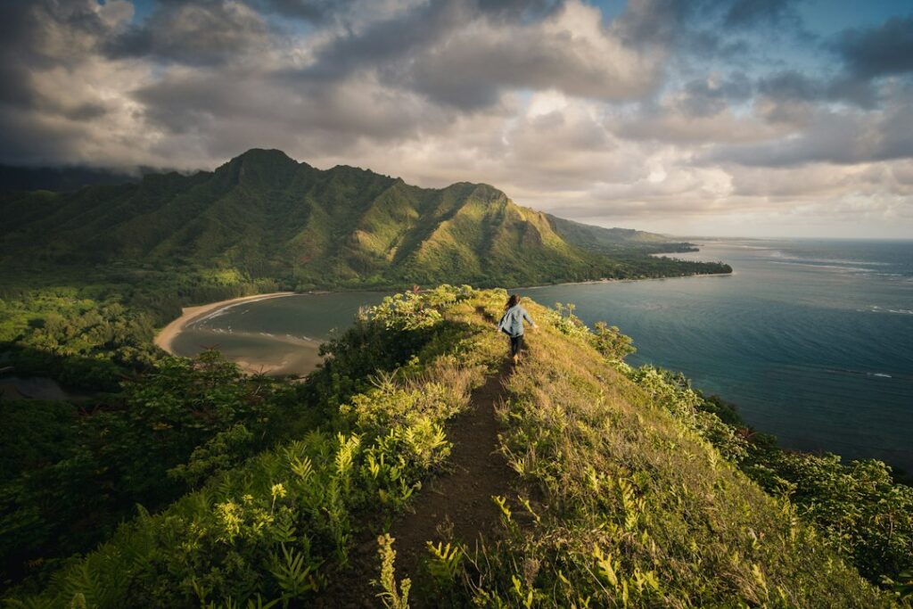
Maui packs a sea-level lava coast, a rain-soaked West Maui ridge, a bamboo forest inside a national park and a 10,023-foot volcanic summit into an island roughly 48 miles long. That range is the appeal. It is also the planning problem: a trail that feels easy at 8 a.m. on the dry leeward coast can be cold, muddy or unsafe somewhere else by early afternoon.
This article sorts nine of the best hikes on Maui into easy, moderate and strenuous tiers. Each entry lists round-trip distance, elevation gain, typical hiking time and where to park. Later sections explain the access rules that catch first-timers, including the non-resident reservation at Iao Valley State Monument and the Haleakala National Park vehicle pass that covers both the summit and the Kipahulu district.
The closing sections cover the conditions that most often turn a routine Maui hike into a risky one: windward afternoon rain and flash flooding, cold and thin air near 10,000 feet, and strong sun above the treeline. A gear list and answers to common questions follow.
How the difficulty tiers are defined
Difficulty ratings for Maui trails vary widely between apps, guidebooks and agency pages, so this article uses three plain thresholds. Easy trails run under 4 miles round trip, with less than 300 feet of climbing and mostly solid footing. Moderate trails add distance, rough lava, heat, altitude or a sustained climb.
Strenuous trails combine 1,000 feet or more of elevation change with at least one extra hazard, such as mud, a narrow exposed ridge or air above 9,000 feet. Each tier reflects total effort, not just the elevation profile. Hoapili, for example, climbs only modestly but crosses shadeless lava where midday heat often reaches the high 80s°F.
| Trail | Tier | Round trip | Elevation gain | Typical time | Best start |
|---|---|---|---|---|---|
| Iao Valley paved loop | Easy | 0.6 mi | ~150 ft | 30–45 min | 7–9 a.m. |
| Hosmer Grove Nature Trail | Easy | 0.5 mi | ~80 ft | 30 min | Any daylight hour |
| Kapalua Coastal Trail | Easy | 3.5 mi | ~150 ft | 1.5–2 hr | 7–9 a.m. |
| Halemauu Trail to rim overlook | Moderate | 2.2 mi | ~400 ft | 1.5–2 hr | 8–10 a.m. |
| Pipiwai Trail to Waimoku Falls | Moderate | 4 mi | ~800 ft | 2.5–3.5 hr | Before 10 a.m. |
| Hoapili Trail to Kanaio Beach | Moderate | 5.5 mi | ~400 ft | 3–4 hr | 6:30–7:30 a.m. |
| Waihee Ridge Trail | Strenuous | 5 mi | ~1,500 ft | 3–4 hr | 7 a.m. |
| Sliding Sands to Ka Luu o ka Oo | Strenuous | 5.5 mi | ~1,500 ft | 4 hr | 9–10 a.m. |
| Sliding Sands to Halemauu traverse | Strenuous | 11 mi one way | ~1,000 ft up, ~2,800 ft down | 6–8 hr | By 8 a.m. |
Easy hikes on Maui
The easy tier suits travelers short on time, mixed-age groups and anyone who wants a short outing before committing to a long day. None of these three trails needs special footwear in dry weather, though closed-toe shoes beat sandals on all of them.
Kapalua Coastal Trail
The Kapalua Coastal Trail runs about 1.75 miles each way along West Maui’s northwest shoreline, linking Kapalua Bay, Oneloa Bay and D.T. Fleming Beach Park. A round trip covers roughly 3.5 miles with about 150 feet of gain. Most walkers finish in 1.5 to 2 hours with stops.
The surface changes often. Paved resort paths give way to a raised boardwalk over protected dunes at Oneloa, then to uneven lava rock around Makaluapuna Point. There, the jagged formations called Dragon’s Teeth sit beside the Honokahua burial site, and signs ask visitors to stay on the marked path.
Parking: small public beach-access lots serve Kapalua Bay and Oneloa Bay, and both can fill by mid-morning. D.T. Fleming Beach Park at the northern end has the largest free lot. Kapalua Bay is one of the calmer summer swimming spots, and the site’s ranked list of the best beaches on Maui covers seasonal surf on this coast.
Iao Valley State Monument loop
Iao Valley’s paved walkway climbs a set of stairs to a lookout facing the Iao Needle. The vegetated pinnacle, known in Hawaiian as Kukaemoku, rises about 1,200 feet from the valley floor. The loop totals roughly 0.6 miles with about 150 feet of gain and takes 30 to 45 minutes.
A lower path follows Iao Stream through a garden area in a valley that saw the 1790 Battle of Kepaniwai. Informal trails beyond the fences are closed. The monument sits at the head of a narrow valley in the West Maui Mountains, so it gets clouds and showers far more often than Wailuku, about 3 miles down the road.
Parking: a single small lot at the end of Iao Valley Road, tied to the reservation system described below. Because the valley is often wet when the coast is dry, it works best as a flexible short stop. The site’s guide to Iao Valley as a rain-afternoon alternative explains how to fit it around changing weather.
Hosmer Grove Nature Trail
Hosmer Grove lies just past the entrance station of Haleakala National Park’s summit district, at about 6,800 feet. Its 0.5-mile loop gains less than 100 feet and takes about 30 minutes. The trail passes conifers planted in the early 1900s as a forestry experiment, then opens onto native shrubland where honeycreepers such as the apapane are sometimes seen.
Parking: a lot beside the Hosmer Grove campground, on a short signed spur off the summit highway. The vehicle pass applies. The loop makes a sensible acclimatization stop on the way up, and a fallback when the summit is fogged in or too windy.
Moderate hikes on Maui
Moderate trails take a half day, more water and better shoes. Each of the three below has a trait that pushes it out of the easy tier: steady climbing and slick roots on Pipiwai, heat and ankle-rolling lava on Hoapili, and an uphill return at nearly 8,000 feet on Halemauu.
Pipiwai Trail to Waimoku Falls
The Pipiwai Trail in Haleakala National Park’s Kipahulu district climbs about 2 miles inland along Palikea Stream to the base of Waimoku Falls, a cascade of roughly 400 feet. The round trip is about 4 miles with around 800 feet of gain. Park guidance suggests 2 to 3 hours, and photo stops often stretch that to 3.5.
Landmarks break the climb into stages. An overlook of 185-foot Makahiku Falls comes at about 0.5 miles, followed by a large banyan tree, footbridges and a boardwalk through dense bamboo forest. The last stretch has rocky footing and small stream crossings, and falling rock makes the pool at the base of Waimoku unsafe. The site’s breakdown of Pipiwai round-trip timing covers pacing by section.
Parking: the Kipahulu Visitor Center lot, about 10 miles past Hana town and usually 2.5 to 3 hours from Kahului on the Hana Highway. The drive, not the hike, is the real limit. Hawaii gasoline prices have run well above the national average in U.S. Energy Information Administration data, so filling the tank in central Maui makes sense.
Hoapili Trail (King’s Highway) at La Perouse Bay
The Hoapili Trail follows part of an ancient stone-lined footpath across a lava flow south of Makena. It is named for Hoapili, an early 19th-century governor of Maui who had the route improved. The usual day hike runs from La Perouse Bay to Kanaio Beach, about 5.5 miles round trip with roughly 400 feet of gain.
Most hikers need 3 to 4 hours. The difficulty comes from conditions, not the elevation profile. There is no shade, the dark rock radiates heat, and loose a’a lava punishes thin soles. South Maui averages only about 10 to 15 inches of rain a year, so the main risk here is dehydration, not mud.
Parking: an unpaved lot at the end of Makena Road at La Perouse Bay, just beyond the Ahihi-Kinau Natural Area Reserve. Starting by 7 a.m. avoids the worst heat, and each hiker should carry at least 3 liters of water. Afternoon winds pick up sharply along this coast.
Halemauu Trail to the crater rim overlook
The Halemauu Trail starts at about 7,990 feet on the Haleakala summit road and crosses subalpine shrubland to a viewpoint on the cliffs above the crater floor. The out-and-back runs about 2.2 miles with roughly 400 feet of elevation change and takes 1.5 to 2 hours. The walk out trends downhill, so the return is the harder half.
Parking: a signed trailhead lot several miles above the park headquarters visitor center. Clouds often spill through the Koolau Gap on this side of the mountain and can cut visibility to a few hundred feet within minutes, so a windproof layer belongs in every pack.
Strenuous hikes on Maui
The strenuous tier covers trails with at least 1,000 feet of climbing plus mud, exposure or altitude. Hikers who have done the harder ridges in the site’s guide to the best hikes on Oahu, or the canyon descents in its Waimea Canyon and Kokee State Park tiers on Kauai, will find the effort familiar.
Waihee Ridge Trail
Waihee Ridge climbs the windward side of the West Maui Mountains to a clearing near Lanilili Peak at about 2,560 feet. The round trip is roughly 5 miles with about 1,500 feet of gain, and fit hikers typically need 3 to 4 hours. Views take in Waihee Valley, Makamakaole Falls and, on clear days, the north shore.
The first 0.2 miles is a steep paved ramp that surprises many visitors. Beyond it, the trail switchbacks through guava forest before following the ridge crest, where several narrow sections have drop-offs on both sides. The red clay tread turns slick within minutes of rain.
Parking: a gated lot off Kahekili Highway (Route 340) near the Maluhia Boy Scout Camp, about 25 minutes from Kahului. Hikers should check the posted gate hours. Trade-wind clouds usually build over the upper ridge by late morning, hiding the views and wetting the trail, so a 7 a.m. start gives the best chance of a clear summit.
Sliding Sands Trail to Ka Luu o ka Oo
The Sliding Sands Trail, called Keoneheehee in Hawaiian, starts at the Haleakala Visitor Center parking lot at about 9,740 feet and descends into the summit crater. The most popular turnaround is the Ka Luu o ka Oo cinder cone, about 5.5 miles round trip with roughly 1,500 feet of elevation change. Park guidance suggests allowing 4 hours.
The descent over loose cinder feels effortless, and that is the trap. Every foot lost must be regained on the way back at 8,200 to 9,740 feet, where each breath carries roughly 25 to 30 percent less oxygen than at sea level. A common planning rule is to allow twice as long for the climb out as for the walk down.
Parking: the summit visitor center lot, which fills with sunrise crowds before dawn and usually frees up after about 8 a.m. The route has no water, shade or shelter. For comparison, the crater walks in the site’s Hawaii Volcanoes National Park day trip guide start more than 5,000 feet lower.
Sliding Sands to Halemauu crater traverse
The full crossing links Sliding Sands to the Halemauu Trail across the crater floor, about 11 miles one way. It descends roughly 2,800 feet, then climbs about 1,000 feet of switchbacks up the crater wall to the Halemauu trailhead at 7,990 feet. Fit, acclimatized hikers need 6 to 8 hours.
The trailheads are roughly 6 road miles apart, so groups need a second vehicle or a drop-off at the summit. The steepest climbing comes at the end, when legs are tired and afternoon clouds often cover the switchbacks. Hikers who feel altitude symptoms on the crater floor should turn back up Sliding Sands rather than push on.
Access rules: Iao Valley reservations and the Haleakala pass
Three kinds of access need planning beyond parking. Iao Valley uses a state reservation system for non-residents. Haleakala charges a vehicle entrance fee that is valid in both of its districts. Sunrise at the summit needs a separate booking. The table below summarizes published rates and booking windows.
| Site | Advance booking | Entry fee | Parking | Booking window |
|---|---|---|---|---|
| Iao Valley State Monument | Non-residents only | $5 per person | $10 per vehicle | Up to 30 days ahead |
| Waianapanapa State Park (Hana Highway) | Non-residents only | $5 per person | $10 per vehicle | Up to 30 days ahead |
| Haleakala NP, summit and Kipahulu | None for daytime entry | $30 per private vehicle | Included | Pass valid 3 days |
| Haleakala summit sunrise (3–7 a.m.) | All vehicles | $1 reservation plus entry fee | Included | 60 days ahead, 7 a.m. HST |
| Kapalua, Hoapili, Waihee Ridge | None | $0 | $0 | Not applicable |
Iao Valley’s non-resident reservation
Non-resident visitors must book a timed entry to Iao Valley State Monument through the state parks online system, which also handles Diamond Head and Waianapanapa. Published rates are $5 per person and $10 per vehicle, and posted hours run 7 a.m. to 6 p.m. Walk-up entry is not guaranteed once slots sell out.
The process mirrors the Oahu system described in the site’s guide to Diamond Head’s non-resident booking window. Visitor fees at state parks have been under review as Hawaii adds conservation-linked charges, a debate covered by Civil Beat, so current rates should be confirmed before booking.
The Haleakala vehicle pass covers Kipahulu
Haleakala National Park charges $30 per private vehicle, $25 per motorcycle and $15 per person on foot or bicycle. The pass is valid for 3 consecutive days and covers both districts. A family that drives to the summit on Monday can hike Pipiwai at Kipahulu on Tuesday or Wednesday on the same receipt.
No road inside the park connects the two districts. The summit is reached from Kula, and Kipahulu is reached via Hana. A Haleakala annual pass costs $55, and the $80 America the Beautiful pass covers every national park, including Hawaii Volcanoes on the Big Island.
Sunrise reservations and the summit road
Every vehicle entering the summit district between 3 a.m. and 7 a.m. needs a $1 sunrise reservation on top of the entrance fee. Bookings open 60 days ahead at 7 a.m. Hawaii time, and a smaller batch is released 2 days before each date. Hikers who arrive after 7 a.m. need only the entrance pass.
The summit is roughly 37 road miles from Kahului. The Hawaii Department of Transportation posts lane work and closures for state highways, including the Hana Highway route to Kipahulu.
What trail access looks like for new Maui residents
For households moving to Maui, the fee picture changes quickly. Hawaii residents with a valid state driver’s license or state ID enter state parks such as Iao Valley and Waianapanapa without entry or parking fees and without a reservation. Out-of-state licenses do not qualify, even for someone who has already signed a lease.
National parks offer no resident discount, but Haleakala’s $55 annual pass pays for itself after two vehicle visits, which is practical for Upcountry residents in Kula or Pukalani. Hawaii has about 1.45 million residents, according to U.S. Census Bureau QuickFacts, and hosts several times that many visitors a year. That gap is why reservation systems now favor residents at crowded sites.
Windward rain and flash-flood cautions
Maui’s northeast trade winds push moist air into the mountains, so windward slopes get heavy rain while leeward coasts stay dry. Clouds usually build over the West Maui Mountains and the Hana coast through late morning, and afternoon showers are routine. Waihee Ridge, Iao Valley and Pipiwai all sit in that wet zone.
| Location | Nearby trails | Approx. annual rainfall | Wettest months |
|---|---|---|---|
| Puu Kukui, West Maui summit | Waihee Ridge, Iao Valley (upstream) | 350+ in | November–March |
| Hana and Kipahulu coast | Pipiwai Trail | 70–120 in | November–April |
| Haleakala summit area | Sliding Sands, Halemauu | 40–60 in | December–March |
| Kahului, central Maui | Staging for Iao and Waihee | ~19 in | December–February |
| Kihei and La Perouse Bay | Hoapili Trail | 10–15 in | December–February |
How flash floods form on Maui trails
Maui’s streams drain steep, narrow valleys, so rain falling miles upslope can reach a trail crossing within minutes, even under blue sky. Water levels can rise several feet very quickly. Of the trails in this article, Pipiwai, the Oheo Gulch pools and the stream at Iao Valley are the most exposed.
Hikers on those trails should watch for these warning signs:
- Water turning brown or carrying leaves and debris.
- A sudden rise in stream noise, or rumbling upstream.
- Rain or dark clouds over the mountains, even if the trail itself is dry.
- A National Weather Service flash flood watch or warning for Maui County.
The rule is simple: never cross a stream that is rising or discolored. Waiting on high ground is far safer, and most flash floods drop within hours. Outlets such as Hawaii News Now publish watches and warnings, and rangers close Kipahulu’s pools when water is high.
Mud, leptospirosis and slick trails
Rain also changes footing. Waihee Ridge’s clay and Pipiwai’s roots and rocks get slippery after even a short shower, which can add 30 minutes or more to a descent. According to the Hawaii State Department of Health, freshwater streams can carry leptospirosis, a bacterial illness that enters through cuts or mucous membranes.
Covering cuts with waterproof bandages and avoiding stream water reduce that risk. Rain patterns also shift by season. The site’s month-by-month look at the best time to visit Maui shows windward trails drying out between May and September.
Cold, wind and altitude at 10,000 feet
Air cools by roughly 3.5°F for every 1,000 feet of elevation gained, so the Haleakala summit is often more than 30°F colder than the beach where the drive began. Wind chill makes it feel colder still. Sunrise temperatures often sit in the 30s°F, and winter brings freezing nights and occasional snow.
| Location | Elevation | Typical daytime high | Typical pre-dawn low |
|---|---|---|---|
| Kihei coast | Sea level | 84°F | 70°F |
| Kula, Upcountry | 3,000 ft | 74°F | 58°F |
| Hosmer Grove | 6,800 ft | 62°F | 45°F |
| Halemauu trailhead | 7,990 ft | 58°F | 42°F |
| Haleakala Visitor Center | 9,740 ft | 52°F | 35°F |
| Puu Ulaula summit | 10,023 ft | 50°F | 32°F |
Altitude symptoms and who should be careful
Driving from sea level to 10,000 feet in about 2 hours gives the body no time to adjust. Mild altitude sickness can cause headache, nausea, dizziness and shortness of breath. The reliable fix is to go lower, and symptoms usually ease after dropping a few thousand feet.
- People with heart or lung conditions should talk to a physician before visiting the summit.
- Pregnant visitors and young children should take extra care with exertion at altitude.
- Scuba divers should wait at least 24 hours after diving before driving to the summit.
- Hikers should drink water steadily, since dry summit air speeds dehydration.
Sun exposure above the treeline
Above roughly 7,000 feet, Haleakala has almost no shade. UV intensity rises about 10 percent for every 1,000 meters of elevation, so the summit gets around 30 percent more UV than the coast. Hawaii’s UV index already reaches 11 or higher on many summer days, which counts as extreme.
Cool air hides the burn. Hikers on Sliding Sands often feel chilly while getting more UV than they would at the beach. Sunscreen should be reapplied every 2 hours. Maui County restricts the sale and use of non-mineral sunscreens, so zinc oxide or titanium dioxide formulas are the safe choice.
Gear list for Maui trails
One packing list can cover all nine trails if hikers add or drop layers by tier. The items below address the island’s three main hazards: slick windward mud, cold wind at altitude, and strong sun on exposed lava and cinder.
Footwear and traction
- Trail runners or hiking shoes with deep lugs for Waihee Ridge, Pipiwai and Sliding Sands.
- Sturdy closed-toe shoes with thick soles for a’a lava on Hoapili.
- Gaiters to keep cinder out of shoes on Sliding Sands.
- Trekking poles for Waihee’s steep, muddy descent.
Rain and cold protection
- A lightweight waterproof rain shell for every windward trail, whatever the morning forecast says.
- A fleece or insulated jacket for any hike above 6,000 feet.
- A warm hat and light gloves for early or late summit hikes.
Sun protection above the treeline
- Mineral sunscreen rated SPF 30 or higher, reapplied every 2 hours.
- A wide-brim hat or cap with a neck cover.
- Polarized sunglasses for glare off cinder and ocean.
- A long-sleeve sun shirt for Hoapili and Sliding Sands.
Water, food and navigation
- 1 liter per person on easy trails, 2 on moderate, 3 or more on strenuous routes.
- Salty snacks and electrolytes for Hoapili and the crater traverse.
- Offline maps downloaded in advance, since Kipahulu and the crater have little cell service.
- A small first-aid kit with waterproof bandages and blister care.
Planning a Maui hiking week by base and season
Drive time shapes a Maui hiking plan as much as trail difficulty does. The main visitor bases sit on opposite coasts, and the trailheads in this article are spread across West Maui, South Maui, Upcountry and the far east end. The table below shows typical driving times in light traffic.
| Trailhead | From Kahului | From Kihei/Wailea | From Kaanapali |
|---|---|---|---|
| Iao Valley | 15 min | 35 min | 45 min |
| Waihee Ridge | 25 min | 50 min | 60 min |
| Kapalua Coastal Trail | 60 min | 70 min | 20 min |
| Hoapili (La Perouse Bay) | 45 min | 25 min | 75 min |
| Haleakala Visitor Center | 1 hr 45 min | 1 hr 50 min | 2 hr 20 min |
| Kipahulu (Pipiwai) | 3 hr | 3 hr 20 min | 3 hr 50 min |
Those numbers favor grouping trails by region. A central Maui day can pair Waihee Ridge at 7 a.m. with Iao Valley before lunch. A South Maui base puts Hoapili 25 minutes away, and a Kaanapali base keeps the coastal trail close. The site’s comparison of where to stay on Maui weighs each region’s drive times.
A realistic week limits long drives to two days, one for the summit and one for the Hana Highway to Kipahulu. The 7-day Maui itinerary for a first trip shows how those days fit around beaches and rest. Official trip-planning information is also available from the Hawaii Tourism Authority’s Go Hawaii site.
Frequently asked questions
What is the best easy hike on Maui for first-time visitors?
The Kapalua Coastal Trail suits most first-time visitors. It runs about 3.5 miles round trip with roughly 150 feet of gain, needs no reservation or fee, and passes several swimmable bays. Iao Valley’s 0.6-mile loop is shorter, but non-residents must reserve entry and pay $5 per person plus $10 for parking.
Do you need a reservation to visit Iao Valley?
Non-residents need an advance reservation for Iao Valley State Monument, made online through the state parks booking system up to 30 days ahead. Fees are $5 per person and $10 per vehicle. Hawaii residents with a valid state driver’s license or ID get in free and do not need to book.
Does the Haleakala entrance pass cover the Pipiwai Trail?
Yes. The $30 private vehicle pass covers both the summit district and the Kipahulu district, where the Pipiwai Trail starts. It stays valid for 3 consecutive days, so visitors can drive to the summit one day and hike to Waimoku Falls the next without paying twice.
How cold does it get at the top of Haleakala?
Sunrise temperatures near the 10,023-foot summit often fall into the 30s°F, and wind chill can make it feel below freezing. Daytime highs often reach only about 50°F. Visitors should bring a warm jacket, hat and gloves, even when coastal Maui is in the 80s.
Is the Waihee Ridge Trail dangerous?
Waihee Ridge is strenuous rather than technical, but its upper ridge has narrow sections with steep drop-offs. Red clay gets very slippery after rain, and clouds often cover the top by late morning. Starting around 7 a.m., wearing lugged shoes and turning back in heavy rain keep the risks manageable.
How long does the Pipiwai Trail take?
The Pipiwai Trail to Waimoku Falls is about 4 miles round trip with roughly 800 feet of gain. Most hikers finish in 2.5 to 3.5 hours. The drive from Kahului to the Kipahulu trailhead adds about 3 hours each way, so the outing takes a full day.
Can you hike Sliding Sands without a sunrise reservation?
Yes. The $1 sunrise reservation applies only to vehicles entering the summit district between 3 a.m. and 7 a.m. Hikers arriving after 7 a.m. need only the $30 vehicle pass. A mid-morning start also makes parking easier, since the summit lot usually clears once sunrise crowds leave.