The Mahaulepu Heritage Trail traces the last undeveloped stretch of coastline on Kauai’s south shore, running roughly 4 miles one-way from Shipwreck Beach in Poipu east to Ha’ula Bay. Households scouting a Kauai relocation often walk it during scouting trips because it reveals what the island still looks like without hotels, resorts, or gated communities blocking the shore.
The route crosses private land owned by Grove Farm, one of the last plantation-era landholders on Kauai. Public access exists as a good-faith arrangement, not a legal easement, which shapes hours, signage, and expected conduct. Walking it responsibly is the price of admission.
Weather realities matter more here than on almost any other Kauai hike. The trail sits fully exposed to south-shore sun with no tree cover, no bathrooms, and no potable water anywhere along the 8-mile round trip. This research brief covers the segment-by-segment route, land-access etiquette, geological stops, sun-load planning, and the vehicle logistics that make the walk workable for a first-time visitor.
Trail overview and total distance
The Mahaulepu Heritage Trail begins at the eastern end of Shipwreck Beach in Poipu, sometimes labeled Keoneloa Bay on maps. From that starting point, the graded coastal path traces cliffs and coves for approximately 4 miles until it reaches Ha’ula Bay, the last accessible stretch before rugged terrain and private ranch land block further travel.
Round trip totals 8 miles on foot, with modest elevation gains around 300 feet across gentle bluff climbs and descents. Most fit walkers finish in 4 to 5 hours including photo stops. Slower paces stretch the day to 6 hours, which becomes a factor because there is no partial shade until the return leg back through the Poipu resort corridor.
The route can be sampled in shorter segments. Many households turn around at Makauwahi Cave, about 1.5 miles in, or at Kawailoa Bay, roughly 2.5 miles from the trailhead. Turnaround options give families with young children or older relatives a chance to preview the coastline without committing to the full 8-mile day.
Distance breakdown by segment
| Segment | Distance from trailhead | Elevation notes | Suggested time |
|---|---|---|---|
| Shipwreck Beach start | 0.0 miles | Sea level | 0 minutes |
| Shipwreck cliff top | 0.2 miles | +80 feet climb | 10 minutes |
| Punahoa Point | 0.7 miles | +40 feet rolling | 25 minutes |
| Makauwahi Cave turnoff | 1.5 miles | Descend to dunes | 45 minutes |
| Kawailoa Bay | 2.5 miles | Beach level | 75 minutes |
| Ha’ula Bay | 4.0 miles | +120 feet bluff | 2 hours |
Starting point at Shipwreck Beach
The trailhead sits directly behind the Grand Hyatt Kauai Resort in Poipu at the eastern edge of Shipwreck Beach. Free public parking exists in a small unpaved lot signed for beach access. That lot fills by 8 AM on weekends and holidays, so an early departure from surrounding neighborhoods pays off in both parking and cooler morning temperatures.
Beach access at Shipwreck itself is protected under Hawaii’s shoreline access laws. Even though the Hyatt is a private resort, the public may cross designated pathways to reach the sand. Similar arrangements govern private-land trails across the state, a pattern explained through the framework of Hawaii kuleana land rights and ahupuaa easements.
The first landmark past the sand is a lithified sand-dune bluff about 80 feet tall. Cliff-jumping used to happen from the top, though local news outlets like the Honolulu Star-Advertiser have covered multiple injuries. Walkers should ignore the informal jumping culture and stick to the trail line marked by foot traffic across the bluff.
Driving in from other parts of Kauai
From Lihue Airport, the trailhead is about 15 miles south via Kaumualii Highway and Poipu Road, a drive that typically takes 25 to 30 minutes without heavy rental-car return traffic. From the North Shore near Princeville, plan on 45 miles and 90 minutes, since the single-lane coastal roads slow progress considerably.
Poipu Road runs directly through the resort corridor. Signage for the Grand Hyatt is prominent; follow those signs past the roundabout and continue to the far east end of Ainako Street. Local drivers use shortcuts through Poipu Beach Road, but first-time visitors should stick to the primary route.
Route in segments from west to east
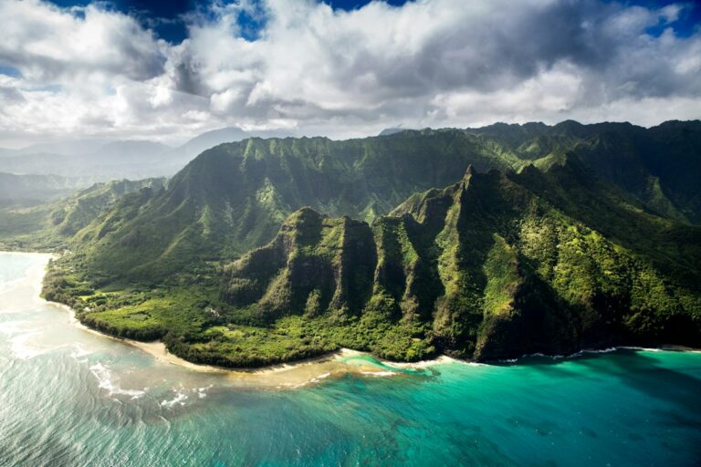
The path rises immediately from the beach onto a rust-red bluff carved from lithified sand. The color comes from iron oxidation in ancient coastal dunes that hardened into rock over roughly 400,000 years. This first climb sets the tone: minimal shade, dramatic cliffs, and unbroken ocean views to the south.
Between the bluff and Punahoa Point, the path skirts a golf course fairway on the inland side. Golfers occasionally hit into the trail corridor, so walkers should stay alert to warning shouts. Signs mark the boundary between the public trail and the private course property to reduce accidental trespass onto fairways.
Middle segment through Mahaulepu Beach
Past Punahoa Point, the trail descends briefly to Mahaulepu Beach, a mile-long stretch of sand and reef backed by ironwood trees. This is the only meaningful patch of partial shade along the route. Some walkers pause here for water and food before continuing east toward the cave complex.
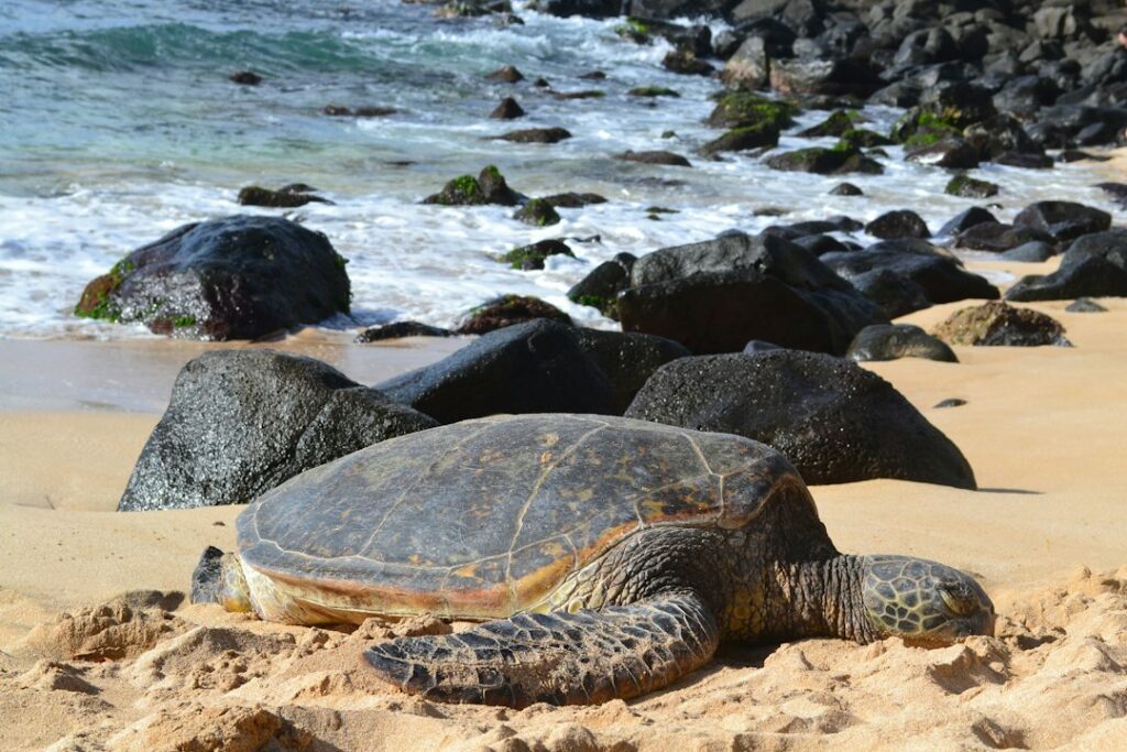
Green sea turtles commonly haul out on Mahaulepu Beach, resting above the tide line. State rules require staying at least 10 feet away, and monk seals require 50 feet of clearance. The same protective etiquette applies elsewhere in the state — similar rules govern turtle behavior at Maui’s Hookipa Point windsurf cove.
Eastern approach to Ha’ula Bay
After Mahaulepu Beach, the path climbs back onto exposed bluffs. This section feels wildest — no golf course inland, no resort roofs visible, and stronger trade winds. Kawailoa Bay appears at the 2.5-mile mark, a smaller cove often used by local families for shore fishing.
The final 1.5 miles to Ha’ula Bay require careful footing. The trail narrows and the surface transitions from packed red dirt to loose limestone. Ha’ula itself is a rocky pocket beach with limited swimming access. Most walkers stop, eat lunch on shaded rocks if any exist, and turn back toward Shipwreck.
Grove Farm private land access etiquette
Most of the trail corridor east of the Grand Hyatt crosses land owned by Grove Farm, a plantation-era company that still holds tens of thousands of acres on Kauai. Public foot access exists by tolerance rather than legal easement, which means Grove Farm can adjust hours, close sections for maintenance, or restrict activities without notice.
Walkers should treat every fence, gate, and posted sign as a boundary that carries real weight. The current arrangement survives only as long as visitors respect it. Households considering a longer stay on Kauai often study the Grove Farm land question as part of understanding the island’s economy and land ownership patterns.
Rules that matter on the ground
- Trail is open dawn to dusk only — no headlamp night hiking allowed.
- No dogs, even leashed, on Grove Farm-owned sections east of Punahoa.
- No camping, fires, or overnight vehicles at the trailhead lot.
- No drones without written Grove Farm permission.
- No collecting fossils, shells, coral, or plants from the corridor.
- Pack out all trash including fruit peels and biodegradable items.
The access dynamic mirrors the etiquette expected at Oahu’s Lanikai Pillbox trail on Kaiwa Ridge, where neighborhood residents have pushed back against overuse. Losing informal access is a real possibility on both trails if visitor behavior deteriorates. First-time walkers should assume they are being watched by property staff even on quiet weekday mornings.
CJM Country Stables and horseback tours
CJM Country Stables operates guided horseback rides across portions of the Mahaulepu corridor. Rides typically run 2 hours and cost around $150 to $180 per person as of recent published rates. Walkers should yield to horses immediately, step off the trail on the downhill side, and speak calmly so horses do not startle.
Sinkhole and paleontology stops
The Makauwahi Cave Reserve sits about 1.5 miles into the walk on a signed spur that leaves the main trail. The site is one of the most important paleontological locations in Hawaii, run as a nonprofit reserve by the Makauwahi Cave Foundation. It occupies roughly 21 acres of restored native plant habitat inside and around a collapsed lithified dune.
The cave itself formed when the roof of an ancient limestone dune collapsed, creating a sinkhole visible from the trail. Sediment layers inside the sinkhole preserve fossils dating back approximately 10,000 years, including extinct flightless ducks, land crabs, and native plant seeds that no longer grow wild on the island.
Visiting hours and donation model
The reserve is open to walk-in visitors Monday through Saturday from 10 AM to 2 PM. Volunteers staff a small welcome shed and give informal tours when available. Donations of $10 per adult help fund restoration work. No advance reservation is required for individuals, though guided group tours can be arranged in advance.
Visitors can enter the sinkhole through a narrow ground-level opening, then walk across the shaded interior floor. Interior temperatures typically run 8 to 12°F cooler than the exposed trail. The cave provides one of the only true shade breaks along the entire 8-mile round trip.
Native plant restoration project
The reserve doubles as a working native plant nursery. Visitors can walk marked paths through populations of ohai, alahee, and native palms. Volunteers occasionally accept help with weeding on scheduled workdays. Households scouting for community involvement opportunities during a potential move sometimes use these workdays as a way to meet longtime residents.
Sun exposure with no natural shade
The Mahaulepu Heritage Trail is one of the most sun-exposed coastal walks on Kauai. From the Shipwreck Beach bluff to Ha’ula Bay, tree cover measures less than 5% of the total corridor. Most of that limited shade sits inside the Makauwahi sinkhole and among the ironwoods behind Mahaulepu Beach.
UV index readings on Kauai’s south shore commonly reach 11 or higher between May and September, according to data compiled by the Hawaii Department of Health. That reading is classified as extreme, capable of causing sunburn on unprotected skin in under 15 minutes. Winter readings drop to 8 or 9, still classified as very high.
Temperature ranges by month
| Month | Average high | Trail feel with sun load | Recommended start |
|---|---|---|---|
| January | 79°F | Warm, occasional wind | 8:00 AM |
| April | 81°F | Hot in still air | 7:00 AM |
| July | 84°F | Very hot, minimal inland breeze | 6:30 AM |
| October | 85°F | Hottest month on the trail | 6:30 AM |
| December | 80°F | Warm but shorter daylight | 8:00 AM |
Wind matters as much as air temperature. When trade winds blow at 10 to 20 mph, evaporative cooling keeps walkers comfortable even at 85°F. On rare Kona wind days, when the flow reverses from the southwest, temperatures feel 8 to 10 degrees hotter and humidity spikes. Checking a marine forecast the night before helps avoid brutal walking conditions.
Sun-protection packing card
The absence of shade forces every household to plan sun protection deliberately. A minimal kit prevents both immediate sunburn and cumulative UV damage that stacks up across a Kauai scouting trip. Reef-safe formulations matter because runoff from Poipu beaches enters coral habitat protected under state law.
Recommended packing list per walker
| Item | Specification | Approximate cost |
|---|---|---|
| Mineral sunscreen | Zinc oxide, SPF 30+, reef-safe | $14 to $22 |
| Wide-brim hat | 3-inch minimum brim, UPF 50 | $28 to $45 |
| Long-sleeve sun shirt | UPF 50 rated, light color | $35 to $60 |
| Polarized sunglasses | UV400 lenses, wrap style | $25 to $80 |
| Water bottle | 3 liters total capacity per person | $15 to $30 |
| Electrolyte tablets | 4 to 6 tablets for the round trip | $8 to $12 |
| Trail snacks | 500 calories, salty and portable | $6 to $10 |
| Small first-aid kit | Blister plasters, tape, wipes | $12 to $18 |
Application timing that actually works
Sunscreen should be applied 20 minutes before stepping onto the trail so mineral ingredients bond to the skin. Reapply at Makauwahi Cave, roughly 45 minutes in, then again at Kawailoa Bay after wading or resting. Sweat and salt strip protection faster than most visitors expect, especially on the return leg heading west into afternoon sun.
Footwear should be closed-toe with grippy soles. The trail combines packed red dirt with loose limestone, sandy patches, and occasional wet rock near coves. Trail runners or hybrid hiking sandals with heel straps work better than flip-flops. The same footwear logic applies to muddy inland trails discussed in the Manoa Falls rainforest footwear selection guide.
Rental car card for reaching the trailhead
Public transit on Kauai does not reach the Mahaulepu trailhead. The Kauai Bus stops at Poipu Shopping Village but not at the Grand Hyatt or beyond. Any household attempting the walk without a car would need to book a private ride-share both directions, at costs that quickly exceed a daily car rental rate.
Rental car sizing and cost bands
| Vehicle class | Typical daily rate | Fits at trailhead lot | Fuel range |
|---|---|---|---|
| Compact sedan | $55 to $75 | Yes, ample space | 350 miles |
| Midsize SUV | $75 to $110 | Yes, fits standard stalls | 380 miles |
| Jeep Wrangler | $95 to $145 | Yes, but overkill | 300 miles |
| Full-size SUV | $110 to $165 | Tight in gravel lot | 400 miles |
| Convertible | $100 to $150 | Yes, but sun exposure | 320 miles |
A compact sedan is enough vehicle for this trail. The last quarter mile of access road is dirt but graded and well maintained. No four-wheel drive is required. The Jeep upsell that most Kauai rental counters push is not needed for Poipu-based trips. It matters for other adventures like the Waipio Valley descent on Hawaii Island, which does require a truck.
Fuel and driving logistics
Fuel prices on Kauai typically run 30 to 60 cents per gallon above U.S. mainland averages, tracked in the retail data reports at the EIA gasoline and diesel dashboard. Filling up in Lihue before driving to Poipu often saves several dollars over pumping at the nearer stations by the resort corridor.
Rental car keys should never be left inside the trailhead vehicle, and valuables should be locked in the trunk before departing the airport. Break-ins at unattended beach lots on the south shore have been documented for years by Honolulu Civil Beat. Insurance deductibles for shattered rear windows commonly run $500 to $1,000.
Wildlife and cultural sites along the walk
The Mahaulepu corridor supports several protected marine species that walkers commonly see from the cliff tops. Humpback whales migrate through the offshore channel between December and April, often visible without binoculars during peak January and February weeks. Green sea turtles bask on Mahaulepu Beach year-round, and Hawaiian monk seals occasionally haul out on quieter stretches of sand.
Ancient Hawaiian sites also appear along the corridor. Stone platforms, house foundations, and low walls mark former fishing settlements that predate contact. Signage identifies a few of these, but many go unmarked. Walkers should never move stones, walk on visible platforms, or pocket artifacts of any kind. The etiquette matches respectful practices at cultural sites across the islands.
Whale watching from the bluffs
The bluff at Punahoa Point sits about 50 feet above sea level, offering an unobstructed south-facing view. Peak whale-watching hours run from 8 AM to noon, when the trade winds tend to be lighter and surface conditions calmer. Households who miss whale season can find similar viewing from other coastal spots like the Puu Poa cliff descent in Princeville.
Shorebirds and native species
Kolea (Pacific golden plovers) winter across the Mahaulepu grasslands from August through April. Wedge-tailed shearwaters nest in burrows along some bluff edges — walkers must stay strictly on the trail during nesting season, roughly March through November, to avoid collapsing nest tunnels. Nest disturbance can carry state fines up to $500 per incident.
Weather patterns and timing decisions
Kauai’s south shore sits in a rain shadow, receiving roughly 25 to 40 inches of annual rainfall compared to the North Shore’s 80 to 200 inches. That climate divide makes Poipu the driest and sunniest coastline on the island, a fact that helps trail planning but amplifies sun exposure risk on long walks.
Winter surf on the south shore is small — usually under 4 feet — while summer south swells routinely bring 6 to 12-foot waves. In contrast, north-facing beaches see winter surf spiking to 15 to 25 feet. This seasonal reversal is why Kauai households often plan hikes based on the swell forecast, not just the rain forecast.
Rain contingency planning
Even on the dry side, brief showers can move through in 10 to 20 minutes. The red dirt on the trail turns slippery within minutes of rain, and slick cliff edges become genuinely dangerous. Walkers should turn around during any active rain, wait for the surface to dry, or reroute inland to the resort corridor for a safer surface.
Rainy stretches on Kauai have alternatives worth knowing in advance. Households caught in unexpected weather sometimes reroute to indoor stops, similar to the way East Hawaii residents plan around January Hilo rainfall and indoor alternative stops. Poipu shopping and museum options are limited but do exist.
Neighborhood context and moving to Kauai
Poipu is one of the most popular resort areas on Kauai, drawing both tourists and part-time residents. Full-time residents cluster in nearby Koloa town, an older plantation-era settlement inland from the coast. Median home prices in the Poipu and Koloa area have exceeded $1.2 million in recent years, well above the Kauai county-wide median.
The Census QuickFacts Hawaii dashboard tracks demographic data useful for scouting households. Kauai County has a total population of roughly 73,000 residents spread across the entire island, giving Poipu a small-town feel even at peak visitor volume. Grocery and household costs run higher than mainland averages, similar to patterns documented in the Honolulu Consumer Price Index summary.
Comparison to other Kauai coastal walks
| Trail | Length one-way | Shade coverage | Access type |
|---|---|---|---|
| Mahaulepu Heritage | 4.0 miles | Under 5% | Private (Grove Farm) |
| Kalalau (Napali) | 11.0 miles | 60%+ | State park, permit |
| Puu Poa Princeville | 0.5 miles | Moderate | Public/HOA passage |
| Sleeping Giant East | 1.8 miles | 75%+ | State forest |
| Waimea Canyon Rim | 0.8 miles | Partial | State park |
Comparison shopping across trails helps first-time visitors understand what Mahaulepu offers that other walks do not: uninterrupted low-elevation coastal exposure across the driest corner of Kauai. It is more accessible than Kalalau, longer than Puu Poa, and more scenic than most inland routes. The tradeoff is sun load and lack of infrastructure.
Long-term considerations for households on Kauai
Households evaluating Kauai for a permanent move often use trails like Mahaulepu as a stress test for the lifestyle. A four-hour walk with no shade reveals how the body adapts to south-shore sun, how much water it takes to stay ahead of dehydration, and how a household divides gear responsibility across walkers of different fitness levels.
Access rights on informal trails also matter for long-term residents. Grove Farm’s tolerance of public access could shift, and residents who rely on the trail for exercise or family time need to understand the underlying land relationship. The kuleana framework, plantation-era leases, and ahupuaa easement traditions all shape what a household can and cannot count on.
Neighborhood alternatives for daily walks
Households living in Poipu often mix trail walks with more urban routes. The Poipu shoreline path runs about 1.5 miles from the Sheraton to the Grand Hyatt with sidewalks, benches, and water fountains. That route works for daily fitness. Mahaulepu serves better as a weekend or scouting-trip commitment when weather and time align.
Comparable island tradeoffs exist elsewhere in the state. Military families relocating through Pearl Harbor often ask about walking access near base, an angle covered in the guide to living in Hawaii on military orders. Similar questions matter for civilians choosing between resort-adjacent Poipu and inland Koloa or Lawai.
Frequently asked questions
Is the Mahaulepu Heritage Trail open on Sundays?
Yes, the Mahaulepu Heritage Trail is generally open Sundays from sunrise to sunset like other days of the week. Grove Farm maintains the dawn-to-dusk rule year-round. Some access roads and gates on adjacent private ranch land may be closed on Sundays, but the main coastal trail from Shipwreck Beach itself remains publicly accessible during daylight hours.
How long does the full 4-mile walk take?
Most fit adults complete the 8-mile round trip in 4 to 5 hours, including 20 to 30 minutes of stops at the Makauwahi Cave and beach coves. Slower paces or extended photo breaks stretch the day to 6 hours. Households with young children often turn around at Kawailoa Bay for a more manageable 5-mile round trip.
Are dogs allowed on the trail?
No, dogs are not permitted on the Grove Farm sections of the Mahaulepu Heritage Trail, even on leash. The rule protects livestock on adjacent pastures and shorebird nesting areas along the bluffs. Households traveling with dogs should choose alternative walks such as the Poipu Beach Park shoreline path, which allows leashed dogs on designated sidewalks.
Is there any drinking water on the trail?
No, there is no potable water anywhere along the Mahaulepu Heritage Trail. Walkers must carry all water in from the trailhead. Plan on at least 3 liters per adult for the full 8-mile round trip in summer conditions, and never rely on refilling at Makauwahi Cave or private ranch buildings. Electrolyte tablets help offset heavy sweating.
Can visitors swim at Mahaulepu Beach?
Mahaulepu Beach permits swimming during calm summer conditions, but reef, currents, and shore break make it unsuitable for young children or weak swimmers. There is no lifeguard on duty, and cell service is spotty. Winter high surf and occasional strong currents can make even wading dangerous. Check surf reports before entering the water at any south-shore beach.
Is a rental car required to reach the trailhead?
Yes, a rental car is effectively required to reach the Mahaulepu trailhead. Public buses do not serve the eastern end of Poipu. Ride-share coverage from Lihue is unreliable outside peak resort hours. A compact rental sedan is enough vehicle for this trip, and no four-wheel drive is needed to access the graded dirt lot behind the Grand Hyatt.
Is there cell service along the trail?
Cell service is inconsistent along the Mahaulepu Heritage Trail. Coverage is strong near the Shipwreck Beach trailhead and dwindles progressively toward Ha’ula Bay. Verizon typically outperforms other carriers on the eastern half of the walk. Walkers should download offline maps in advance and share their planned turnaround time with a household contact before starting the trip.