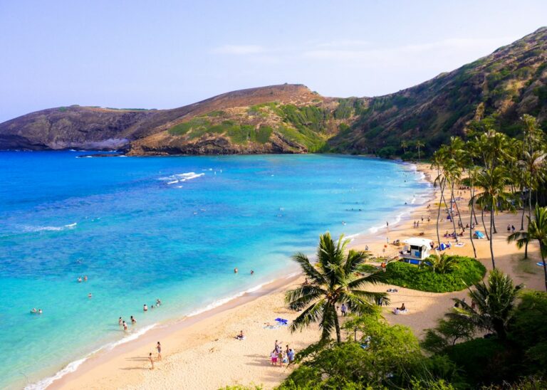
Honolua Bay sits at the northwest tip of Maui, tucked into the shoreline just past Mile Marker 32 on Honoapiilani Highway. The bay is one of only 11 Marine Life Conservation Districts in the state, protected since 1978 by the Hawaii Department of Land and Natural Resources. Between May and September, its reef delivers some of the clearest reef snorkeling on West Maui — with visibility that can exceed 60 feet on the right morning.
From October through April, the same bay flips character entirely. North Pacific swells push through the exposed entry channel, kicking sand and coral rubble into the water column and shutting down safe reef access for days at a time. During that window, Honolua transforms from snorkel destination into pro surf venue, hosting World Surf League events on the outer point.
That seasonal split defines every trip planning decision. Relocating households and repeat visitors who understand the swell calendar, the muddy trail access, the reserve rules, and the fallback bays around West Maui can build itineraries that hold up even when the ocean does not cooperate.
The Seasonal Swell Pattern That Governs Honolua
Honolua Bay faces roughly north-northwest, which puts it directly in the firing line of North Pacific storm swells. Between October and April, low-pressure systems in the Aleutians and Gulf of Alaska generate long-period groundswells that reach Maui within 48 to 96 hours. When forecast buoys read above 4 feet at 14 seconds from the northwest, the bay churns.
During that window, the reef inside the bay is not just closed to snorkeling — it is functionally hazardous. Wave sets refract around the point, sediment lifts off the bottom, and horizontal visibility drops from 60 feet to under 6. The DLNR does not officially close the water, but lifeguards and local shops steer visitors elsewhere until the swell passes.
The reverse pattern holds from May through September. Trade winds still dominate, but they blow across the bay from the southeast, effectively pushing chop away from the entry point. Groundswells from the North Pacific taper off, and the reef settles into a glass-flat state most mornings before 10 a.m. That is the window that put Honolua on the snorkel map.
Reading the buoy forecast before driving
The NOAA Pauwela buoy sits off Maui’s north shore and previews what Honolua will see roughly six hours later. A reading of 2 feet at 9 seconds usually means calm reef conditions. Anything above 5 feet or 15 seconds should push a snorkel plan south to Kapalua or Ulua instead.
Visitors comparing swell windows across islands may find the Kauai shoulder-season swell pattern instructive, since the same North Pacific systems that shut down Honolua also close out Tunnels and Ke’e on Kauai’s north shore during identical months.
The National Weather Service Honolulu forecast office issues High Surf Advisories when forecast north-shore surf exceeds 15 feet. During those advisories, Honolua reef access should be abandoned entirely — even from shore, standing wave push can knock swimmers off the entry rocks.
The Muddy Trailhead and Access Path
Honolua Bay has no beach parking lot, no ranger station, and no paved path to the water. The trail begins across from a small dirt pullout on Highway 30, roughly 0.3 miles of dense green tunnel through introduced mango, kukui, and hala trees before opening onto a boulder-cobble shoreline. There is no lifeguard.
The trailhead sits at about 100 feet elevation. The path drops steadily to sea level over the third of a mile, crossing a small streambed near the halfway point. That streambed is the single biggest access variable — after any measurable West Maui rainfall, the runoff turns the last 200 yards into ankle-deep clay soup.
Sturdy sandals or trail shoes matter here more than most Hawaii snorkel sites. Slick soles on the rock-and-mud transition zone put ankles at real risk of rolling, and stepping onto shoreline boulders in wet flip-flops has sent more than a few visitors to Maui Memorial with lacerated feet.
Parking realities and the shoulder lot
The unofficial parking corridor along Highway 30 fits roughly 20 vehicles safely off the roadway. By 8 a.m. on a July weekend, that shoulder is often full. Cars parked with wheels on the fog line have been ticketed, and one section closer to the north end sees regular tow removals during surf events.
A second lot exists at the top of the ridge above the bay — reached by continuing north on Highway 30 to the scenic overlook. Overlook parking is legal but adds a steeper 0.4-mile descent through the same forest trail from a different entry, and few casual snorkelers use it.
Because parking is so tight, visitors staying in Kaanapali or Lahaina often pair a Honolua morning with an afternoon at nearby beaches. The Lahaina snorkeling roundup catalogs Puamana, Baby Beach, and Wahikuli Wayside for that pattern.
DLNR Marine Life Conservation District Rules
Honolua Bay and adjacent Mokuleia Bay together form the Honolua-Mokuleia Marine Life Conservation District, one of the oldest reserves in the Hawaiian Islands. The designation was formalized in 1978 under Hawaii Administrative Rules Chapter 13-31, and the reserve boundary covers roughly 45 acres of nearshore water from Lipoa Point to the northwest headland.
Inside the reserve, all fishing is prohibited — no rod-and-reel, no spearfishing, no shore casting, no gathering of shells, live rock, coral, or invertebrates. Feeding fish is also banned. Enforcement falls to DOCARE, the DLNR’s conservation officer division, which patrols the shoreline irregularly and issues citations that carry fines of up to $1,000 for first offenses.
Snorkelers and free divers are welcome, but the same rules against contact apply. Standing on coral, kicking with fins in shallow water, and touching honu (green sea turtles) are all prohibited under federal law layered on top of state reserve rules. NOAA fisheries enforces a 10-foot approach distance from any resting honu.
What the reserve status changes in practice
Because Honolua has been protected for nearly five decades, fish density on the reef is measurably higher than at unprotected West Maui sites. University of Hawaii reef surveys conducted in 2023 counted more than double the biomass per acre inside the reserve compared to nearby uncontrolled reefs. That translates into visible schools of goatfish, surgeonfish, and yellow tang.
The reserve status also means that anything a snorkeler picks up — a shell, a piece of coral rubble, an empty urchin test — must go back where it came from. Enforcement officers periodically stop hikers walking back to the trailhead and inspect bags. The Hawaii Department of Health and DLNR both publish shoreline signage summarizing these rules.
For a broader look at how similar reserve designations shape shoreline access, the Hawaii shoreline certification and DLNR survey process covers the regulatory scaffolding around protected coastal zones statewide.
What Snorkelers Encounter Inside the Bay
On a calm May morning, the swim from the cobble shoreline out to the reef edge takes about six minutes at a relaxed pace. The bay floor drops from 4 feet at entry to 25 feet at the reef shelf, then steps down again to 40-plus feet along the outer edge where the pelagic drop begins.
The reef is a mix of lobe coral (Porites lobata), cauliflower coral (Pocillopora meandrina), and rice coral. Bleaching events in 2019 and 2023 reduced live coverage below its historical peak, but reserve status has helped the reef recover faster than unprotected West Maui sites. A NOAA monitoring survey in 2024 recorded 32% average live coral cover inside the reserve.
Common fish sightings on a typical calm-day visit include yellow tang, moorish idol, saddle wrasse, achilles tang, parrotfish, and multiple butterflyfish species. Green sea turtles regularly graze the reef flats, and spinner dolphins occasionally transit the outer bay before 9 a.m. Reef whitetip sharks are present but rarely seen by snorkelers.
Depths, currents, and where visibility peaks
Visibility inside Honolua is highest along the north wall, where a rocky ledge runs from shore to the reef point. The current here typically pulls outward, meaning snorkelers should swim out along the north wall and drift back with the flow near the south side. Reversing that pattern turns the return swim into a slog.
Depth varies quickly. Within 40 yards of the entry, snorkelers move from waist-deep to 15 feet of water. Beyond the reef shelf, the outer wall reaches 60 feet, which is where turtles often rest during midday. Free divers who venture beyond the reef shelf need buddy separation protocols and surface float visibility.
Water temperature ranges from 75°F in February to 82°F in September. A 2mm shorty wetsuit is comfortable for extended stays in the cooler months, though most visitors snorkel in swimsuits and a rash guard year-round. The Maui snorkel spot comparison lays out temperature and difficulty across the island’s main reef sites.
Alternatives When the North Swell Is Running
When Honolua shuts down, West Maui and South Maui offer sheltered alternatives on nearly the same coastline. The move is always southward — the entire west and south shore lie in the swell shadow of the West Maui Mountains, so a bay 20 minutes down the road can be flat while Honolua is 15 feet.
Kapalua Bay is the closest fallback at 3 miles south. It faces west and southwest, catches only wrapping swell energy, and remains snorkelable during most north-swell events under 12 feet. Coverage of that site — including the entry timing and coral fringe — sits in the Kapalua Bay reef swim guide.
Further south, Napili Bay, Airport Beach, and Black Rock at Kaanapali all offer easier entry points and lifeguard coverage. South Maui sites — Ulua, Wailea Beach, Makena Landing, and Ahihi-Kinau — are entirely sheltered from north swells and remain reliably calm through the winter months.
Side-by-side snorkel alternatives
| Site | Drive from Honolua | North swell resistance | Lifeguard | Entry type |
|---|---|---|---|---|
| Kapalua Bay | 7 min | Good under 12 ft | No | Sand beach |
| Napili Bay | 12 min | Good under 10 ft | No | Sand beach |
| Airport Beach (Kahekili) | 18 min | Excellent | Yes | Sand beach |
| Black Rock (Kaanapali) | 22 min | Excellent | Yes | Sand beach |
| Ulua Beach (Wailea) | 60 min | Excellent — south facing | No | Sand + ladder |
| Ahihi-Kinau Reserve | 75 min | Excellent — south facing | No | Lava rock scramble |
For visitors who want detailed turtle-cleaning cove coverage in South Maui, the Ulua Reef turtle guide maps entry ladders and midday viewing windows. Ulua is one of the few sites where honu appear predictably even in the middle of the day.
When even the alternatives churn
Once or twice a winter, an especially large swell wraps far enough south to affect Kapalua and Napili as well. During those events, snorkelers should abandon West Maui altogether and drive to South Maui or up to Central Maui’s Iao Valley for a non-water day. The Iao Valley afternoon alternative guide covers indoor-adjacent options.
Visitors traveling in winter should also weigh the humpback whale season, which peaks in February. Whale watching from charter boats compensates for a lost snorkel day, and departure timing matters more than most itineraries assume. The February humpback charter timing writeup details morning-versus-afternoon boat conditions.
Timing the Trip Within the Season
Even during the May-September calm window, not every day at Honolua delivers 60-foot visibility. Trade wind strength, tide phase, morning cloud cover, and prior-24-hour rainfall all affect what a visitor actually sees underwater. Serious snorkelers watch the forecast for 48 hours before choosing a Honolua morning.
Trade winds from the east-northeast are ideal — they blow offshore relative to the bay entrance, flattening chop and holding the reef water clear. Kona winds from the south or southwest can push chop into the bay from the outside, dropping visibility even when swell is small. Wind above 20 mph should push plans south regardless.
Tide phase matters less at Honolua than at shallower reefs, but a rising tide with clean water is optimal. High-tide slack, roughly 30 minutes on either side of the tide peak, produces the calmest surface conditions and the best light penetration to the reef floor.
Time-of-day rhythm at the bay
| Time window | Typical conditions | Crowd level | Visibility |
|---|---|---|---|
| 6:30 – 8:30 a.m. | Glass surface, low wind | Low (5-15 people) | 50-70 ft |
| 8:30 – 10:30 a.m. | Best light, trades building | Moderate (30-60) | 40-60 ft |
| 10:30 a.m. – 1 p.m. | Trades at strength, chop | Peak (100+) | 25-40 ft |
| 1 – 3 p.m. | Wind chop, sediment lift | High | 15-30 ft |
| 3 – 5 p.m. | Winds easing | Thinning | 20-35 ft |
The clear pattern is early morning. Arriving at the trailhead by 7:30 a.m. secures parking and delivers the visibility peak. Any visitor who reaches the shoreline after 10 a.m. in July or August will find both the parking corridor and the water column considerably more crowded and cloudier.
Snorkel Gear Packing Checklist
Honolua’s rocky entry rewards preparation. Unlike Kapalua’s sand beach, the shoreline here is boulders and cobble that demand shoes both to reach the water and to protect feet in the transition zone. Most rental snorkel packages from Lahaina shops include the essentials, but visitors flying in with checked bags often bring their own.
Core packing list
- Mask with silicone skirt, tested for seal fit before travel
- Snorkel with dry-top valve (helps in occasional wind chop)
- Full-foot fins or open-heel fins with neoprene booties
- Sturdy water shoes for the trail and cobble shoreline
- Rash guard with SPF 50 rating for extended surface time
- Reef-safe mineral sunscreen (zinc-oxide based, non-nano)
- Dry bag (10 liters minimum) for phones and car keys
- Refillable 32-oz water bottle for post-swim rehydration
- Small microfiber towel for the walk back to the car
Hawaii law prohibits the sale of sunscreens containing oxybenzone or octinoxate as of January 2021, and the reserve status at Honolua adds an implicit expectation that visitors bring only mineral formulations. Ranger patrols occasionally check.
Rental gear cost comparison
| Rental source | Basic mask/snorkel/fins | Weekly rate | Distance from Honolua |
|---|---|---|---|
| Snorkel Bob’s Napili | $9/day | $35 | 4.5 mi |
| Boss Frog’s Lahaina | $8/day | $30 | 11 mi |
| ABC Store Kaanapali | $15/day | $60 | 9 mi |
| Costco pre-purchased set | $45 flat | — | Kahului warehouse |
Travelers staying more than four days almost always come out ahead purchasing a set at Costco in Kahului than renting daily. Rentals shine for one-off users or families who want prescription mask options that the retail stock does not carry.
Rental Car Considerations for the Highway 30 Drive
Honolua sits along a stretch of Highway 30 that most major rental car agreements formerly restricted or prohibited. Alamo, Enterprise, National, and Budget contracts historically flagged the road past Kapalua as an off-limits zone due to the narrow one-lane sections along the Kahakuloa coast. That policy has been quietly loosened by most companies as of 2024, but readers should read the fine print.
The section that concerns rental companies is not Honolua itself — the drive from Lahaina to the Honolua trailhead is standard two-lane highway. The restricted section begins about 2 miles past the trailhead where the road narrows to one lane and hugs a cliff. Snorkelers who turn around at Honolua stay well within the covered driving zone.
For visitors who plan to loop the full island via the Kahekili Highway, checking the specific rental contract before departure prevents an uncovered incident claim. Turo hosts in Kahului often list vehicles without the mile-marker restriction that traditional agencies apply.
Vehicle type recommendations
A standard midsize sedan handles the drive to Honolua fine. Ground clearance is unnecessary — the trailhead pullout is unpaved but level. A compact SUV is more comfortable if the itinerary includes South Maui as well, since the Honoapiilani stretch has been repaved in most sections. Full-size trucks struggle with the tight parking corridor at the trailhead.
Fuel and drive-cost planning
| Route | Distance | Drive time | Fuel cost (28 mpg, $4.90/gal) |
|---|---|---|---|
| Kahului airport → Honolua | 32 mi | 55 min | $5.60 |
| Lahaina town → Honolua | 11 mi | 22 min | $1.90 |
| Kaanapali resort strip → Honolua | 9 mi | 18 min | $1.55 |
| Kapalua Village → Honolua | 3 mi | 7 min | $0.55 |
| Wailea resort area → Honolua | 36 mi | 75 min | $6.30 |
Hawaii gasoline prices consistently run 40-50% above the mainland national average, based on EIA weekly petroleum data. Visitors basing in South Maui but driving daily to Honolua should factor $12-14 in fuel per round trip.
Housing and Neighborhood Context Around the Bay
The zone around Honolua Bay is almost entirely conservation land, with no residential subdivisions closer than Kapalua Village three miles south. Relocating households drawn to the West Maui snorkel scene most often base in Napili, Kahana, or Kaanapali, where vacation rentals and long-term condos are concentrated. Housing supply on West Maui tightened significantly after the August 2023 Lahaina fire.
Short-term rental rules on Maui differ from Oahu’s stricter framework, but the state legislature has moved multiple bills through committee that would restrict transient vacation use in older apartment-zoned buildings. Newcomers weighing a West Maui base should track those developments through Honolulu Civil Beat reporting.
Buyers researching ohana or accessory dwelling potential on Maui-side lots often start with the equivalent Oahu framework as a reference point. The Honolulu ADU and ohana permit rules writeup lays out how those secondary units are permitted, which mirrors much of the Maui process.
Where to base for a snorkel-first itinerary
- Napili — closest cluster of vacation condos; 12 minutes to Honolua
- Kapalua — luxury tier, walkable to the Kapalua Bay backup site
- Kaanapali — resort scale, more dining, 22 minutes to trailhead
- Lahaina — recovering post-fire; some rentals reopening as of 2026
- Kahana — mid-priced condo belt with solid pantry access
What May-Trip Visitors Should Know
May stands out as the best single month for a Honolua-first trip. North Pacific swell activity has usually calmed by the second week, trade winds are established but not yet at their July peak, and pre-summer crowds have not filled the shoulder parking. The Hawaii in May pricing and basing guide covers off-peak lodging rates.
Water temperature in May averages 76-78°F, warm enough for extended snorkeling without a wetsuit. Air temperatures average 82°F highs and 66°F lows in Lahaina during May, per BLS regional climate context. Rainfall on West Maui averages 0.6 inches for the month, one of the driest windows of the year.
Visitors who prefer to avoid all crowd overlap can target the last two weeks of April, when Easter travel has cleared and summer schedules have not yet begun. Trade-off: swell probability is still meaningfully higher than mid-May, so a backup day plan matters more.
Health, Safety, and Environmental Watchouts
The reef at Honolua is deeper than at many casual snorkel sites — over the reef edge, water depth exceeds 60 feet. Snorkelers who float over that drop should have solid breath control and stay within visual range of their entry point. Panic in open water accounts for most Hawaii snorkel-related fatalities, per Hawaii Department of Health drowning surveillance.
Bacterial water quality can degrade after heavy rainfall. Runoff from the surrounding pineapple-land converted watershed carries sediment and occasional agricultural bacteria into the bay. State health authorities issue brown-water advisories after 24-hour rainfall events exceeding 1 inch — snorkelers should stay out for at least 24 hours after any such advisory.
Jellyfish and box jellyfish are less common at Honolua than at south-shore reefs, but the 8-to-10-day post-full-moon window is when reports peak statewide. Portuguese man-of-war can appear during strong Kona wind events. Both stings respond to vinegar rinse followed by hot-water immersion.
Reef etiquette and honu contact rules
Green sea turtles at Honolua are habituated to snorkelers but remain federally protected. NOAA guidelines require a minimum 10-foot approach distance. Turtles that surface next to a snorkeler on their own are fine — no need to swim away frantically — but active approach, chasing, or touching is a federal violation with fines up to $10,000 under the Endangered Species Act.
The state also enforces a shoreline no-anchor zone within the reserve. No boat should anchor inside Honolua Bay proper. Snorkel and dive charter operators use mooring buoys or drift-drop patterns. Any anchor scarring is investigated by Hawaii DOT harbors division in coordination with DLNR.
Frequently asked questions
When is the best time of year to snorkel Honolua Bay?
Mid-May through mid-September offers the calmest and clearest reef conditions. North Pacific swells subside during those months, trade winds stay moderate, and water temperature climbs to 80°F. The single best month for combining calm water with lower crowds is typically May, before the summer school-vacation peak arrives in mid-June.
Is there an entrance fee at Honolua Bay?
No entrance fee applies. Honolua Bay is a state Marine Life Conservation District managed by DLNR, but access is free and there is no gate, kiosk, or reservation system. Parking along Highway 30 is also free, though limited. Unlike Hanauma Bay on Oahu, visitors do not need to book ahead or pay a non-resident admission charge.
Can visitors park at the Honolua trailhead?
Yes, along the roadside shoulder of Highway 30 near Mile Marker 32. Roughly 20 vehicles fit safely off the pavement. By 8 a.m. on summer weekends, that shoulder is often full. Overflow parking sits at the ridge overlook 0.4 miles north, though that entry requires a longer downhill hike to reach the water.
How muddy is the trail after rain?
The 0.3-mile trail can turn to slick clay for 24 to 48 hours after any measurable West Maui rainfall. The middle stream crossing is the worst section. Sturdy trail sandals or closed-toe water shoes are essential during and after wet spells. During brown-water advisories issued after 1-inch rain events, snorkelers should avoid the water entirely.
Are there restrooms or showers at Honolua Bay?
No restrooms, no showers, no drinking water, and no trash cans exist at the trailhead or shoreline. The closest public facilities sit at D.T. Fleming Beach Park, roughly 1.2 miles south on Highway 30. Visitors should use the Fleming or Kapalua facilities before driving up and pack all waste out with them.
What should snorkelers do if a swell arrives during their visit?
Exit the water immediately if wave sets exceed shoulder height or if visibility drops below arm’s length. Shift the itinerary south to Kapalua, Napili, or Airport Beach — all under 25 minutes away. Larger north swells that wrap into those bays send plans further south to Ulua or Wailea Beach in South Maui.
Do rental cars have any restrictions for Honolua Bay access?
The drive to Honolua from Lahaina, Kaanapali, or Kahului is standard two-lane highway with no rental restrictions. The formerly restricted single-lane section of Highway 30 lies past the Honolua trailhead near Kahakuloa. Snorkelers who turn around at Honolua remain fully within the coverage zone of all major rental car agreements.