Most disappointing Hawaii trips share a single cause: the visitor booked the wrong side of the island. Every major Hawaiian island has a wet windward coast facing the northeast trade winds and a dry leeward coast sheltered behind the mountains. The gap is not subtle. Hilo averages about 126 inches of rain a year, while Kailua-Kona, roughly 75 miles away by road, averages about 18.
That split explains why one family comes home from a January week with photos of rainbows and waterfalls and another comes home with sunburns and snorkel videos, both from the same island. Neither got unlucky. They stayed on different sides of the same mountain, often without realizing it.
This article explains the physics in plain terms and gives paired rainfall numbers for Hawaii Island, Maui, Kauai and Oahu. It covers the winter Kona winds that flip the pattern, then turns it all into booking advice. It also shows how to read an island map the way residents do, using windward, leeward, mauka and makai.
Windward vs leeward Hawaii: the short answer
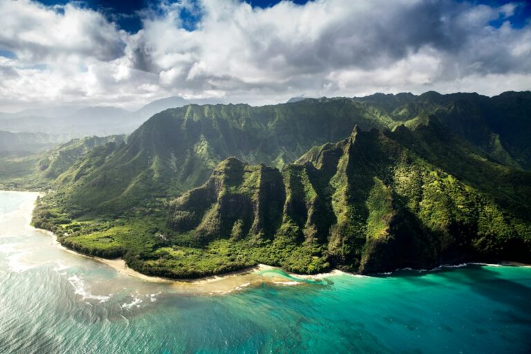
Windward means the side facing into the prevailing wind. In Hawaii that wind is the northeast trade wind, so windward coasts face north and east. Leeward means the sheltered side, facing south and west. As a rule, windward is green, cloudy and wet, while leeward is sunny, brown and dry.
- Windward examples: Hilo, Hana, Princeville, Hanalei, Kaneohe and Kailua on Oahu.
- Leeward examples: Kailua-Kona, the Kohala Coast, Kihei, Wailea, Lahaina, Poipu, Waikiki, Ko Olina and Waianae.
- Windward trade-off: lush scenery and strong waterfalls, with more showers and cloud cover.
- Leeward trade-off: reliable sun and calmer water, with drier, hotter landscapes.
One name catches people out. Kailua on Oahu is a windward beach town, while Kailua-Kona on Hawaii Island is leeward. Anyone comparing rental listings should check which island a “Kailua” address is on before assuming anything about the weather.
How trade winds and mountains make rain
The trade winds
Hawaii sits in the path of the northeast trade winds, which blow steadily across thousands of miles of open Pacific. They usually run 10 to 20 mph. They blow roughly 80 to 95 percent of the time from May through September and around 50 to 80 percent of the time in winter.
Crossing all that warm ocean, the air picks up moisture. By the time it reaches the islands it is humid and ready to rain, but it has to be pushed upward before it can drop that water.
Orographic lift
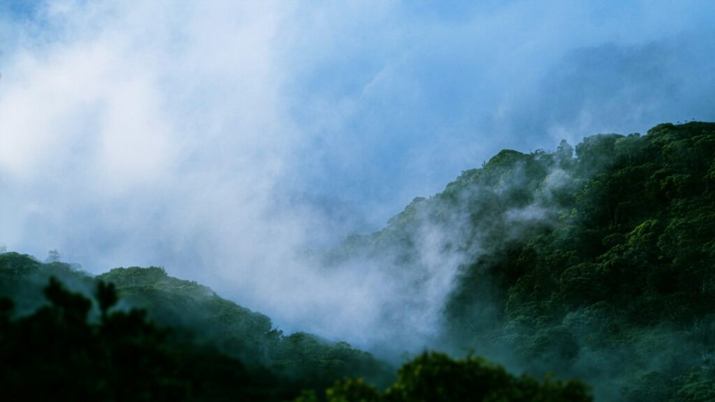
The mountains do the pushing. When trade-wind air hits a slope, it is forced upward. Rising air cools at roughly 5.5°F per 1,000 feet until it saturates, then more slowly once clouds form. Cooler air holds less water vapor, so the moisture condenses into clouds and falls as rain on the windward slopes.
Meteorologists call this orographic lift. It is why the heaviest rain on every island falls partway up the windward mountainsides rather than at the coast, often between 2,000 and 6,000 feet. It is also why windward valleys like Manoa on Oahu and Waipio on Hawaii Island stay so green.
The rain shadow
After the air crosses the crest, it descends the leeward side and warms as it sinks. Warmer air can hold more moisture, so the clouds evaporate instead of raining. The result is a rain shadow: a band of dry, sunny coastline downwind of each mountain range.
The taller and broader the mountain, the stronger the shadow. That is why the Kohala Coast on Hawaii Island is one of the driest places in the state. Mauna Kea and the Kohala Mountains shield it, and some resort areas there average under 10 inches of rain a year.
The trade-wind inversion
One more factor matters on the tallest peaks. A layer of warm, dry air usually sits around 5,000 to 7,000 feet and stops clouds from growing taller. Clouds pile up beneath it. Above it, the summits of Mauna Kea (13,803 feet) and Haleakala (10,023 feet) are often dry and clear while the slopes below are soaked.
Paired rainfall numbers on the same island
The clearest way to see the effect is to compare a windward town and a leeward town on the same island. The figures below are approximate long-term annual averages from commonly cited station records. Individual years vary widely, and totals rise sharply with elevation.
| Island | Windward town | Annual rain | Leeward town | Annual rain | Ratio | Drive between |
|---|---|---|---|---|---|---|
| Hawaii Island | Hilo | ~126 in | Kailua-Kona | ~18 in | ~7 to 1 | ~75 mi, 1 hr 40 min |
| Maui | Hana | 80+ in | Kihei | ~15 in | ~5 to 1 | ~65 mi, 2.5 to 3 hr |
| Kauai | Princeville | ~85 in | Poipu | ~30 in | ~3 to 1 | ~40 mi, 1 hr 10 min |
| Oahu | Kaneohe | ~60 to 70 in | Waianae | ~20 in | ~3 to 1 | ~40 mi, about 1 hr |
The ratio column matters most. On Hawaii Island, Hilo gets roughly seven times as much rain a year as Kailua-Kona. On Kauai and Oahu the gap is smaller but still around three to one. That is the difference between frequent passing showers and mostly dry days.
The drive-time column matters just as much. On every island, you can reach the dry side from the wet side on the same day. That is the basis for the sun-chasing strategy later in this article.
Hawaii Island: Hilo 126 inches vs Kailua-Kona 18 inches
Hilo is regularly cited as one of the wettest cities in the United States, with measurable rain on well over 250 days in a typical year. Much of it falls overnight and in the early morning, so afternoons can clear. Still, visitors on a winter trip should expect wet pavement on most days.
Kailua-Kona sits on the leeward flank of Hualalai, shielded from the trades by Mauna Kea and Mauna Loa. The Kona shoreline averages about 18 inches a year. Its pattern is unusual. Afternoon sea breezes pull clouds upslope, so the coffee belt at 1,000 to 3,000 feet gets afternoon showers, mostly in summer, while the beaches stay dry.
The Kohala Coast
North of Kona, the Kohala Coast resort areas around Waikoloa and Mauna Lani are even drier, often cited at 7 to 10 inches a year. For a winter trip where sun is the priority, this stretch is the most reliable choice in the state. The trade-offs between bases are laid out in where to stay across Kona, Kohala and Hilo.
Volcano and the uplands
Hawaii Volcanoes National Park sits at about 4,000 feet on the windward side of Kilauea. It averages roughly 100 inches of rain a year and runs 10 to 15°F cooler than the coast. From a Kona base the drive takes about 2 to 2.5 hours each way. The Kona vs Hilo base comparison for a Volcanoes day trip works through those numbers.
Vog (volcanic haze) complicates the picture. When Kilauea is erupting, the usual trades carry the haze around the island’s south point and it collects along the Kona coast, so the sunny side can also be the hazier side. The trade-wind vog direction chart shows how that shifts, and the Hawaii Department of Health publishes air-quality guidance.
Maui: Hana 80+ inches vs Kihei 15 inches
Maui is two volcanoes joined by an isthmus, and each has a wet side and a dry side. Haleakala catches the trades on its northeast face, which feeds the rainforest along the Hana Highway. Hana town averages 80 inches or more a year, and the slopes above it get far more. The Big Bog, at about 5,400 feet on Haleakala’s windward flank, averages roughly 400 inches.
Kihei, on the leeward southwest coast, averages about 15 inches a year, and neighboring Wailea and Makena are just as dry. West Maui shows the same pattern on a smaller scale. The Puu Kukui summit gets well over 300 inches, while Lahaina, less than 7 miles away, gets roughly 13 to 15.
Visitors see Maui’s split most clearly on the road to Hana. Many leave sunny Kihei at 7 a.m. and hit steady rain by mile marker 10. That is normal, not bad luck. The mile-marker sequence from Paia to Hana shows where the waterfalls run strongest, which is exactly where the rain falls.
Kauai: Princeville 85 inches vs Poipu 30 inches
Kauai is the oldest of the main islands, and its single central volcano makes the rain fall off in every direction from the middle. The north shore around Princeville and Hanalei averages about 85 inches a year. Poipu, on the south shore, averages about 30. The east side around Lihue and Kapaa falls in between at roughly 40 to 50 inches.
The west side is driest of all. Waimea and Kekaha, in the rain shadow of the high interior, get around 20 inches a year, and the Waimea Canyon area can be sunny while the north shore is socked in. The Kauai rainfall split between Poipu and Princeville breaks down the yearly figures further.
Mount Waialeale: the extreme case
At the center of Kauai, Mount Waialeale rises to about 5,148 feet. That is almost exactly the height where trade-wind clouds pile up under the inversion. Its summit gauge has produced long-term averages commonly cited around 450 inches a year, which puts it among the rainiest places on Earth.
The summit is steep, nearly circular and open to moist wind from almost every side. Air cannot flow around it, so it has to rise straight up. Yet Kekaha, roughly 20 miles to the southwest, gets about 20 inches. Few places anywhere show orographic rain and its rain shadow this sharply.
| Island | Wettest area | Approx. annual rain | Driest coastal area | Approx. annual rain |
|---|---|---|---|---|
| Kauai | Mount Waialeale summit | ~450 in | Kekaha, west side | ~20 in |
| Maui | Big Bog, Haleakala | ~400 in | Kihei to Makena | ~10 to 15 in |
| Maui (west) | Puu Kukui summit | 300+ in | Lahaina | ~13 to 15 in |
| Hawaii Island | Upper slopes above Hilo | 200+ in | Kawaihae, Kohala Coast | ~7 to 10 in |
| Oahu | Koolau crest above Manoa | ~250 in | Honolulu airport | ~16 to 17 in |
Oahu: Kaneohe vs Waianae
Oahu’s split follows its two mountain ranges. The Koolau Range forms a long wall on the windward east side, and the towns below it, Kaneohe and Kailua, catch the trade-wind showers. Kaneohe averages roughly 60 to 70 inches a year in town and 100 inches or more near the base of the cliffs.
The Waianae coast on the west side sits in the Koolau rain shadow and averages about 20 inches a year. Honolulu’s airport, on the leeward south shore, records only about 16 to 17 inches. Waikiki gets roughly 20 to 25, while upper Manoa Valley, about 3 miles inland, can get more than 150.
That gap between Waikiki and Manoa explains Honolulu’s famous rainbows. Showers spill over the Koolau crest and drift toward the sunny shore. The Nuuanu Pali Lookout sits right on that crest, where the trades funnel through a gap in the ridge and visitors look down on the green windward side.
Oahu is the easiest island for sun-chasing. The H-3 freeway links Kaneohe to the Pearl Harbor area in about 25 minutes, and the Waianae coast is another 30 to 40 minutes on. The City and County of Honolulu posts park and road notices, and the Hawaii Department of Transportation lists state highway closures.
Wet season vs dry season: how the split shifts by month
Hawaiian tradition recognizes two seasons: kau, the warm dry season from May through October, and hooilo, the cooler wet season from November through April. Windward rain continues all year, but winter cold fronts and heavier showers raise totals on both sides.
The table shows approximate average monthly rainfall at typical locations. Treat these as rough guides, since a single storm can bring a month’s average rain in one day.
| Month | Hilo (windward) | Kailua-Kona (leeward) | Princeville (windward) | Poipu (leeward) | Honolulu (leeward) |
|---|---|---|---|---|---|
| January | ~9.5 in | ~2.0 in | ~9 in | ~4 in | ~2.3 in |
| March | ~14 in | ~2.0 in | ~10 in | ~3 in | ~2.0 in |
| June | ~7 in | ~1.5 in | ~4 in | ~1 in | ~0.3 in |
| August | ~9.5 in | ~1.8 in | ~5 in | ~1.3 in | ~0.5 in |
| November | ~15.5 in | ~1.8 in | ~10 in | ~4 in | ~2.3 in |
| December | ~11 in | ~1.8 in | ~10 in | ~4 in | ~3.0 in |
Two patterns stand out. First, windward areas stay wet even in summer. Hilo’s driest month still averages about 7 inches, more than Kona usually gets in three months. Second, leeward Honolulu and Poipu get most of their rain from November through March. The dry side is less dry in winter, though still far drier than the windward side.
The Hawaii rainy season guide covers month-by-month planning in more depth, including which weeks tend to bring cold fronts.
Kona winds: when the pattern reverses
Several times each winter, the trades weaken or stop and the wind swings around to blow from the south or southwest. Residents call these Kona winds, because they come from the direction of the leeward Kona coast. They are most common between October and April and can last from a day to more than a week.
When the wind reverses, so does the rain. Moist southerly air rises against the normally dry leeward slopes. Kihei, Waikiki and Kona can get heavy rain while Hilo and Hana stay fairly clear. A strong Kona low, a storm system that can stall near the islands, can drop 10 inches or more in a day on leeward areas.
The December 2021 Kona low is a recent example. It caused flooding and power outages on Oahu and Maui and led to a statewide emergency proclamation, as reported by the Honolulu Star-Advertiser and Hawaii News Now. Storms that large are uncommon, but smaller Kona-wind days happen most winters.
Kona winds also bring other changes visitors notice:
- Muggy, still air that feels hotter despite cloud cover.
- Vog drifting toward Oahu, Maui and the Hilo side instead of Kona.
- Rougher surf and murkier water on south- and west-facing beaches.
- Calmer, glassy water in windward bays that are usually choppy.
The practical rule: in winter, check the wind direction before deciding which side to explore. If the forecast mentions southerly or Kona winds, the windward side may be the better bet that day.
How to read an island map like a resident
Hawaii residents rarely give directions using north, south, east and west. They use the island’s shape instead. Knowing four terms makes forecasts, listings and road signs much easier to follow. All four appear in the guide to Hawaiian words visitors hear every day.
- Mauka: toward the mountains, inland and usually uphill. Cooler and often wetter.
- Makai: toward the ocean. Warmer, and on leeward coasts usually sunnier.
- Windward: the coast facing northeast into the trade winds. Green, cloudy, showery.
- Leeward: the coast sheltered from the trades, facing south or west. Sunny and dry.
A three-step map check
To judge any address, first find the island’s highest ground. Second, picture an arrow blowing from the northeast toward the southwest. Third, ask whether the address is in front of the mountains, facing the arrow, or behind them. In front means windward and wetter. Behind means leeward and drier.
Elevation changes the answer. A leeward address 2,000 feet mauka, such as Holualoa above Kona or Kula on Maui, gets more afternoon cloud and cooler nights than the beach below. A windward address right on the water, with no mountain directly behind it, may be drier than one tucked against the cliffs.
Oahu’s local compass
On Oahu’s south shore, residents also say “Diamond Head” for roughly east and “Ewa” for roughly west. A forecast saying showers will favor “windward and mauka areas” means Waikiki, Ko Olina and the other leeward coasts should stay mostly dry.
Booking advice: pick the dry side, chase the sun, pack a shell
Pick the dry side in winter
For trips between November and March where beach time is the priority, staying on the leeward side is the single most effective choice. That means Kona or the Kohala Coast on Hawaii Island, Kihei or Wailea on Maui, Poipu on Kauai, and Waikiki or Ko Olina on Oahu.
Windward bases still make sense for travelers who want waterfalls, rainforest hikes and often lower nightly rates. Hilo hotels and north shore Kauai rentals can cost less than their leeward equivalents in peak season. The catch is some rain on most days, especially from November through March.
Summer changes the math. From May through September, leeward coasts are reliably dry and windward showers tend to be lighter and shorter, so a Princeville or Hilo base costs you fewer beach hours. In winter, surf on the north shores of Kauai and Oahu can reach 20 feet or more and close many north-facing beaches to swimming.
Chase the sun by car the same day
The dry side is always within a few hours’ drive, so a rainy morning rarely has to mean a lost day. Residents often check the radar at breakfast and drive toward the leeward coast. The table lists typical same-day escapes.
| Staying in | Sunnier escape | Distance | Typical drive | Annual rain at escape |
|---|---|---|---|---|
| Hilo | Kailua-Kona via Saddle Road | ~75 mi | ~1 hr 40 min | ~18 in |
| Hilo | Kohala Coast via Saddle Road | ~80 mi | ~1 hr 45 min | ~7 to 10 in |
| Hana | Kihei via Hana Highway | ~65 mi | ~2.5 to 3 hr | ~15 in |
| Princeville | Poipu | ~40 mi | ~1 hr 10 min | ~30 in |
| Kapaa | Waimea, Kauai | ~33 mi | ~1 hr | ~20 in |
| Kaneohe | Ko Olina | ~35 mi | ~45 to 60 min | ~20 in |
| Waikiki (Kona-wind day) | Kailua, Oahu | ~13 mi | ~25 to 35 min | ~40 in |
Sun-chasing takes a car, since public transit on the neighbor islands is limited. Rental rates vary a lot by season and airport, as the Hawaii rental car price guide details. Hawaii County posts road and park notices for the Big Island.
Two cautions apply. Saddle Road climbs past 6,600 feet, where night temperatures can drop into the 40s°F and fog can sharply cut visibility. The Hana Highway has roughly 600 curves and dozens of one-lane bridges, so it is a slow escape route. Heavy rain can also bring flash floods and rockfalls that close it.
Pack a rain shell regardless
Even the driest coasts get passing showers. Any mauka trip, such as Haleakala, Waimea Canyon, Kokee or Volcano, can take you from 85°F sun to 50°F drizzle in under an hour. A packable rain shell weighing 8 to 12 ounces covers all of it.
- A hooded rain shell rather than an umbrella, since trade winds flip umbrellas.
- A fleece layer for summits, Kokee and Volcano.
- Trail shoes with real grip for muddy windward paths.
- A dry bag for phones on waterfall hikes and boat tours.
For wet-day plans that skip the drive entirely, rainy-day activities on Kauai lists museums, cafes and covered attractions. The same approach works on the other islands.
What the split means for people considering a move
For households researching a move rather than a vacation, the windward-leeward split matters even more in daily life. Constant humidity on windward coasts means fighting mold, running dehumidifiers and maintaining the outside of the house more often. Leeward homes deal with heat, dust and more air-conditioning use.
Electricity prices make both more expensive. Hawaii’s residential electricity prices are the highest in the nation, generally above 40 cents per kWh in recent EIA data, so running dehumidifiers or air conditioning year-round adds up. Rooftop solar also produces more on sunny leeward roofs than under windward cloud.
Water supply differs too. Parts of Puna and the Hilo side rely on rainwater catchment, which works well at 100-plus inches a year and poorly in a drought. Leeward Kona and Kohala depend on groundwater and county systems. Census QuickFacts has county-level housing, income and population figures.
Frequently asked questions
Which side of Hawaii gets the most rain?
On every island, the windward side gets the most rain because it faces the northeast trade winds. That means the north and east coasts: Hilo on Hawaii Island, Hana on Maui, Princeville and Hanalei on Kauai, and Kaneohe and Kailua on Oahu. Leeward south and west coasts are much drier.
Is Kona or Hilo better for a winter trip?
For sun and beach time, Kona is better in winter. It averages about 18 inches of rain a year compared with roughly 126 in Hilo, and its winter months are usually dry. Hilo suits travelers who care most about waterfalls, rainforest and being closer to Volcanoes National Park.
Does it rain every day on the windward side?
Not all day, but showers are frequent. Hilo records measurable rain on well over 250 days in a typical year, much of it overnight or in the early morning. Many windward days mix brief showers with sunny breaks, especially in summer, when trade-wind showers are lighter and shorter.
What is a Kona wind?
A Kona wind blows from the south or southwest instead of the usual northeast trades, most often between October and April. It reverses the normal pattern, bringing rain and humidity to leeward areas like Kihei and Waikiki while windward coasts may clear. It also pushes vog toward Oahu and Maui.
Why is Mount Waialeale so rainy?
Mount Waialeale sits at the center of Kauai, rises steeply to about 5,148 feet and faces moist trade winds from nearly every side. Air is forced straight up its slopes and condenses just below the trade-wind inversion. Its long-term average is commonly cited at about 450 inches a year.
Can visitors drive from the rainy side to the sunny side in one day?
Yes, on every island. Typical drives take about 1 hour 40 minutes from Hilo to Kona, 1 hour 10 minutes from Princeville to Poipu, and under an hour from Kaneohe to Ko Olina. Hana to Kihei is the longest common escape at roughly 2.5 to 3 hours.
What do mauka and makai mean in Hawaii forecasts?
Mauka means toward the mountains, and makai means toward the ocean. When forecasts say showers will favor windward and mauka areas, the uplands and trade-facing slopes will be wettest and leeward coastal areas will stay drier. Street directions use the same terms instead of north and south.
Is a rain jacket necessary on the dry side?
Yes. Even Kihei, Poipu and the Kohala Coast get passing showers. Most itineraries also include at least one mauka trip, such as Haleakala, Waimea Canyon or Volcano, where rain and temperatures in the 40s or 50s°F are common. A packable shell weighs under a pound and handles wind better than an umbrella.