Big island hikes cover a wider range of conditions than trails on any other Hawaiian island. In one day’s drive, a hiker can go from a paved rainforest loop at 1,100 feet to a cinder trail at 13,000 feet, where the air holds about 60 percent of the oxygen found at sea level. A trail that looks short on the map can still be very exposed.
This guide ranks the island’s most-searched trails from easiest to hardest: Akaka Falls, Devastation Trail, the two Puu Huluhulu hikes, Pololu Valley, Kilauea Iki and the Mauna Kea summit area. Each entry covers distance, elevation change, heat and vog exposure, the best time of day, and whether Kona or Hilo is the better base.
For households researching a move, these trails become regular weekend outings rather than one-time trips. Over a year, resident fee exemptions, annual passes and drive times from each side of the island matter more than they do over a week, so those details appear throughout.
Big Island hikes at a glance: the difficulty tiers
The table below ranks the trails covered here by overall effort. Distance and elevation figures come from National Park Service, Hawaii State Parks and Hawaii County trail descriptions, rounded for planning. Times assume a steady pace with photo stops.
| Trail | Tier | Distance | Elevation change | Typical time | Trailhead elevation |
|---|---|---|---|---|---|
| Akaka Falls loop | Easy | 0.4 mi loop | About 100 ft | 20–30 min | About 1,100 ft |
| Devastation Trail (HVNP) | Easy | 1.0 mi one way | Under 50 ft | 30–45 min round trip | About 3,600 ft |
| Puu Huluhulu (Saddle Road) | Easy | 0.6 mi loop | About 200 ft | 30–40 min | About 6,750 ft |
| Puu Huluhulu (Mauna Ulu, HVNP) | Moderate | 2.5 mi round trip | About 150 ft | 1.5–2 hr | About 3,200 ft |
| Pololu Valley lookout trail | Moderate | About 1.2 mi round trip | About 420 ft | 1–1.5 hr | About 450 ft |
| Kilauea Iki | Moderate | 3.3 mi loop | About 400 ft | 2–3 hr | About 3,900 ft |
| Mauna Kea: Lake Waiau | Strenuous (altitude) | About 1.2 mi round trip | About 200 ft | 1–1.5 hr | About 13,200 ft |
| Mauna Kea: Humuula Trail | Very strenuous | About 6 mi one way | About 4,600 ft gain | 5–8 hr up | About 9,200 ft |
The tiers reflect more than mileage. Lake Waiau is about the same length as the Pololu trail, yet it ranks harder because every step is above 13,000 feet. Kilauea Iki is the longest of the moderate hikes, but once the 400-foot descent to the crater floor is done, the grade is gentle.
Easy: Akaka Falls State Park loop
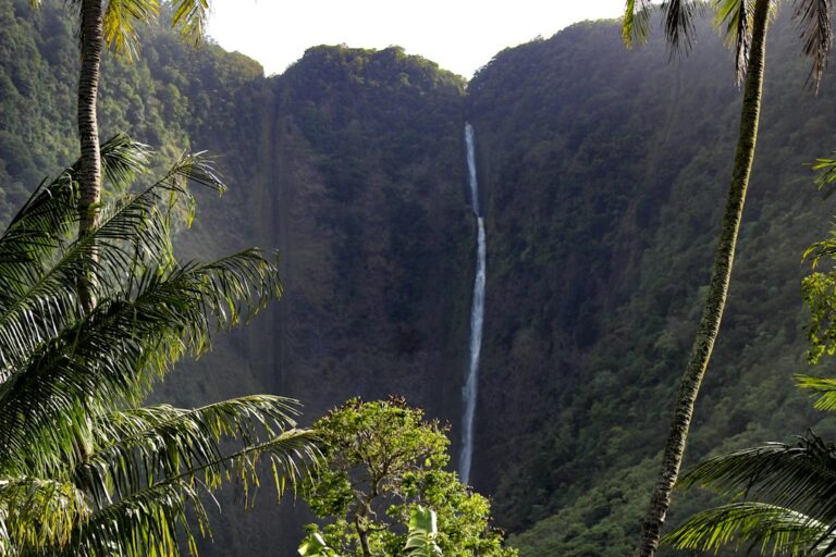
Akaka Falls is the most accessible waterfall walk on the island. A paved 0.4-mile loop runs up and down through bamboo, heliconia and banyan to two viewpoints. Kahuna Falls is roughly 100 feet tall, and Akaka Falls drops 442 feet into a fern-lined gorge. The Akaka Falls loop walk guide walks through it in detail.
Distance, steps and grade
The loop is short but not flat. Concrete steps add roughly 100 feet of total up and down, which matters for anyone with knee trouble or a stroller. Most visitors finish in 20 to 30 minutes. The trail stays wet all year, and moss on the steps turns slick after the frequent showers on the Hamakua Coast.
Fees and resident exemption
Hawaii State Parks charges non-residents a $5 per-person entry fee plus $10 per vehicle for parking. Residents with a Hawaii driver’s license or state ID enter and park free. For a relocating family of four, that works out to about $30 per visit until residency paperwork is done, and nothing after that.
Heat, vog and timing
Heat exposure is low. The trail is under tree cover at about 1,100 feet, and daytime highs usually reach the high 70s °F. Vog rarely matters this far north of Kilauea. Rain is the real variable. The windward side gets heavy afternoon showers, so mornings between 8:30 and 10:30 a.m. tend to be drier and less crowded.
Base town
Akaka Falls is a Hilo trail. The park sits above the village of Honomu, about 11 miles and 25 minutes north of downtown Hilo. From Kailua-Kona it is roughly 2 hours each way through Waimea, so Kona-based visitors usually combine it with other Hamakua stops. The things to do in Hilo roundup lists good stops to pair with it.
Easy: Devastation Trail in Hawaii Volcanoes National Park
Devastation Trail is a paved, nearly level path through the cinder field left by the 1959 Kilauea Iki eruption. Lava fountains that year reached about 1,900 feet and buried the surrounding ohia forest in pumice. The trail runs about 1 mile one way from the Devastation parking area to an overlook near the Puu Puai cinder cone.
The surface is smooth enough for most wheelchairs and strollers, and the elevation change is under 50 feet. Hikers can walk it as a 2-mile out-and-back, or walk one way and have a driver wait at the far lot. Either way, it adds 30 to 45 minutes to a park visit.
Exposure and best time
There is almost no shade, and the dark cinder soaks up sun. At about 3,600 feet the air is cool, typically 55 to 70 °F, but UV stays intense. Vog depends on wind direction and eruption activity at Halemaumau. Early morning or late afternoon light is best for photographing the bleached dead trees against the black ground.
Easy and moderate: the two Puu Huluhulu hikes
Two different trails share the name Puu Huluhulu, which confuses trip planning. One is a short forested cinder cone on Saddle Road near the Mauna Kea Access Road. The other is a hike across a lava field off Chain of Craters Road, inside the national park. They suit different days and different base towns.
Puu Huluhulu on Saddle Road
This roughly 0.6-mile loop climbs about 200 feet through a kipuka, a patch of older native forest surrounded by younger lava flows. The trailhead is at about 6,750 feet, across from the Mauna Kea Access Road junction. That makes it a good place to stretch and start adjusting to altitude before driving higher. Temperatures here are often in the 50s °F.
Puu Huluhulu at Mauna Ulu
The national park version starts at the Mauna Ulu parking area and covers about 2.5 miles round trip with roughly 150 feet of gain. Most of it crosses rough pahoehoe from the 1969–1974 Mauna Ulu eruption, following rock cairns, before climbing a short forested cone. The top looks out over Mauna Ulu’s crater and, on clear days, the coastline.
Footing is the main challenge. Lava edges are sharp, and a fall can mean deep cuts on hands and knees. The route has no shade, so late-morning sun reflecting off the lava feels much hotter than the 65 to 75 °F air temperature. Starting before 9 a.m. or after 3 p.m. keeps conditions comfortable.
Moderate: Pololu Valley lookout trail
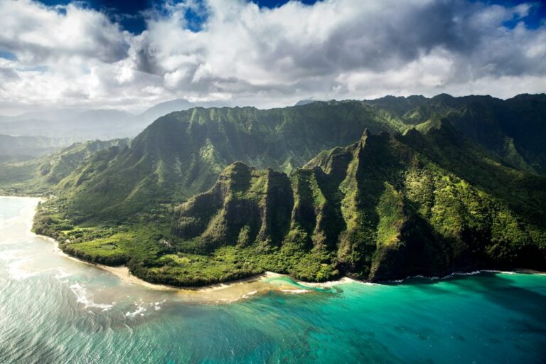
Pololu Valley sits at the northern end of the Kohala sea cliffs, where Highway 270 ends past Hawi and Kapaau. The trail drops from the roadside lookout to a black-boulder beach in roughly 0.6 miles each way, losing about 420 feet through a series of switchbacks. The climb back up is the hard part.
Trail surface and hazards
The path is packed dirt and loose rock that turns to slick mud after rain, which is common on the windward Kohala coast. Several sections have exposed roots and steep drop-offs. Most hikers allow 1 to 1.5 hours round trip, including time on the beach. Trekking poles help on the way down.
The beach is not safe for swimming. Currents are strong all year, and winter swells from roughly November to March bring heavy waves breaking right on the shore. Wading in or drinking from the valley stream carries a leptospirosis risk, especially with open cuts. The leptospirosis risk guide for waterfall trails explains the risk.
Access, parking and stewardship
Parking at the end of the road is extremely limited, and the local community actively looks after the land the trail crosses. Access rules, parking enforcement and occasional closures have changed in recent years, so check current conditions with Hawaii County before driving out. Civil Beat has covered the local debate over visitor pressure in North Kohala.
Heat, vog and base town
Heat exposure is moderate. Temperatures at the trailhead usually run 75 to 82 °F, and the midday climb back up is where hikers most often get exhausted. Vog sometimes drifts this far north when trade winds weaken. Pololu suits a Kona or Kohala base. It is about 1 hour 15 minutes from Kailua-Kona, 40 minutes from Waimea and nearly 2 hours from Hilo.
Moderate: Kilauea Iki crater loop
Kilauea Iki is the best-known day hike in Hawaii Volcanoes National Park. The 3.3-mile loop starts on the crater rim at about 3,900 feet and descends roughly 400 feet through ohia and tree-fern rainforest. It then crosses the hardened surface of the 1959 lava lake, where steam still rises from cracks in the floor.
The Kilauea Iki crater floor walk guide covers the full route from rim to floor, including which direction to walk. In short, the loop takes 2 to 3 hours. The forest descent uses switchbacks and stone steps, and the crater crossing is about 1 mile of uneven, mostly flat pahoehoe marked by cairns.
Fees and passes
Entry to Hawaii Volcanoes National Park costs $30 per private vehicle and is valid for 7 days in a row. Motorcycles pay $25, and people on foot or bicycle pay $15. For residents and frequent visitors, the $55 Hawaii Tri-Park annual pass covers this park, Haleakala and Puuhonua o Honaunau. The $80 America the Beautiful pass covers federal sites nationwide.
Heat and vog on the crater floor
The crater floor traps heat. Air temperatures at this elevation are often around 60 to 70 °F, but the black rock gives off heat, and there is no shade for about 45 minutes of walking. Vog and sulfur dioxide are a bigger concern during active eruption episodes at Halemaumau, roughly 2 miles southwest.
The Hawaii Department of Health publishes air quality readings and vog advisories, and the park posts closures when gas levels rise. Hikers who have asthma or heart conditions, or who are pregnant, should check readings before setting out. Sulfur dioxide can bring on symptoms quickly.
Best time and parking
The Kilauea Iki Overlook parking lot is small and often full by 9 or 10 a.m. Starting by 8 a.m. gets you a space and puts the crater crossing ahead of the midday sun. Afternoons often bring rain, since the Kilauea summit area gets more than 100 inches a year. Overflow parking is at the Thurston lava tube and Devastation lots.
Base town
Hilo is the better base. The trailhead is about 30 miles and 45 minutes from downtown Hilo, compared with roughly 96 miles and 2 hours 15 minutes from Kailua-Kona. Volcano Village, 5 minutes from the park entrance, is closest of all. The Volcanoes National Park day trip comparison sets out the Kona-versus-Hilo trade-off in detail.
Strenuous: Mauna Kea summit-area hikes and altitude sickness
Mauna Kea rises to 13,803 feet, and its summit area has a very different climate from the rest of the island. Overnight temperatures drop below freezing every month of the year. Snow is possible from roughly November through March, and winds can top 50 mph. Short trails here are harder on the body than long trails at sea level.
The acclimation stop
The usual advice is to stop for at least 30 minutes at the Onizuka Center for International Astronomy visitor station, at 9,200 feet, before going higher. Its hours and services have changed in recent years, so confirm current status before driving up. The Mauna Kea acclimation and sunset cutoff guide covers the timing in detail.
Who should not go above 9,200 feet
The mountain’s managers advise these groups not to go up to the summit area:
- Children under 13
- Pregnant people
- Anyone with heart, lung or significant respiratory conditions
- Anyone who has been scuba diving in the previous 24 hours
- People in poor general health or with uncontrolled high blood pressure
Recognizing altitude sickness
Signs of acute mountain sickness include headache, nausea, dizziness, unusual tiredness and shortness of breath while resting. Confusion, loss of coordination or a wet cough point to a more serious illness. The only reliable treatment is to go down promptly. Dropping even 2,000 to 3,000 feet usually brings relief.
Lake Waiau
Lake Waiau, at roughly 13,020 feet, is one of the highest lakes in the United States and an important cultural site. The trail leaves the summit road at about 13,200 feet and covers about 0.6 miles each way over loose cinder. At sea level this would take 20 minutes. At this altitude, most hikers need 1 to 1.5 hours round trip.
Humuula Trail
The Humuula Trail climbs about 6 miles from near the visitor station to the summit area, gaining roughly 4,600 feet. It is one of the hardest day hikes in Hawaii. Hikers should register at the visitor station, start by 6 or 7 a.m., and turn back by early afternoon whether or not they have reached the top.
Road access and closures
The road above the visitor station runs about 8 miles, roughly 5 of them unpaved, and requires four-wheel drive. Many rental car contracts forbid driving it. Rangers close the summit road for ice, snow and high winds, as the Mauna Kea snow and road closure guide explains. Visitors must leave the summit area about 30 minutes after sunset.
Base town
Mauna Kea works from either side of the island by way of Saddle Road, which the Hawaii Department of Transportation maintains as the Daniel K. Inouye Highway. The visitor station is about 1 hour from Hilo and about 1 hour 30 minutes from Kailua-Kona. Hilo has a slight edge for early-morning hikes.
Heat, vog and best time of day by trail
Exposure depends more on elevation and on which side of the island a trail is on than on distance. The comparison below sums up conditions on a typical day, along with the start time that usually gives the best mix of temperature, light and parking.
| Trail | Typical air temp | Shade | Vog exposure | Best start time |
|---|---|---|---|---|
| Akaka Falls | 70–79 °F | Full tree cover | Low | 8:30–10:30 a.m. |
| Devastation Trail | 55–70 °F | Almost none | Moderate to high | Before 9 a.m. or after 3 p.m. |
| Puu Huluhulu (Saddle) | 45–60 °F | Partial | Low to moderate | Any daylight hour |
| Puu Huluhulu (Mauna Ulu) | 65–75 °F | None until the cone | Moderate to high | Before 9 a.m. |
| Pololu Valley | 75–82 °F | Partial | Low | 7–9 a.m. |
| Kilauea Iki | 60–70 °F | Rim only | Moderate to high | 7–8 a.m. |
| Lake Waiau | 30–50 °F | None | Low | 10 a.m.–2 p.m. |
Vog levels depend heavily on wind. Normal northeast trade winds push volcanic haze toward the Kau district and the Kona coast. On “Kona wind” days, when the wind comes from the south or west, the haze can blow toward Hilo and the national park instead. These days are most common from October through April. Hawaii News Now forecasts often include vog outlooks.
Season matters too. Summer days are longer, with sunset around 7:00 p.m. in late June compared with about 5:40 p.m. in late November. Winter brings more rain on the windward side and a chance of snow on Mauna Kea. The Big Island month-by-month weather guide breaks down conditions further.
Kona or Hilo: which base suits which trail
The island stretches about 93 miles from north to south, and its two main towns are on opposite coasts. That makes your base the biggest factor in how many of these hikes fit into a trip, or into a resident’s normal weekend. The table compares one-way drive times from each town.
| Trail | From Kailua-Kona | From Hilo | Better base |
|---|---|---|---|
| Akaka Falls | About 2 hr | About 25 min | Hilo |
| Kilauea Iki and Devastation | About 2 hr 15 min | About 45 min | Hilo |
| Puu Huluhulu (Mauna Ulu) | About 2 hr 30 min | About 1 hr | Hilo |
| Pololu Valley | About 1 hr 15 min | About 2 hr | Kona |
| Puu Huluhulu (Saddle) | About 1 hr 15 min | About 40 min | Either |
| Mauna Kea visitor station | About 1 hr 30 min | About 1 hr | Either, slight Hilo edge |
The pattern is clear. Four of the seven trails favor Hilo, one favors Kona, and two work from either side. Many visitors split a stay between both coasts, as the Kona, Kohala or Hilo comparison describes. Doing that puts every trail within a one-way drive of about 1 hour.
For relocating households, the math is different. Kona has drier weather and most of the island’s beaches, while Hilo puts the rainforest and volcano trails within an easy morning’s drive. Fuel cost is part of the decision, since the EIA regularly lists Hawaii among the most expensive gasoline markets in the country.
Fees, passes and resident savings
Trail fees on the island are small next to lodging and food, but they add up for frequent hikers. Residents gain the most from fee exemptions and annual passes, which helps explain why long-term households hike much more often than short-term visitors.
| Site | Non-resident cost | Resident cost | Annual option |
|---|---|---|---|
| Akaka Falls State Park | $5 per person plus $10 parking | Free with Hawaii ID | Not needed |
| Hawaii Volcanoes National Park | $30 per vehicle, 7 days | $30 per vehicle, 7 days | $55 Tri-Park or $80 national pass |
| Pololu Valley | No entry fee | No entry fee | Not applicable |
| Mauna Kea summit area | No entry fee | No entry fee | Not applicable |
| Puu Huluhulu (Saddle) | No entry fee | No entry fee | Not applicable |
A household that visits the national park three times a year spends $90 on single-visit entry, compared with $55 for the Tri-Park pass. The pass pays for itself on the second visit. Fees and rules can change, so check the official park pages and the Hawaii Tourism Authority before each season.
Gear list: layers, sun protection and water
Packing for big island hikes means preparing for three climates in one bag. A hiker can leave Kona at 82 °F and be standing at Lake Waiau by noon at 35 °F, with wind chill below freezing. The checklist below covers the full range.
Layers for altitude
- Moisture-wicking base layer, not cotton
- Fleece or light down jacket for Kilauea and Mauna Kea
- Waterproof shell for windward rain and summit wind
- Warm hat and light gloves above 9,000 feet
- Long pants for lava fields, since falls on pahoehoe cause deep scrapes
Sun protection
The UV index across Hawaii regularly hits 11 or higher, the “extreme” category, and UV rises roughly 10 percent for every 3,300 feet of elevation. On Mauna Kea, bare skin can burn in under 15 minutes, even on a cold day.
- Mineral sunscreen, SPF 30 or higher, since Hawaii bans oxybenzone and octinoxate formulas
- Wide-brimmed hat or cap with neck cover
- Sunglasses with UV protection, essential above 9,000 feet
- Lip balm with SPF for the dry air at high altitude
How much water to carry
A common rule of thumb is about 0.5 liters per hour in mild conditions and up to 1 liter per hour in heat or at altitude, where dry air pulls more moisture out with each breath. None of the trails listed here has safe drinking water along the way.
| Trail | Water per person | Extra items |
|---|---|---|
| Akaka Falls | 0.5 liter | Rain jacket, grippy shoes |
| Devastation Trail | 0.5–1 liter | Hat, sunscreen |
| Puu Huluhulu (Mauna Ulu) | 1–1.5 liters | Gloves, long pants |
| Pololu Valley | 1–1.5 liters | Trekking poles, first-aid kit |
| Kilauea Iki | 1.5–2 liters | Rain shell, snack, vog mask if advised |
| Lake Waiau | 1–1.5 liters | Down jacket, gloves, sunglasses |
| Humuula Trail | 3–4 liters | Full layers, headlamp, electrolytes |
Footwear and extras
Closed-toe shoes with firm soles are the minimum for every trail except Akaka Falls, and even there sandals slip on wet steps. Lava rock tears up thin mesh running shoes within a few outings. Hiking shoes or boots with deep treads last longer and grip better on both mud and pahoehoe.
Outdoor gear usually costs more on the island than on the mainland, in line with the higher prices shown in Honolulu data from the Bureau of Labor Statistics. Many relocating hikers ship their durable gear rather than buying replacements after they arrive.
Safety, closures and trail etiquette
Several of these trails can close with little warning. Eruption episodes, high sulfur dioxide, flash floods, ice on the summit and storm damage can all close trails for a while. The national park, Hawaii State Parks and Hawaii County each post updates, and the Star-Advertiser reports major closures statewide.
- Stay on marked trails and follow the cairns, since crater edges and lava crust can collapse
- Do not build new rock cairns, which can mislead other hikers
- Leave lava rocks, sand and plants where they are
- Respect cultural sites, especially at Lake Waiau and Pololu
- Tell someone your route and when you expect to be back
- Carry a charged phone, but expect weak signal on Saddle Road
Hikers comparing these trails with others in the state can find a similar breakdown in the Oahu hikes ranked by difficulty. No other island offers the altitude range of Hawaii Island, where one weekend can include a rainforest waterfall, a cooled lava lake and a lake above 13,000 feet.
Frequently asked questions
What is the easiest hike on the Big Island?
The Akaka Falls loop is the easiest well-known hike. It covers 0.4 paved miles in 20 to 30 minutes, with about 100 feet of stairs. Devastation Trail in the national park is a close second. It is a flat, paved 1-mile path that most wheelchairs and strollers can handle.
How long does the Kilauea Iki hike take?
Most hikers finish the 3.3-mile Kilauea Iki loop in 2 to 3 hours. That includes a roughly 400-foot descent through rainforest, about 1 mile across the crater floor and the climb back to the rim. Starting by 8 a.m. helps you get parking and avoid the midday heat.
Is the Pololu Valley trail hard?
Pololu is moderate. The trail is only about 0.6 miles each way, but it drops roughly 420 feet on muddy, rocky switchbacks. The climb out in midday sun is where most hikers struggle. Sturdy shoes, trekking poles and at least 1 liter of water make it manageable.
Can you hike Mauna Kea without acclimating?
Health guidance strongly advises against it. Visitors should spend at least 30 minutes at the 9,200-foot visitor station before going higher, because driving straight from sea level to 13,000 feet raises the risk of altitude sickness. Children under 13, pregnant people and anyone with heart or lung conditions should not go up.
Should hikers stay in Kona or Hilo for Big Island hikes?
Hilo suits more of these trails. Akaka Falls, Kilauea Iki, Devastation Trail and the Mauna Ulu Puu Huluhulu are all within about 1 hour of Hilo. Kona is closer to Pololu Valley. Mauna Kea works from either town by way of Saddle Road, though Hilo is roughly 30 minutes closer.
How much water should hikers carry on Big Island trails?
Plan on about 0.5 liters per hour in mild conditions and up to 1 liter per hour in heat or at altitude. That means 1.5 to 2 liters for Kilauea Iki and 3 to 4 liters for the Humuula Trail. None of the trails covered here has safe drinking water along the way.
Does vog affect hiking in Hawaii Volcanoes National Park?
It can. During eruption episodes, sulfur dioxide and vog levels rise near Kilauea’s summit, especially on Kona wind days. People with asthma or heart conditions are the most sensitive. Checking state air quality readings and park alerts before arriving is the best way to decide whether to hike that day.
Do Hawaii residents pay to enter Akaka Falls State Park?
No. Residents with a valid Hawaii driver’s license or state ID don’t pay the entry or parking fee. Non-residents pay $5 per person plus $10 per vehicle, so a visiting family of four spends about $30 per visit.