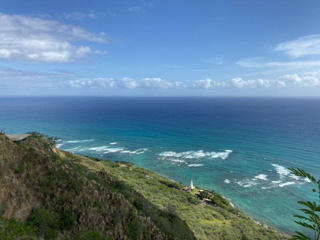
Papakolea, the olivine-tinged pocket beach on the Big Island’s southern flank, sits below a collapsed cinder cone about 2.5 miles from the end of South Point Road. Most visitors reach it by paying a landowner-run shuttle to bounce them across the pasture; a determined minority walk the 5-mile round trip on foot. Both options require research before the drive south from Kailua-Kona or Volcano.
The shuttle economy that has developed on Ka Lae — the southernmost point in the United States — turns on cash payments of roughly $20 to $30 per rider, an unpaved track worn deep into pastureland, and a running dispute between private access operators and the Hawaii Department of Land and Natural Resources. For households relocating to the Big Island, the trip doubles as an introduction to how remote south-shore recreation actually works.
What follows is a research-based breakdown of the fee model, the physical route, the geology of Pu’u Mahana, the weather at the point, and the reasons personal 4WD attempts have become discouraged. Every household will weigh the trade-offs differently, but the underlying variables are consistent across the calendar.
The Shuttle Fee Model at South Point Road
The shuttle service is not a permitted concession. Operators are private landowners or hui members who charge riders to bounce across the pasture in modified pickup trucks and passenger vans with wooden benches bolted into the bed. The going rate has drifted upward over the past decade, and most drivers now quote $20 per person one way or $30 round trip. Cash is expected — no credit card readers, no Venmo, no exceptions.
Vehicles typically stage at the paved parking lot at the end of South Point Road, roughly 12 miles south of Highway 11 (Mamalahoa Highway) between mile markers 69 and 70. Riders queue near the boat hoists at the cliff; a driver waves the next group over when a truck bed empties. Wait times can hit 30 minutes at peak morning arrival, especially between 9 a.m. and 11 a.m.
Typical fee ranges
| Segment | Cash rate per person | Notes |
|---|---|---|
| Round trip (adult) | $25-$30 | Most common posted quote |
| One-way ride out | $15-$20 | Walk back option |
| One-way ride back | $15-$20 | Walk out option |
| Kids under 12 | $15-$20 | Driver’s discretion |
| Group flat rate (bed of 6) | $120-$160 | Negotiated on site |
| Bicycle add-on | Rarely accepted | Bed space limited |
Drivers do not issue receipts. Small bills are appreciated because change on the pasture is inconsistent, and most riders arrive with a $50 or $100 that the driver cannot break. A pair adding up to $60 in $20s solves that friction. Groups larger than four sometimes negotiate a flat rate for the whole bed rather than per-head pricing.
How queues form during peak season
June through August and the December-January window see the heaviest arrival flow, with 40-80 riders lined up at the parking lot by 9 a.m. on clear days. Drivers rotate on informal turn order, and no single dispatcher governs the queue. During slow midweek visits in October or February, the shuttle can look empty until a party appears; drivers still ask the full round-trip rate.
Tipping is not expected but is welcome for smooth rides or extra explanation about Pu’u Mahana on the way. A $5-$10 cash tip in the driver’s hand at drop-off is a common norm among relocating households who eventually make the trip a second or third time.
Walking the 2.5-Mile One-Way Track
The alternative is to walk the same rutted road — 2.5 miles each way, roughly 5 miles round trip, across open Ka’ū pasture with zero shade and no potable water. Moving weight, most parties log the outbound leg in 55-75 minutes and the return in 70-90 minutes because heat, wind fatigue, and the climb back up from the beach compound. Total on-foot round-trip time typically lands between three and four hours.
The road surface is deeply eroded volcanic soil and cinder, cut by a network of parallel truck tracks. Ankle-rolling ruts run 6-18 inches deep in places. Trail runners handle it fine, but flip-flops and open sandals are a hazard. A visual comparison at the Papakolea hike-versus-truck breakdown walks through the tempo trade-offs.
Estimated walking pace
| Segment | Distance | Time (moderate pace) | Elevation change |
|---|---|---|---|
| Parking lot to first hui gate | 0.4 mi | 10-15 min | Flat |
| Fence line to bluff overlook | 1.6 mi | 35-45 min | +40 ft |
| Bluff overlook to beach floor | 0.5 mi | 15-20 min | -115 ft |
| Beach back to overlook | 0.5 mi | 20-25 min | +115 ft |
| Overlook back to parking | 2.0 mi | 50-70 min | -40 ft |
Pacers who have hiked the Ka’ena Point west-side trek on Oahu will recognize the tempo — a long flat approach across exposed coastline, then a short scramble down. Papakolea’s descent to the beach floor, though, is steeper and looser than Ka’ena’s approach.
What the outbound leg feels like
The first half mile is dead flat and open, with sweeping views of the Kaʻū cliffs to the south. The middle mile picks up wind exposure because there are no windbreaks — walkers frequently report leaning 5-10 degrees into a steady breeze. The final half mile before the overlook drops gently, then the bluff appears with the pocket beach visible below.
Runners moving at 8-10 minute-per-mile pace occasionally pass shuttle trucks on the road, though the trucks average 12-18 mph in the ruts. This creates an odd dynamic where fit walkers reach the overlook only 20-25 minutes after a truck departure that left them behind, before factoring in queue time.
Weather at Ka Lae: Wind, Heat, and Sun Exposure
Ka Lae is one of the windiest coastal points in the state. The trade winds funnel across the tip of the island with almost nothing to break them. Ironwood trees at the point lean permanently downwind, a visual shorthand for the average conditions. Sustained wind of 15-25 mph is normal; gusts to 35-45 mph are common in summer.
The wind is not a nuisance — it is the safety story. Combined with an average midday air temperature of 82-86°F from May through October and reflected radiation off pale pasture and dark cinder, sun exposure ramps quickly. The National Weather Service’s Honolulu office regularly issues heat advisories that extend to the leeward Big Island coast; the resource page at the Hawaii Department of Health tracks warm-season advisory patterns.
Ka Lae monthly conditions
| Month | Avg high (°F) | Typical wind (mph) | Rainfall (in) | Trip note |
|---|---|---|---|---|
| January | 79 | 12-20 | 1.8 | Cooler; possible swell |
| April | 82 | 15-22 | 0.9 | Reliable trades |
| July | 85 | 18-28 | 0.4 | Peak heat and wind |
| September | 86 | 15-25 | 0.5 | Hottest days |
| November | 81 | 12-20 | 1.4 | Variable trades |
There is no shade on the walk out, none at the overlook, and only a small band of shadow at the base of the cinder cone in the late afternoon. Households used to the shaded rainforest trails around Volcano Village and its cinder cone lots will find the exposure jarring by comparison, even though the elevation difference is only about 3,700 feet.
Vog and visibility
Volcanic gas from Kilauea’s ongoing degassing occasionally drifts south during Kona wind reversals, dropping visibility at Ka Lae and adding a sulfur haze to the air. The state agriculture department’s air quality station data at Hawaii Department of Agriculture monitoring can preview conditions before the drive. Reversal days typically cluster in October and again in April.
The Cinder Cone Geology of Pu’u Mahana
Papakolea sits inside a breached tuff cone called Pu’u Mahana, formed roughly 49,000 years ago during a hydrovolcanic eruption on the southwest flank of Mauna Loa. Sea-level rise and wave erosion breached the cone’s seaward wall, and the ocean now scours olivine crystals out of the cone’s tephra deposits, dropping them onto the pocket beach below.
The green color comes from olivine, a magnesium-iron silicate mineral that crystallizes early during basaltic eruptions. Individual grains at Papakolea run 0.5-2 millimeters and have a density near 3.3 g/cm³, which is why the heavier olivine concentrates on the beach while lighter black basalt fragments wash out. The result is a beach whose sand is roughly 60-90 percent olivine by volume, depending on wave conditions.
Papakolea is one of only four widely recognized green sand beaches on earth. The others sit in Guam, Norway, and the Galapagos. Its geology is closer in origin to the young pyroclastic cones inside Hawaii Volcanoes National Park than to the older sea cliffs at Akaka Falls on the Hamakua Coast. A similar cone-and-crater dynamic shows up at Kilauea Iki’s crater floor at HVNP.
Beach dimensions
- Pocket beach width: roughly 200 feet
- Depth (waterline to base of cliff): 30-50 feet at low tide
- Height of cinder cone wall behind beach: 105-120 feet
- Descent from bluff overlook: about 115 vertical feet down loose scree
- Age of cone: approximately 49,000 years
- Dominant sand color: olive-green, varying with wave-sorted olivine
Why the color intensifies after storms
Winter and shoulder-season swells stir the cinder wall and beach floor, redistributing the sand and often unearthing new olivine caches. Visitors after a January storm frequently describe the color as noticeably more saturated than during a calm summer week. The pattern is inconsistent, but a big swell in the prior 72 hours generally correlates with the greenest observed sand.
Why DLNR Discourages Private 4WD Access
The pasture road is technically on land that mixes private ownership, Hawaiian Home Lands parcels, and state easements. The Department of Land and Natural Resources and the county have both flagged the growing braided-track network as an environmental problem — trucks driving parallel to existing ruts have widened the disturbed corridor from a single track to a network 100-200 feet wide in places.
Erosion carries fine soil and cinder into nearshore waters at Papakolea and Kaulana Bay, contributing to sedimentation over reef flats. Coverage from Honolulu Civil Beat and the Honolulu Star-Advertiser has repeatedly documented the tension between hui members who monetize the route and state officials who cannot easily close a road they do not own outright.
Discouragement of private 4WD is practical, not just regulatory. Visitors who take rental SUVs onto the route routinely get stuck. Most rental contracts through major agencies explicitly prohibit driving on South Point Road past the pavement. Recovery fees for a stuck vehicle can run $500-$1,500 because tow trucks operating out of Naalehu or Ocean View must travel 20-40 miles to reach the point.
Reasons to skip private 4WD
- Rental contract violations invalidate collision coverage
- Ruts routinely bottom out standard-height SUVs
- Loose cinder can trigger sudden traction loss
- Recovery from Naalehu tow operators averages $500-$1,500
- Braided tracks worsen erosion into the reef flats
- DLNR and county officials have proposed access restrictions
What the ongoing dispute means for visitors
Proposals to formalize the shuttle service, cap operator numbers, or reroute the trail resurface every few years without resolution. Visitors should treat access as provisional — the current pattern could change with little notice if a landowner closes a gate or the state issues new restrictions. Checking recent news the week of a planned visit is prudent, particularly during legislative session periods that run January through May.
Cash-Only Logistics and What to Bring
Cash is the single most cited pain point for first-time visitors. The nearest reliable ATM sits at the Ocean View Malama Market or the Naalehu 76 station, both roughly 20-30 minutes back up Highway 11 from the South Point turnoff. Add another 45-60 minutes if the driver decides to loop back for cash after reaching the parking lot; that lost time often kills the visit for late-morning arrivals.
Water is second on the list. Ka Lae has no potable water source, no vending, no shade shelter. Guides advise 2-3 liters per person for a shuttle round trip, 3-4 liters per person for a walking round trip. Reusable insulated bottles keep water drinkable in midday temperatures that regularly hit 88-92°F at the beach floor.
Packing list
| Item | Shuttle round trip | Walking round trip |
|---|---|---|
| Water | 2-3 liters/person | 3-4 liters/person |
| Cash | $30-$40/person | $0 needed |
| Sun protection | Hat, SPF 50, sunglasses | Hat, SPF 50, sunglasses, long sleeves |
| Footwear | Athletic shoes or tevas | Closed-toe trail shoes |
| Electrolytes | 1 packet | 2-3 packets |
| Snacks | Light | 400-600 calories |
| Small towel | Optional | Optional |
A wide-brim hat is worth more than any other single accessory on this trip. Baseball caps do not protect the ears or neck, and sunburn on those spots is the most common minor injury walkers report. Long-sleeve UPF shirts add negligible weight and drop heat load significantly by blocking direct radiation on the shoulders and arms.
Comparing Shuttle vs Walk Trade-Offs
The right choice depends on time, budget, physical readiness, and heat tolerance. The shuttle compresses the entire excursion into 90-150 minutes on the ground. The walk stretches it to 3.5-4.5 hours. Cost inverts the math: a couple pays $50-$60 for the shuttle round trip but nothing extra to walk, aside from the water and food already required.
Side-by-side comparison
| Factor | Shuttle | Walk |
|---|---|---|
| Round-trip time on ground | 90-150 min | 3.5-4.5 hrs |
| Cost per adult | $25-$30 | $0 |
| Cost per family of four | $80-$120 | $0 |
| Physical effort | Low, bumpy ride | Moderate, sun-exposed |
| Heat exposure | 15-20 min each way | 2.5-3 hrs total |
| Recommended min. age | 5+ | 10+ |
| Rain contingency | Trucks proceed | Route becomes slick |
Families with young kids or older visitors almost always come out ahead on the shuttle. Fit adults with a full water supply, a start time before 7:30 a.m., and previous experience on exposed trails like the Pipiwai bamboo forest track to Waimoku Falls or the Mahaulepu heritage coastal walk on Kauai can safely walk the round trip.
A hybrid strategy works well: ride the shuttle out to conserve time and energy, then walk back with a spare liter of water. This cuts total time on ground to roughly 3 hours, halves the cash outlay to $15-$20 per person, and rewards the walker with downwind conditions on the return leg most days.
Safety, Currents, and Descending to the Beach
The descent from the cinder-cone rim to the beach involves 115 vertical feet of loose scree over a series of makeshift steps hikers have carved into the tephra. It is neither maintained nor engineered. Sturdy shoes and a low center of gravity matter — the return climb is where most twisted ankles happen. The route on the western wall is generally more stable than the eastern face.
Once at sea level, currents are the concern. Papakolea sits inside a partial embayment, but the pocket beach is fully exposed to the southeast swell that wraps Ka Lae. Rip currents and shorebreak intensify from November through April. Signs at the overlook warn against swimming; there are no lifeguards, no rescue boats, and no cell coverage at the beach floor.
Beach safety notes
- No lifeguards or emergency infrastructure at the beach floor
- Cell service drops below the bluff overlook
- Winter surf can wash across the sand into the cone wall
- Shorebreak intensifies with southern hemisphere swells May-September
- Currents can push swimmers east toward open ocean
- Rescue from Ocean View or Naalehu can take 60-90 minutes
Removing sand from Papakolea is a Hawaii state offense under sand and mineral removal statutes tracked by the tax department at tax.hawaii.gov and the state’s parks system. Fines can reach thousands of dollars, and rangers occasionally check bags at the parking lot. Photographs and memory are the only appropriate souvenirs.
Planning the Day from Kailua-Kona or Volcano
South Point Road turns off Highway 11 near mile marker 70, about 62 miles southeast of Kailua-Kona and 55 miles southwest of Volcano Village. Drive times average 1:45-2:15 from Kona and 1:15-1:45 from Volcano depending on Kaʻū traffic. The Hawaii Department of Transportation’s condition page at HDOT logs closures on Route 11 that occasionally interrupt access.
Sample departure timing
| Origin | Suggested departure | Arrival at South Point | Return to lodging |
|---|---|---|---|
| Kailua-Kona | 5:45 a.m. | 7:45 a.m. | 1:00 p.m. |
| Waikoloa | 5:15 a.m. | 7:45 a.m. | 1:30 p.m. |
| Volcano Village | 6:15 a.m. | 7:45 a.m. | 12:30 p.m. |
| Hilo | 5:45 a.m. | 7:45 a.m. | 1:00 p.m. |
| Naalehu | 7:00 a.m. | 7:30 a.m. | 11:30 a.m. |
An early start — arriving between 7:30 and 8:15 a.m. — cuts wind exposure, avoids the noon heat spike, and beats the mid-morning shuttle queue. It also stacks well with lunch in Naalehu or a coffee stop at Punaluʻu, both back along the return route on Highway 11. The county’s tourism materials at the County of Hawaii map alternate points of interest on the same corridor.
Fueling and food stops along Route 11
Naalehu has one small grocery, a bakery, and two gas stations; Ocean View has one gas station and a hardware store. There is no full-service restaurant between Ocean View and South Point Road. Households often pack a cooler with sandwiches and iced water for after-hike consumption at the parking lot before the drive north, since the closest sit-down meal after the trip is 25-30 minutes away.
How Papakolea Fits Into a Big Island Beach Itinerary
Green sand is one of four sand colors visible along a two-day loop through Hawai’i County. White sand at Hapuna, salt-and-pepper at Kua Bay, black sand at Punaluʻu, and green at Papakolea sit within about 130 miles of highway. The Big Island beach rankings for 2026 group these by swim safety, sand type, and access difficulty.
Papakolea rarely tops the ranking for swim quality because of its currents and hard-to-reach descent. It does top the ranking for geological novelty. A common combination is to pair Papakolea in the morning with Punaluʻu black sand in the early afternoon — the two are 32 miles apart on Highway 11 with a total drive time under 50 minutes.
Green sea turtles frequently haul out at Punaluʻu between 11 a.m. and 3 p.m., making it a natural companion stop. Households comparing Big Island beaches often add Manukā State Wayside 20 miles west of South Point for a shaded picnic before the drive back to Kona.
Considerations for Households Relocating to Hawaiʻi Island
For visitors weighing a move to Kaʻū, the Papakolea trip is a preview of what south-island life feels like: long unpaved access routes, sparse services, informal cash economies, and dramatic weather swings across short distances. Kaʻū’s population sits under 10,000 across an area roughly the size of Rhode Island, and services thin out fast west of Naalehu.
Households seriously considering purchases in Ocean View, Discovery Harbour, or Naʻalehu often make the Papakolea day their first field test of tolerance for dust, wind, and drive time. The vibe suits some households and repels others; there is no substitute for spending a full day on the ground before signing a purchase offer.
Frequently asked questions
How much does the Papakolea green sand shuttle cost?
The landowner-operated shuttle typically charges $20-$30 per adult round trip in cash, with one-way rates around $15-$20. Prices are not fixed; drivers may quote higher on peak weekends. Children usually pay a discounted rate at driver discretion. There is no online booking, ticket window, or credit card option — arrive with small bills and expect informal payment.
Can visitors drive a rental 4WD to Papakolea?
Most rental agencies explicitly prohibit driving past the pavement at South Point Road, and DLNR discourages private vehicle use because of erosion and vehicle recovery incidents. A stuck rental typically costs $500-$1,500 to tow from Naalehu, and any damage voids collision coverage. Visitors who ignore the restriction risk both fines from operators and out-of-pocket repair costs. Walk or shuttle instead.
How long does the walk to Papakolea take round trip?
A moderate-pace round trip walk covers about 5 miles of open pasture road plus the descent to the beach, totaling 3.5 to 4.5 hours. Add 30-60 minutes for time on the sand. Heat, wind, and the return climb from the beach floor add fatigue on the second leg, so allow for slower pacing than the outbound distance would suggest.
Is there shade on the trail or at the beach?
No. The 2.5-mile track crosses fully exposed Ka’ū pastureland with no trees, no shade shelters, and no potable water. The beach itself sits in a breached cinder cone with a small strip of afternoon shadow along the western wall. Sun protection, wide-brim hats, long sleeves, and 3-4 liters of water per person are essential for both walkers and shuttle riders.
Why is the sand green at Papakolea?
The green color comes from olivine, a magnesium-iron silicate mineral that crystallized in basaltic magma during the Pu’u Mahana eruption roughly 49,000 years ago. Waves and weather have eroded the cone’s seaward wall, concentrating dense olivine crystals on the beach floor. Grains average 0.5-2 millimeters, and olivine makes up 60-90 percent of the sand depending on recent wave sorting.
Is swimming at Papakolea safe?
Swimming is generally not recommended. There are no lifeguards, no rescue services, and no cell coverage at the beach floor. Currents wrap around Ka Lae, the southernmost point in the United States, and rip currents intensify from November through April. Signs at the bluff overlook warn against entering the water. Most visitors wade only ankle-deep or watch from the descent stairs.
What time of day is best to visit?
Early morning between 7:30 and 8:30 a.m. offers the coolest temperatures, lowest wind, and shortest shuttle queue. Midday visits between 11 a.m. and 2 p.m. subject riders to peak heat and reflected radiation from pale pasture. Late afternoon works if returning before dusk, since the road becomes hazardous in the dark. Sunrise arrivals also secure a spot in the first shuttle rotation.
Can visitors take home a jar of green sand?
No. Removing sand, rock, or mineral material from Papakolea is prohibited under Hawaii state law, and violations can carry fines in the hundreds to thousands of dollars. Rangers occasionally inspect bags at the parking lot after high-visibility enforcement periods. The olivine ecosystem depends on the beach retaining its material, and photographs are the only appropriate souvenir.


