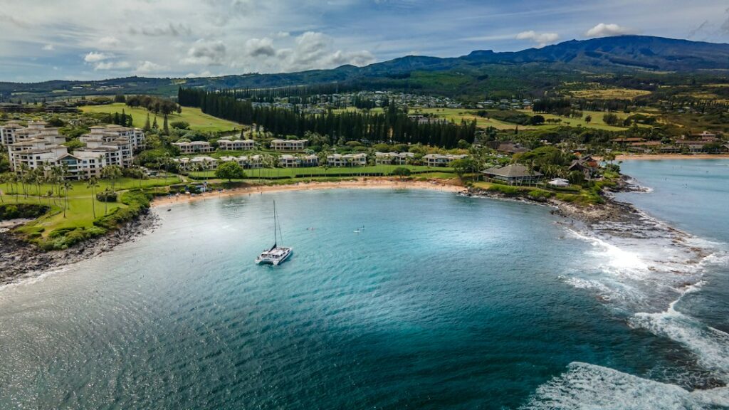
Kealakekua Bay sits on the leeward side of Hawaii Island, about 12 miles south of Kailua-Kona along the Kona Coast. Its northern promontory, Ka’awaloa, holds the 27-foot obelisk marking where Captain James Cook died in February 1779. Directly offshore lies one of the state’s clearest, most fish-dense snorkel sites, a marine life conservation district managed by the state.
Because the monument beach itself is the only easy entry point to that clear water, and because vehicle access to Ka’awaloa is blocked, the three practical ways to reach the fish are a guided catamaran from Kailua Pier, a Zodiac from Keauhou, or a 3.8-mile roundtrip foot descent from Napo’opo’o. Each carries a different price, timeline, and skill demand.
Households researching a Big Island move often add this stop while scouting South Kona for housing. The choice among the three routes tends to hinge on group fitness, tolerance for a small boat, and how much of the morning the reader wants to trade for time in the water.
Why the Cook Monument snorkel site stands out on the Kona Coast
The site draws snorkelers for one repeatable reason: visibility that regularly reaches 80 to 100 feet on calm mornings, backed by a 315-acre marine life conservation district where fishing has been sharply restricted since 1969. Coral cover along the north wall stays healthier than most Kona shoreline reefs, and yellow tang, Moorish idol, and parrotfish shoals stay dense year-round.
The bay’s crescent shape also blocks most trade wind chop from November through March, when Kailua-Kona’s leeward coast averages surf under 3 feet. Water temperature runs between 76°F in February and 82°F in September, warm enough for a 1mm shorty or skin suit rather than a full wetsuit on most tours.
Compared with more crowded stops like the Maluaka reef on South Maui, Kealakekua trades sea turtle density for higher fish counts and clearer water. The tradeoff is access: this bay has no drive-up shore entry near the best coral, so all three routes below cost real time or money.
The three access routes at a glance
Each route reaches the same water column but at very different price and effort points. The table below sets the baseline before the deeper sections on each option.
| Route | Departure | Roundtrip time | Adult cost | Fitness demand |
|---|---|---|---|---|
| Catamaran | Kailua Pier | 4.5 hours | $165–$195 | Low |
| Zodiac raft | Keauhou Bay | 4 hours | $145–$175 | Moderate |
| Ka’awaloa Trail | Napo’opo’o Road | 3–5 hours | $0 | High |
| Kayak with guide | Napo’opo’o Wharf | 4 hours | $120–$160 | Moderate |
The two boat charters and the guided kayak all include reef-safe sunscreen, snorkel gear, and typically a snack or lunch. The trail is free, but reaching it still means a rental car, water, and roughly a gallon of fluids per hiker under midday sun.
Guided catamaran: Kailua Pier and Keauhou departures
Two operators dominate the catamaran morning window into Kealakekua Bay: Fair Wind Cruises and Body Glove Hawaii. Body Glove runs from Kailua Pier in the center of Kailua-Kona town, while the flagship Fair Wind II departs from Keauhou Bay about 6 miles south. Both use twin-hull catamarans carrying 100 or more passengers.
Fair Wind II from Keauhou Bay
Fair Wind II is a 60-foot catamaran that departs Keauhou Bay at 9:00 a.m. for the four-and-a-half hour Deluxe Morning trip, returning around 1:30 p.m. The vessel includes a 15-foot waterslide, high-dive platform, and a 30-foot boarding ladder, which families with children or nervous swimmers frequently cite as the easiest boarding of any Kona snorkel option.
Ticket prices sit around $175 for adults and $115 for children ages 4 to 12 as of the current season, with a continental breakfast and hot barbecue lunch included. The Keauhou launch is the same harbor used for the evening manta ray night snorkel, which lets visitors stack both experiences in a single day.
Body Glove from Kailua Pier
Body Glove’s 65-foot Kanoa II leaves Kailua Pier at 8:00 a.m. and returns by 12:30 p.m. Ticket prices run roughly $165 adult and $115 child, with a 20-foot waterslide, freshwater rinse showers, and a full deli-style lunch on board. Kailua Pier sits at the base of Ali’i Drive, so guests staying in Kailua-Kona hotels often walk to the boarding line.
The bigger tradeoff between the two operators is departure timing and stability. Fair Wind’s Keauhou start puts it in the bay slightly ahead of Body Glove, but Body Glove’s shorter transit still leaves ample time above the reef. Both boats anchor along the same section of the north wall, roughly 200 yards from the Cook obelisk.
Zodiac raft charters from Keauhou
Zodiac operators run 24- to 32-foot rigid-hull inflatables from Keauhou Bay for parties who want smaller groups, faster transit, and access to sea caves along the coastline between Keauhou and Kealakekua. Sea Paradise, Kona Ocean Adventures, and Captain Zodiac all book in this window, typically capping trips at 16 to 24 guests.
Adult prices generally range from $145 to $175 for a four-hour morning trip that includes two snorkel stops: the Cook monument reef itself and one of the shallower coves near Kealakekua Point or Manini Beach. The rafts sit low to the water, which makes marine life sightings closer but also more physical on the ride out.
The tradeoff between raft and catamaran mirrors the debate on Kauai’s Napali Coast between Zodiac and larger catamarans. Rafts reach the bay in 25 to 35 minutes versus 60 to 75 minutes on a catamaran, but the ride pounds through swell, and guests with back trouble or motion sensitivity often regret the choice.
Zodiacs also carry no waterslide, no bathroom on most vessels, and only bento-box lunches or wraps. Households prioritizing time in the water over amenities tend to prefer them; families with younger children usually do not.
The Ka’awaloa Trail from Napo’opo’o
The unguided land route to the monument is the Ka’awaloa Trail, a 1.9-mile one-way descent that begins on Napo’opo’o Road above the bay. Roundtrip distance runs 3.8 miles with roughly 1,300 feet of elevation change, most of it lost on the way down and regained on the return in full afternoon sun.
Trail conditions and grade
The trail follows an old jeep road cut through kiawe scrub and lava rubble. Grade averages 13 to 15 percent, with looser sections near the ridgeline. There is no shade after the first quarter mile, no water source at either end, and no cell reception across most of the descent. Loose ankle-turning rock is the primary hazard.
Trailhead parking sits along Napo’opo’o Road roughly 500 feet uphill of the intersection with Highway 11’s Milepost 111. The unpaved shoulder holds maybe 15 vehicles on a weekday morning and fills before 8:00 a.m. on weekends. The Hawaii Department of Land and Natural Resources posts stewardship rules at the trailhead, though enforcement is intermittent.
Water, timing, and heat exposure
Because Ka’awaloa faces west and holds no shade, midday air temperatures at trail level regularly hit 88 to 92°F between May and October. Rangers and rescue crews recommend at least one gallon of water per hiker, salty snacks, and departure no later than 6:30 a.m. so the return climb starts before 11:00 a.m.
The trail ends at a rocky landing next to the monument, not a sand beach. Snorkelers stage gear on lava benches, enter through a small break in the rocks, and swim north to the coral wall. Slippage on wet rock is the leading cause of Kealakekua rescue calls, and Hawaii County fire crews respond by boat because the road is closed to civilian vehicles.
Napo’opo’o charter departures and guided kayak options
Napo’opo’o Wharf, on the south shore of the bay, has historically been the shortest-transit launch to the monument reef. It sits directly across the bay from Ka’awaloa, a paddle or short skiff ride of roughly 1.1 miles one way. State rules now require any landing at the monument beach to be part of a permitted commercial tour or a special-use activity.
Two kayak-with-guide operators, Kona Boys and Aloha Kayak, hold state-issued Special Activity Permits that allow their guides to land small groups at the monument beach for snorkeling. Trips run about 4 hours, cost $120 to $160 per adult, and typically launch from Napo’opo’o Wharf around 7:30 a.m., when trade-wind chop is minimal.
Unguided kayak rentals are still available in Kailua-Kona, but paddling to Kealakekua and landing without a permit-holding guide is not allowed. Enforcement has been documented in Honolulu Civil Beat coverage of DLNR permitting, and citations run into the hundreds of dollars for landings on the Ka’awaloa side.
The Napo’opo’o launch also offers something the other routes do not: a quick pivot back to South Kona coffee country for the afternoon. Many guided trips end by noon, freeing time for Belt Road coffee farm stops between Captain Cook and Holualoa on the return drive.
Morning water clarity and timing
Every operator schedules snorkel time between 9:30 a.m. and 11:30 a.m., and the reason is simple physics. Kealakekua Bay faces west; the sun climbs the eastern ridge behind Ka’awaloa around 7:15 a.m. and does not directly light the reef until roughly 9:00 a.m. By 9:30 a.m. the water column is bright without the surface glare that dominates late morning.
Visibility peaks between 9:30 and 10:30 a.m. on calm days, when the state’s coastal water quality monitoring records low turbidity along the leeward coast. The Hawaii Department of Health’s Clean Water Branch publishes weekly bacterial and turbidity readings, and Kealakekua consistently scores among the state’s cleanest bays.
By early afternoon, two changes usually degrade the water. First, onshore trade winds pick up between 12:00 and 1:00 p.m., raising surface chop that scatters incoming light. Second, particulate from mid-morning boat traffic settles more slowly in the enclosed bay than in open water, so visibility tightens from 100 feet to closer to 60 feet.
Tide range on the Kona Coast is only about 2 feet between mean high and mean low, so tidal timing matters less here than on the north shore of Oahu or the shallow reefs of Hulopoe Cove on Lanai. Wind and boat wake matter more.
Spinner dolphin protected-species distance rule
Kealakekua Bay is one of the most consistent resting bays for Hawaiian spinner dolphins on the Kona Coast. The pods hunt at night in deep water and return to the shallow bays after sunrise to rest, socialize, and nurse calves. Kealakekua, Honaunau, and Kauhako Bay each hold pods on rotating mornings.
Federal rules under the Marine Mammal Protection Act, finalized in 2021 by NOAA Fisheries, prohibit swimming, approaching, or remaining within 50 yards of a spinner dolphin. The rule applies to boats, kayaks, and swimmers within 2 nautical miles of the shoreline. Violations carry civil penalties up to $32,500 per incident.
Guided operators handle this rule by anchoring in the outer bay, dropping snorkelers at the reef, and repositioning if pods drift into the swim zone. Unguided swimmers and kayakers are still responsible for maintaining distance, which in practice means turning back to shore any time pods arrive within the 50-yard buffer.
The etiquette parallels what visitors learn on Lanai’s Manele Bay and Hulopoe reef, though enforcement in Kealakekua has been more visible since the 2021 rulemaking. Trip briefings on Fair Wind, Body Glove, and Zodiac operators now include the 50-yard rule as a mandatory line item.
Why unguided landing at the monument beach is restricted
The Ka’awaloa flat where the obelisk stands is state land, but the surrounding waters are a marine life conservation district and the Ka’awaloa Trail terminates at a small pebble landing that historically saw heavy unguided traffic. Erosion, human waste, and vessel damage led DLNR to restrict commercial landing to permit holders and to close vehicle access on the old jeep road.
Under current rules, only tours with a Commercial Use Permit or Special Activity Permit issued by the Hawaii Department of Land and Natural Resources may land at the Ka’awaloa flat. Unguided kayakers arriving by water are asked to stay offshore. Foot traffic via the trail is still allowed because it lands on public trust land above the tide line.
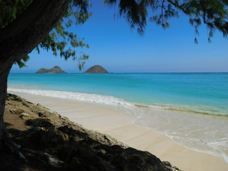
The parallel is the Mokulua Islands off Lanikai, where guided kayak groups can land under specific rules and unguided paddlers face a stricter set of restrictions. Kealakekua is stricter still because the marine conservation designation adds a second layer of state oversight.
Enforcement is inconsistent but not absent. DLNR officers periodically check the wharf, and citations for landing without a permit have been documented in Star-Advertiser and Hawaii News Now reporting. Households considering unguided access should assume they will not land at the monument beach and plan around swimming out from the trail terminus instead.
Costs, rentals, and full-day logistics
The full-day cost of the Kealakekua snorkel varies more with rental car and lodging choices than with the tour itself. The table below shows a typical mid-range comparison for a party of two departing from a Kailua-Kona hotel.
| Line item | Catamaran day | Zodiac day | Trail day |
|---|---|---|---|
| Tour tickets (2 adults) | $350 | $310 | $0 |
| Rental car (day rate) | $65 | $65 | $65 |
| Fuel (round trip Kailua-Kona) | $8 | $8 | $14 |
| Parking | $10 pier lot | $0 | $0 shoulder |
| Water and snacks | $0 included | $0 included | $18 |
| Total | $433 | $383 | $97 |
The trail day looks dramatically cheaper on paper, but it carries higher physical risk, no included gear, and no included snorkel guide. Households not already carrying masks, fins, and rash guards should add $60 to $80 for a rental set from a Kailua-Kona dive shop. Reef-safe sunscreen adds another $15 to $22 per tube.
Fuel pricing on the Big Island runs 40 to 65 cents higher per gallon than the national average, tracked in EIA gasoline and diesel data. Rental car returns at Kona International Airport typically require refueling within 10 miles of the terminal to avoid inflated agency rates.
Gear checklist for the trail approach
- One gallon of water per hiker, plus electrolyte tablets.
- Mask, fins, and defog; snorkel with dry-top valve preferred.
- Rash guard, wide-brim hat, and reef-safe mineral sunscreen.
- Trail shoes with grip, not sandals, on the descent.
- Small dry bag for phone, keys, and rental car fob.
- Salty snack, chafing balm, and a whistle for signaling.
What the trip signals for a Big Island move
Households scouting Hawaii Island for relocation often use the Kealakekua trip to test three factors: heat exposure on unshaded terrain, cost of guided marine activities, and the density of protected-species and permit rules. All three matter for anyone considering a home purchase in Captain Cook, Kealakekua, or Kainaliu.
South Kona properties above Highway 11 sit between 1,200 and 1,800 feet of elevation, which drops daytime highs by 6 to 10°F versus the shoreline. Buyers who found the Ka’awaloa trail brutal at sea level often shift toward mauka listings during their scouting week for exactly that reason.
Marine access rules also compound over a year of local life. A resident who kayaks weekly, snorkels frequently, or wants to guide guests through spinner dolphin protocol will encounter the same DLNR framework repeatedly. Understanding it before closing on a home avoids expensive citations and neighbor friction.
The area also pairs well with alternative day trips that scouting households add to their week. Akaka Falls on the Hamakua Coast and the Onomea Bay and Hamakua botanical gardens circuit both make natural next-day stops for buyers already circling the island by rental car.
Weather, seasonality, and what months work
Kealakekua Bay sits in the driest quadrant of the Big Island. Kailua-Kona averages 26 inches of annual rainfall, and Napo’opo’o receives roughly 32 inches, most of it falling in short late-afternoon showers between November and March. Morning conditions are usable roughly 340 days per year.
The two most restrictive months are typically January and February, when higher north Pacific swell wraps into the bay on 6 to 10 mornings. Operators cancel or reposition to Kealakekua Point or Manini Beach when north swell exceeds 6 feet at outer buoys. Local marine forecasts track this daily.
| Month | Water temp | Cancellation risk | Visibility |
|---|---|---|---|
| January | 76°F | High | 50–80 ft |
| February | 76°F | High | 50–80 ft |
| April | 78°F | Low | 80–100 ft |
| June | 80°F | Very low | 80–100 ft |
| September | 82°F | Very low | 80–100 ft |
| October | 81°F | Very low | 90–100 ft |
Tourism data suggests April through June and September through mid-October are the calmest snorkel windows. Trade winds soften, humidity drops, and visibility peaks. October averages the fewest cancellations and the highest reported guest satisfaction across all three access methods.
Kona International Airport arrivals grew after the 2020 dip and now support at least three morning catamaran departures on peak days. Booking two to three weeks out is usually sufficient outside the winter holiday and spring break windows.
Frequently asked questions
Is the Ka’awaloa Trail safe for children or older hikers?
The trail is generally too exposed for children under 10 and hikers over 65 without significant hill training. Grade averages 13 percent, there is no shade, and the return climb starts in midday heat. Hawaii County fire crews respond to multiple heat-related rescues on this trail each year. Guided catamaran or Zodiac options carry far lower medical risk for these groups.
Can visitors rent kayaks in Kailua-Kona and paddle to the monument themselves?
Unguided kayakers can paddle into Kealakekua Bay but cannot legally land at the Ka’awaloa monument beach without a state Special Activity Permit. Enforcement is real and citations run in the hundreds of dollars. Guided kayak tours from Kona Boys or Aloha Kayak hold the required permits, launch from Napo’opo’o Wharf, and include gear, guiding, and a lawful landing.
What is the best month to snorkel Kealakekua Bay?
Late April through mid-June and September through mid-October offer the calmest conditions, warm 79 to 82°F water, and the lowest cancellation rates. January and February bring the highest cancellation risk from north swell wrapping into the bay. October historically ranks highest for water clarity and lowest for tour disruptions on the Kona Coast.
Are Fair Wind II and Body Glove interchangeable choices?
They cover the same reef but differ in departure point and boarding style. Fair Wind II leaves Keauhou Bay with a wide boarding ladder and family-oriented deck. Body Glove leaves Kailua Pier with a slightly earlier start and shorter transit. Guests with mobility concerns typically prefer Fair Wind; guests staying in Kailua-Kona hotels often prefer Body Glove for walk-on access.
What happens if a spinner dolphin pod arrives while people are snorkeling?
The federal 50-yard rule requires swimmers to move away rather than approach. Guided operators reposition the boat and quietly recall guests. Unguided swimmers should stop finning toward the pod, keep low body posture, and drift back toward the reef. Violations carry civil penalties, and NOAA enforcement in Kona has increased since the 2021 rulemaking.
How much of the day does a catamaran trip use?
Plan for six to seven hours from hotel to hotel. A typical Body Glove morning trip runs 8:00 a.m. to 12:30 p.m., plus 30 minutes of pier check-in and 20 to 40 minutes of drive time each way from Kailua-Kona lodging. Fair Wind II from Keauhou runs 9:00 a.m. to 1:30 p.m. with similar drive-time overhead.
Do the tours include reef-safe sunscreen?
All major catamaran and Zodiac operators now provide reef-safe mineral sunscreen at no charge, matching the state ban on oxybenzone and octinoxate that took effect January 2021. Guests bringing outside sunscreen should verify the label. Tour operators may confiscate non-compliant bottles at the loading pier, and reapplication stations onboard use mineral formulations only.