Roughly 8 miles north of Hilo on the Big Island’s windward Hamakua Coast, a modest brown sign at mile marker 7 on Highway 19 points visitors toward a 4-mile scenic loop that most rental drivers blow past at 50 mph. That loop — a surviving fragment of the Old Mamalahoa Highway that hugs Onomea Bay — carries drivers across three single-lane bridges, past the Hawaii Tropical Bioreserve & Garden, and down to a spring-fed waterfall view.
For research-oriented travelers plotting a half-day out of Hilo, the corridor stacks three distinct stops within roughly 30 highway miles: the botanical loop at Onomea, the state park at Akaka Falls, and a fuel-and-snack stop in Honomu or Papaikou. The pairing works because each destination fits inside a 45–90 minute window and shares the same weather system.
This article breaks down the practical mechanics of the drive — where to slow down for the detour, how much time to allocate at the paid garden, what the free vertical waterfall view actually shows, why the one-lane bridges demand traffic etiquette rather than confidence, and how to layer the stop with Akaka Falls without triggering a full-day departure from Hilo.
Where the Onomea Bay scenic loop sits on the Hamakua Coast
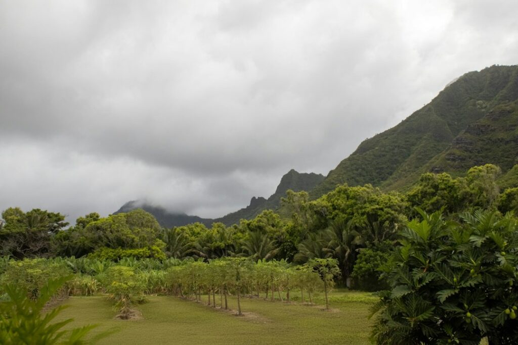
The Hamakua Coast is the roughly 50-mile stretch of shoreline between Hilo and Waipio Valley on the windward side of Hawaii Island. Highway 19, the Hawaii Belt Road, runs the length of it, cutting inland from the ocean and bridging the gulches that drain the flanks of Mauna Kea. Onomea Bay sits at approximately the 8-mile mark from downtown Hilo, near the small community of Papaikou.
The scenic loop itself is not the modern belt road. It is a preserved 4-mile section of the earlier Old Mamalahoa Highway that survived when HI-19 was rebuilt inland with wider shoulders and longer bridges. The detour drops from Highway 19 down toward sea level, traces the edge of the bay, then climbs back up to rejoin the main road roughly 4 miles later at approximately mile marker 11.
Drivers heading north from Hilo pass the southern entrance to the loop first. The northern entrance, signed as “Scenic Route,” appears just past the Papaikou area. Either direction works, but northbound access tends to feel less abrupt because the descent grade lines up with the driver’s side of the road.
Distance and drive-time reference
| Starting point | Miles to Onomea entrance | Typical drive time |
|---|---|---|
| Hilo International Airport (ITO) | 10 miles | 18 minutes |
| Downtown Hilo (Banyan Drive) | 8 miles | 14 minutes |
| Akaka Falls State Park entrance | 7 miles | 13 minutes |
| Waipio Valley Lookout | 42 miles | 62 minutes |
| Kailua-Kona | 84 miles | 110 minutes |
Reading the mile markers: finding the 4-mile detour off HI-19
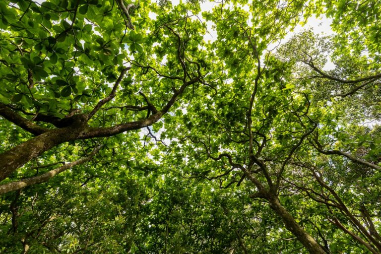
The scenic loop signage is small, brown, and easy to miss at highway speed. Northbound drivers on HI-19 should slow near mile marker 7. The sign reads “Scenic Route — 4 Miles” and points right (mauka to makai — inland to seaward). The turn is a sharp right into a two-lane road that immediately begins descending through jungle canopy.
Southbound drivers coming from Honokaa or Akaka Falls encounter the northern entrance first, near mile marker 11. Both entrances are legal for both directions, so a common tactic is to enter northbound at the southern sign, loop through, and continue north on HI-19 toward Akaka Falls. This ordering avoids doubling back.
Traffic on the loop itself moves at 15–25 mph. Rental drivers accustomed to the 55 mph pace of the belt road often overshoot the entrance, then reverse or execute a U-turn — a maneuver that is difficult on the narrow shoulder. The safer approach is to preset the trip odometer at the “Hilo City Limits” sign and count down.
Signage on Highway 19 is maintained by the Hawaii Department of Transportation, though the Old Mamalahoa Highway loop falls under Hawaii County jurisdiction. Reports of damaged or missing scenic route signs sometimes route through the county rather than the state — a distinction that matters if drivers encounter downed signage after a storm.
What the entrance looks like
- Small brown “Scenic Route” sign, 24 by 12 inches, easy to miss at speed.
- Sharp turn onto a two-lane paved road with immediate downhill grade.
- No fuel, no restrooms, and no cell signal for large stretches inside the loop.
- Speed drops from 55 mph on HI-19 to roughly 20 mph within 100 yards.
The Hawaii Tropical Bioreserve & Garden: admission and what $30 buys
Roughly halfway around the scenic loop sits the visitor entrance to the Hawaii Tropical Bioreserve & Garden, a nonprofit botanical preserve founded in 1978 on a 40-acre valley that drops from the roadway down to the shoreline at Onomea Bay. Adult admission runs about $30, with children ages 6–16 typically priced at $15 and children under 6 admitted free. Prices update annually, so verifying at the visitor kiosk before parking is standard practice.
The garden houses more than 2,000 species of tropical plants collected from the Pacific Rim, Central America, and Southeast Asia. Visitors receive a laminated trail map at check-in and follow a boardwalk system that descends roughly 500 feet in elevation over a paved path with handrails. The full loop takes most walkers between 75 and 120 minutes at a research pace.
Facilities and physical demands
The garden is not stroller-friendly on the lower boardwalk sections. Wheelchairs can access the entrance pavilion and gift shop but not the descent. Restrooms exist at the top before the boardwalk begins; none exist along the trail. The paved surface can be slick after rain — an almost daily condition on the Hamakua windward side, where annual rainfall totals often exceed 140 inches.
| Category | Standard admission | What it includes |
|---|---|---|
| Adult (17+) | $30 | Trail map, boardwalk access, guided reference sheet |
| Child (6–16) | $15 | Trail map, boardwalk access |
| Child (under 6) | Free | With paying adult |
| Kamaaina rate | ~$15 | Hawaii ID required |
| Military discount | ~$25 | Active-duty ID required |
The garden accepts credit cards and cash at the kiosk. Reservations are not required for individual visitors, though group tours over 10 people typically call ahead. Standard hours run 9 a.m. to 5 p.m. daily except December 25 and January 1, with last admission around 4 p.m.
What visitors encounter inside the garden
The garden trail passes through several distinct microclimates as it descends toward Onomea Bay. Upper sections feature heliconia and ginger collections. Middle sections open onto a stream valley with mango, breadfruit, and monkeypod trees. The lower boardwalk reaches an ocean overlook with pandanus and coconut palms fringing the shoreline.
Named plant collections include a torch ginger stand estimated at over 40 varieties, a heliconia collection with roughly 80 documented species, and orchid displays that rotate seasonally. Wildlife occasionally spotted along the trail includes coqui frogs (invasive but audible), several honeycreeper species, and freshwater goby in the stream at higher elevations.
Photographers appreciate the light quality inside the valley. The canopy filters direct sun into a diffused wash that reduces harsh shadows, particularly around 10 a.m. to 2 p.m. Tripods are permitted on the boardwalk but must be positioned to allow other visitors to pass — the boardwalk width does not accommodate two-way traffic with a spread tripod.
The vertical Onomea waterfall side view from the roadway
Not every visitor pays $30 to enter the botanical garden. A separate free viewing option exists roughly 100 yards south of the paid entrance: a small dirt pull-off on the makai (ocean) side of the loop road with a fenced overlook. From this pull-off, hikers can see a slim vertical waterfall dropping through a fern-lined gully into the upper garden area.
The waterfall is spring-fed and runs year-round, though volume swells sharply after rain. Because the water source sits at higher elevation than the garden’s paid trail, the vertical drop is best appreciated from the roadside angle. The garden trail approaches from below and does not offer the same head-on framing.
Parking at the free overlook is limited to 3–4 cars. Vehicles must pull entirely off the paved surface — the loop road is one lane in stretches and a parked car sticking into the lane creates a genuine hazard for oncoming traffic. Drivers who cannot fit fully off the pavement should continue past and use the garden lot instead.
Photography angle notes
- Morning light (before 10 a.m.) hits the falls face-on with the sun behind the road.
- Afternoon backlight can wash out the water against the dark rock face.
- Wide-angle lenses (24 mm equivalent) capture the fern gully framing best.
- Rain often creates a mist plume visible from the pull-off within 20 minutes of a downpour.
One-lane bridges and roadside parking discipline
The scenic loop crosses three narrow bridges that predate modern two-way traffic standards. Two of the three bridges are effectively one lane wide, with wooden or concrete railings that leave no shoulder. The convention on the loop is that the vehicle already committed to the bridge deck has right of way, and oncoming drivers wait at the abutment for the crossing to clear.
Rental drivers not used to shared-lane bridges often stop halfway across when they see oncoming headlights — a move that jams both directions. The correct etiquette is to check for oncoming traffic before entering, then commit and clear the deck at 10–15 mph without stopping. Similar single-lane bridge etiquette applies on other Hawaii routes, including the crossings covered in Hana Highway fuel planning between Paia and Hana.
Parking directly on the loop road is discouraged outside the marked garden lot and the roadside overlook pull-offs. Homeowners along the loop have posted no-parking signs after years of visitor gridlock. Hawaii County police have issued citations for blocking bridge approaches, and tow trucks operate on the corridor. Assuming a rental car left on a blind curve will still be there in 90 minutes is a bad bet.
Where parking is legal on the loop
| Location | Approximate capacity | Cost |
|---|---|---|
| Hawaii Tropical Bioreserve & Garden lot | 60 cars | Free with admission |
| Waterfall roadside overlook | 3–4 cars | Free |
| Northern loop pull-off (mauka side) | 2–3 cars | Free |
| Onomea Trail parking (Kahili Trail) | 5 cars | Free |
| Anywhere on the bridge deck | 0 (illegal) | Tow risk |
Rain-jacket packing and Hamakua weather realities
The Hamakua Coast north of Hilo is one of the wettest inhabited stretches in the United States. Papaikou records approximately 130–170 inches of annual rainfall, distributed across roughly 220 rain days per year. That means the statistical odds of at least a passing shower during any given 90-minute botanical garden visit exceed 60 percent, according to National Weather Service normals summarized by the Hawaii Department of Health climate reports.
Practical packing for the corridor includes a lightweight waterproof shell (not a poncho, which snags on trail railings), closed-toe shoes with tread, and a dry bag for camera equipment. Wet-weather gear rated at 10,000 mm hydrostatic head or better handles a Hamakua shower without saturating in 20 minutes. Similar tropical-rain footwear notes apply on other windward Hawaii trails covered in Manoa Falls rainforest muddy trail footwear selection.
Rain probabilities by month
| Month | Average rain days | Average monthly rainfall |
|---|---|---|
| January | 21 | 16.5 inches |
| March | 22 | 17.8 inches |
| May | 18 | 10.4 inches |
| July | 19 | 10.9 inches |
| September | 17 | 9.8 inches |
| November | 21 | 15.7 inches |
The drier months on the Hamakua Coast — statistically September and early October — align with shoulder-season pricing. Visitors planning around Hawaii’s May shoulder-season timing and Lei Day should still assume a rain shell will earn its space in the daypack. January rainfall specifically can push indoor alternatives to the top of the itinerary, as detailed in the January Hilo rainfall and East Hawaii indoor stops rundown.
Pairing Onomea with Akaka Falls State Park
Akaka Falls sits about 7 miles north of the northern exit of the Onomea scenic loop, near the town of Honomu. The state park charges $5 per non-resident vehicle and $1 per non-resident pedestrian for entry. Hawaii residents with valid ID enter free. Payment is at a self-serve iron ranger kiosk or through the state parks reservation system online.
The main draw is a 442-foot single-drop waterfall visible from a paved overlook loop of approximately 0.4 miles. The full loop includes Kahuna Falls (about 300 feet) as a secondary view. Most visitors complete the walk in 30–45 minutes, making it a natural pairing with the longer 75–120 minute Onomea garden stop.
Half-day loop from Hilo — timing template
| Segment | Elapsed time | Notes |
|---|---|---|
| Depart Hilo | 0:00 | Fuel up in Hilo — no gas on the loop |
| Arrive Onomea scenic loop | 0:15 | Park at garden lot |
| Botanical garden visit | 0:15–1:45 | Boardwalk descent and return |
| Waterfall roadside view | 1:45–2:00 | Free overlook, 3–4 car pull-off |
| Drive to Akaka Falls | 2:00–2:20 | Approximately 12 miles |
| Akaka Falls loop walk | 2:20–3:00 | 0.4-mile paved loop, $5 entry |
| Snack in Honomu | 3:00–3:30 | Bakery and general store |
| Return to Hilo | 3:30–4:15 | ~15 miles back on HI-19 |
This timing template assumes a mid-morning departure from Hilo, arrival at the garden before lunch, and return in time for an early Hilo dinner. Households anchoring in Hilo can extend the day with the Wednesday vendor rotation at the Hilo Farmers Market if the timing lines up.
Fuel, food, and restroom cadence along the corridor
No gas stations exist on the scenic loop itself. The nearest fuel is in Hilo at the southern end of the corridor and in Honokaa, roughly 30 miles north. Papaikou has a small convenience store but no fuel pumps. Drivers should top off in Hilo, especially when planning to continue past Akaka Falls toward Waipio Valley or the Kohala Coast.
Hawaii gasoline prices tend to run 25–40 percent above the mainland average, according to EIA weekly gasoline price data. Budgeting $5.00–$5.50 per gallon for regular unleaded in the Hilo area is a reasonable planning number, though weekly prices vary. A 12-gallon rental compact refill in Hilo before the loop costs roughly $60–$66 at typical rates.
Food and snack stops on the corridor
- Papaikou — small convenience store, coffee and packaged snacks.
- Honomu — Woodshop Gallery cafe area and Honomu Bakery for baked goods.
- Pepeekeo — deli sandwiches at limited local outlets.
- Hilo — full-service restaurants, farmers market, and grocery chains.
Restrooms exist at the botanical garden entrance (paid access), at Akaka Falls State Park (free with entry), and at Hilo gas stations. The loop road itself has no public restrooms. Households traveling with young children or older adults should factor restroom cadence into the timing.
Alternative botanical stops and the Hakalau garden reference
The primary garden at Onomea Bay is often confused with a similarly named preserve near Hakalau, roughly 12 miles further north on HI-19. Hakalau is the small unincorporated community just past the northern end of the Onomea loop, and the search phrase “Onomea Bay Hakalau garden” often mixes these two geographies. The Hawaii Tropical Bioreserve & Garden is the paid attraction on the Onomea loop specifically.
North of Onomea, additional botanical and roadside stops include the World Botanical Gardens near Hakalau (separate ownership, separate ~$15 admission) and the small pull-offs at Kolekole Beach Park and Umauma Falls. Each stop can be added to the corridor, though half-day timing tightens quickly. Full-day itineraries can extend as far as the Waipio Valley descent and its truck grade requirement.
Botanical alternatives near the Onomea corridor
| Attraction | Location | Approximate adult admission |
|---|---|---|
| Hawaii Tropical Bioreserve & Garden | Onomea scenic loop | $30 |
| World Botanical Gardens | Near Hakalau, mile 16 | $15 |
| Umauma Falls Experience | Umauma River, mile 16 | $25 |
| Liliuokalani Gardens (Hilo) | Banyan Drive, Hilo | Free |
| Panaewa Rainforest Zoo & Gardens | South of Hilo | Free |
Vehicle selection and rental etiquette on the loop
The scenic loop does not require four-wheel drive or high clearance. Any standard rental sedan can complete the 4-mile detour comfortably, provided the driver respects the 20 mph speeds and the bridge etiquette. Larger vehicles — Class C RVs and full-size pickups with trailers — struggle on the one-lane bridges and are discouraged.
Bicycles occasionally use the loop for its low-speed traffic and scenic value. Drivers should expect to encounter cyclists on blind curves, particularly on weekend mornings. Passing safely requires waiting for a straight section — the loop’s centerline is often obscured by canopy shadow and there is no shoulder for a cyclist to swing onto.
Rental car contracts from the major Hilo airport agencies typically do not restrict the scenic loop or Akaka Falls road. They do restrict certain other Hawaii Island routes, including Saddle Road on some contracts (though this has loosened) and the descent into Waipio Valley on virtually all contracts. Households checking rental restrictions before departure avoid unpleasant billing surprises.
Weather-day contingencies and indoor alternatives
When Hamakua rainfall exceeds a passing shower — say, one of the January or November storm days averaging over an inch of rain in 24 hours — the botanical garden boardwalk remains open but becomes genuinely hazardous. The paved sections turn slick and the descent grade compounds the risk. Serious downpours also close portions of Akaka Falls for standing water on the paved loop.
Indoor alternatives in Hilo on a washout day include the Imiloa Astronomy Center, the Pacific Tsunami Museum, the Lyman Museum, and covered markets. These stops layer well with the botanical stop when a morning shower delays the outdoor portion. Emergency supply planning for prolonged wet weather is a separate matter, addressed in the Hawaii tropical storm 14-day emergency supply guide.
Wet-weather decision points
- Rain rate above 0.25 inches/hour — delay garden entry by 45 minutes.
- Winds gusting over 25 mph — falling branches at Onomea overlook.
- Roadway flooding on HI-19 gulches — postpone the corridor entirely.
- Flash flood watch posted — Akaka Falls and roadside overlooks close.
How the Onomea corridor compares to other Hawaii scenic stops
Visitors who have driven the Road to Hana on Maui or the north shore of Kauai often ask how Onomea compares. The scale is smaller. Onomea is a 4-mile detour with one paid attraction and one free waterfall view, versus the Road to Hana’s 52-mile corridor with dozens of stops. The compressed footprint is a feature for households on tight itineraries.
Compared to the Twin Falls stop on Maui’s Hana Highway — a paid private-property stop with a similar botanical-plus-waterfall profile — Onomea offers longer boardwalk time and less crowd pressure. Etiquette lessons transfer well from one to the other; readers researching Maui’s version can consult Twin Falls Maui roadside pullout etiquette for parallel expectations on pullout discipline and access norms.
Households basing outside of Hilo can still incorporate the Hamakua corridor into a longer loop. Kona-based travelers face a 100-mile drive each way — a full-day commitment. Maui-based travelers considering an inter-island day trip should weigh flight timing against a shorter alternative such as the Piilani Highway return loop from Hana already available on their island.
Residential impact and community etiquette
The scenic loop passes several dozen private residences, some with driveways that open directly onto the narrow roadway. Residents have raised concerns over the past decade about visitor speed, noise, and parking spillover — issues that have prompted no-parking signs and periodic enforcement. Visitors who treat the loop as an active neighborhood rather than a theme park generally have smoother interactions.
Practical courtesies include keeping voices moderate at the roadside overlook, refraining from drone flight over private property (Hawaii County restricts drone operation in many residential zones), and pulling forward at driveways to allow residents to exit. Blocking a driveway even for a two-minute photo stop is grounds for a police call.
Community sentiment along the Hamakua Coast has shifted noticeably as visitor volumes have grown, mirroring debates covered in local reporting at Civil Beat and other independent Hawaii outlets. Households considering a move to the Big Island’s east side should factor visitor-traffic externalities into any prospective home purchase near a scenic route.
Historical context: the Old Mamalahoa Highway
The Old Mamalahoa Highway predates the modern Hawaii Belt Road by decades. Originally a King’s Highway alignment, the route served as the primary Hilo-to-Hamakua connector through the plantation era. When sugar operations dominated the coast, the road carried cane trucks, mail wagons, and passenger vehicles across bridges hand-poured in the early twentieth century.
The scenic loop preserved at Onomea Bay is one of the few remaining stretches where the original alignment survives essentially intact. Preservation-minded county planning kept it operational as a low-speed alternative when HI-19 was rebuilt on a straighter, higher grade inland. The bridges on the loop are period infrastructure, not modern replacements, which explains their narrow deck widths.
Understanding the corridor’s origin helps calibrate expectations. Visitors comparing it to a manicured national park drive will be surprised by the residential intermixing and the informal parking discipline. Visitors comparing it to a modern arterial will be surprised by the slow speeds. The right mental model is “surviving plantation-era back road,” which frames both charm and constraint.
Budget summary: cost of the half-day loop
| Line item | Estimated cost (party of 2) | Notes |
|---|---|---|
| Rental car fuel (30 miles round trip) | $8 | ~1.5 gallons at $5.25/gal |
| Hawaii Tropical Bioreserve & Garden (2 adults) | $60 | Cash or card at kiosk |
| Akaka Falls State Park entry | $5 | Per non-resident vehicle |
| Snacks in Honomu | $18 | Bakery and coffee |
| Lunch in Hilo post-loop | $40 | Casual sit-down for 2 |
| Total half-day budget | ~$131 | Excluding lodging |
Households already staying in Hilo effectively pay only the incremental fuel, admission, and food costs. Visitors driving from Kona should add roughly $50–$60 in additional fuel and factor 3.5 hours of highway time. The Honolulu CPI data from the Bureau of Labor Statistics continues to show elevated Hawaii price levels across food and transportation categories, which underlines why exact-cost budgeting matters more here than on the mainland.
Frequently asked questions
Is the Onomea scenic loop safe to drive in a standard rental car?
Yes. The 4-mile detour is fully paved and does not require four-wheel drive or high clearance. Speeds run 15–25 mph, and the surface is maintained by Hawaii County. The one-lane bridges require attention and yielding etiquette, but a compact sedan handles the route without difficulty when the driver respects posted speeds and pulls fully off the pavement for parking stops.
Do visitors need reservations for the Hawaii Tropical Bioreserve & Garden?
Individual visitors do not need reservations. Admission is handled first-come, first-served at the entry kiosk, which accepts cash and credit cards. Groups of 10 or more typically call ahead. The garden opens at 9 a.m. daily except December 25 and January 1, with last admission around 4 p.m. and closure at 5 p.m.
Can the botanical garden and Akaka Falls be done in the same morning?
Yes, comfortably. A common template is a 9 a.m. Hilo departure, 90 minutes at the botanical garden, 20-minute drive north, and 40 minutes at Akaka Falls, returning to Hilo by 1 p.m. Total corridor mileage is about 30 miles round trip. Building in a Honomu snack stop adds another 20–30 minutes without stretching the day.
What happens if it rains during the botanical garden visit?
Light rain does not close the garden — that would eliminate operations for most of the year on the Hamakua Coast. Heavy downpours make the boardwalk descent slick, so visitors experiencing intense rain should pause under the entry pavilion and wait 15–20 minutes for the shower to pass. A packable rain shell is standard equipment for this corridor year-round.
Is the free waterfall view worth stopping for if the garden is already booked?
The roadside overlook offers a legitimate vertical view of the spring-fed falls dropping through fern canopy. It is not a substitute for the paid garden experience, but as a 10-minute add-on it justifies a stop. Parking is tight — only 3–4 cars — and the pull-off requires fully clearing the loop road pavement to avoid blocking one-lane traffic.
How does the Hamakua corridor fit into a household move-planning trip?
Households scouting a Big Island move often plan a reconnaissance visit that includes the Hamakua corridor as one of several east-side stops. Container shipping via Matson or Pasha runs on separate schedules unrelated to visitor logistics. Scouting a corridor takes hours; scheduling household goods takes weeks and should be planned independently, with quotes secured 60–90 days ahead.