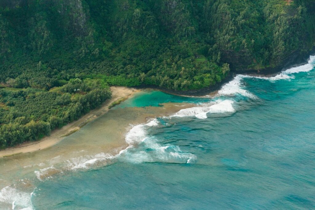
Kauai’s western coast holds a rare geographic advantage for sunset watchers. The Kekaha shoreline runs roughly 15 miles from Waimea town northwest toward Polihale, presenting an unbroken view across open Pacific with only the low silhouette of Niihau breaking the horizon on clear evenings.
This exposure — combined with the leeward rain shadow that keeps skies clearer here than anywhere else on the island — makes the Kekaha strand a preferred sunset perch for residents and visiting photographers alike. The catch is knowing where to stop, when the light aligns, and how to read the shore break before wading in for a foreground reflection shot.
The breakdown below covers pullout geography along Highway 50, the seasonal azimuth swing that moves sunset from southwest in winter to northwest in summer, safety context around the notorious west-shore rips, and lodging tradeoffs for photographers weighing early-evening drives from Poipu against basing closer in Waimea.
Why Kekaha faces sunset uniquely
Every Kauai coast sees the sun each day, but only the west and southwest shores face the horizon where the sun actually sets over water. Kekaha and Polihale together form the westernmost stretch of the island, meaning the sun sinks directly into the sea rather than behind ridgelines.
Compare this to the North Shore, where Napali cliffs cut into sunset views from October through March, or the East Shore, where the sun drops behind the interior mountains hours before ocean horizon time. Kekaha’s flat coastal plain — a former sugar cane belt — leaves the sky uncluttered from land horizon to sea horizon.
Niihau on the horizon
Roughly 17 miles offshore, the privately owned island of Niihau sits low and long against the western sky. Its highest point, Paniau, reaches only 1,281 feet, so it reads as a dark blue-grey slab rather than a peak. On humid summer evenings the island can vanish into haze entirely.
The village of Puuwai, home to roughly 170 residents according to Census population summaries for Kauai County, sits on Niihau’s leeward side and is invisible from Kekaha. Photographers sometimes catch its faint silhouette against the sun disk, but the settlement itself is too small to resolve without heavy telephoto reach.
The rain shadow effect
Kekaha receives roughly 20 inches of rain per year, a fraction of Mount Waialeale’s 400-plus inches at the island’s wet center. This leeward positioning translates into more clear evenings than any other Kauai shore, and it is the single strongest argument for the drive west when weather cancels sunset plans in Poipu or Princeville.
The 15-mile Kekaha strand in detail
The continuous sand runs from the mouth of the Waimea River northwest past Kekaha town, past the Pacific Missile Range Facility at Barking Sands, and onward to Polihale State Park. Total shoreline distance is roughly 15 miles of unbroken beach — the longest such stretch in the state.
Access varies dramatically along that arc. The southern third parallels Highway 50 with easy roadside pullouts. The middle third, fronting the PMRF military base, is restricted. The northern third requires the notorious dirt road to Polihale, best handled in a high-clearance vehicle.
Kekaha town section
Kekaha town proper hosts roughly 3,500 residents. The main sunset infrastructure is Kekaha Beach Park, a linear strip park running parallel to Highway 50 with restrooms, outdoor showers, picnic pavilions, and camping permits available through the county.
Parking is plentiful during weekdays but fills on Friday and Saturday evenings when local families arrive with coolers and folding chairs. Weekday sunsets often see only a scattering of vehicles at any given pullout, which suits photographers wanting clean foregrounds.
Beyond the base to Polihale
North of the PMRF gate, the paved road ends and a rutted cane-haul road continues five miles to Polihale State Park. That destination sits outside the scope of this article — most sunset visitors turn around at Kekaha rather than committing to a slow, dusty return drive after dark.
Sunset azimuth shifts across the year
The sun does not set in the same spot every night. Kauai sits at roughly 22° north latitude, and the azimuth of sunset swings across roughly 50 degrees of horizon between the winter and summer solstices. Understanding this arc is essential for planning a specific compositional shot.
Winter positions (November through February)
Around the December solstice, the sun sets at an azimuth near 245 degrees — southwest of due west. From pullouts along Highway 50 south of Kekaha town, this places the sun disk to the left of Niihau rather than behind it, with the sun tracking toward the mouth of the Waimea River as it descends.
Winter sunsets on Kauai occur near 5:55 PM in mid-December, according to standard almanac tables. Blue hour runs about 25 minutes past the horizon dip, and full nautical darkness follows within 45 minutes.
Summer positions (May through August)
Around the June solstice, sunset azimuth pushes to roughly 295 degrees — well north of due west. From the same Highway 50 pullouts, the sun now sets to the right of Niihau, and on evenings near the solstice the disk can align nearly behind the north end of the island.
June sunset arrives near 7:15 PM Hawaii Standard Time — Hawaii does not observe daylight saving. Long summer twilights favor extended shooting sessions, with soft afterglow lasting past 8:00 PM on the clearest evenings.
Equinox alignments
In March and September, sunset lands close to due west (270 degrees), placing the sun disk directly behind Niihau’s central bulk from viewpoints on the Kekaha shoreline. This alignment produces the strongest silhouette compositions with the island rimmed in fire, and photographers often plan travel around the two equinox windows for exactly this reason.
Historical context of the west shore
The Kekaha strand once fronted the largest sugar plantation on the west side, operational from the 1880s until 2000. The former plantation lands now sit under seed corn agriculture and the PMRF military footprint. Understanding this shift explains the current land ownership patterns that limit public access along the middle third of the beach.
Waimea town to the south holds particular significance as the first landing point of Captain Cook in 1778, marking the earliest sustained European contact with the Hawaiian islands. The Waimea Foreign Landing Historic Site and adjacent statue mark the location.
Modern residents of Kekaha include descendants of plantation-era Japanese, Filipino, Portuguese, and Puerto Rican workers, alongside Native Hawaiian families with generational ties to the land. Reporting from Civil Beat and other local outlets covers the complex intersection of military presence, agriculture, and residential life on this stretch of coast.
Highway 50 pullouts versus Kekaha Beach Park amenities
The Kekaha corridor of Highway 50, also called Kaumualii Highway, runs from Waimea town northwest to the PMRF main gate. The Hawaii Department of Transportation maintains this route as State Route 50, and the shoulder pullouts are informal but tolerated. Mile markers roughly 23 through 32 bracket the useful sunset zone.
Pullout characteristics
The pullouts are compressed-gravel or hardpan strips between the pavement and the low seawall. Most fit three to six vehicles. No formal facilities exist at the pullouts themselves — no restrooms, no potable water, no lighting after dark.
Photographers who prefer to spread out often use the mile-25 and mile-27 pullouts. These sit far enough from town to feel remote yet remain paved-highway accessible in any rental car, unlike the four-wheel-drive commitment required for Polihale.
Kekaha Beach Park amenities
Kekaha Beach Park runs approximately one mile along the highway between mile markers 24 and 25. Its amenity list makes it the sensible base for families or anyone wanting a longer stay. The comparison below lays out the practical differences.
| Feature | Highway 50 pullouts | Kekaha Beach Park |
|---|---|---|
| Parking capacity | 3–6 vehicles per pullout | 60+ vehicles total |
| Restrooms | None | Yes, multiple blocks |
| Outdoor showers | None | Yes |
| Picnic pavilions | None | Yes, 6+ tables |
| Camping | Prohibited | Permit through Kauai County |
| Lighting after dark | Highway only | Partial park lighting |
| Distance to sand | 10–30 feet | 20–100 feet |
Shore break and rip current cautions
The Kekaha shoreline is a steep-fronted beach without a protective reef. Waves break directly onto sand, generating shore break that can slam swimmers into the beach face and produce strong outflowing rips through breaks in the sandbar. The Hawaii Department of Health monitors water quality, but lifeguards do not staff most of this stretch outside of designated park zones.
Winter versus summer wave patterns
West-facing shores receive both south swells in summer and northwest wraparound swells in winter, so no true off-season exists. General patterns from the Hawaii surf season calendar apply: larger, more powerful winter waves November through March, generally smaller but sometimes long-period south swells May through September.
Shore break heights of four to eight feet are common. Sudden closeout waves catch photographers who wade in for reflection shots and then turn their backs to line up a composition. Standing knee-deep with a camera pointed at land is a documented way to get hit hard.
Rip current geometry
Rips form where returning water finds gaps in the offshore sandbar. On Kekaha these tend to align with subtle depressions in the beach face — often visible as darker water lanes cutting through the whitewater. Swimmers pulled seaward should paddle parallel to shore, not against the outflow.
The county recommends staying out of the water entirely on high-surf advisory days along this coast. Sunset photography from dry sand carries no such risk, but any evening plan that includes swimming demands checking the National Weather Service marine forecast that morning.
Drive times from lodging bases
Where visitors sleep determines whether Kekaha sunset is a casual after-dinner excursion or a committed expedition. Kauai’s road network has one primary loop broken by Napali, and Kekaha sits at the west terminus of that road. All approaches use Highway 50.
| Origin | Distance | Typical drive | Rush-hour buffer |
|---|---|---|---|
| Waimea Town | 4 miles | 25 minutes to far pullout | +5 minutes |
| Hanapepe | 12 miles | 25 minutes | +10 minutes |
| Kalaheo | 18 miles | 35 minutes | +10 minutes |
| Poipu | 24 miles | 40 minutes | +15 minutes |
| Lihue Airport | 35 miles | 55 minutes | +20 minutes |
| Kapaa | 45 miles | 75 minutes | +25 minutes |
| Princeville | 70 miles | 110 minutes | +30 minutes |
The Poipu question
Poipu is the largest resort concentration on Kauai’s south shore, and many first-time visitors book there without realizing the west-end drive commitment. From Poipu, a 40-minute one-way drive means leaving the resort area at least 90 minutes before sunset to allow for parking and setup — a two-hour round-trip commitment per evening.
Comparing that logistics load against the alternative laid out in the Poipu versus Princeville lodging analysis often changes booking decisions once photographers see the numbers. The tradeoff involves resort amenities and pool access versus proximity to the actual shooting location.
The Waimea shortcut
Waimea town sits four miles east of Kekaha proper. A 25-minute drive from a Waimea-based rental reaches even the far pullouts near mile 30, and there is a small ecosystem of vacation rentals in and around town at prices well below Poipu resorts. Options thin fast in high season.
Photographer lodging strategy
Serious landscape photographers weigh three variables: proximity to the shoot location, availability of morning-departure infrastructure (coffee, gas, snacks), and cost per night. Kauai’s west side scores well on proximity but weakly on the second two.
Base options and tradeoffs
| Base | Kekaha drive | Nightly range | Grocery access |
|---|---|---|---|
| Waimea town rental | 25 minutes | $175–$325 | Small store + Ishihara deli |
| Kekaha vacation home | 5 minutes | $225–$450 | Menehune Food Mart |
| Hanapepe rental | 25 minutes | $150–$275 | Local grocery |
| Kalaheo cottage | 35 minutes | $165–$310 | Medium market |
| Poipu resort | 40 minutes | $395–$925 | Full grocery in Koloa |
| Princeville resort | 110 minutes | $450–$975 | Full grocery in Princeville |
The Kekaha in-town play
A handful of vacation homes and condos exist in Kekaha proper. These minimize drive time to essentially zero, allowing photographers to run out for a five-minute sunset check, retreat if the sky looks flat, and return within an hour if clouds break.
The town itself has limited restaurant infrastructure — one or two family-style operations plus the Menehune Food Mart. Photographers who base here typically buy provisions in advance from a larger store on the drive west or stop at the Ishihara Market poke counter in Waimea.
The Kalaheo compromise
Kalaheo sits at roughly 800 feet of elevation above Poipu, offering cooler nights, cheaper rentals than the resort strip, and a 35-minute run to Kekaha. Its position between Poipu and the west shore, described further in the Kalaheo upcountry breakdown, makes it a common compromise base for visitors who also want reef snorkeling within reach.
What to book, and when
West-side lodging inventory is thin. Booking three to six months ahead is standard for the December through March high season, and last-minute searches often surface only Poipu resort rooms at premium prices. The Hawaii Tourism Authority publishes visitor data through gohawaii.com for those tracking seasonal demand curves.
Building a full west-side day around sunset
Because the drive from central Kauai is substantial, most visitors combine sunset at Kekaha with other west-side destinations earlier in the day. Two logical pairings dominate the itineraries seen in visitor guidebooks.
Waimea Canyon and Kokee
The road up to Waimea Canyon State Park and continuing to Kokee State Park begins at Waimea town center. A full canyon-rim exploration takes four to six hours, easily consuming the afternoon before a descent for sunset. Trail difficulty tiers are covered in the Waimea Canyon and Kokee hikes breakdown, and distance from Puu O Kila Lookout back to Kekaha pullouts runs about 22 miles and 45 minutes downhill.
Hanapepe and Salt Pond
Twelve miles east of Kekaha, Hanapepe offers a small-town arts district and the Salt Pond Beach Park nearby. Combining a late-afternoon Hanapepe stop — described in the Hanapepe relocation profile — with a sunset drive west takes advantage of the geographic arrangement without adding significant backtrack mileage.
Gear, timing, and technique
The Kekaha environment demands the same landscape kit that works elsewhere on Kauai, plus a few coast-specific additions. Wind-driven sand and salt spray reach further inland than at reef-protected beaches, so protective gear matters more here.
Recommended kit
- Wide-angle lens in the 16–35mm range for foreground-emphasized compositions
- Telephoto 70–200mm or longer to compress Niihau against the sun disk
- Circular polarizer for cutting mid-afternoon glare on wet sand
- Neutral density filter (3 or 6 stops) for silky-water exposures at blue hour
- Sturdy tripod rated for wind gusts of 20+ mph
- Microfiber cloth and rocket blower for salt spray removal
- Rain cover even on cloudless evenings — mist reaches inland
- Headlamp with red-light mode for post-sunset walk back to vehicle
Timing the arrival
The recommended arrival window is roughly 75 minutes before official sunset time. That buffer allows parking selection, tripod setup, meter checks, and adjustment for changing cloud position without the pressure of a shrinking golden-hour window.
Blue hour after sunset delivers arguably better compositional light than the sunset itself, particularly on evenings with mid-level cloud cover reflecting pink and purple tones from below. Staying at least 30 minutes past horizon dip is standard practice among landscape photographers working this coast.
Wind and salt reality
Northeast trade winds accelerate around Kauai’s south and west corners, and afternoon speeds at Kekaha commonly range from 10 to 25 mph. Long telephoto exposures require weight bags on the tripod center column, and lens vibration during shutter release is a real risk without a remote trigger.
Photographers accustomed to inland pullouts such as the Wailua Falls Maalo pullout often underestimate how much salt spray reaches equipment on the open Kekaha coast. Sealed camera bodies handle it, but daily cleaning of lens fronts and controls is required.
Weather patterns and dress
Kekaha’s leeward climate runs warm and dry compared to the rest of Kauai. Air temperatures at sunset in June commonly sit near 81°F, dropping to 73°F an hour after dark. December sunsets often see 76°F falling to 68°F, cool enough that light layers earn their packing weight.
Water temperature holds between 74°F in winter and 80°F in summer, warm enough for wading foreground shots without wetsuit protection. The evening air can feel cool once wet, however, so a windbreaker layer belongs in every kit bag even in July.
Sand and gear considerations
The Kekaha sand is fine and mobile. Camera bags placed directly on the beach face pick up sand in every zipper and seam. A small tarp or fold-up pad prevents this and is a standard part of west-side photo kits.
How Kekaha compares to other Hawaii sunset points
Every main Hawaiian island has its preferred sunset venue. Ranking them by ocean-horizon accessibility, sky clarity, and photographic composition places Kekaha near the top of the list, though the drive commitment from most lodging bases costs it points for casual visitors.
Oahu and other-island comparisons
Oahu’s Sunset Beach on the North Shore delivers dramatic winter waves as foreground but suffers from crowds. Ko Olina on the leeward side offers calmer sunsets but with resort hotels bracketing the view. Neither offers the offshore-island silhouette that gives Kekaha its signature framing element.
Maui’s Kapalua and Kaanapali coasts face west toward Lanai and Molokai, offering somewhat similar offshore-island silhouette compositions. The Big Island’s Kona coast faces open ocean but lacks the geographic accent Niihau provides for Kauai’s western view.
The Kauai internal comparison
Within Kauai, only the Napali cliff viewpoints rival Kekaha for ocean-horizon views, but those vantages require substantial hiking to reach. Poipu’s south shore delivers usable sunsets from spots like the Shipwreck cliff overlook, though the sun descends behind cliffs at certain seasons rather than into open water.
Etiquette and community context
Kekaha is a working residential town, not a resort. Locals use the beach every evening for family gatherings, fishing, and cultural practices. Visiting photographers who acknowledge this and yield space accordingly tend to have better experiences than those who set up dominant tripods in the middle of a family barbecue zone.
Fishing and cultural use
Shore casting for papio, ulua, and other species is common along the entire strand after dark. Fishing lines run 100 feet or more offshore, and stepping over them at night is a real hazard. Photographers moving between pullouts should keep headlamps low and check for line before crossing.
Parking discipline
The Highway 50 pullouts sit narrow between fast-moving traffic and the seawall. Pull fully off the pavement, park parallel, and open passenger-side doors only. State DOT signage prohibits overnight parking at most pullouts, and enforcement does occur.
Language and cues
A short greeting exchanged with families already present at a pullout goes a long way. West Kauai has a strong sense of community and long memory for both visitors who respect it and those who do not. Loud drone launches are the fastest way to sour an evening’s welcome.
Frequently asked questions
Is Kekaha Beach safe for evening swimming?
Shore break and rip currents make Kekaha one of the more hazardous swimming beaches on Kauai. County lifeguards do not staff most of the strand, and evening light limits water visibility. Sunset photography from dry sand is safe, but swimming should be limited to daylight hours and calmer swell windows only.
Can Niihau ever be photographed in detail from Kekaha?
With a 400mm or longer telephoto lens in clear evening conditions, the coastline shape and higher terrain of Niihau become visible. The village of Puuwai sits on the far side and is not visible even with heavy magnification. Summer haze often reduces the island to a faint silhouette.
Which month offers the best sunsets at Kekaha?
March and September equinox windows align the sun disk directly behind Niihau, producing silhouette compositions favored by landscape photographers. October and November also deliver frequent dramatic sky conditions as trade wind patterns transition. Peak clear-sky months are June and July, though these produce less dramatic cloud color overall.
Are drones allowed at Kekaha Beach?
The Pacific Missile Range Facility restricts airspace in portions of the west side, and drone operators must check FAA airspace maps before flying. Kekaha Beach Park itself falls outside PMRF’s active zone, but county park rules and community sensitivity make drone use unwelcome during busy family evenings.
Is there cell service at Kekaha pullouts?
Coverage is reliable through Kekaha town proper and thins as the highway approaches the PMRF gate. Photographers relying on weather apps or sun-angle planners for azimuth calculations should download offline data before leaving Waimea. Verizon and T-Mobile both maintain reasonable coverage through the town corridor.
Can visitors camp along the Kekaha strand?
Camping is permitted at Kekaha Beach Park with a Kauai County permit purchased in advance. Roadside pullouts along Highway 50 prohibit overnight parking and camping. Polihale State Park to the north also allows permit camping, though the access road requires a high-clearance vehicle for a comfortable arrival.
What food options exist near Kekaha at sunset?
Kekaha town has the Menehune Food Mart and a small selection of takeout counters. More substantial options sit four miles east in Waimea, including the Ishihara Market poke counter and several plate-lunch operations. Photographers commonly pack provisions from Waimea before driving west for the evening.


