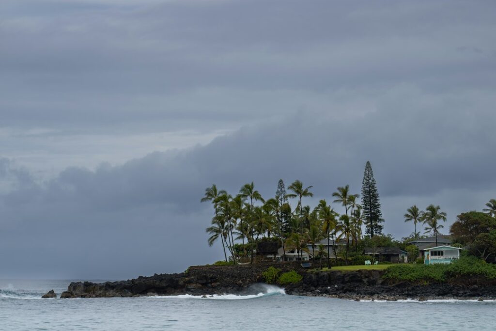
Waimanalo’s coastline stretches roughly five miles along the windward flank of Oahu, and the section known locally as Sherwood Forest — a shaded ironwood belt between Bellows and Waimanalo Bay Recreation Area — has confused first-time visitors for decades. The beach itself carries no signage announcing “Sherwoods,” and the ironwood canopy hides the shoreline until walkers step through the trunks onto open sand.
The confusion tightens because portions of this coast run behind Bellows Air Force Station, which limits weekday access, while other stretches sit inside Waimanalo Beach Park’s Kaiona Point district. Households moving to Windward Oahu often ask which lot corresponds to “Sherwoods,” where the sanctioned public gate opens, and whether the shorebreak behaves differently a few hundred yards north or south along the strand.
This research brief maps the ironwood grove parking, the public shoreline entry after the Bellows fence line, the Kaiona Point tidepool shelf, current shore-break patterns under standard trade winds, lifeguard tower coverage, restroom and shower placement, and side-by-side numbers against Waimanalo Bay Recreation Area so a visitor can choose the correct pull-off before leaving Honolulu.
Where the Sherwood Forest strand sits on the Waimanalo coast
The 5.5-mile Waimanalo coastal arc runs from Makapuu Point at the southern end to Wailea Point in the north. Sherwood Forest occupies the middle third, wedged between the fenced Bellows Air Force Station lands to the north and the public Waimanalo Beach Park district that surrounds Kaiona Point to the south. Kalanianaole Highway (Route 72) parallels the shore roughly 400 to 900 feet inland.
The “Sherwood Forest” nickname refers to the dense ironwood (Casuarina equisetifolia) grove planted decades ago behind the beach berm. The canopy shades a strip of sand and understory that averages 200 to 350 feet in depth from highway shoulder to water line. That shade — rare on windward beaches — is why locals name-check the grove first, then the water second.
Drivers approaching from Honolulu reach Sherwoods after crossing Makapuu Head via Kalanianaole Highway. Distance from downtown Honolulu measures about 15 miles; typical drive time is 30 to 45 minutes off-peak. The alternative route across the H-3 freeway tunnel to Kaneohe adds about 4 miles but avoids coastal traffic between Hawaii Kai and Makapuu Lookout.
Landmarks that anchor the drive
Southbound drivers use these visual cues in order: the Makapuu Lighthouse trailhead, Sea Life Park, Kaupo Beach Park, then the long straight stretch where the ironwood canopy first appears on the right shoulder. Signage for Waimanalo Beach Park comes before Sherwoods; the ironwood grove pull-offs begin roughly 0.7 miles further north along Kalanianaole Highway.
The ironwood grove parking layout
Sherwood Forest does not offer a paved lot with painted stalls. Instead, parking uses a chain of shoulder pull-offs and unpaved gaps inside the ironwood belt itself. Vehicle capacity across the informal grove parking totals roughly 120 to 180 cars on a busy Saturday, though local etiquette leaves lanes open for through-traffic and for beachgoers unloading gear.
Three access points serve the grove. The southernmost gap sits closest to the Kaiona Point tidepools; the middle gap opens to the widest shore-break section; the northernmost gap approaches the Bellows fence line where camping starts on weekends. The City and County of Honolulu maintains the shoulder easements but has not paved dedicated stalls.
Break-ins have been reported historically along all three access points. Signs at the grove entrances warn drivers not to leave valuables visible. Local outlets including Hawaii News Now and the Honolulu Star-Advertiser have covered periodic property-crime advisories tied to windward beach lots, so visitors typically travel with keys, phones, and no wallet.
Weekend versus weekday parking capacity
Weekday mornings between Tuesday and Thursday rarely fill more than 30% of the pull-offs. Weekend usage spikes sharply after 9 a.m., and by 11 a.m. on a Saturday during summer swell lulls, the ironwood shoulder can reach 90 to 100% occupancy. Visitors targeting shade for a full day typically arrive before 8:30 a.m. to secure a canopy spot.
Table 1 summarizes typical parking timing across the week.
| Day | Peak fill hour | Approx. spots free at 10 a.m. | Approx. spots free at 2 p.m. |
|---|---|---|---|
| Monday | 3 p.m. | 110 | 60 |
| Wednesday | 1 p.m. | 90 | 45 |
| Friday | 12 p.m. | 60 | 20 |
| Saturday | 11 a.m. | 15 | 0 |
| Sunday | 10 a.m. | 10 | 0 |
Sanctioned public shoreline access after Bellows
Bellows Air Force Station controls a fenced beach frontage north of Sherwoods that is only open to the general public from noon Friday through midnight Sunday, plus federal holidays. Outside those hours, the Bellows shoreline gate closes, and civilians must use the Sherwood Forest pull-offs or the Waimanalo Beach Park entrances further south.
The transition from Bellows-controlled sand to sanctioned public shoreline is not fenced at the water line, and Hawaii’s shoreline access laws grant the public passage along wet sand below the vegetation line. Beach walkers can therefore stroll north from Sherwoods into the Bellows frontage during weekends, but they cannot enter the military parking or camping areas without gate authorization.
Household relocation candidates researching windward stays should note that Bellows weekend camping is reserved for active-duty, retired, and Department of Defense-affiliated households. The general public cannot camp on Bellows sand. City-permitted camping is available further south inside the Waimanalo Bay Recreation Area, which operates under City and County of Honolulu park rules and a separate permit calendar.
Where the fence actually meets the beach
The Bellows perimeter drops down to the sand roughly 0.4 miles north of the northernmost Sherwood ironwood pull-off. Concrete blocks and low posts mark the boundary at the vegetation line. Signage reminds walkers that entering the treeline crosses into federal property. On weekend afternoons, uniformed staff sometimes patrol the boundary but rarely restrict shoreline transit along the wet sand.
Kaiona Point tidepool zone
Kaiona Point marks the low rocky headland at the southern end of Waimanalo Beach Park, roughly 1.2 miles south of the Sherwood Forest ironwoods. The point holds a shallow shelf of eroded volcanic rock that fills with tidepools at low tide. Water depth across the shelf ranges from ankle-deep to about 2 feet during a 0.3-foot low tide window.
Marine life visible in the pools includes small hermit crabs, juvenile reef fish, opihi limpets, and the occasional a’ama crab scuttling across dry rock. The Hawaii Department of Health’s Clean Water Branch posts periodic advisories for the Waimanalo shoreline after heavy rain, and visitors should check the beach-monitoring dashboard before wading into pools where runoff channels may drain.
The Kaiona shelf sits far enough from the deeper Sherwood shore-break that swimmers rarely mix the two zones. Families with young children often drive past the ironwood grove specifically to reach Kaiona for the calmer, contained tidepools, then walk north 0.6 miles along the wet sand toward Sherwoods for a shore-break experience later in the day.
Tide timing for the Kaiona shelf
The best tidepool windows fall around monthly spring low tides, when Waimanalo can see negative low tides in the -0.2 to -0.5 foot range. Neap tides in the +0.4 to +0.7 range still expose portions of the shelf. Windward Oahu experiences a mixed semi-diurnal cycle with two highs and two lows daily. Visitors targeting pool exposure should aim for the morning low before trade winds strengthen.
Windward shore-break behavior in trade-wind conditions
Sherwood Forest sits on an east-facing shoreline that receives the standard windward Oahu wind and swell pattern. Trade winds from the east-northeast blow 10 to 25 mph across the sand for roughly 70% of the calendar year, with the strongest sustained trades typically in June, July, and August. Wind chop stacks on top of open-ocean swell to produce the classic Waimanalo shore-break.
The dominant swell direction varies seasonally. During Hawaii’s south-shore summer window from May through September, north- and east-swell energy drops, and the windward shore-break can soften to knee-high dumpers. Winter delivers more north-northeast swell that wraps around Makapuu; wave faces at Sherwoods commonly reach 3 to 6 feet on those days. The Hawaii surf-season calendar tracks the seasonal split in more detail.
The physical setup — a steep sand berm, shallow inner shelf, and abrupt drop just past the shorebreak — makes for a punchy, board-throwing wave that produces frequent minor injuries. Body-surfers and body-boarders favor Sherwoods precisely because of this steep, close-out shape. Stand-up swimmers unfamiliar with dumping waves should stay near the shore edge or move south to the gentler Kaiona water.
How vog interacts with trade-wind days
Sherwood Forest sits upwind of the Kilauea vog plume in most trade-wind patterns, so air quality along the Waimanalo shoreline typically stays cleaner than leeward Honolulu. The vog direction and trade-wind chart outlines when Kona wind reversals can push haze into windward air. During Kona events, visibility across the bay can drop from 30-plus miles to under 8 miles.
Lifeguard tower coverage across the strand
The Honolulu Ocean Safety division staffs two permanent lifeguard towers along the Waimanalo-Sherwoods corridor. Tower 3W stands inside Waimanalo Beach Park near the Kaiona Point end; Tower 3E covers the central Waimanalo Bay Recreation Area entrance further north. Sherwood Forest itself, sitting between the two, has no dedicated tower — a critical detail for parents planning where to sit.
Standard staffed hours run 9 a.m. to 5:30 p.m. daily. Response times from Tower 3W to a distressed swimmer at the southern Sherwood grove pull-off are estimated at 3 to 5 minutes on foot across the sand. From Tower 3E to the northern grove pull-off, response is similar. The middle grove pull-off — deepest into the unpatrolled gap — is the highest-risk seat.
Waimanalo has recorded multiple shorebreak spinal injuries per year according to City ocean-safety statistics referenced by Honolulu Civil Beat and the Star-Advertiser. Injuries cluster on holiday weekends when tower staff can be overwhelmed by simultaneous rescues. Anyone unsure of shorebreak reading should stay within a 200-yard sightline of a staffed tower.
How to signal for help without a tower nearby
- Raise one arm straight overhead — universal ocean-distress signal.
- Send a companion running toward the nearest tower rather than swimming out.
- Call 911 and request Ocean Safety dispatch to Waimanalo Beach Park.
- Note the nearest pull-off number to give dispatch a precise access point.
- Do not attempt untrained rescues in dumping shorebreak.
Restrooms, showers, and gear placement
Fixed restroom and shower facilities are not built inside the Sherwood Forest ironwood belt. Visitors staged inside the grove use the facilities at either bookend: Waimanalo Beach Park near Kaiona Point or Waimanalo Bay Recreation Area to the north. Walking distance from the middle Sherwood pull-off to the nearest restroom measures approximately 0.8 miles along the sand.
Waimanalo Beach Park facilities include two restroom blocks, four outdoor rinse showers, three covered picnic pavilions, and a small playground. Waimanalo Bay Recreation Area, immediately north, offers additional restrooms plus the primary campground for city-permitted overnight stays. Both parks maintain drinking water spigots, though pressure and reliability vary — visitors typically pack 1 to 2 gallons per person for a full beach day.
Table 2 compares facility counts across the three Waimanalo-corridor access points.
| Facility | Waimanalo Beach Park | Sherwood Forest grove | Waimanalo Bay Rec Area |
|---|---|---|---|
| Restroom blocks | 2 | 0 | 2 |
| Rinse showers | 4 | 0 | 4 |
| Picnic pavilions | 3 | 0 | 6 |
| Lifeguard towers | 1 (3W) | 0 | 1 (3E) |
| Campground | No | No | Yes (permit) |
| Paved parking stalls | ~45 | 0 | ~85 |
What to bring in the absence of grove facilities
- Portable shade — the ironwoods drop needles constantly onto blankets.
- Two towels per person: one for sand, one dry for the drive.
- Water in insulated bottles; the grove hits 84°F on summer afternoons.
- Cash for the roadside shrimp trucks along Kalanianaole Highway.
- Rash guard for children — shorebreak scrapes are the top injury.
The 5-mile shoreline strand: Sherwoods versus Waimanalo Bay Recreation Area
Sherwood Forest and Waimanalo Bay Recreation Area (WBRA) sit on the same continuous sand strand but present very different visitor experiences. WBRA offers formal camping, developed pavilions, wider paved parking, and a broader shorebreak playing field with two lifeguard towers historically rotating coverage. Sherwoods offers dense shade, minimal formal infrastructure, and access to the Kaiona tidepool shelf 1.2 miles south.
The choice between the two often depends on group size and shade priority. Solo travelers, couples, and families with young children who value canopy shade tilt toward the Sherwood ironwoods. Larger family gatherings and multi-day campers tilt toward WBRA. Households moving from mainland climates who have not experienced the direct-noon UV load on windward Oahu often underestimate how quickly full-sun beaches burn.
Weekend crowd density differs meaningfully as well. WBRA sees higher per-square-foot occupancy on Saturday afternoons because the paved lot fills first and pushes overflow into the ironwood grove. Sherwoods therefore acts as a pressure valve. When both fill, visitors either continue north to Bellows (weekend-only) or south to Waimanalo Beach Park to attempt the Kaiona-side lots.
Numeric comparison at a glance
Table 3 summarizes how the two access points differ across measurable factors.
| Factor | Sherwood Forest grove | Waimanalo Bay Rec Area |
|---|---|---|
| Distance from Honolulu | 15 miles | 16 miles |
| Off-peak drive time | 35 min | 38 min |
| Parking capacity | ~150 shoulder | ~85 paved |
| Shade coverage | Dense ironwood | Sparse open lawn |
| Lifeguard tower on site | No | Yes (3E) |
| Camping permit | Not allowed | City permit required |
| Restrooms on site | 0 | 2 blocks |
| Sand strand length | ~1.5 mi | ~1.6 mi |
| Typical shorebreak height | 1–4 ft summer / 3–6 ft winter | 1–4 ft summer / 3–6 ft winter |
| Weekend fill hour | 11 a.m. | 10 a.m. |
Timing the visit around trades, tides, and sunlight
Windward Oahu weather typically follows a predictable morning-to-afternoon arc. Sunrise at Waimanalo falls between 5:50 a.m. in June and 7:10 a.m. in December. Trade winds are lightest at dawn, often 5 to 10 mph, before strengthening to 15 to 22 mph by early afternoon. Water temperature runs 75 to 78°F in winter and 78 to 82°F in summer.
Early arrivals catch calmer water, quieter shore-break shapes, and easier parking. By 10 a.m. the ironwood shade begins to extend past the berm line, giving mid-morning setups the widest usable canopy. Late-afternoon visits benefit from cooling trade breezes and softer light for photography, though the shore-break tends to look larger as the tide swings.
Rainfall patterns matter for beach planning. Waimanalo receives roughly 40 to 45 inches of rain annually, most falling in the November-through-March wet season. Windward showers pass quickly — 5 to 20 minutes — but stacked cells can wet a beach day for hours. Radar-checking before departure prevents wasted trips, and the Kaiona tidepool side dries faster than the exposed shore-break section.
How to pair Sherwoods with nearby windward stops
The Sherwood Forest visit pairs efficiently with several other windward destinations for a full day. Reserving a slot at Hoomaluhia Botanical Garden in Kaneohe before a morning beach session works well. Adventurous hikers add the Lanikai pillbox sunrise climb beforehand, though pillbox parking bans require careful planning.
Safety, hazards, and shoreline etiquette
Shorebreak-related neck and shoulder injuries top the Waimanalo incident log annually. City Ocean Safety historically classifies Waimanalo among the top-five injury beaches on Oahu. Visitors accustomed to gentle mainland surf — Gulf Coast, Chesapeake, Southern California summer — often mistake the steep wave face for something a child can body-surf safely.
The second common hazard is Portuguese man-of-war stings, which arrive on windward beaches after sustained east-northeast winds push them ashore. Sightings peak in the weeks following a full-moon phase. Beach warning flags posted by Ocean Safety at the two towers indicate current conditions; the middle Sherwood grove lacks flag signage entirely.
Property crime and car break-ins remain the third-most-cited concern in local reporting. Visitors leaving vehicles inside the ironwood grove routinely travel with backpack, keys, and phone only. Insurance considerations for household relocations — including how deductibles interact with rental-car policies — can be reviewed alongside the broader Hawaii healthcare cost guide when planning a move.
Local etiquette that keeps access open
- Do not park across driveways or private-lot entries along the highway shoulder.
- Pack out every piece of gear — the grove has no trash service.
- Keep music at conversational levels; residential homes back onto the highway.
- Yield the shorebreak line to local body-surfers who know the sand shifts.
- Rinse gear at Waimanalo Beach Park showers before returning to a rental vehicle.
Community context of the Sherwoods name and ironwood plantings
The “Sherwood Forest” nickname predates most current maps and refers, according to community lore documented in local coverage over the decades, to the dense canopy that made the grove feel like the mythical woodland setting. Ironwood trees were introduced across coastal Hawaii for erosion control and windbreak function, and Waimanalo received extensive plantings during mid-20th-century public-works programs.
Ironwoods are non-native and drop dense needle mats that suppress native understory. Environmental agencies including the Hawaii Department of Health and state land-management staff periodically evaluate whether to thin plantings for native restoration versus preserve them for community shade. The trees also stabilize the sand berm behind the shore-break, a function locals value during winter high-surf months when erosion accelerates.
The Waimanalo community itself has advocated for keeping the grove wild rather than paving formal lots. Residents through the Waimanalo Neighborhood Board have historically pushed back against tourism-oriented development along this stretch. Visitors who research the corridor before arriving generally find a warmer welcome by treating the grove as a residential park rather than a tourist attraction.
Language and place names to know
- Waimanalo: “potable water” in Hawaiian — reflects historic springs.
- Kaiona: local name tied to a mo’o (water spirit) traditionally associated with the point.
- Koolau: the mountain range towering behind the coast to the west.
- Kalanianaole: the highway named after Prince Jonah Kuhio Kalanianaole.
- Makapuu: the southern point marking the corridor’s start for southbound drivers.
Choosing Sherwoods versus other Oahu beach days
Visitors weighing an Oahu itinerary often compare Waimanalo Sherwoods against the North Shore winter break, the West Side desert beaches, or Waikiki’s sheltered flat water. Each shoreline reflects a different Oahu experience. The Waimanalo-Sherwoods strand offers powerful windward sand, dense shade, and a resident local community that makes the beach feel like a neighborhood park rather than a tourist plaza.
For households evaluating a longer stay on the island, day trips across regions help build a mental map. A morning at Sherwoods paired with an afternoon drive to the North Shore neighborhoods illustrates how dramatically Oahu’s coastlines differ. Similarly, a leeward day at the Waianae coast demonstrates the west-side aridity contrast.
Historical and cultural stops such as the Arizona Memorial at Pearl Harbor require advance ticket reservations through Recreation.gov. Sherwoods pairs poorly with Pearl Harbor as a same-day itinerary because of the traffic circuit around Honolulu, so most researchers split those visits across separate days.
Sherwoods versus the west-side Kaena Point corridor
Windward Sherwoods and the far-western Kaena Point albatross reserve occupy opposite ends of Oahu — physically and experientially. Sherwoods is shaded, accessible, and family-friendly. Kaena Point demands a 5-mile round-trip walk across open lava and dry brush. Visitors researching an Oahu week typically allocate one day to each rather than attempting both back-to-back.
Frequently asked questions
Is Sherwood Forest beach free to enter?
Yes. Parking along the Kalanianaole Highway shoulder inside the ironwood grove costs nothing, and there is no entry fee for the sand or water. The adjoining Waimanalo Beach Park and Waimanalo Bay Recreation Area also charge no day-use fee. Campground permits at WBRA carry a separate City and County of Honolulu permit fee and require advance reservation.
Where exactly does the Bellows public access weekend gate open?
Bellows Beach opens to the general public from noon Friday through midnight Sunday, plus federal holidays. The main entry gate sits on Tinker Road off Kalanianaole Highway, roughly 1.3 miles north of the northernmost Sherwood grove pull-off. Outside the sanctioned window, only Department of Defense-affiliated households may enter. Public shoreline transit along wet sand is still permitted below the vegetation line at all hours.
Are the Kaiona Point tidepools safe for children?
Kaiona Point tidepools are among the calmer wading spots on the Waimanalo corridor when tide, wind, and swell align. Best conditions come at low tide during trade-wind days without a strong east-northeast swell. Rock surfaces are sharp, so reef shoes are recommended. Parents should still supervise closely; sudden wave sets can wash over the shelf even in otherwise calm windows.
How long is the walk from Sherwoods to the nearest restroom?
From the middle ironwood grove pull-off, the walk south along the sand to the Waimanalo Beach Park restroom block near Kaiona measures approximately 0.8 miles, or 15 to 20 minutes at beach pace. Walking north to the Waimanalo Bay Recreation Area restrooms is a similar distance. There are no restrooms or portable toilets inside the ironwood grove itself.
Is there mobile phone signal at Sherwood Forest beach?
Coverage across the Waimanalo corridor varies by carrier. Major networks generally provide usable 4G LTE signal across the ironwood grove and open beach because towers on the Koolau ridge line above the highway have relatively clear line-of-sight. Data speeds slow noticeably on peak weekend afternoons when hundreds of visitors share the same sectors. Emergency 911 calls have historically connected reliably from the sand.
Which is better for a first visit: Sherwoods or Waimanalo Bay Recreation Area?
Neither is objectively better. First-time visitors seeking shade, quiet, and a shorter walk to Kaiona Point tidepools tend to prefer the Sherwood Forest ironwood grove. Groups wanting picnic tables, lifeguard-tower proximity, restrooms, and paved parking generally choose Waimanalo Bay Recreation Area. Many households sample both across a two-visit itinerary before deciding which access point suits their household style.
What is the difference between Waimanalo Beach Park and Waimanalo Bay Recreation Area?
Waimanalo Beach Park sits at the southern end of the strand near Kaiona Point and offers a smaller pavilion cluster, a playground, and the Tower 3W lifeguard station. Waimanalo Bay Recreation Area sits further north beyond the Sherwood grove, offers the primary campground with City permits, more pavilions, and the Tower 3E lifeguard station. Both share the same continuous sand.


