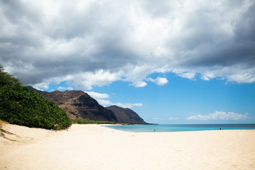
Farrington Highway (Route 93) runs roughly 40 miles from Kapolei out to the pavement’s end at Yokohama Bay, and the fuel infrastructure thins fast once drivers leave the H-1 interchange. Households relocating to Nanakuli, Maili, Waianae, or Makaha inherit a specific refueling geography — three name-brand stations, a handful of cash-only pumps, and a stretch of empty coastline where a low tank becomes a real problem.
The coast’s isolation shapes prices too. Retail gasoline on the Waianae side runs $0.30 to $0.60 per gallon above Central Oahu averages, driven by low station density, tanker delivery costs, and captive weekday commuter demand. Kaena Point trekkers, weekend beachgoers, and residents commuting to Honolulu jobs share the same three pumps, which fills the queues on Sunday afternoons and Friday nights.
This guide sequences the fuel points from east to west, catalogs typical prices against Central Oahu benchmarks, flags cash-only backup options, and lays out a refueling plan for anyone driving past Makaha toward the Ka’ena Point Natural Area Reserve. Every station listed is confirmed operational as of the most recent field surveys and state fuel-market data.
The Farrington Highway fuel corridor at a glance
Farrington Highway is the only paved arterial serving the Waianae Coast, tracing the shoreline from Kalaeloa in the south to Ka’ena Point on the far northwest. The road carries roughly 25,000 vehicles per day near Nanakuli and drops to under 5,000 by Makaha, according to Hawaii DOT traffic counts. Fuel stations mirror that density curve — more pumps clustered near Nanakuli, fewer as the highway heads west.
The three name-brand stations on the coast — Chevron Nanakuli, 76 Waianae, and Aloha Petroleum Makaha — sit roughly 4 to 6 miles apart. That spacing feels generous compared with a rural mainland corridor, but the practical range for planning purposes assumes a stopover only during station operating hours, which are shorter than urban Honolulu benchmarks.
Approximate station spacing
| Station | Mile marker (approx) | Miles from H-1 | Miles to next station west |
|---|---|---|---|
| Chevron Nanakuli | MM 9 | 7 | 5.2 |
| 76 Waianae | MM 14 | 12 | 3.8 |
| Aloha Makaha | MM 18 | 15.5 | 7.5 (to Yokohama) |
| Yokohama Bay (road ends) | MM 25 | 23 | N/A |
Chevron Nanakuli: the first coast station heading west
Chevron Nanakuli sits on Farrington Highway near the Nanaikapono Elementary neighborhood, roughly seven miles past the Kalaeloa interchange where H-1 hands off to Route 93. Drivers heading west from Kapolei will see it on the makai (ocean) side of the highway, immediately after the Nanakuli Village shopping center. The station typically opens at 5:00 AM and closes by 10:00 PM, with 24-hour pay-at-pump access available on most credit cards.
The Nanakuli forecourt runs six standard dispensers with regular (87 octane), plus (89), and premium (91), plus one diesel pump on the westernmost island. Prices here tend to be the lowest on the coast — often $0.05 to $0.15 per gallon cheaper than the Waianae or Makaha stations, since the location is closest to the tanker route from the Campbell Industrial Park refinery corridor.
The attached convenience store carries a limited grocery selection alongside standard fuel-stop items. ATMs charge a $3.50 surcharge, and the store accepts EBT for eligible items. Restrooms require a code from the cashier and are inside the retail building, not on the forecourt. Weekend evenings see steady traffic from residents returning from Central Oahu jobs.
76 Waianae: mid-coast anchor with the widest hours
The 76 station in Waianae town sits along Farrington Highway near the intersection with Lualualei Homestead Road, about 12 miles past the H-1 interchange. It functions as the operational heart of the Waianae Coast fuel network — the busiest of the three, the one most likely to be open past 10:00 PM, and typically the last stop for coast residents driving home from a late Honolulu shift.
Pump availability includes regular, plus, premium, and diesel. The forecourt has eight dispensers, most equipped with tap-to-pay contactless readers alongside standard chip readers. The 76 in Waianae accepts every major fleet card, which matters for landscaping crews, delivery drivers, and DOT contractors who work the coast on weekly routes.
Adjacent to the station is a strip mall with a McDonald’s, a bank, and a small pharmacy — the most concentrated retail cluster between Nanakuli and Makaha. Waiting queues here can stretch to 10 minutes on Sunday afternoons when the Waianae Farmers Market ends and beach traffic returns from Poka’i Bay. Weekday mornings between 5:00 and 7:00 AM see similar backups from commuters heading toward town.
Why 76 Waianae sees the heaviest coast traffic
Household demand concentrates here because Waianae town itself holds roughly 13,000 residents, making it the largest population center on the coast. The station’s 24-hour pay-at-pump also draws overnight demand from Kalaeloa-based commercial vehicles. Regulars report that the Sunday evening top-off is the most crowded window, corresponding to the return trip from weekend visits with family in Ewa or Kapolei.
Aloha Petroleum Makaha: the last pumps before Yokohama
The Aloha station in Makaha is the final full-service fuel point on the Waianae Coast before Farrington Highway thins into the pavement leading to Yokohama Bay. Located roughly 15 miles from the H-1 interchange and 7.5 miles from where the paved road ends near Kaena Point trailhead parking, this station is the definitive last-tank-top-off for anyone planning a Ka’ena Point round trip.
Aloha Makaha runs four dispensers with regular, plus, and premium — but no diesel as of the most recent survey. Drivers of diesel vehicles heading toward Ka’ena Point must fuel at 76 Waianae or earlier. The station typically operates from 6:00 AM to 9:00 PM, with the pay-at-pump kiosk accessible outside those hours for credit card holders.
Prices at Aloha Makaha typically run the highest of the three coast stations, often $0.10 to $0.25 per gallon above the Chevron in Nanakuli. The convenience store is smaller than the Nanakuli or Waianae counterparts, carrying essentials — bottled water, packaged snacks, sunscreen, and cheap flip-flops. Restroom access requires a purchase or a $1 fee for non-customers, per posted signage.
What Makaha lacks that matters for out-of-towners
The Makaha station does not have an ATM inside the building, though the strip mall next door has one that charges $4.00. There is no air pump on the forecourt; travelers who need tire inflation should handle it at the 76 Waianae. Trekkers should top off water bottles at the store’s cooler section since there is no potable water tap between Makaha and Yokohama.
Price premium: what Waianae pumps cost versus Central Oahu
Retail gasoline on the Waianae Coast consistently runs above the Central Oahu benchmark, and understanding the spread helps households budget accurately. The state average for regular unleaded on Oahu hovered near $4.70 per gallon through 2025, based on EIA weekly retail gasoline data and AAA reporting. Waianae Coast stations typically post $0.30 to $0.60 per gallon above that baseline.
The drivers of that premium are structural rather than seasonal. Fuel deliveries to the coast travel by tanker along the same 15-to-25-mile route from the Campbell Industrial Park storage terminals, but low daily volume per station means fixed delivery cost gets spread across fewer gallons. Retail competition is limited to three name-brand outlets, which lets each station hold pricing power that would erode in a denser market.
Households relocating to Nanakuli or Waianae from mainland cities with 50-cent-spread suburbs may still find the coast premium jarring because Central Oahu prices are already among the highest in the United States. A relocating family driving 12,000 miles per year in a 25-mpg vehicle spends roughly $190 to $290 more annually on fuel by pumping on the coast versus filling in Kapolei on the daily commute home.
Typical coast versus Central Oahu pump prices
| Location | Regular ($/gal) | Plus ($/gal) | Premium ($/gal) | Diesel ($/gal) |
|---|---|---|---|---|
| Chevron Nanakuli | $4.95 | $5.19 | $5.42 | $5.65 |
| 76 Waianae | $5.09 | $5.33 | $5.56 | $5.79 |
| Aloha Makaha | $5.19 | $5.43 | $5.66 | N/A |
| Kapolei (Costco) | $4.38 | $4.62 | $4.85 | $4.99 |
| Aiea (76 station) | $4.65 | $4.89 | $5.12 | $5.35 |
Costco Kapolei consistently posts the lowest fuel prices reachable from the Waianae Coast, with a spread of $0.55 to $0.85 per gallon below Nanakuli. That gap justifies a Kapolei detour on the way home from town for households with 20-gallon tanks, since a full fill saves roughly $12 to $17. Membership requirements and Sunday afternoon queues of 20+ vehicles complicate the routine.
Cash-only rural options and independent pumps
Beyond the three name-brand stations, the Waianae Coast supports a small tier of independent fuel outlets that operate on a cash-first or cash-only basis. These pumps serve fishing crews, construction contractors working coast job sites, and residents who prefer not to leave a card trail with major oil companies. Their locations and hours shift more often than the branded stations.
The most reliable independent option historically has been the Maili Store area pumps, though operators have rotated over the past decade. Payment is cash in advance at the counter, no pay-at-pump. Prices sometimes undercut the branded stations by $0.05 to $0.10 per gallon when the operator receives a favorable wholesale delivery, but supply is inconsistent enough that no household should rely on them as a primary refueling plan.
Travelers heading west with only credit or debit should assume the three name-brand stations are the only viable fuel points. Cash-only pumps also skip the octane variety — most independent locations sell only regular unleaded 87, with no premium or diesel. This constrains their utility for turbocharged or diesel-equipped vehicles common among coast landscaping and construction crews.
Backup fuel strategy for the coast
- Carry $40 to $60 in small bills when driving past Waianae town westbound.
- Never assume an independent pump is open on a Sunday or holiday.
- Confirm current cash-only operator status by asking at the Waianae 76 counter.
- Keep a 5-gallon marine-grade jerry can in the vehicle for Kaena runs.
- Diesel drivers must plan around 76 Waianae as the westernmost diesel point.
Fueling for the Ka’ena Point trek from Yokohama Bay
The Ka’ena Point Natural Area Reserve sits at Oahu’s far northwestern tip, reachable by a roughly 5-mile round-trip trek along the coastal dirt track that begins where Farrington Highway ends near Yokohama Bay. Trekkers driving from Honolulu or Central Oahu should treat Aloha Makaha as the last commercial fuel point, since the 7.5-mile stretch beyond it has no services of any kind.
The Ka’ena Point west trek to the albatross colony is a full-day commitment for most visitors, especially during the November-through-July Laysan albatross nesting season when trailhead traffic peaks. A vehicle sitting at Yokohama for 4 to 6 hours in direct sun with a low tank offers no useful reserve for the return drive if traffic backs up or a coast station has closed early.
Conservative planning assumes the vehicle needs at least a half tank at the Yokohama trailhead. That covers the 23-mile drive back to the H-1 interchange plus a margin for detours to Poka’i Bay or a swim stop at Makaha. Trekkers driving rental cars should check the fuel gauge before leaving Waikiki since Waikiki-to-Ka’ena round trip totals roughly 90 miles on a single-tank rental workflow.
Fuel planning distances from Waikiki to Ka’ena Point
| Leg | Distance (mi) | Typical drive time | Fuel used at 28 mpg (gal) |
|---|---|---|---|
| Waikiki to Kapolei (Costco fill) | 21 | 30 min | 0.75 |
| Kapolei to Aloha Makaha | 15.5 | 25 min | 0.55 |
| Aloha Makaha to Yokohama trailhead | 7.5 | 15 min | 0.27 |
| Yokohama round-trip trek (walking) | 5 (foot) | 2.5 hrs | 0 |
| Yokohama back to Waikiki | 44 | 75 min | 1.57 |
| Total driving loop | 88 | 2h 25m | 3.14 |
Households comparing this planning problem to other Hawaii fuel-scarce corridors will recognize familiar patterns. The Waianae setup echoes the Paia-to-Hana fuel cadence on Maui and the Chain of Craters rim-to-sea fuel plan in HVNP, where the last pump before a long unserviced stretch dictates whole-day logistics.
Timing runs to avoid weekend surges and holiday closures
Coast stations run on schedules that reflect local household demand more than tourist flow, which creates distinct queue patterns. Sunday afternoons between 3:00 and 6:00 PM see the heaviest congestion at 76 Waianae, driven by families returning from the Kapolei big-box stores. Friday evenings between 5:00 and 7:00 PM saturate all three stations with commuters and Poka’i Bay beach traffic.
Holiday closures matter more on the coast than in urban Honolulu. Chevron Nanakuli and Aloha Makaha typically close by 6:00 PM on Christmas Eve and Thanksgiving, while 76 Waianae maintains its pay-at-pump kiosk 24 hours but shutters the store. New Year’s Day sometimes sees the Makaha station open only from noon to 5:00 PM. Household planning should assume shortened holiday hours across all three brands.
The best refueling windows for out-of-town visitors driving to the coast are weekday mornings before 10:00 AM and weekday evenings after 8:00 PM. Both windows see pump availability without queues. Sunday morning before 9:00 AM also runs empty at all three stations, since local congregations attend services and beach traffic has not yet built.
Weekly demand pattern on coast pumps
- Monday-Thursday 5-7 AM: commuter surge at Nanakuli and Waianae.
- Friday 5-7 PM: pre-weekend fill-up at all three coast stations.
- Saturday 8-10 AM: beach-day fills at 76 Waianae and Aloha Makaha.
- Sunday 3-6 PM: heaviest weekly congestion across the corridor.
- Weeknight 10 PM-5 AM: kiosk-only access at Chevron and 76.
Safety, payment security, and pump-etiquette norms on the coast
The Waianae Coast has a reputation among Oahu residents for higher property crime rates than the East side of the island, and fuel stations feature in that reputation. Honolulu Police Department data shows elevated vehicle break-in incidents in the Nanakuli-to-Maili section, particularly overnight. Households and visitors should treat fuel stops as brief, purposeful transactions rather than extended breaks with valuables visible.
Skimmer devices have been reported on coast pumps periodically, following patterns seen across Oahu since 2019. Best practice at any coast station involves paying at the register when possible, using a credit card rather than debit, and inspecting the card reader for loose bezels or misaligned scanner overlays before inserting. Contactless tap-to-pay at 76 Waianae bypasses the swipe reader entirely.
Local etiquette on the coast values a fast pump-and-go — long idling in a pump lane while checking phones or organizing groceries draws visible frustration from residents queued behind. The unwritten rule is fuel, pay, move to a parking spot for anything else. This norm holds especially firm at 76 Waianae during the Sunday evening congestion window.
Pump-side safety checklist
- Inspect card readers for loose or mismatched bezels before inserting.
- Keep windows up and doors locked while pumping fuel.
- Move away from the dispenser immediately after completing payment.
- Do not leave phones, wallets, or backpacks visible on the seat.
- Report suspicious card-reader hardware to the station cashier.
EV charging gaps and hybrid strategy on the Waianae Coast
Electric vehicles face a distinct challenge on the Waianae Coast. As of the most recent Hawaii Department of Transportation charging network map, the corridor west of Kapolei has minimal DC fast-charging coverage. The nearest reliable Level 3 fast charger for coast residents sits at the Ka Makana Ali’i mall in Kapolei, roughly 12 miles east of Nanakuli.
Level 2 charging on the coast is sparse — the Ko Olina Resort area has hotel-guest chargers, and Waianae Coast Comprehensive Health Center has a small public installation. There is no charging infrastructure west of Waianae town. EV drivers planning a Ka’ena Point trek must complete a full round trip on battery reserves loaded before leaving the H-1 corridor.
Hybrid vehicle strategy is currently the pragmatic middle ground for coast households. A plug-in hybrid recharged overnight at home covers the daily Waianae-to-Kapolei commute on battery, then switches to gasoline for weekend Ka’ena runs. Toyota RAV4 Prime and Ford Escape plug-in models are increasingly visible in Waianae town driveways for exactly this reason.
Households comparing Oahu EV coverage to other corridors may want to reference the H-3 windward freeway route or the Tantalus Drive ridge circuit where charging density is higher because those corridors sit closer to Honolulu proper.
Combining fuel stops with coast recreation and beach access
Residents and visitors rarely make a dedicated trip out to the Waianae Coast just to buy gasoline. Fuel stops typically bundle into weekend beach runs, hikes, or restaurant outings. That framing changes the calculus — the price premium is easier to accept when the fill-up serves as a functional pause between activities rather than a standalone errand.
Poka’i Bay Beach Park, one of the safest swimming beaches on the coast, sits half a mile from the 76 Waianae station. Makaha Beach, world-famous for winter surf, sits within 1.5 miles of Aloha Makaha. Both make natural pairings with a fuel stop on the way in or out. The ranked list of Oahu beaches details several coast options worth planning around.
Combined-trip planning also reduces effective miles-per-gallon costs. A household that drives out to Waianae for a beach afternoon and returns with a full tank has amortized the drive across the recreational value of the trip. Trekkers extending the day to the Ka’ena Point albatross viewing gain even more per-mile value from the same fuel spend.
For readers weighing the coast against other Oahu outings that require less fuel planning, the urban East side and Windward corridors both offer day trips that stay well within dense refueling coverage. Those alternatives suit visitors who prefer a lower-logistical-load trip and want to skip the coast price premium entirely.
Long-term household budgeting for Waianae Coast fuel spend
Relocating households looking at Nanakuli, Maili, Waianae, or Makaha rentals should model fuel as a distinct line item rather than folding it into a generic transportation budget. The combination of coast price premiums, long commute distances to Honolulu jobs, and limited transit alternatives can add $150 to $300 per month to household spend compared with the same household living in Ewa Beach or Mililani.
A two-vehicle household commuting to downtown Honolulu from Waianae town averages roughly 44 miles per day per vehicle for the commute alone. At 25 mpg and $5.10 per gallon, that translates to about $9.00 per vehicle per day, or roughly $180 per month per vehicle in commuting fuel alone before any weekend or errand driving. Two vehicles push the annual fuel cost past $4,500.
Public transit alternatives exist but constrain schedules. TheBus Route 40 runs from Makaha through Waianae town to Kapolei and Honolulu, with travel times of 90 to 120 minutes each way from Waianae to downtown. Many coast households run one vehicle for the working spouse’s commute and rely on TheBus for the second adult, which shifts the fuel budget calculation significantly.
Annualized coast fuel cost estimates
| Household profile | Miles/year | Avg MPG | Avg price/gal | Annual fuel spend |
|---|---|---|---|---|
| Single commuter, sedan | 13,000 | 32 | $5.05 | $2,052 |
| Two-vehicle Waianae commute | 26,000 | 26 | $5.10 | $5,100 |
| Retiree, minimal driving | 6,500 | 28 | $5.05 | $1,172 |
| Contractor pickup, coast jobs | 18,000 | 18 | $5.55 | $5,550 |
| Hybrid commuter, Prius | 13,000 | 50 | $5.05 | $1,313 |
The Honolulu CPI transportation category tracked by the Bureau of Labor Statistics captures some of this pressure, though the coast premium sits above the metro average. Cross-referencing that with the Hawaii state electricity profile illustrates why energy costs consume a larger share of household income on Oahu than in most mainland metros.
State-level fuel taxes also contribute. The Hawaii Department of Taxation collects a state fuel tax of roughly 16 cents per gallon, with additional county surcharges that push the combined tax burden above 50 cents per gallon in Honolulu County. These figures feed directly into pump prices at every coast station.
Comparing Waianae Coast fuel logistics to other Hawaii scenic routes
Understanding the Waianae Coast fuel geography in isolation misses useful context. Hawaii offers several corridors where the last-pump-before-remote-area planning problem repeats with slightly different variables, and cross-referencing helps households calibrate expectations before committing to a coast residence or a full-day trek out to the west end.
Maui’s Hana Highway offers the closest analog. The Paia-to-Hana mile-marker sequence shows how fuel stations become progressively rarer as the road winds east, with Paia and Ha’iku carrying the last reliable pumps before Hana town itself. The Waianae situation is less severe — Aloha Makaha covers the coast better than any single Maui station covers eastbound Hana traffic.
The Big Island’s Chain of Craters Road inside Hawaii Volcanoes National Park presents the most dramatic version of the problem. There are zero fuel points inside the park; drivers must fill in Volcano Village or Pahoa before entering. The Waianae Coast setup is comparatively forgiving because coast stations exist between the H-1 interchange and the trailhead, whereas HVNP offers nothing between park entrance and the sea.
Kauai’s north shore around Kilauea Point and the Big Island’s Pololu Valley Kohala switchback both feature similar fuel-thinning patterns, though each has one or two additional pumps compared with the Waianae setup. The Waianae Coast falls into the middle of the Hawaii fuel-scarcity spectrum overall.
Frequently asked questions
How much gas do drivers actually need for a full Waianae Coast day trip from Waikiki?
A round trip from Waikiki to Yokohama Bay covers roughly 88 miles total. A vehicle achieving 28 mpg burns approximately 3.14 gallons for the driving portion alone. Adding a margin for detours to Poka’i Bay or Makaha Beach brings the practical fuel requirement to about 4 gallons, which is comfortably one-quarter tank on most sedans and SUVs.
Is it worth driving back to Kapolei Costco to save money on gas?
For a 20-gallon fill, the Kapolei Costco spread of $0.55 to $0.85 per gallon under Nanakuli prices saves $11 to $17. That justifies a detour only if the household is already driving through Kapolei for other errands. Adding a dedicated 24-mile round trip from Waianae town for fuel alone rarely pencils out once time and additional fuel burn are factored in.
Which coast station has the safest overnight parking for stranded travelers?
None of the three name-brand coast stations offer secure overnight parking, and residents strongly discourage sleeping in vehicles at any of them. Travelers needing an overnight base near the coast should book lodging in Ko Olina or Kapolei instead. The Waikiki versus Ko Olina lodging tradeoff outlines both options in detail for first-time visitors weighing the coast.
Are diesel pickups and RVs served by the Waianae Coast fuel stations?
Chevron Nanakuli and 76 Waianae both offer diesel at standard automotive dispensers suitable for pickups and small RVs. Aloha Makaha does not carry diesel as of recent surveys. Larger Class A motorhomes may find the pump lanes tight; the 76 Waianae forecourt handles them best. Diesel drivers heading toward Ka’ena Point must plan around 76 Waianae as the westernmost diesel point.
What happens if a vehicle runs out of gas past Makaha?
The stretch from Aloha Makaha to Yokohama Bay is 7.5 miles of two-lane road with no shoulder services. A stranded driver would need to call AAA or a private tow, both of which may take 60 to 90 minutes to reach the coast on a busy weekend. Cell coverage is thin near Yokohama; a call may need to happen from higher elevations further east.
How often do coast gas prices change during the year?
Waianae Coast pump prices generally follow the state trend covered by the Star-Advertiser and Civil Beat. Adjustments typically arrive 1 to 2 weeks after Oahu-wide changes, and the spread between coast and Central Oahu widens when wholesale prices rise. December and July are the historically most expensive months for coast pump prices.
Are there restrooms at all three coast stations?
All three name-brand coast stations offer restrooms, but access varies. Chevron Nanakuli requires a code from the cashier for its inside restroom. 76 Waianae has separate exterior restrooms accessible during business hours. Aloha Makaha requires either a purchase or a posted $1 non-customer fee. For long stops before the Ka’ena Point trek, plan to combine restroom use with a snack or water purchase.


