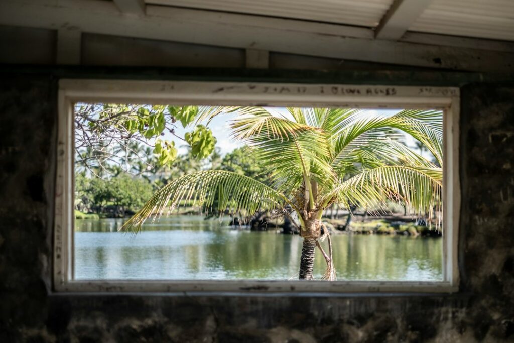
The Makapuu Lighthouse Trail sits on the southeastern tip of Oahu, a 2.5-mile round-trip paved switchback that climbs from a State Wayside parking lot to a 647-foot ridge above the Kaiwi Channel. The route is one of the few Oahu hikes that combines a stroller-friendly surface with a headland view of two offshore islands, a working lighthouse, and a seasonal humpback whale corridor.
For households relocating from the mainland, the trail functions as a low-friction introduction to Hawaii’s exposed windward geometry. It answers questions that lava-tube caves and rainforest waterfalls cannot: what a trade-wind headland actually feels like, how the sun tracks over volcanic ridgelines through the calendar, and where the coastline turns from suburban to raw within a 30-minute drive of Waikiki.
This piece covers the paved ascent step by step — mileage, elevation, gate hours, directional lighting, the tidepool spur, and the December–April whale vantage — plus a rental-car card for the drive from town and a sun-and-wind packing card sized for the ridge’s exposure.
The Paved Ascent at a Glance
The trail begins at the Kaiwi State Scenic Shoreline parking lot at 8751 Kalanianaole Highway, a signed pullout roughly 14 miles east of Waikiki. From the gate, a two-lane paved service road switches back and forth for about 1.25 miles up the western flank of the pali, gaining approximately 500 feet of elevation before topping out on a bluff at 647 feet.
The surface is old asphalt roughly 15 feet wide, with painted centerlines in some sections. Wheelchairs, jog strollers, and cane users routinely reach the top viewing platform. Two shaded benches sit along the second switchback, and a lookout pier at the summit funnels foot traffic toward the ridge edge and an interpretive rail overlooking Makapuu Point below.
| Metric | Value |
|---|---|
| Distance (round trip) | 2.5 miles |
| Elevation gain | ~500 feet |
| High point | 647 feet |
| Surface | Paved asphalt |
| Typical time | 60–90 minutes |
| Shade | Minimal |
| Restrooms | None at gate or summit |
| Parking capacity | ~50 vehicles |
| Fee | Free |
What the paved surface changes
Compared with rooted footpaths like the Manoa Falls corridor, a paved trail flips the failure mode. Instead of mud, twisted ankles, and slick basalt, the risks become heat radiating off asphalt, sunburn on a shadeless traverse, and knee load on the descent. Households who acclimate here can then step up to unpaved options such as the ridgeline covered in the Ehukai Pillbox route or the muddy shoe-selection notes in the Manoa Falls footwear write-up.
Gate Hours and Access Windows
The vehicle gate at the parking lot follows the Hawaii State Parks schedule for the Kaiwi State Scenic Shoreline. From April 1 through Labor Day the gate opens at 7 a.m. and closes at 7:45 p.m. From the day after Labor Day through March 31 the closing time shifts back to 6:45 p.m. Opening stays 7 a.m. year-round. Vehicles left inside after closing are locked in overnight.
The lot holds roughly 50 cars in marked stalls, with additional roadside pullouts along the highway shoulder. On weekends between March and May, the lot regularly fills by 8 a.m., and rangers occasionally close the driveway when overflow spills into the bike lane. Weekday mornings before 8 a.m., or weekday afternoons between 2 and 4 p.m., see the lowest turnover pressure.
| Period | Vehicle gate opens | Vehicle gate closes |
|---|---|---|
| April 1 – Labor Day | 7:00 a.m. | 7:45 p.m. |
| Day after Labor Day – March 31 | 7:00 a.m. | 6:45 p.m. |
| Foot access to ridge | Generally continuous | Gate locks vehicles only |
Walking in outside gate hours
The paved trail sits outside the vehicle gate itself, and some hikers arrive on foot before dawn to shoot first light, parking along the highway shoulder or using rideshares. Because access rules can shift with maintenance closures and enforcement patterns, posted signage at the entry always overrides older printed guidance. Households planning a predawn attempt should verify current rules with the City and County of Honolulu and Hawaii State Parks before committing.
Sunrise vs Sunset — Directional Lighting on the Ridge
Because the trail wraps the western flank of a headland pointed roughly southeast, morning light and evening light produce almost opposite compositions. Sunrise fires directly across the Kaiwi Channel, silhouetting Manana (Rabbit Island) and Kaohikaipu Island as dark shapes against a lit horizon. Sunset drops behind the walker, backlighting the ridge from the hiker’s back and washing the lighthouse structure in warm side-light against the Ko’olau range.
Photographers optimizing for the working red-and-white lighthouse itself typically prefer the last hour before sunset, when the low western sun raises exposure on the seaward side of the tower. Those chasing color across the channel and offshore islands favor sunrise, especially November through February, when the sun rises far enough south to align with the two-island silhouette. Weather-dependent, both windows shift a few degrees week to week.
Sunrise times worth planning around
Honolulu sunrise ranges from about 5:50 a.m. in mid-June to about 7:11 a.m. in mid-January. To arrive at the summit for first light in December, a household needs to leave Waikiki around 5:45 a.m., start walking by 6:35 a.m., and cover the 1.25-mile ascent in about 30 minutes. In June, that same schedule slides more than an hour earlier and butts against the 7 a.m. vehicle gate opening.
| Month | Approx sunrise | Approx sunset |
|---|---|---|
| January | 7:11 a.m. | 6:00 p.m. |
| March | 6:36 a.m. | 6:44 p.m. |
| June | 5:50 a.m. | 7:16 p.m. |
| September | 6:22 a.m. | 6:44 p.m. |
| December | 7:04 a.m. | 5:53 p.m. |
When the gate constrains the plan
Between May and August, the 7 a.m. vehicle gate consistently opens after sunrise. Households targeting first-light photography during those months either walk in from the highway shoulder or shift their timing to civil twilight rather than the sun break itself. In winter months, the gate opens well before sunrise, and the drive from Waikiki fits comfortably inside a single coffee-and-drive routine, provided traffic on Kalanianaole Highway stays clear of construction closures.
The Tidepool Spur
About one third of the way up the paved switchbacks, a signed but rough spur descends westward toward a set of tidepools known locally as the Makapuu Tide Pools or Pele’s Chair Tidepools. The spur drops roughly 100 vertical feet across loose rock and dried grass over about a quarter mile, without a maintained tread. Unlike the paved main route, this side trip requires closed-toe grip footwear and honest scrambling ability.
At low tide, the shelf exposes shallow basins fed by wave splash across a lava bench. Salt spray coats the approach year-round, and swells breaking against the outer edge can wash across the shelf without warning. State signage warns against turning one’s back on the surf. The Halona Blowhole pullout a few miles west shows the same wave-energy pattern in a more accessible roadside format.
When the spur is worth it
The tidepool detour adds about 45 minutes to the round trip and roughly 200 feet of extra elevation change on the way back. Households traveling with young children, seniors, or anyone in flip-flops should skip it and keep to the paved main. For visitors comparing shoreline shelves across islands, the Puako fringe tidepool walk on Hawaii Island offers a gentler entry to reef-flat exploration.
December–April Humpback Vantage
North Pacific humpback whales migrate to the main Hawaiian Islands each winter to calve and breed, arriving in November, peaking in late January through March, and largely departing by May. The Makapuu ridge sits directly above the Kaiwi Channel, one of the busiest crossings between Oahu and Molokai, giving hikers an elevated vantage 647 feet above the water surface.
That elevation matters. From sea level, a whale spout might reach 15–20 feet high before dispersing in trade winds. From the summit platform, the same spout stands out against a wide arc of ocean, and breaches roughly the length of a school bus become visible at ranges of two to three miles offshore. Binoculars in the 8×42 to 10×50 range make the difference between a distant splash and a countable pod.
Sighting probability climbs steeply through winter. Late December offers scattered sightings; January and February deliver near-daily activity between 8 a.m. and 11 a.m.; March through mid-April continues to produce mother-calf pairs closer to shore. Households comparing Oahu vantages with Maui, where the shallow Auau Channel concentrates activity, can cross-reference the Kaanapali humpback migration peak notes for context.
| Month | Sighting frequency | Notes |
|---|---|---|
| November | Low | First scouts arrive |
| December | Moderate | Numbers ramp weekly |
| January | High | Near-daily surface activity |
| February | Peak | Highest calf counts |
| March | High | Competitive pods close to shore |
| April | Moderate | Departure begins |
| May | Low | Straggler tail-slaps only |
| June–October | None | Whales in Alaskan feeding waters |
Wind and lighting for spotting
Morning winds tend to be lighter, producing flatter water and easier surface tracking. By midafternoon, trades in the 15–25 mph range chop the channel and hide low spouts among whitecaps. Overcast days with soft light actually improve contrast on the water surface — dark whale backs stand out against gray more clearly than against blue glare. A polarized lens on binoculars or sunglasses cuts glare noticeably during peak January and February sessions.
Rental-Car Card — Driving from Waikiki
Makapuu sits at the southeastern tip of Oahu, roughly 14 miles east of Waikiki along Kalanianaole Highway (Route 72). The drive covers 25–35 minutes each way outside of rush hour, longer if lunchtime traffic near Hawaii Kai backs up. The route is the same coastal stretch used to reach the Koko Head Railway ascent, allowing a two-stop morning that pairs a stair climb with the paved lighthouse walk.
| Item | Detail |
|---|---|
| Route | Kalanianaole Highway (Route 72) |
| Distance | 14 miles |
| Drive time | 25–35 minutes |
| Toll | None |
| Rental daily rate | $55–$95 economy, off-season |
| Gasoline cost | ~$4.80/gal Oahu average |
| Round-trip fuel cost | $6–$8 economy car |
| Parking at trailhead | Free, ~50 stalls |
| Recommended departure | Before 7:15 a.m. or after 9:30 a.m. |
Households comparing rideshare against a rental should note that a one-way Uber from Waikiki to the trailhead typically runs $32–$48 depending on surge, and return service can be intermittent because the parking lot sits outside dense residential coverage. Renting a car for a single day of east-Oahu circuit driving remains the more predictable option. Current fuel costs are tracked at the EIA weekly gasoline update.
Building a half-day loop
Because Route 72 continues around the windward corner past Waimanalo, a half-day loop can pair Makapuu with Waimanalo Beach, Sea Life Park across the highway, and the Halona Blowhole and Sandy Beach on the return. Households wanting a full ridgeline change of scenery can add the Tantalus Drive viewpoint loop once they return toward downtown, though that tacks roughly another 90 minutes onto the day.
Sun-and-Wind Packing Card
The ridge is exposed on all sides above 200 feet of elevation, with no tree cover, no shade shelters, and no water on the trail. Trade winds funnel between Manana Island and the point, and the switchbacks catch full sun from mid-morning through late afternoon. Packing decisions here separate a pleasant 90-minute outing from a sunstroke incident that ends the vacation early.
| Item | Specification |
|---|---|
| Water | 32–48 oz per person minimum |
| Sunscreen | SPF 30–50, reef-safe (mineral) |
| Hat | Brimmed, chin strap (winds gust 25+ mph) |
| Sunglasses | Polarized, UV400 |
| Layers | Light windbreaker for summit |
| Footwear | Closed sneakers or trail runners |
| Camera | 200mm+ zoom for whales; wide for lighthouse |
| Binoculars | 8×42 or 10×50 for channel spotting |
| Timing | Pre-9 a.m. or post-4 p.m. in summer |
Reef-safe sunscreen requirement
Hawaii law bans the sale of sunscreens containing oxybenzone and octinoxate, two ingredients linked to coral bleaching, as of January 1, 2021. Mainland households traveling with existing supplies should check bottle labels before packing. The Hawaii Department of Health maintains guidance on approved mineral formulations at health.hawaii.gov, and most Oahu drugstores stock zinc-oxide alternatives in the $12–$22 range per bottle.
Wind exposure by time of day
Trade winds on Oahu’s eastern shoreline typically strengthen from late morning through midafternoon. Hikers who summit before 9 a.m. often experience calm 8–12 mph conditions on the ridge; those arriving between 1 and 3 p.m. routinely face 18–25 mph sustained winds with higher gusts through the funneled saddle just below the summit. Loose hats become airborne quickly; camera lens caps and water bottle caps also disappear over the cliff edge.
Weather Patterns and Best Season Windows
Southeastern Oahu sits in the leeward-to-side rain shadow of the Ko’olau range, with the Makapuu ridge receiving roughly 20 inches of rainfall annually — dramatically less than the 158 inches falling on Manoa Valley 12 miles inland. That statistic drives most of the trail’s usability calendar. Sunny days dominate May through September; scattered showers and short rainbows dominate November through March.
Air temperature on the ridge tracks close to Honolulu shoreline readings: 82–88°F summer daytime highs, 72–76°F winter daytime highs, with overnight lows rarely dropping below 65°F. Perceived warmth on the exposed ridge runs higher than shoreline reports because of asphalt radiation and afternoon sun angles. Households from cooler climates should treat any midday summer visit as a serious heat-exposure situation, not a casual walk.
| Metric | Summer (May–Oct) | Winter (Nov–Apr) |
|---|---|---|
| Daytime high | 82–88°F | 72–76°F |
| Overnight low | 72–75°F | 65–68°F |
| Rainy days/month | 4–7 | 8–14 |
| Trade-wind speed | 12–22 mph | 8–18 mph |
| Ocean temp offshore | 78–82°F | 74–77°F |
Rainfall and slippery-surface days
Because the trail is paved rather than dirt, a passing shower rarely produces mud, but wet asphalt on the descent grade develops slick zones where surface algae and salt residue mix. Older worn sections near the second switchback stay wet longer under overcast conditions. Trail runners with lugged soles or sneakers with fresh tread handle the descent noticeably better than smooth-sole flip-flops or dress sandals on the return.
Kona wind reversals
Two to five times per winter, the standard trade-wind pattern reverses and southerly Kona winds bring humid, still air to the leeward coasts. On those days, the ridge feels stiller than usual, with visibility across the Kaiwi Channel dropping under haze. Households experiencing their first Kona reversal often mistake it for a smog event; the pattern typically clears within 48–72 hours as trades reassert themselves.
What Relocating Households Learn From Regular Visits
For families researching a permanent move, Makapuu functions as a repeatable diagnostic. Return visits across seasons show how the same trade-wind headland changes character between rainy winter cold fronts, dry summer trades, and shoulder-season Kona reversals. A household that walks the trail once in February and once in August has already sampled the two dominant weather regimes that shape utility bills, gardening choices, and school-commute planning.
The trail also demonstrates the compressed geography that a Hawaii address delivers. From a Kaimuki or Aina Haina apartment, the parking lot is 15 minutes away. From Waikiki, it is 25–35. From a Ko Olina resort, closer to an hour. Households weighing lodging trade-offs before moving can compare against the Waikiki versus Ko Olina lodging framework to see how commute geometry changes with base location.
Fitness and pacing signals
The paved surface makes pacing measurable. Newcomers to island heat typically cover the 1.25-mile ascent in 28–36 minutes at first, dropping to 22–26 minutes after two or three visits as they learn to hydrate before the climb rather than during it. That improvement curve is one of the more concrete cues that mainland cardio conditioning has adapted to warm-humid conditions, a shift most households notice within the first six weeks of residency.
Comparing Makapuu with Other Oahu Paved and Semi-Paved Ascents
Makapuu belongs to a small set of Oahu trails that pair genuine elevation with a maintained walking surface. The most direct comparisons are Diamond Head, a paved-and-stepped ascent inside a tuff cone, and Lanikai Pillbox, an unpaved packed-dirt climb of similar length. Diamond Head requires entry fees and reservations; Makapuu does not.
For newcomers building up to unpaved options, the paved crater route covered in the Diamond Head Crater summit ascent piece offers a similar time commitment with more shade and less wind exposure. From there, the natural next step is a footpath climb rather than a service road.
| Trail | Round trip | Elevation | Surface | Fee |
|---|---|---|---|---|
| Makapuu Lighthouse | 2.5 mi | 500 ft | Paved asphalt | Free |
| Diamond Head Summit | 1.8 mi | 560 ft | Paved + stairs | $5 out-of-state |
| Koko Head Railway | 1.6 mi | 1,048 rungs | Wooden ties (rough) | Free |
| Lanikai Pillbox | 1.7 mi | 500 ft | Dirt/rock | Free |
Coastal alternatives on the same drive
Because Kalanianaole Highway threads a continuous coastline from Diamond Head to Waimanalo, households can chain vantage stops without doubling back. The H-3 Freeway windward crossing offers a mountain-tunnel counterpart for those wanting to complete a full southeast-plus-windward loop, ending at Kaneohe rather than looping back through Hawaii Kai. Either route touches Sandy Beach, Makapuu Beach, and the lighthouse pullout in sequence during a single morning.
Practical Costs, Safety, and Local Context
There is no entry fee, no reservation system, and no permit requirement for the paved trail as of 2026. Parking is free within the marked lot and along signed shoulder pullouts. Costs concentrate on the drive itself, sunscreen and water resupply, and any binoculars or camera gear a household chooses to carry. The Honolulu-area CPI series tracks broader visitor cost drift year over year.
Local outlets such as the Honolulu Star-Advertiser occasionally publish updates on gate schedules, ranger enforcement of the tidepool spur, and seasonal parking-lot construction. Households planning a first visit should scan the current week’s headlines for closure notices, particularly during winter high-surf advisories that periodically close the tidepool approach without closing the main paved ridge.
Cell coverage and emergency access
Verizon and AT&T both maintain reliable coverage across the parking lot and the switchbacks up to the summit platform. The nearest emergency service dispatch point is the Waimanalo Fire Station, roughly seven minutes away by ambulance. Households with medical concerns should carry any needed medication with them; there is no shelter on the ridge if a family member cannot descend under their own power.
Wildlife etiquette
Federally protected Hawaiian monk seals occasionally haul out on the beaches below the ridge, and NOAA guidelines require a 50-foot buffer. Green sea turtles use the same beaches. Neither species should be approached, touched, or fed. The paved trail itself does not encounter wildlife closely, but the tidepool spur places hikers directly into the coastal zone where these encounters occasionally occur.
Frequently asked questions
How long does the Makapuu Lighthouse Trail actually take?
A moderate pace covers the 2.5-mile round trip in 60–90 minutes, including a 10–15 minute stop at the summit platform. Slower walkers, stroller pushers, and families with young children should plan two hours. Adding the tidepool spur extends the round trip to roughly three hours and requires closed-toe footwear rather than beach sandals.
Can strollers and wheelchairs really reach the summit?
Yes. The entire main trail is paved asphalt at a service-road grade, and manual wheelchairs, jog strollers, and cane users reach the summit regularly. The tidepool spur is not accessible. Two benches along the second switchback offer rest points, and the summit platform has a low interpretive rail suitable for wheelchair viewing over the cliff edge.
Is the lighthouse itself open to the public?
No. The 1909 red-and-white tower remains an active U.S. Coast Guard aid to navigation and is closed to visitor entry. Its 12-foot Fresnel lens still operates. The summit viewing platform sits above and behind the lighthouse, offering a clear rooftop view but no interior access. There are no scheduled tours or open days.
When during the year are humpback whales most visible from the ridge?
Peak sighting frequency runs from late January through early March, with near-daily surface activity visible from the 647-foot summit. December and April produce moderate sightings on the ramp-up and departure sides of the season. From June through October, humpbacks are in Alaskan feeding waters and are not seen along the Kaiwi Channel.
What is the best time of day to photograph the lighthouse?
The last hour before sunset delivers the strongest side-light on the seaward face of the red-and-white tower, with the Ko’olau range providing depth behind the frame. Sunrise silhouettes Manana and Kaohikaipu islands across the channel but places the lighthouse itself in shadow. Overcast midday flattens contrast and softens the volcanic ridgeline behind the structure.
How do the summer and winter gate hours differ?
From April 1 through Labor Day, the vehicle gate opens at 7 a.m. and closes at 7:45 p.m. From the day after Labor Day through March 31, closing shifts back to 6:45 p.m. Opening stays 7 a.m. year-round. Vehicles left inside after closing are locked in overnight and require a call to state parks for release.
Is the tidepool spur safe with young children?
No. The spur drops roughly 100 feet across loose rock and dried grass over an unmaintained tread, and swells periodically wash across the outer shelf without warning. State signage warns against turning one’s back on the surf. Households with young children, seniors, or anyone in open-toe footwear should stay on the paved main trail and skip the spur.


