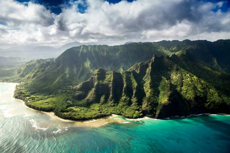
Papohaku Beach on Molokai’s west end runs roughly three miles from north to south, making it one of the longest continuous sand strands in the main Hawaiian Islands. The width alone — often over 300 feet at low tide — creates an almost desert-like impression. Wind, exposure, and the absence of any fringing reef define what the beach is and what it is not.
Relocating households researching Molokai often see photos of Papohaku’s empty sand and assume it functions like a Maui resort beach. It does not. The break offshore rolls into the sand without coral to slow it, producing shore break, backwash, and rip currents strong enough to defeat capable swimmers on visually calm days.
The beach is still a superb camping and beachcombing destination for households who can accept it on its own terms. Papohaku Beach Park sits at the middle of the strand and offers county-permitted tent camping, restrooms, and outdoor showers. What follows covers currents, permits, packing for wind, and the ruined resort next door.
Where Papohaku sits on Molokai’s west end
Molokai’s west end tapers into a dry, leeward peninsula anchored by Puu Nana and the flat coastal plain that runs down to the shore. Papohaku faces almost due west, catching afternoon sun and the full swell from the northwest during winter. The village of Maunaloa sits about 5 miles inland, and the small commercial airport at Hoolehua is about 17 miles east.
The park’s official address is on Kaluakoi Road, reached by turning off Farrington Highway (State Route 460) near the former Kaluakoi Resort. From either the ferry terminal or the airport, drive time runs 30 to 45 minutes depending on cattle crossings and construction along the western spur.
Papohaku means “stone wall” in Hawaiian, a reference to ancient heiau ruins scattered above the coastal cliffs at each end of the beach. The dunes themselves — some cresting at 40 feet — were the source of decades of sand mining before conservation rules ended commercial extraction in the 1970s.
Basic geography at a glance
| Feature | Detail |
|---|---|
| Beach length | Approximately 3 miles (4.8 km) |
| Beach width at low tide | Up to 300 feet in central stretch |
| Dune height | Peaks near 40 feet along back-beach |
| Facing direction | Due west (270°) |
| Distance from Hoolehua Airport (MKK) | Approximately 17 miles |
| Distance from Kaunakakai Wharf | Approximately 22 miles |
| Nearest fuel station | Maunaloa, ~5 miles inland |
| Nearest full grocery | Kaunakakai, ~22 miles |
Why the swimming warning is not overcautious
Ocean safety data from the state and Maui County lifeguard reports consistently rank Molokai’s west end among the highest-risk unguarded shorelines in the archipelago. The combination is uncommon: no fringing reef, west-facing exposure, steep beach profile, and no lifeguard tower stationed on the sand.
Most Hawaiian beaches enjoy some coral protection that dissipates incoming energy before it reaches the sand. Papohaku has none. Waves break directly onto the beach face, creating a shore-pound that can slam an adult swimmer into hard-packed sand. Broken bones and dislocated shoulders have been documented at similar unguarded beaches across the state.
State-level shoreline injury and drowning statistics are compiled by the Hawaii Department of Health, and Molokai’s west end appears in those reports at rates disproportionate to its low visitor count. Households used to lifeguarded Maui beaches should recalibrate expectations before arrival.
The three principal hazards
- Shore break: waves collapsing on the beach face rather than offshore.
- Rip currents: outbound flows that intensify during rising tides.
- Backwash: seaward-flowing water that undercuts standing legs.
Winter swells from November through March can push wave heights above 15 feet during northwest Pacific storm systems. Even summer’s south-swell periods still deliver 3 to 6 foot faces that break with unusual force because no reef diffuses the energy before it reaches the sand.
Currents, shore break, and the missing reef
The bathymetric profile off Papohaku drops sharply. Within 100 yards of shore the bottom falls to 40 feet or more, and by 400 yards offshore it exceeds 100 feet. This steep drop-off produces the pounding shore break — waves reach shallow water quickly and collapse near the sand rather than gradually feathering across a reef flat.
Rip currents form at intervals along the length of the beach, not just at obvious channels. Photos of Papohaku on a calm day can look benign; the outbound flow is often invisible. Wading past knee depth means committing to a return trip against water that may move 3 to 5 feet per second seaward.
The contrast with a reef-protected swimming spot such as Kapalua Bay on West Maui is stark. Kapalua’s fringing coral turns Pacific swell into rippled water inside the bay; Papohaku transmits open-ocean energy directly to the sand with no buffer.
Readers familiar with Tunnels Reef and the Haena winter cutoff can transfer some of that mental model here, with one adjustment. At Papohaku there is no summer safe season. The reef never appears. The dangerous condition is the default condition, twelve months a year.
Ocean condition patterns by season
| Season | Typical wave face | Wind direction | Swim advisory |
|---|---|---|---|
| Winter (Nov–Mar) | 10–20 ft | NE to variable | No entry recommended |
| Spring (Apr–May) | 3–8 ft | NE trades | Wading only, calm mornings |
| Summer (Jun–Aug) | 2–6 ft | Steady NE trades | Wading only, still hazardous |
| Fall (Sep–Oct) | 3–10 ft | NE trades building | Wading only, watch swell reports |
The camping permit process through Maui County
Molokai falls under Maui County jurisdiction for parks and permitting, even though the two islands are separated by the Pailolo Channel. Papohaku Beach Park is a Maui County park and requires a permit obtained through the county’s Department of Parks and Recreation, not the state DLNR.
The distinction matters because state park permits (like those for Palaau on the same island) run through a different portal and different fees. Applying to the wrong system delays the trip and does not transfer.
How to apply
- Visit the Maui County Parks online permit portal or an in-person office.
- Select Papohaku Beach Park and dates (up to three consecutive nights).
- Pay the per-person, per-night fee at time of application.
- Print the permit and carry a paper copy to the site.
Fee structure
| Camper type | Per person, per night |
|---|---|
| Maui County resident adult (18+) | $3.00 |
| Non-resident adult (18+) | $8.00 |
| Maui County resident child (under 18) | $1.00 |
| Non-resident child (under 18) | $3.00 |
| Application processing | Included |
Permits are issued in advance and enforced by county staff who circulate through the park. Camping without a permit can result in fines and eviction. The three-night maximum applies per park within a 30-day window — a practical limit that prevents long-term encampments.
Weekend and holiday demand is heavier, especially during summer break for local families. Applying at least 14 days ahead is prudent. The park’s total footprint accommodates roughly 40 tent sites, though there are no numbered pads — camping is dispersed under the kiawe trees along the back-beach line.
Facilities and what the park does and does not provide
Papohaku Beach Park has restrooms, cold outdoor showers, potable water spigots, picnic tables, and grills. A single covered pavilion offers shade during the hottest afternoon hours. The road into the park is paved, and there is enough parking for both day-use and overnight vehicles.
Fire pits are not universal — check current signage on arrival. Kiawe branches litter the sand and burn hot, but campers should bring their own fuel because collecting downed wood is regulated. Charcoal is generally permitted in the built grills when signage allows.
What the park lacks
- Lifeguard tower — no professional supervision on the beach.
- Cell service — coverage is spotty across the west end.
- Camp store or vending — nearest food is Maunaloa or Kaunakakai.
- Hot showers — outdoor showers are cold-water only.
- RV hookups — the park is tent-only in practice.
- Trash service overnight — bins fill quickly on weekends.
Packing for wind, sun, and exposure
Papohaku’s west-facing orientation produces predictable daily weather. Sunny mornings give way to trade winds that build from 10 to 25 mph by early afternoon. Gusts above 30 mph are common as the sun sets. The wind is the single biggest packing consideration after camping essentials.
Tent selection
Ultralight backpacking tents rarely survive a full night at Papohaku. Free-standing dome tents rated as 3-season, with full pole crossings and reinforced guy-out points, perform better. Four-season expedition tents are overkill on warmth but excel in wind resistance and pole stiffness against soft-sand loads.
Windbreak strategy
A dedicated beach windbreak — either a purpose-made shelter or a tarp rigged between kiawe trees — dramatically improves camp comfort. The dunes offer partial shelter, but the sand behind them can still gust. Deadman anchors (sand-filled bags buried at guy-out points) hold better than standard tent stakes on soft ground.
Packing checklist for two campers, two nights
| Category | Item | Notes |
|---|---|---|
| Shelter | 3-season dome tent | Rated 30+ mph wind minimum |
| Shelter | Extra guy lines, 6 stakes | Sand pegs or deadman bags |
| Sleep | Lightweight bag or liner | Overnight lows around 68°F |
| Water | 2 gallons per person per day | Refill at park spigot |
| Sun | SPF 50 mineral sunscreen | Reapply every 2 hours |
| Wind | Beach windbreak, 6–8 feet | Set up facing predominant NE |
| Light | Headlamp + backup lantern | No park lighting after dusk |
| Cook | Camp stove + fuel canister | Wood collection restricted |
| Food | Cooler, 10 lb ice, 3-day meals | Nearest store 22 miles east |
| First aid | Stocked kit + tweezers | Kiawe thorns are common |
Sunscreen deserves specific mention. Hawaii’s reef-safe sunscreen law under Act 104 bans oxybenzone and octinoxate. Bring mineral (zinc or titanium) formulations. Even at an unshaded beach with no reef offshore, the statewide law applies and rinsed sunscreen enters the same watershed.
The Kaluakoi Resort ruins next door
Immediately north of the Papohaku Beach Park entrance sits the shell of the Kaluakoi Hotel and Golf Club. The resort opened in 1977 and closed in 2001 after ownership disputes and declining occupancy. What remains is a landscape of empty concrete pads, abandoned villas, an overgrown 18-hole golf course, and a swimming pool filled with rainwater.
The property is private, though several public shoreline access easements cut through it toward Kepuhi and Papohaku beaches. Trespassing into the interior structures is unwise — vandalism damage, unstable roofs, and periodic security patrols make the ruins a look-but-do-not-enter destination.
What visitors can legally see
- Public shoreline access paths from Kaluakoi Road to Kepuhi Beach.
- The outer perimeter of the golf course from public roads.
- The Papohaku entrance approach with the former resort’s landscaping.
- The abandoned Paniolo Hale complex, viewed from public road.
The resort’s decline mirrors broader Molokai economics. Per Census Bureau QuickFacts, the island’s population sits near 7,400 residents — a base too small to sustain large-scale tourism infrastructure. Long-standing community opposition to further tourist development has kept redevelopment stalled for more than two decades.
Local coverage in outlets like Honolulu Civil Beat and the Honolulu Star-Advertiser has tracked the property’s ownership shifts and community objections through multiple failed sale attempts. Anyone considering a west-end investment should read that background carefully.
Combining a Papohaku camping trip with a Kaluakoi ruins walk works well as a half-day itinerary. Park at Papohaku, walk 25 minutes north along the beach, and access the ruins from the shoreline. Return before afternoon winds build past 20 mph around 2 to 3 pm.
Reaching Molokai and driving to the west end
Molokai has two arrival options in theory. Hoolehua Airport (MKK) is served by Mokulele Airlines and, seasonally, Hawaiian Airlines from Honolulu. The Molokai Ferry from Lahaina, Maui was suspended in 2016, with intermittent restart discussions that have not produced a return of service.
Rental cars are limited on the island. Alamo operates a small counter at the airport, and reservations should be made weeks ahead during summer. Rates typically run higher than Maui equivalents due to the small fleet size and delivery costs across the Pailolo Channel.
Flight and driving times
| Route | Duration | Notes |
|---|---|---|
| Honolulu (HNL) to Molokai (MKK) | 25–30 minutes | Mokulele or Hawaiian |
| Kahului (OGG) to Molokai (MKK) | 20–25 minutes | Mokulele |
| MKK to Kaunakakai town | 15 minutes | State Route 460 |
| MKK to Papohaku Beach Park | 30–45 minutes | Via Kaluakoi Road |
| Kaunakakai to Papohaku | 40–50 minutes | 22 miles west |
| Kaunakakai to Halawa Valley | 90 minutes | Separate day trip east |
Food and fuel run out on the west end. Kaunakakai has two grocery stores (Friendly Market and Misaki’s) and several fuel stations. Stock up there before heading west, because Maunaloa’s amenities have shrunk dramatically since Molokai Ranch closed its west-end operations in 2008.
State transportation planning for the airport and roads is documented at the Hawaii Department of Transportation. Kaluakoi Road, the paved spur into Papohaku, is county-maintained and has visible pothole wear from tropical rain that arrives in short, intense bursts.
Seasonal weather windows and swell timing
Papohaku sees roughly 300 sunny days per year, with average high temperatures of 82°F in summer and 78°F in winter. Rainfall on the west end is low — about 12 to 15 inches annually — making it one of the driest camping zones in the entire state.
Monthly considerations
| Month | Avg high (°F) | Rain (in) | Swell notes |
|---|---|---|---|
| January | 78 | 2.1 | NW swells 10–20 ft |
| March | 78 | 1.4 | Late NW season |
| May | 81 | 0.6 | Transitional, smaller |
| July | 84 | 0.4 | South swells 3–6 ft |
| September | 84 | 0.7 | Building NE trades |
| December | 78 | 1.9 | NW swells 10–15 ft |
The camping-comfort peak runs May through September when trade winds are steady but tropical rain is minimal. September and early October are increasingly popular as afternoon heat drops and swell remains manageable. For broader interisland timing, the best time to visit each Hawaiian island guide covers Molokai’s shoulder seasons.
Winter camping is possible but wind and swell noise can disrupt sleep. The distant boom of a 15-foot wave breaking a hundred yards offshore is louder than most first-time campers expect. Foam earplugs help, and side-vent tents ventilate better than double-wall models when trades push through.
Cultural and environmental respect
Molokai has actively resisted the tourism development trajectory of Maui and Oahu since the 1990s. Community sentiment about visitors is polite but firm: quiet behavior, no drone use, respect for private access, and no removal of sand, shells, or stones from the beach.
The state Department of Land and Natural Resources classifies beach sand as a natural resource. Removing sand, even a jar as a souvenir, is prohibited under Hawaii Revised Statutes and can carry fines. The same principle applies at popular black-sand and green-sand beaches elsewhere in the archipelago.
Practical respect guidelines
- Keep voices low, especially after 9 pm at the park.
- No drones without explicit landowner and airspace permission.
- Pack out all trash including cigarette butts and bottle caps.
- Leave sand, rocks, and shells on the beach.
- Ask permission before photographing residents or homes.
- Yield to hunters and ranchers on shared west-end roads.
The short-term rental restrictions on Kauai and the retirement community landscape on Molokai both illustrate the same underlying dynamic. Outer-island residents have less patience for tourist behavior that Waikiki tolerates as background noise.
Combining Papohaku with other Molokai stops
A three-day Molokai visit centered on Papohaku camping can include several additional stops without much backtracking. Halawa Valley on the east end requires a 90-minute drive one way and is best done as a full day trip separate from the west-end camping schedule.
Suggested three-day west-end itinerary
- Day 1: Arrive MKK, provision at Kaunakakai, drive to Papohaku, pitch tent before wind builds past 15 mph.
- Day 2: Morning beach walk (3 miles round-trip), Kaluakoi ruins loop, afternoon rest in pavilion shade.
- Day 3: Break camp early, drive to Kalaupapa overlook at Palaau State Park, return to airport by afternoon.
Kepuhi Beach, immediately north of Kaluakoi, is a shorter (half-mile) crescent with the same swimming hazards but easier access to shade. Some campers day-trip between Papohaku (base camp) and Kepuhi (afternoon shelter walks). Both beaches share the same absence of any reef structure offshore.
Households comparing Molokai to other islands’ beach experiences might contrast Papohaku with the reef-protected snorkel spots on the Big Island’s ranked beach list or with Maui’s more developed sandy stretches covered in the best time to visit Maui guide. The contrasts are more instructive than any single beach description.
Emergency planning and communication
Cell service at Papohaku is inconsistent. Verizon and T-Mobile both drop to no bars in the dune line. AT&T sometimes holds a single bar at the beach edge. Emergency calls should be attempted from the pavilion or the parking area first, since elevation and open exposure improve odds.
The nearest emergency room is Molokai General Hospital in Kaunakakai, roughly 45 minutes by road. Air ambulance transport to Oahu or Maui takes 30 to 45 minutes flight time plus ground coordination. Ocean-related injuries at Papohaku that require hospitalization typically mean an off-island transfer within hours.
Emergency contact quick reference
- 911 works whenever any carrier signal is available.
- Coast Guard Sector Honolulu handles ocean rescues around Molokai.
- Molokai General Hospital main line for non-emergency medical questions.
- Maui County Parks after-hours line for camping permit issues.
- Satellite messengers (inReach, Zoleo) work reliably at the beach.
A written trip plan left with someone off-island is worth the effort — expected arrival at the park, expected departure, vehicle description, and check-in times. Search coordination on Molokai is faster when a starting point exists.
Frequently asked questions
Can you swim at Papohaku Beach at all?
Strong swimmers occasionally enter during calm summer mornings, but ocean safety officers routinely advise against it because rip currents, shore break, and backwash operate even on visually flat days. There is no lifeguard tower, no reef protection, and rescues rely on distant response. Most researchers and residents treat Papohaku as a wading and beachcombing beach rather than a swimming beach.
How far in advance should camping permits be booked?
Maui County recommends booking at least 14 days ahead, and demand jumps during June, July, and holiday weekends when local families camp. Permits are limited but the park rarely reaches capacity outside those peak periods. Weekday campers in shoulder months such as April, May, September, and October can often obtain permits within a week of the planned visit.
Is there any shade at Papohaku Beach Park?
Kiawe trees along the back-beach provide dappled shade, and a single covered pavilion accommodates picnic tables. Campers should assume the tent site itself will bake in afternoon sun and plan tent orientation accordingly. A separate sun shelter or tarp pitched at an angle to the sun’s path adds crucial afternoon relief between roughly 12 and 4 pm daily.
Can you visit the Kaluakoi Resort ruins legally?
The property is privately owned and posted, but public shoreline access easements cross the grounds toward Kepuhi and Papohaku beaches. Walking those defined paths is lawful; entering buildings, the pool area, or golf course structures is trespassing. Security patrols pass occasionally and posted signs are enforced. The ruins are best viewed from the outside without lingering or photographing interiors.
Are campfires allowed at Papohaku Beach Park?
Charcoal fires in the park’s built grills are generally permitted, but open ground fires and driftwood collection are restricted. Kiawe wood burns hot and produces long-lasting embers, so campers who plan to cook should bring commercial charcoal or a canister camp stove. Signage at the pavilion states current fire rules, which can change during drought advisories on the dry west end.
Does the west end of Molokai have cell service?
Coverage is patchy. AT&T sometimes holds a single bar at the beach edge, while Verizon and T-Mobile users often see no signal at all in the dune line. The pavilion and the parking lot generally get slightly better reception. Campers relying on communication should download offline maps in advance and consider a satellite messenger for multi-night stays.
What months offer the calmest ocean at Papohaku?
June through August generally see the smallest surf as northwest Pacific swells drop off. Even in summer, though, south swells and trade wind chop still produce 3 to 6 foot faces breaking on the sand. Winter months from November through March bring 10 to 20 foot northwest swells that make the beach unsafe even for wading beyond ankle depth.
Is Papohaku a good sunset viewing location?
Yes. The west-facing orientation places the sun directly over the horizon from roughly 6:20 pm in December to 7:15 pm in June. The three-mile length means visitors can find solitude even on crowded evenings. Photographers should arrive at least 45 minutes before sunset to scout foreground compositions and rig windbreaks against the strengthening evening trades.