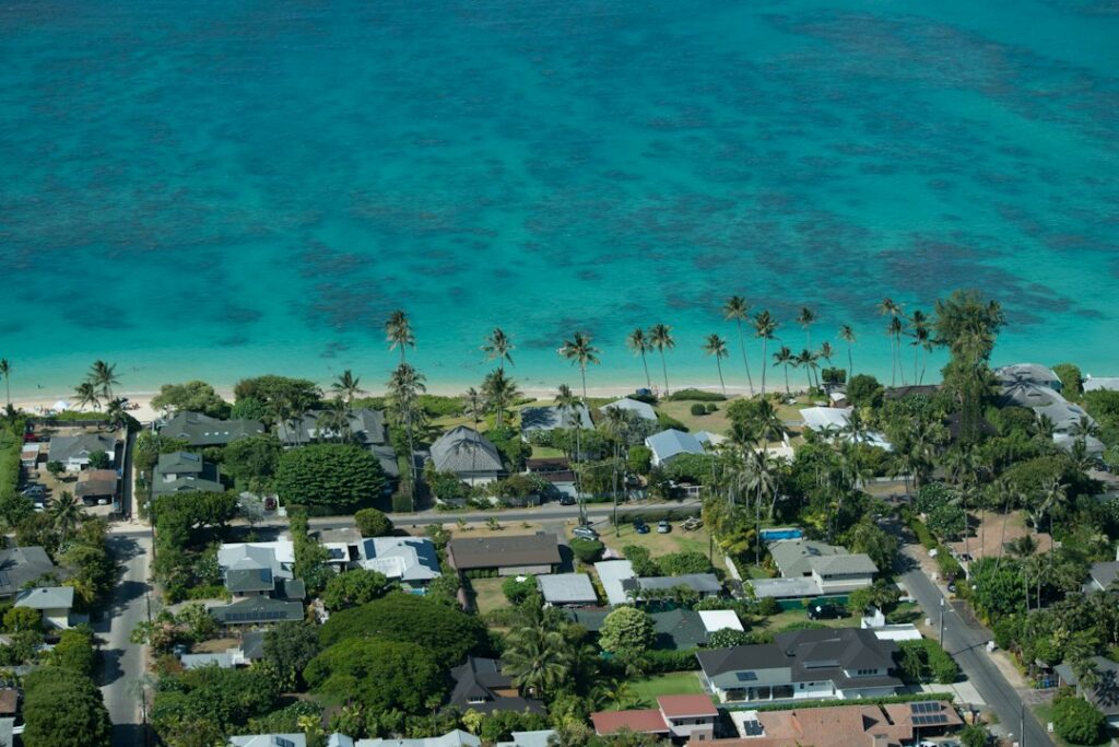
Honolulu spreads across the southern coast of Oahu, but the label covers dozens of distinct neighborhoods with vastly different prices, climates, and commutes. A relocating household moving from Denver or Charlotte can easily assume the city functions like a single market. It does not. Rain totals, traffic, and cost per square foot shift dramatically over five-mile stretches.
This overview pulls together public data and observable patterns to describe how Honolulu-area neighborhoods differ. It compares Kailua on the windward side against Hawaii Kai in the east, Manoa in the valleys, Kakaako downtown, Mililani in central Oahu, and Ewa Beach out west. The goal is orientation for someone who has never lived there, not personal recommendation.
Prices below reference published listings and the U.S. Census QuickFacts profile for Hawaii. Weather notes draw on National Weather Service climate zones for Oahu and long-run rainfall averages. Actual figures shift monthly, so the tables serve as a snapshot for research rather than a real-time quote.
How Honolulu divides up geographically
Oahu measures roughly 44 miles long and 30 miles wide, and the City and County of Honolulu covers the entire island. When residents say “Honolulu,” they typically mean the urban strip from Pearl Harbor east to Diamond Head. When they say a neighborhood name like Kailua or Mililani, they mean a district that may sit 30 minutes to an hour from downtown by car.
Five broad regions organize the island for newcomers: the urban core along the south shore, the windward side across the Koolau mountains, east Honolulu past Diamond Head, central Oahu on the plateau, and the west or leeward side ending at Kaena Point. Each region has its own weather, price band, and school district feel.
The single-highway geography matters more than mainland transplants expect. H-1 is the only continuous east-west artery on the south side. H-2 branches north into central Oahu, and H-3 punches through the mountains to the windward side. A crash on any of these can freeze the commute for two hours.
Regions at a glance
| Region | Example neighborhoods | Distance to downtown | General price tier |
|---|---|---|---|
| Urban core | Kakaako, Ala Moana, McCully | 0–3 miles | High for condos |
| Windward | Kailua, Kaneohe, Waimanalo | 12–15 miles | Very high for houses |
| East Honolulu | Hawaii Kai, Aina Haina, Kahala | 10–14 miles | High to very high |
| Inland valleys | Manoa, Nuuanu, Palolo | 3–6 miles | High for older homes |
| Central Oahu | Mililani, Wahiawa, Waipio | 18–25 miles | Mid to high |
| West/leeward | Ewa Beach, Kapolei, Waianae | 18–35 miles | Mid to lower |
Windward side: Kailua, Kaneohe, and Waimanalo
The windward side sits east of the Koolau mountain range, which the H-3 tunnel and the older Pali and Likelike highways cross. Kailua is the flagship town, with about 40,500 residents and a beach identity built around Kailua and Lanikai beaches. Homes cluster in flat, walkable grids one to three miles from the water.
Kailua median single-family home prices have moved between roughly $1.4 million and $1.9 million in recent quarters, with Lanikai and Beachside blocks running well above that range. Rents for a three-bedroom house typically land between $4,200 and $6,500 per month. A deeper look sits in the Kailua neighborhoods guide.
Kaneohe covers a larger area to the north with more affordable pockets, older homes on generous lots, and a strong local family character. Waimanalo, at the south end of the windward coast, remains more rural, with agricultural zoning, horse properties, and stretches of Native Hawaiian homelands. It has the coast’s lowest median prices but limited housing supply.
Windward climate notes
Kailua receives roughly 40 to 55 inches of rain per year depending on the block, with heavier totals against the mountains and lighter totals near the coast. Trade winds run onshore most days between April and October, which keeps interiors cooler than leeward inland spots. The tradeoff is persistent humidity that pushes newcomers to plan for mold control.
Residents new to the tropics often underestimate what constant moisture does to closets, wall interiors, and leather. The site’s guide to mold and humidity in Hawaii homes covers the ventilation and dehumidifier setup that windward houses tend to need year-round.
East Honolulu: Hawaii Kai, Aina Haina, and Kahala
East Honolulu runs from Diamond Head to Makapuu, with H-1 becoming Kalanianaole Highway around Aina Haina. Hawaii Kai is the largest planned community in the area, built starting in the 1960s around a marina system with roughly 30,000 residents. Blocks are laid out in cul-de-sacs, ranch-style homes dominate, and boating access is a common draw.
Median single-family home prices in Hawaii Kai typically fall between $1.5 million and $2.1 million. Marina-front houses run higher. Rents for a three-bedroom sit near $4,500 to $6,000 per month. Sunny weather is a defining feature — the area often records some of the lowest rainfall totals on Oahu, closer to 15 to 25 inches per year.
Aina Haina and Niu Valley sit between Hawaii Kai and Kahala, with mid-century homes, quiet streets, and a small commercial strip. Kahala anchors the west end of east Honolulu with the highest prices on the south shore, including waterfront estates that regularly clear $10 million. Its inland blocks are more accessible but still command $2 million-plus.
Commute pattern from east Honolulu
Morning drive time from Hawaii Kai to downtown covers roughly 11 miles but can take 45 to 70 minutes between 7 and 9 a.m. Kalanianaole narrows to two lanes each way east of Aina Haina, so any incident cascades. Off-peak, the same trip runs 20 to 25 minutes. State highway data at HIDOT tracks project timelines that occasionally affect this stretch.
Inland valleys: Manoa, Nuuanu, and Palolo
The valleys behind the urban core carry an older, more academic character. Manoa is home to the University of Hawaii at Manoa, and roughly 20,000 residents live in the surrounding grid. Homes range from 1920s Craftsman cottages to remodeled two-story houses on steep lots. The valley catches heavy afternoon rain, with annual totals near 80 inches at its upper end.
Median Manoa single-family prices generally run $1.6 million to $2.4 million, with lower Manoa lots less expensive than the upper valley. Rents for a three-bedroom hover around $4,000 to $5,500 per month. Traffic funnels through a small number of streets to reach H-1, which adds friction to the otherwise short 3.5-mile trip downtown.
Nuuanu extends inland from downtown Honolulu into the Koolau foothills. It combines historic homes, cool valley air, and quick access to Pali Highway toward the windward side. Palolo sits east of Manoa with lower prices, tighter lots, and a mix of long-tenured families and rentals near the Kaimuki commercial district.
Why valley climate feels different
Valley floors trap moisture and cool in the evening, so nighttime temperatures often drop 6 to 10 degrees below the coast. Residents in Manoa frequently report needing blankets year-round, a surprise for anyone assuming Hawaii means universal warmth. The tradeoff is more frequent afternoon showers and slower drying laundry lines than in Kakaako or Hawaii Kai.
Urban core: Kakaako, Ala Moana, and downtown
Kakaako sits between downtown and Ala Moana, and it has transformed rapidly from an industrial district into a dense high-rise neighborhood. Towers such as Ward Village properties, Kōʻula, and Victoria Place have added thousands of condo units since 2016. Studios and one-bedrooms dominate rentals, with pricing set by view corridor, floor, and building amenities.
A one-bedroom Kakaako condo typically rents for $2,500 to $4,000 per month. Two-bedroom units run $3,800 to $6,500. Purchase prices span roughly $650,000 for older buildings up to $2 million for new high floors. HOA fees frequently reach $900 to $1,600 per month, a number newcomers often overlook in their budget planning.
Ala Moana centers on the shopping mall of the same name and the adjacent beach park. Downtown Honolulu carries government offices, older office towers, and Chinatown at its western edge. Both have improving residential density but remain more commercial than Kakaako. Restaurant density along this strip is among the highest in the state — see the Honolulu restaurants guide for concrete options.
Living dense in Honolulu
Condo living in Kakaako trades yard space and a garage for walkability and shorter commutes. The Honolulu gyms guide lists the studio and full-service options that cluster along Kapiolani Boulevard and Ala Moana Boulevard, most within a 10-minute walk of urban-core towers.
Utility costs behave differently in these towers. Central AC is rare; individual split systems dominate, and electricity charges by the kilowatt-hour run among the highest in the country. The EIA electricity profile for Hawaii shows residential rates that recently exceeded 40 cents per kilowatt-hour, roughly triple the U.S. average.
Central Oahu: Mililani, Waipio, and Wahiawa
Central Oahu sits on the plateau between the Waianae and Koolau ranges. Mililani opened in 1968 as one of the state’s earliest master-planned communities and now has about 27,000 residents in Mililani Town and roughly 23,000 more in Mililani Mauka up the hill. Streets are gridded, cul-de-sacs common, and multiple community pools and parks anchor daily life.
Median single-family prices in Mililani generally run $950,000 to $1.35 million, with newer Mauka homes at the higher end. Three-bedroom rentals sit near $3,200 to $4,500 per month. The trade for lower prices is a longer commute — H-2 south to H-1 west to downtown covers 18 to 22 miles and often takes 55 to 80 minutes in morning peak.
Waipio, Waikele, and Waipahu sit closer to Pearl Harbor along H-1, with a mix of townhomes, older single-family homes, and outlet shopping. Wahiawa lies north of Mililani near Schofield Barracks. It carries a more military and agricultural feel, with older housing stock and prices roughly 20 to 30 percent below Mililani.
Central Oahu weather
The plateau sits at 800 to 1,000 feet of elevation, which drops nighttime temperatures 4 to 8 degrees below the coast. Days remain warm year-round, but morning fog is common in December and January. Trade winds cross the plateau strongly, which keeps homes drier than valley locations and helps with mold prevention.
West side: Ewa Beach, Kapolei, and Waianae
West Oahu has grown fastest over the past two decades. Ewa Beach, Kapolei, and the newer Hoopili development sit on flat former sugarcane land, with prices below the urban core but longer commutes to downtown. A detailed breakdown lives in the Ewa Beach living guide for households considering the area.
Ewa Beach median single-family prices generally fall between $850,000 and $1.15 million. Three-bedroom rentals sit near $3,000 to $4,200 per month. Kapolei sits slightly higher for equivalent square footage due to its status as the “second city” with a hospital, court complex, and University of Hawaii West Oahu campus.
Waianae Coast, farther west along Farrington Highway, has the lowest prices on Oahu, with median single-family homes often below $700,000. It also has the longest commute — 33 miles to downtown, frequently 90 minutes or more in morning peak — and limited highway alternatives if H-1 backs up.
West side climate
The leeward side receives the lowest rainfall on Oahu, with Ewa Beach and Kapolei often below 20 inches per year. Trade winds arrive from the northeast and lose moisture crossing the Koolau range, so afternoon showers are rare. Sunshine is abundant. The tradeoff is heat: afternoon temperatures in July and August routinely reach 88 to 92 °F, several degrees above the windward side.
Commute realities across the island
Honolulu commute times track poorly with mileage because H-1 saturates during peaks. A 12-mile drive from Hawaii Kai and a 22-mile drive from Mililani can take the same 70 minutes on the same morning. The city’s rail project, Skyline, opened its first segment in June 2023 between East Kapolei and Aloha Stadium, with future phases planned toward Ala Moana Center.
Commuters often stack costs beyond fuel. Car insurance in Hawaii averaged roughly $1,570 per year for a single vehicle in recent data — the car insurance breakdown covers the specifics. Registration adds another line item, described in the vehicle registration guide for new residents.
Peak-hour commute times to downtown
| Starting neighborhood | Distance | Off-peak drive | 7–9 a.m. peak |
|---|---|---|---|
| Kakaako | 1 mile | 5 minutes | 10–15 minutes |
| Manoa | 3.5 miles | 10 minutes | 20–30 minutes |
| Hawaii Kai | 11 miles | 20 minutes | 45–70 minutes |
| Kailua (via H-3) | 13 miles | 25 minutes | 40–65 minutes |
| Mililani | 20 miles | 25 minutes | 55–80 minutes |
| Ewa Beach | 19 miles | 25 minutes | 60–90 minutes |
| Waianae | 33 miles | 45 minutes | 90–120 minutes |
Reverse commutes — say, downtown to Mililani in the morning — often run at near off-peak times. Households with two workers heading opposite directions sometimes tolerate a longer suburb address for that reason. State highway conditions and closures publish through HIDOT in near real time.
Microclimate differences that affect daily life
Oahu’s mountain ranges create sharp weather boundaries over short distances. Two homes 6 miles apart can differ by 40 inches of annual rainfall. This shapes practical choices: window screens, roof material, garage vs. carport, and even the type of clothes dryer that makes sense. Newcomers who tour only during a dry week can miss the pattern entirely.
Annual rainfall by area
| Neighborhood | Approx. annual rainfall | Wet months | Dry months |
|---|---|---|---|
| Upper Manoa | 75–90 inches | November–March | June–August |
| Kaneohe | 55–70 inches | November–March | June–August |
| Kailua | 40–55 inches | November–March | June–August |
| Mililani | 35–45 inches | November–March | June–August |
| Kakaako | 18–25 inches | November–March | June–August |
| Hawaii Kai | 15–25 inches | November–March | June–August |
| Ewa Beach | 15–20 inches | November–March | June–August |
Temperature patterns
Average daytime highs across Oahu run 78 to 82 °F in January and 85 to 90 °F in August. What varies is nighttime temperature and wind. Coastal condos in Kakaako rarely dip below 72 °F even in winter, while inland Mililani and Manoa can reach 62 °F on a January night. Air quality reports post through the state agriculture monitoring network during vog events.
Trade winds and vog
Trade winds blow from the northeast about 70 percent of the year, cooling windward and central Oahu. When they shift to south or Kona winds — often in October and February — volcanic smog from the Big Island can drift over Oahu. Leeward areas like Ewa Beach and Kapolei see the heaviest impact during those periods, sometimes for several days at a time.
Price ranges by area
Median prices below draw on recent Honolulu Board of Realtors sales trends. They shift monthly, and specific streets vary widely. The purpose here is comparative rather than definitive. Statewide demographic and income context sits in the Census QuickFacts for Hawaii, useful for calibrating what any given price range means against local incomes.
Approximate 2025 single-family and rental ranges
| Neighborhood | Median SFH price | 3BR rent | Character |
|---|---|---|---|
| Kahala | $2.4M–$5M+ | $6,000–$12,000 | Waterfront estates, oldest wealth |
| Kailua | $1.4M–$1.9M | $4,200–$6,500 | Beach town, walkable |
| Hawaii Kai | $1.5M–$2.1M | $4,500–$6,000 | Marina, planned suburb |
| Manoa | $1.6M–$2.4M | $4,000–$5,500 | Academic, rainy valley |
| Kakaako (condo) | $650K–$2M | $2,500–$6,500 | Dense high-rise |
| Mililani | $950K–$1.35M | $3,200–$4,500 | Master-planned, family focused |
| Ewa Beach | $850K–$1.15M | $3,000–$4,200 | Newer, flat, western |
| Waianae | $550K–$750K | $2,500–$3,400 | Rural coast, long commute |
Property taxes on Oahu remain low relative to the mainland, but state income and general excise taxes bite deeper. The Hawaii GET explanation covers the 4.5 percent effective rate on Oahu, and the Hawaii Department of Taxation publishes the current schedules.
Financing works similarly to the mainland, but local credit unions often lead on Hawaii mortgage products. The banks and credit unions guide compares the major players. Household budgeting for high electricity should reference the state electricity profile above to avoid sticker shock at the first bill.
Schools, families, and neighborhood fit
Public school assignment on Oahu follows geographic boundaries under the Hawaii Department of Education. Manoa, Aina Haina, Hawaii Kai, Kailua, and Mililani carry reputations for stronger neighborhood schools, though rankings shift year to year. Charter and private options concentrate in the urban core and east Honolulu, with tuition at long-established schools like Punahou reaching about $30,000 per year.
Families comparing districts often build a spreadsheet before touring. The Honolulu family neighborhoods guide narrows the field to the areas most commonly chosen by relocating families with school-age children. The Hawaii Department of Health also publishes childhood immunization and school health data useful during evaluation.
Practical setup after choosing a neighborhood
Signing a lease or closing on a home starts a series of administrative tasks that catch newcomers off guard. Vehicle registration must transfer within 30 days of establishing residency. The vehicle registration walkthrough lists the exact forms and safety inspection steps, all handled through City and County of Honolulu offices.
Voter registration, jury duty summonses, and driver license transfers follow soon after. Local news through Star-Advertiser and Civil Beat helps new residents keep tabs on neighborhood-level issues like rail expansion, zoning fights, and school boundary changes. Both outlets publish daily.
Common newcomer mistakes
- Underestimating humidity’s impact on wood furniture and leather goods.
- Assuming west side sunshine means low utility bills — AC use runs high.
- Booking apartments in Manoa without touring during a November rain event.
- Ignoring Kalanianaole Highway construction timelines from Hawaii Kai.
- Comparing Kakaako HOA fees only to the mainland high-rise average.
- Assuming H-3 stays open — it closes for high winds and accidents.
Frequently asked questions
Which Honolulu neighborhood is cheapest for new residents?
Among mainstream options, Waianae and Wahiawa carry the lowest median single-family prices on Oahu, often below $750,000. Both require long commutes to downtown — 33 miles from Waianae and 20 miles from Wahiawa — and have limited job density nearby. Ewa Beach and Waipahu offer a middle path with prices between $850,000 and $1.15 million and better freeway access to Pearl Harbor.
Is Kailua worth the commute for a downtown job?
Kailua sits 12 to 15 miles from downtown Honolulu depending on the route through the Pali, Likelike, or H-3. Peak morning drives run 40 to 65 minutes. Households prioritizing beach access, cooler evenings, and a walkable town center often accept the tradeoff. Households with young children and downtown work often opt for Manoa or Kaimuki to shorten the daily trip.
How much does climate really vary across Honolulu?
Rainfall differences reach 60 inches per year between upper Manoa and Ewa Beach, only 15 miles apart. Nighttime temperatures vary 8 to 10 degrees between coastal Kakaako and inland Mililani in winter. Vog exposure hits leeward areas hardest during Kona wind events. These microclimates affect utility bills, mold risk, and clothing choices in ways that mainland climate maps do not signal.
Are Kakaako condos a good starter option for singles?
Kakaako offers the shortest commutes, densest walkability, and highest concentration of new construction on Oahu. One-bedroom rents run $2,500 to $4,000 per month, and purchase prices for older buildings start near $650,000. HOA fees frequently reach $900 to $1,600 monthly. Singles and childless couples working downtown often prefer this stack over a suburban house with a longer commute.
Does Hawaii Kai have hurricane or flood risk?
Hawaii Kai sits at low elevation around a marina, which raises flood exposure during storm surge events, though direct hurricane landfalls on Oahu remain rare. FEMA flood zone maps and City and County of Honolulu emergency planning materials cover specific block-by-block risk. Newer homes carry insurance premiums that reflect that exposure. Buyers should request flood zone confirmation before closing on any marina-adjacent property.
Where do most military families end up living on Oahu?
Military households stationed at Pearl Harbor, Hickam, or Schofield typically cluster in Ewa Beach, Kapolei, Mililani, Wahiawa, and Aiea. These areas balance affordability, base access, and family-friendly street layouts. On-base housing is also available. Windward postings at Marine Corps Base Hawaii in Kaneohe draw families to Kailua, Kaneohe, and Waimanalo, though Kailua rents strain BAH budgets for junior enlisted.
How reliable is public transit for a car-free lifestyle?
TheBus covers most of Oahu with reasonable frequency on urban routes, and Skyline rail added service between East Kapolei and Aloha Stadium in June 2023. Kakaako, Ala Moana, and Waikiki support the most realistic car-free lifestyle. Commutes from Kailua, Hawaii Kai, or Mililani without a car require significant patience — one-way trips can exceed 90 minutes even in off-peak windows.


