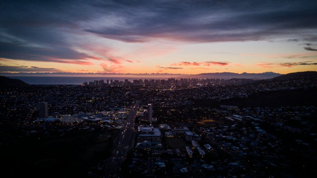
The full circle route around Oahu covers roughly 120 miles when a driver follows the standard loop: H-1 east through town to Kalanianaole Highway, up the windward Kamehameha Highway, across the North Shore, and back through central Oahu via H-2 and H-1. Newcomers usually plan it for a Saturday. Most finish after dark.
On paper, 120 miles at posted speed limits should take about two and a half hours. In practice, the loop consumes a full daylight window because the two-lane coastal sections north of Waimanalo rarely allow more than 35 mph, tour vans stack up at Byodo-In and Kualoa Ranch, and Haleiwa Town funnels every driver into a single congested intersection near the historic bridge.
This guide breaks down the mileage, realistic drive time, fuel station cadence, cell dead zones along the Ko’olauloa coast, and the eight to ten anchor stops that most newly relocated residents build into their first orientation loop. Rental car mileage caps, one-way versus round-trip logistics, and the shoulder-driving hazards on the windward stretch get their own sections below.
The 120-mile loop: what the route actually covers
The circle route is a rough oval that hugs the shoreline for about two-thirds of its length. Starting from Waikiki, drivers head east on H-1, which becomes Kalanianaole Highway (Route 72) after Kahala. That highway skirts Hanauma Bay, wraps around Makapu’u Point, and drops down to the windward town of Waimanalo. Total distance from Ala Moana to Waimanalo Beach: about 20 miles.
From Waimanalo, drivers continue north on Kalanianaole, then merge onto Kamehameha Highway (Route 83) in Kailua. Route 83 is the workhorse of this loop. It carries traffic through Kaneohe, past the Byodo-In Temple, along the Ko’olauloa coast through Ka’a’awa and Punalu’u, up to Kahuku, and around to the North Shore beach towns of Sunset, Pupukea, and Haleiwa. This windward and North Shore stretch runs about 55 miles.
From Haleiwa, the return leg cuts through central Oahu on Kamehameha Highway past Dole Plantation, joins H-2 south at Wahiawa, and merges back into H-1 near Pearl City for the final push into Honolulu. That inland return covers roughly 35 miles. The full round-trip mileage lands between 115 and 125 depending on side trips into Kailua town or up the Pupukea-Paumalu ridge.
Drivers who reverse the loop, heading west on H-1 first and running the North Shore counter-clockwise, end up with the same mileage but a different pace. Counter-clockwise puts the slow windward two-lane stretch in the afternoon, when trade-wind rain squalls are more common along the Ko’olau range. Most first-timers go clockwise for that reason.
Realistic drive time and pacing
Pure driving time with zero stops runs five to seven hours on a typical weekday. Sunday mornings before 8 AM can trim that to about four hours because the windward two-lane is empty and Haleiwa has not yet clogged. Friday afternoons in either direction can push past eight hours because the H-1 east return at 4 PM crawls at 15 mph from Aiea to downtown.
The realistic full-day plan, with eight to ten photo stops of 20-45 minutes each, is 10-12 hours of clock time from a 7 AM Waikiki departure to a 6 or 7 PM return. That leaves room for a sit-down lunch in Haleiwa, a beach swim on the North Shore, and one or two short trail walks. Anything more ambitious becomes a two-day itinerary with a Turtle Bay or Ko Olina overnight.
| Segment | Distance | Driving time | Typical stops |
|---|---|---|---|
| Waikiki to Waimanalo | 20 miles | 45-60 min | Diamond Head, Hanauma, Makapu’u |
| Waimanalo to Kaneohe | 10 miles | 25-35 min | Sherwoods, Lanikai overlook |
| Kaneohe to Kahuku | 30 miles | 70-90 min | Byodo-In, Kualoa, Kahana Bay |
| Kahuku to Haleiwa | 18 miles | 35-50 min | Turtle Bay, Sunset, Waimea |
| Haleiwa to Waikiki | 35 miles | 50-75 min | Dole Plantation, Pearl Harbor |
Add the five row midpoints and pure drive time totals about 4 hours 20 minutes. The gap between that theoretical minimum and the 5-7 hour reality is entirely stoplights, tour-bus queues at pullouts, and the one-lane bottleneck at Rainbow Bridge in Haleiwa.
Which direction to drive: clockwise or counter-clockwise
Clockwise (east first, north second) is the popular choice for good reason. Morning light hits the eastern cliffs at Makapu’u and the windward Ko’olau range beautifully. Traffic on H-1 flows outbound before 8 AM. The North Shore is reached by early afternoon, when Haleiwa restaurants are open for lunch and the Dole return leg happens before evening rush hour on H-1 west.
Counter-clockwise (H-1 west first, North Shore in the morning) suits drivers who want to catch the North Shore surf breaks at their best morning conditions in winter. From November through February, waves at Waimea, Pipeline, and Sunset can reach 12-25 feet, and morning offshore trades make the surface glassy. The tradeoff is arriving at Makapu’u and the southeast coast in late afternoon shadow.
A third option, popular with residents doing errands, is to skip the loop entirely and use the H-3 freeway from Halawa to Kaneohe as a shortcut through the Ko’olau range. The H-3 turns a 40-minute windward crossing into 15 minutes but bypasses everything between Kahala and Kaneohe.
The eight to ten anchor stops
The circle is defined by its anchor stops. Skipping them turns the drive into a monotonous coastal cruise. Building all of them in stretches the day past sunset. Most first-time loops settle on eight destinations spaced roughly 12-18 miles apart, with a lunch break at the Haleiwa midpoint. The state visitor authority’s official Oahu travel resource highlights many of these same anchor destinations.
Diamond Head Crater
The crater rim trail is 1.6 miles round trip with 560 feet of elevation gain. Non-resident entry costs $5 walk-in per person or $10 per vehicle with a reservation booked through the state parks portal. The Diamond Head summit ascent takes about 90 minutes with photos and opens at 6 AM. Many loop drivers skip this and start at Hanauma to save time.
Hanauma Bay
Hanauma requires an advance timed reservation booked at 7 AM two days before arrival. Non-resident entry is $25 plus $3 parking. The bay closes Mondays and Tuesdays and reopens Wednesday at 6:45 AM. Snorkelers should budget two hours minimum from parking to the reef and back up the switchback path.
Makapu’u Lighthouse Trail
The paved 2-mile round trip to the lighthouse overlook climbs 500 feet with sea-cliff views of Manana Island and, from November through May, migrating humpback whales offshore. The trailhead has a small paved lot that fills by 8 AM on weekends. The Makapu’u paved ascent takes most walkers 60-75 minutes round trip.
Waimanalo Beach and Sherwoods
Waimanalo Bay Beach Park has three miles of white sand and calm summer swimming water. Sherwood Forest, the shaded south end of the beach, has picnic tables under ironwoods and access to Kaiona Point bathing pools at low tide. Drivers pressed for time typically pass through Waimanalo without stopping and gain 45 minutes.
Byodo-In Temple
The replica Kyoto temple in the Valley of the Temples memorial park sits at the base of the Ko’olau cliffs in Kaneohe. Admission is $5 per adult and $2 for seniors and children. Open 8:30 AM to 5 PM daily. Parking is free but the driveway can back up on weekend mornings when tour vans arrive in bunches. Budget 45 minutes for the koi ponds and bell house.
Kualoa Regional Park and Ranch
The 4,000-acre Kualoa Ranch offers movie-location tours, ATV rides, and horseback rides starting at $52 for a jungle expedition bus and running past $180 for a premium ATV combo. The Kualoa Ranch filming tour options require advance booking and pull loop drivers off Kamehameha Highway for two to four hours. Kualoa Regional Park across the road is free and offers the classic Mokoli’i (Chinaman’s Hat) photo.
Turtle Bay and Kahuku
Turtle Bay Resort marks the northeastern corner of the island at mile 33 on Kamehameha Highway from Kaneohe. Non-guests can park at the beach access lot free of charge and walk to Kuilima Cove. Kahuku, three miles further, is the shrimp truck row: Giovanni’s, Romy’s, and Fumi’s all serve garlic shrimp plates for $16-20 with a 20-40 minute wait at lunch.
Haleiwa Town
The historic North Shore hub concentrates about 30 shops and restaurants along a mile of Kamehameha Highway. Rainbow Bridge, the one-lane 1921 span at the north entrance to town, backs traffic up to five minutes each direction on weekends. Matsumoto Shave Ice has been the marquee stop since 1951 and averages a 20-minute line on Saturday afternoons.
Dole Plantation
The plantation grounds off Kamehameha Highway in Wahiawa offer the Pineapple Express train ride ($13.75 adult), the Plantation Garden Tour ($8), and the Pineapple Garden Maze ($9.25). A combo pass runs about $26. The grounds are free to enter and the gift shop’s Dole Whip line rarely runs longer than 10 minutes. Add 60-90 minutes if any paid attraction is included.
Fuel stations and gas planning
The circle route is not empty of gas stations, but the spacing gets thin between Kaneohe and Haleiwa. The last reliable fuel on the windward leg is the 7-Eleven or Aloha station in Kaneohe near the Windward Mall. After that, drivers pass one small station in Ka’a’awa, one in Punalu’u, and one in Kahuku before Haleiwa. The stretch from Kaneohe to Kahuku is about 32 miles with three intermittent stations.
Windward stations run $0.30-0.60 per gallon higher than Costco Iwilei or Sam’s Club Pearl City. According to the EIA weekly fuel price series, Hawaii statewide averages have run roughly $1.00-1.30 above the U.S. lower-48 mainland average for years, and rural Oahu stations run higher still. Filling in Honolulu before departure saves $8-15 on a typical loop.
| Location | Route mile from Waikiki | Notes |
|---|---|---|
| Kahala 76 station | 5 | Last cheap fuel eastbound |
| Waimanalo Shell | 18 | One station, closes 10 PM |
| Kaneohe Aloha / 7-Eleven | 28 | Last full-service before windward gap |
| Ka’a’awa 76 | 40 | Small, may close early |
| Punalu’u minimart | 48 | Limited hours, pay inside |
| Kahuku 76 | 60 | Reliable, open until 10 PM |
| Haleiwa Chevron | 78 | Full service, higher price |
| Wahiawa Costco (members) | 95 | Cheapest fuel on the route |
Rental car drivers should return to the airport with the tank at least three-quarters full to avoid Hertz or Enterprise refueling charges of $9-11 per gallon. The Costco station on Alakawa Street in Iwilei, 3 miles from HNL, is the standard last fill-up point for members. Non-members typically use the Aloha station on Nimitz Highway near the airport rental return lots.
Cell signal dead zones along the windward coast
The Ko’olauloa stretch from Ka’a’awa to Kahuku has intermittent cell coverage. All three major carriers show weak or no signal in the shadow of the Ko’olau range, particularly in Kahana Valley, Punalu’u, and behind Malaekahana. Drivers relying on turn-by-turn navigation should download offline Google Maps or Apple Maps regions before leaving Kaneohe. The Hawaii carrier coverage comparison details the specific dead-zone patterns on each network.
Verizon generally holds the strongest coverage on the windward coast but still drops in Kahana. T-Mobile improved coverage after adding Ko’olauloa sites in 2022 but remains spotty near the Crouching Lion. AT&T runs a distant third on this stretch. Emergency calls to 911 usually connect on any active carrier because the phone will roam to whichever tower is reachable.
| Windward segment | Verizon | T-Mobile | AT&T |
|---|---|---|---|
| Kaneohe town | Strong LTE | Strong LTE | Strong LTE |
| Waiahole to Ka’a’awa | Fair 4G | Weak 4G | Weak 4G |
| Kahana Bay | Weak, drops calls | Often no signal | Often no signal |
| Punalu’u | Weak 4G | Weak 4G | Very weak |
| Hauula to Laie | Fair 4G | Fair 4G | Fair 4G |
| Kahuku to Turtle Bay | Strong LTE | Strong LTE | Fair 4G |
Streaming music, Spotify offline playlists, or downloaded podcasts are more reliable than cellular audio through the Ko’olauloa stretch. Drivers using CarPlay or Android Auto have reported the head unit pausing mid-song near the Crouching Lion viewpoint as the connection drops entirely.
Rental car mileage caps and one-way logistics
Most major rental agencies on Oahu, including Enterprise, Hertz, Budget, and Alamo, include unlimited mileage on standard passenger and SUV bookings. Discount and off-airport agencies sometimes cap daily mileage at 100-200 miles with per-mile overage fees of $0.25-0.40. Drivers should confirm the mileage terms in the rental agreement before departure because a full circle loop with side trips can easily exceed 150 miles in one day.
One-way rentals across islands are not possible with any Oahu-based agency because the vehicles cannot leave the island. Within Oahu, some agencies allow returns to Kualoa, Turtle Bay, or Ko Olina by advance arrangement but attach a $50-125 drop fee. Most loop drivers pick up and return at the airport or Waikiki desks and drive round-trip, which is simpler and cheaper.
Peer-to-peer rental platforms sometimes impose stricter caps. A Turo host may set 200 miles per day and charge $0.50 per additional mile, which can add $30-60 to a full circle day. Reading the specific listing terms matters more with peer-to-peer bookings than with traditional agencies.
| Agency type | Typical daily cap | Overage fee | One-way drop-off |
|---|---|---|---|
| Enterprise, Hertz, Budget | Unlimited | N/A | Limited, $50-125 fee |
| Alamo, National, Avis | Unlimited | N/A | Rare, arrange in advance |
| Discount Hawaii agencies | 150-200 mi/day | $0.25-0.40 | Not typically offered |
| Turo peer-to-peer | Host-set, often 200 | $0.30-0.60 | Host-dependent |
Residents without a car who want to run the loop occasionally can rent for a single day for $60-110 through Enterprise or Hertz Waikiki desks, avoiding both the airport surcharge and the mileage question entirely. Context on car-free island living sits in the TheBus and getting around Oahu guide.
Sections that require careful shoulder driving
Kamehameha Highway from Ka’a’awa through Punalu’u narrows to 22 feet in places with almost no shoulder. Cars parked on the mauka side for beach access sit inches from the fog line. Pedestrians walking along the highway between the beach and small shops force slow, alert driving. Speed limits on this stretch drop to 25 and 35 mph and are enforced with radar during weekend spot patrols.
The Hau’ula to Laie stretch has a similar narrow-shoulder profile but with more pedestrian traffic near the Polynesian Cultural Center and BYU-Hawaii campus. Drivers should watch for cyclists, especially in the early morning training window from 5 to 7 AM when club rides are common along Route 83. Passing a cyclist requires a full lane change because there is often nothing to the right. Local reporting from Honolulu Civil Beat has covered pedestrian-safety proposals for the Ka’a’awa segment.
The Kalanianaole Highway climb over the Halona Blowhole ridge past Hanauma has tight curves with limited sight distance. Tour buses regularly stop in the small pullouts, sometimes with a wheel over the fog line. Following distance matters more here than raw speed. On the North Shore, the sharp curve past Kaena Point Road can surprise drivers approaching too fast, though the loop route does not require going that far west.
Flash flood signage on the windward side is not decorative. Kahana Valley streams cross Route 83 and can flood the roadway within 20 minutes of a heavy squall. During red flood warnings issued by the National Weather Service, Kamehameha Highway is sometimes closed at the Kahana bridge. Checking traffic updates before departure is prudent. The HDOT road closure page lists current highway status.
Weather, traffic, and the best time to go
Trade winds blow onshore on the windward side about 75% of the year, bringing brief showers that pass in 10-20 minutes. December through March is the wettest period; June through August the driest. The North Shore surf season runs November through February with wave heights of 15-25 feet at Pipeline, Waimea, and Sunset. Summer waves at those breaks are typically flat or 2-4 feet.
H-1 traffic patterns dominate the return leg’s timing. Westbound H-1 out of Honolulu backs up from 3:30 to 6:30 PM on weekdays. Eastbound H-1 into Honolulu backs up from 6:30 to 9:00 AM weekdays. A clockwise loop starting at 7 AM avoids both windows. A counter-clockwise loop starting at 6 AM avoids the morning inbound crush but must finish before 3 PM to beat the afternoon return jam.
Sunrise and sunset shape the daylight window. In June, sunrise is around 5:50 AM and sunset around 7:15 PM, giving 13-plus hours of light. In December, sunrise is around 7:05 AM and sunset around 5:55 PM, giving barely 11 hours. Winter loops need earlier departures to finish before dark on the two-lane windward stretch where headlight glare from oncoming cars can be blinding.
What to pack for the day
A full-day loop deserves preparation, not just a phone and a wallet. Water bottles, sunblock, a hat, sandals for beach stops, closed-toe shoes for the Makapu’u and Diamond Head trails, and a light rain jacket for windward squalls all pay off. Snacks matter because sit-down food is only available at Kailua, Kaneohe, Kahuku shrimp trucks, and Haleiwa. Between those, there is little more than convenience-store fare.
- Two liters of drinking water per person
- Reef-safe sunblock and a hat
- Sandals for beach stops, closed-toe shoes for short trails
- Light windbreaker or rain jacket for windward squalls
- Beach towel and a change of shirt
- Cash for shrimp trucks and small windward stands
- Offline maps downloaded before Kaneohe
- Downloaded music or podcasts for the dead zones
- Full tank of gas from a Honolulu station
- Charged phone plus a backup battery pack
Drivers with children should add motion-sickness precautions. The winding Kalanianaole climb past Hanauma and the narrow curves through Ka’a’awa reliably produce car-sickness in kids who have been screen-focused in the back seat. Frequent short stops at Sandy Beach, Waimanalo, or Kualoa Regional Park help reset.
Alternative loop variations
Not every circle drive has to be the full 120 miles. Residents who want the windward experience without the North Shore add-on can drop over the Ko’olau range via the H-3 Halawa-to-Kaneohe crossing, run north to Kualoa or Kahana Bay, and return the same way for a 45-mile half-loop that takes three to four hours.
A ridge alternative adds the Pali Lookout at the top of Nu’uanu or the Tantalus Drive ridge circuit to the standard loop for 30-45 extra minutes and one of the best land-based views of Honolulu. Both add on cleanly from the Punchbowl exit off H-1.
A garden variation swaps Byodo-In for Ho’omaluhia Botanical Garden, a free 400-acre City and County of Honolulu park at the base of the Ko’olau cliffs. Weekend entry requires an advance reservation booked through the parks portal. Weekday entry is walk-up.
For comparison, drivers who have run the Hana Highway fuel-planning drive on Maui will find the Oahu circle less white-knuckle but no faster because Oahu compensates with more traffic and more stoplights. Both drives share the same lesson: budget a full day, fuel up early, and download offline maps.
Frequently asked questions
Can the full loop be done in half a day?
Yes, but only barely and only with tight discipline. A 5 AM Waikiki departure clockwise, three photo stops of 15 minutes each, no sit-down meal, and a return by noon covers the 120 miles in about seven hours. Anyone hoping to swim, hike Makapu’u, or eat in Haleiwa should plan a full 10-12 hour day instead.
Is the drive dangerous for out-of-state drivers?
The route is straightforward for anyone comfortable with two-lane highways, but the windward shoulder-driving stretch and the Kalanianaole cliff curves require attentive lane discipline. Speeds are moderate, at 25-45 mph on the coastal sections. The main hazards are pedestrians on Route 83, sudden tour-bus stops, and glare from oncoming headlights after sunset on unlit two-lane stretches.
Do all the anchor stops require reservations?
Hanauma Bay, Diamond Head, Ho’omaluhia on weekends, and any paid Kualoa Ranch tour require advance reservations. Byodo-In, Makapu’u trailhead, Waimanalo, Kualoa Regional Park, Turtle Bay beach access, Haleiwa, and Dole Plantation are all walk-up. Reservations for Hanauma open two days ahead at 7 AM and sell out within minutes, so it needs the earliest planning.
Where is the best lunch stop on the loop?
Haleiwa Town sits at roughly the halfway point by time and offers the widest selection: Haleiwa Beach House, Cholo’s Mexican, Kono’s for pulled pork, Giovanni’s shrimp truck on the way in, and Matsumoto Shave Ice for dessert. Kailua town, off the standard route by a few minutes, adds Buzz’s Steakhouse and Kalapawai Cafe as alternatives.
Can a driver skip the North Shore and still enjoy the loop?
Yes. A Kaneohe or Kualoa turnaround delivers the best windward scenery, Byodo-In, and the Chinaman’s Hat photo in about half the time. Returning the same way via Kalanianaole Highway or crossing the Pali or H-3 back into Honolulu completes a 50-70 mile half-loop that fits comfortably in four to five hours with two stops.
Is cell service reliable enough for rideshare on the windward side?
No. Uber and Lyft coverage on the Ko’olauloa coast is thin, and drivers rarely accept trips originating in Kahana, Punalu’u, or Hauula because there is no return fare. Rideshare from Turtle Bay back to Honolulu can run $85-120 and take 20 minutes to match a driver. A rental car remains the practical way to run the loop.
Are electric vehicles workable for the full circle?
Yes, with planning. A Tesla or other 250-plus mile EV starting fully charged completes the 120-mile loop comfortably with 40-50% remaining. Turtle Bay Resort, Kualoa Ranch, and the Whole Foods Kailua lot host Level 2 or Supercharger stations. Drivers should not attempt the loop with an EV below 60% state of charge because windward charging is limited.


