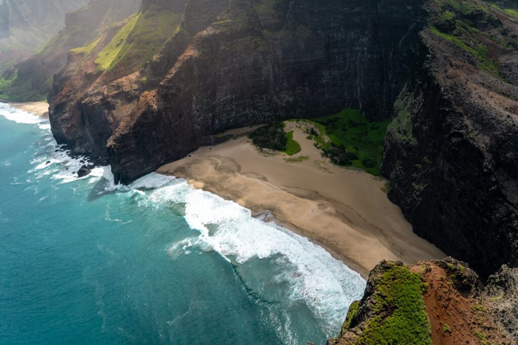
Hawaii Island is the only Hawaiian island where the question “when should we go?” has two different correct answers depending on which side of the runway a traveler sleeps on. The Hilo side of the island collects more than 125 inches of rain a year. The Kona coast, roughly 90 miles away by road, collects under 20 inches, and the strip near the airport at Keāhole averages closer to 10.
That single fact reorders everything. A week that is miserable in Hilo can be flawless in Waikoloa. A month that produces reliable Kona sunshine can also produce the island’s worst vog, because the same trade winds that dry the leeward coast carry volcanic sulfur dioxide around South Point and stack it against the Kona slopes each afternoon.
Layered on top of the weather are two occupancy events that reprice entire coasts — the Ironman World Championship in October and the Merrie Monarch Festival in April — plus fare cycles into Kona (KOA) and Hilo (ITO) that behave almost nothing alike. What follows is a month-by-month breakdown, a vog primer, the airfare and rental-car math, and a framework for matching a specific week to a specific kind of traveler.
Two climates, one island: why the “best time” depends on the coast
Hawaii Island spans about 4,028 square miles and rises to 13,803 feet at the summit of Mauna Kea. Those two numbers explain the climate split. Moist northeast trade winds hit the windward slopes, lift, cool, and dump their moisture on the Hilo and Puna side before ever reaching the leeward Kona coast.
The result is one of the sharpest rainfall gradients in the United States. Hilo International Airport records roughly 126 inches annually. Drive over the Daniel K. Inouye Highway and annual totals drop below 20 inches on the Kohala and North Kona shoreline, where resorts sit in what amounts to a coastal desert.
What windward rain actually looks like
Hilo-side rain is not usually an all-day event. It arrives as heavy overnight and early-morning showers, often clearing by mid-morning, with a second band in late afternoon. Rainfall totals are high because individual showers are intense, not because the sky stays gray for 12 hours.
That pattern makes Hilo workable for travelers who plan around it. Waterfalls run hard, the rainforest is genuinely green, and the town’s museums, markets and indoor and near-town attractions in Hilo absorb a wet afternoon without much loss. Travelers who booked a beach week, though, will feel cheated.
What leeward dryness costs
The Kona and Kohala coasts deliver sunshine at a rate that embarrasses most of the Pacific — but they are hot, exposed, and dependent on afternoon sea breezes. June through September highs run 85–88°F at sea level with little cloud cover until the daily mauka buildup arrives around 2 p.m. Shade is scarce on the lava fields.
Month-by-month rainfall, temperature, and price pressure
The table below pairs the two coasts side by side so the trade-off is visible in one place. Rainfall figures are long-term monthly averages; ocean temperatures are surface readings off the Kona coast, which is where most snorkeling and diving happens.
| Month | Hilo rain (in) | Kona coast rain (in) | Kona avg high (°F) | Ocean temp (°F) | Demand pressure |
|---|---|---|---|---|---|
| January | 9.7 | 0.8 | 81 | 76 | High |
| February | 9.0 | 0.7 | 81 | 75 | Peak |
| March | 14.4 | 0.9 | 81 | 75 | High (spring break) |
| April | 12.4 | 0.7 | 82 | 76 | Split: Hilo peak, Kona soft |
| May | 8.0 | 0.5 | 83 | 77 | Low |
| June | 7.3 | 0.3 | 85 | 79 | Rising |
| July | 10.7 | 0.5 | 86 | 80 | Peak (families) |
| August | 10.1 | 0.6 | 86 | 81 | High |
| September | 8.2 | 0.7 | 86 | 81 | Low after Labor Day |
| October | 9.9 | 1.1 | 85 | 80 | Ironman spike, then low |
| November | 15.5 | 1.2 | 83 | 79 | Low until Thanksgiving |
| December | 10.5 | 1.0 | 81 | 77 | Peak after Dec 18 |
Two patterns stand out. March and November are the wettest months in Hilo, at 14.4 and 15.5 inches, and both are months when windward-side trip reports skew negative. Kona’s driest stretch is May through August, under 0.7 inches a month, which is also when heat and vog peak.
The same seasonal logic applies differently on each island, which is why the timing answer for Hawaii Island rarely matches the answer for Kauai’s north-shore rain cycle or for Maui’s whale-season pricing. Travelers comparing all four should start with the island-by-island timing comparison.
Vog: the variable no other Hawaiian island shares
Vog is the haze formed when sulfur dioxide and other gases from Kīlauea react with sunlight, oxygen and moisture. It is not smoke and it is not marine layer. On heavy days it reduces visibility on the Kona coast to a few miles, dulls sunsets into a flat orange, and irritates the airways of people with asthma or COPD.
Emission volume tracks eruptive activity at Kīlauea’s summit and rift zones, which varies month to month and year to year. The Hawaii Department of Health publishes short-term air-quality data and advisories at health.hawaii.gov, and local outlets including Civil Beat and Hawaii News Now cover eruption onsets within hours.
How wind direction decides who breathes it
Trade winds blow from the northeast on roughly 80 to 90 percent of summer days and 50 to 60 percent of winter days. Under trades, vog moves southwest from the summit, wraps around Ka Lae (South Point), and rides the afternoon sea breeze up the Kona and Kohala coast. Hilo, upwind, stays clear.
When trades collapse and southerly or “Kona” winds take over — most commonly between October and April — the pattern reverses. Vog pushes into Puna, Hilo and Volcano village, and can reach Maui and Oahu. The mechanics behind these reversals are mapped in more detail in this trade-wind and vog direction breakdown.
| Wind pattern | Frequency | Areas affected | Areas clear | Typical months |
|---|---|---|---|---|
| Northeast trades | ~85% of summer days | Kaʻū, South Kona, Kailua-Kona, Waikoloa | Hilo, Puna, Hāmākua | May–September |
| Light/variable | ~15–25% of winter days | Volcano, Kaʻū, pooling in valleys | Varies daily | November–March |
| Kona (southerly) | ~10–20% of winter days | Hilo, Puna, Volcano, sometimes Maui/Oahu | Kohala, North Kona | October–April |
Practical steps for sensitive travelers
- Book North Kohala or Waimea over South Kona if vog sensitivity is a concern.
- Schedule outdoor hikes for mornings; vog concentrations usually build after noon.
- Carry rescue inhalers in a daypack, not the hotel room.
- Treat Hawaii Volcanoes National Park as a weather-dependent day, not a fixed one.
- Check air-quality readings the night before, then confirm at breakfast.
Airfare cycles into KOA versus ITO
Kona and Hilo are not interchangeable arrival points. KOA carries the large majority of the island’s mainland nonstops — West Coast service daily, plus seasonal nonstops from Denver, Dallas, Chicago and the Pacific Northwest. ITO’s mainland nonstop service is thin and seasonal, so most Hilo-bound travelers connect through Honolulu or Kahului.
That structural difference shapes price behavior. KOA fares follow classic leisure cycles with troughs in May and September and spikes around Christmas and Ironman week. ITO fares are effectively a mainland fare to Honolulu plus an interisland segment running $60 to $130 each way, which makes the total less volatile but rarely cheaper.
| Route | Low-season round trip | Peak round trip | Cheapest months | Book ahead |
|---|---|---|---|---|
| LAX → KOA | $380 | $720 | May, September | 60–90 days |
| SFO → KOA | $395 | $760 | May, September | 60–90 days |
| SEA → KOA | $450 | $850 | Late April, October | 75–110 days |
| DEN → KOA | $520 | $980 | May, September | 90–120 days |
| ORD → KOA | $580 | $1,050 | May, September | 90–150 days |
| LAX → HNL → ITO | $455 | $880 | May, September | 60–90 days |
| HNL → ITO (interisland) | $62 | $148 | Tuesday/Wednesday | 21–45 days |
Open-jaw itineraries
Flying into ITO and out of KOA — or the reverse — eliminates a 190-mile round-trip backtrack and lets a traveler see both coasts without repeating the drive. Most carriers price this as two one-ways with little or no penalty. The cost shows up in the rental car, covered further down.
Travelers pairing Hawaii Island with a second island should sequence carefully; the logic differs from the standard two-island pairing itineraries because Hawaii Island alone justifies seven to ten days.
Event weeks that reprice the island
Two events move rates more than any weather pattern. Both are worth planning around — toward or away, but never accidentally into.
Ironman World Championship, October
The race is based in Kailua-Kona, historically on a Saturday in early-to-mid October. Roughly 2,000 to 2,500 athletes arrive with support crews, and many book a full week or more. Kona-side lodging fills 9 to 12 months out, nightly rates rise 40 to 80 percent, and Aliʻi Drive closes for the run course.
Race week is a poor choice for a quiet beach trip and an excellent one for spectators. The weeks immediately before and after are among the best value windows of the year, once athlete inventory releases.
Merrie Monarch Festival, April
Merrie Monarch is a hula competition held in Hilo during the week following Easter, with the main competition nights Thursday through Saturday. It is the largest cultural event on the island, and Hilo’s small lodging inventory — a few thousand rooms island-wide on that coast — sells out months ahead. Competition tickets are distributed by mail order with a narrow request window; the ticket release timeline for Merrie Monarch covers the specifics.
| Event window | Coast affected | Lodging premium | Book by | Alternative week |
|---|---|---|---|---|
| Ironman week (October) | Kona / Kohala | +40% to +80% | 12 months out | Late October |
| Merrie Monarch (April) | Hilo / Hāmākua | +50% to +100% | 9–12 months out | Mid-May |
| Spring break (mid-March) | Both | +25% to +45% | 6 months out | Early May |
| Christmas–New Year | Both | +60% to +120% | 10–12 months out | Mid-January |
| Thanksgiving week | Kona / Kohala | +30% to +50% | 7 months out | Early November |
Event calendars and dates are published each year through the state tourism site at gohawaii.com and covered locally by the Honolulu Star-Advertiser.
Lodging rates by coast and season
Kohala resorts, Kailua-Kona condos, Volcano cabins and Hilo hotels occupy four separate price tiers that move on different schedules. The figures below are typical nightly rates before tax, based on mid-range inventory in each category.
| Area | Jan–Mar | Apr–May | Jun–Aug | Sep–Nov | Late Dec |
|---|---|---|---|---|---|
| Kohala resort (Waikoloa, Mauna Lani) | $495 | $355 | $445 | $340 | $740 |
| Kailua-Kona condo (1BR) | $245 | $180 | $215 | $175 | $360 |
| Hilo hotel (mid-range) | $185 | $205 | $195 | $165 | $235 |
| Volcano cabin / B&B | $165 | $155 | $180 | $145 | $215 |
| Waimea / upcountry rental | $195 | $165 | $185 | $160 | $250 |
Add roughly 17 to 18 percent in combined taxes — the state transient accommodations tax, the Hawaii County surcharge, and general excise tax at about 4.44 percent on the island. Current rates and definitions are published by the state at tax.hawaii.gov. Resort fees of $35 to $55 nightly and parking of $25 to $40 sit on top.
Note the Hilo anomaly: April rates rise while Kona rates fall, entirely because of Merrie Monarch. It is the one month when the cheap coast is the expensive one.
Ocean conditions, snorkeling and whale season
Kona’s leeward position produces the calmest, clearest reef water in the state for much of the year. Summer swell arrives from the south and affects South Kona and Kaʻū shorelines; winter northwest swell hits Kohala’s north-facing bays but largely spares the Kona coast.
Water temperatures range from 75°F in late February to 81°F in August and September. Visibility on the Kona drop-off commonly exceeds 80 to 100 feet in May, June, September and October, which are the strongest months for reef days. The broader seasonal picture appears in this month-by-month snorkeling conditions guide.
Humpbacks and manta rays
- Humpback whales: mid-December through early April, peak mid-February.
- Manta ray night dives off Keauhou: year-round, calmest May through September.
- Spinner dolphins: morning hours in Kealakekua and Honaunau bays.
- Green sea turtles: year-round on Kohala and Punaluʻu shorelines.
Mauna Kea, Saddle Road, and what rental contracts say
The Daniel K. Inouye Highway (Route 200, still called Saddle Road) crosses the island between Hilo and the Kona side, topping out near 6,632 feet. It was rebuilt over the past two decades and is now a modern two-lane highway maintained by the state; conditions and closures are posted through the Hawaii Department of Transportation.
Saddle Road itself is no longer prohibited by most major rental agreements. The restriction that persists applies to the Mauna Kea Access Road, which leaves Route 200 near mile marker 28 and climbs to the visitor station at 9,200 feet, then continues unpaved to the 13,803-foot summit.
The contract language that matters
Most rental contracts on the island prohibit driving above the visitor station in a two-wheel-drive vehicle, and several prohibit summit travel in any vehicle from their fleet. Violating it does not trigger a gate — it voids collision coverage. A recovery tow from the summit road runs $1,000 to $2,000 and is not reimbursable.
Travelers who want the summit generally have three options: a guided summit tour at $250 to $350 per person, a 4WD rental from a local company whose contract explicitly permits it, or stopping at the visitor station for stargazing at 9,200 feet.
Winter closures
The summit road closes for ice, snow and high wind several times between December and March, occasionally for 24 to 72 hours at a stretch. Closures are decided by conditions, not calendar, and the specific triggers for summit road closures are worth reading before booking a winter tour. Summit temperatures fall to 25–35°F overnight year-round.
Rental cars, two-airport drop fees, and driving distances
A rental car is not optional on Hawaii Island. There is limited public transit, and the drive from KOA to Hilo is about 95 miles via Saddle Road, roughly two hours, or 125 miles and three hours via the northern Hāmākua route.
| Item | KOA pickup | ITO pickup | Notes |
|---|---|---|---|
| Midsize, low season (weekly) | $385 | $340 | September, May cheapest |
| Midsize, peak (weekly) | $680 | $560 | Late December, Ironman week |
| SUV, low season (weekly) | $510 | $455 | Not summit-approved |
| Jeep/4WD (weekly) | $695 | $640 | Check summit clause in writing |
| One-way drop fee to other airport | $50–$125 | $50–$125 | Waived by some agencies |
| State rental vehicle surcharge | ~$7.50/day | ~$7.50/day | Plus airport concession fees |
The drop fee is the deciding number on open-jaw trips. At $50 it is cheaper than four hours of backtracking and a night of extra lodging. At $125 plus airport concession recovery, the math gets closer. Some agencies waive it entirely between KOA and ITO, so it pays to price both directions. Broader island-by-island rates appear in this rental car pricing breakdown by island and season.
Fuel and driving costs
Hawaii carries the highest average gasoline prices of any state, generally running $1.20 to $1.60 above the national average according to federal weekly fuel data. A seven-day itinerary covering both coasts, Volcanoes National Park and the Kohala coast typically burns 35 to 45 gallons.
Which week for which traveler
The month-by-month data only becomes useful when matched to a trip’s purpose. The framework below assigns specific windows to specific traveler profiles.
| Traveler | Best window | Base | Why | Avoid |
|---|---|---|---|---|
| Beach and reef focus | Sep 8 – Oct 5 | Kohala or Kailua-Kona | 81°F water, low rates, 100-ft visibility | Ironman week |
| Budget first | May 1 – Jun 10 | Kailua-Kona condo | Lowest combined fare and lodging | Memorial Day weekend |
| Whale watching | Feb 1 – Mar 10 | Kohala coast | Peak humpback density | Mid-March spring break |
| Volcano and rainforest | Sep, or May | Volcano or Hilo | Lower Hilo rainfall, fewer tour buses | November’s 15.5 inches |
| Culture and hula | Merrie Monarch week | Hilo | Unmatched cultural access | Booking late |
| Families, school calendar | Jun 15 – Jul 10 | Kohala resort | Driest Kona months, warm water | Peak heat and vog |
| Vog-sensitive travelers | Nov, Jan–Feb | North Kohala or Waimea | Weaker trades, upwind position | Kaʻū and Volcano in summer |
| Stargazing and summit | Apr–May, Sep–Oct | Waimea or Kona | Fewest weather closures | December–February ice |
The two strongest weeks overall
If one week had to serve the widest range of travelers, mid-September after Labor Day and the second week of May are the answers. Both combine soft airfare, the lowest lodging rates of the year, warm water, low Hilo rainfall by local standards, and no competing event.
Both carry one trade-off: they fall inside the strong-trade season, so the Kona coast is more likely to see vog. Travelers who cannot tolerate that should invert the recommendation and choose early November or late January instead, accepting higher Hilo rainfall in exchange for cleaner air on the leeward side.
Practical planning notes for longer stays
Some visitors treat a Hawaii Island trip as a scouting run for a possible move. Two cost realities shape those stays. Electricity is the most expensive in the nation, with residential rates reported by federal energy data running roughly two and a half to three times the mainland average — which makes air-conditioned Kona rentals noticeably pricier per week.
Groceries follow the same pattern; the Honolulu-area consumer price index published by the Bureau of Labor Statistics understates Hawaii Island, where distribution adds another layer. Island-level differences are broken out in this grocery price comparison across the four islands.
Travelers bringing a pet must clear the state’s rabies quarantine requirements, including the direct-release program administered through the Animal Quarantine Station, which requires vaccination and blood-test timing arranged months in advance. Anyone shipping a vehicle for a multi-month stay ships through Matson or Pasha Hawaii, with West Coast transit typically running 9 to 14 days.
County-level details — beach park hours, camping permits, and road advisories outside the state system — are posted by Hawaii County. Travelers weighing Hawaii Island against a first trip to Oahu’s surf and fare cycles or against the Maui versus Kauai decision should note that Hawaii Island rewards longer stays and more driving than any other island.
Frequently asked questions
When is the cheapest time to visit the Big Island?
Late April through early June and mid-September through mid-November hold the lowest combined airfare and lodging. Kona resort rates in May often run 30 to 40 percent under February, and round-trip fares from the West Coast dip toward $380. Avoid Ironman week in October and Merrie Monarch week in April.
Should travelers fly into Kona or Hilo?
Kona (KOA) carries most mainland nonstops and sits beside the dry resort coast, making it the default for beach trips. Hilo (ITO) usually requires a Honolulu connection adding $60 to $130 each way, but places travelers 45 minutes from Volcanoes National Park instead of two hours.
How bad is vog for an average visitor?
Most healthy travelers notice hazy air and muted sunsets rather than physical symptoms. People with asthma, COPD, heart conditions or pregnancy can experience coughing, throat irritation and shortness of breath on heavy days. Concentrations vary with Kīlauea activity and wind direction, so checking Department of Health readings each morning is the practical approach.
Which month has the worst rain on the Big Island?
November is wettest in Hilo at roughly 15.5 inches, followed by March at 14.4 inches. On the Kona side, November and October top out near 1.2 and 1.1 inches respectively. The gap between coasts is larger than the gap between any two months on either coast.
Can rental cars be driven to the Mauna Kea summit?
Most major rental agreements prohibit travel above the visitor station at 9,200 feet, and violating that clause voids collision coverage rather than triggering any gate. Travelers wanting the 13,803-foot summit should book a guided tour at $250 to $350 per person or rent 4WD from a company that permits it in writing.
Is Saddle Road still off-limits in rental contracts?
No. The Daniel K. Inouye Highway was rebuilt as a modern two-lane state highway, and most agencies no longer restrict it. The prohibition that remains covers the unpaved Mauna Kea Access Road above the visitor station. Confirming the exact wording at the counter still protects travelers from a coverage dispute.
How many days does Hawaii Island need?
Seven to ten days works better than the five most travelers allocate. The island spans 4,028 square miles, and the drive between Kona and Hilo is 95 to 125 miles depending on route. Splitting the stay between coasts — four nights Kona, three nights Hilo or Volcano — avoids long daily backtracks.
Is Ironman week worth planning around deliberately?
For spectators, yes: race day in Kailua-Kona is one of the most atmospheric days on the island, with the pier swim start and Aliʻi Drive finish free to watch. For everyone else it means 40 to 80 percent lodging premiums, road closures and full restaurants. The following week returns to normal pricing.


