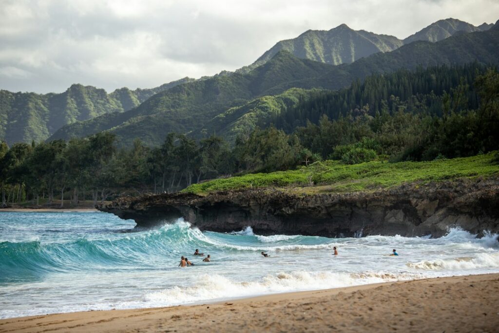
Hawaii ranks among the safer states for violent crime and among the worst for theft from parked cars. That split confuses people researching a move or a first long trip, because the question “is Hawaii safe” gets answered with crime statistics when the actual dangers are mostly environmental. The things that put mainland arrivals in emergency rooms and obituaries are water, weather, and unlocked assumptions about both.
Roughly 30 to 40 people drown in Hawaii waters each year, and visitors account for a disproportionate share of those deaths relative to how few of them are in the islands on any given day. In the same year, thousands of vehicle break-ins get reported on Oahu alone, almost none of them violent. Nobody is likely to be mugged at a trailhead. A daypack left on the back seat is another matter.
This article covers the measurable risks: property crime rates against national averages, where rental-car break-ins cluster and why, drowning and rip-current data, shoreline and lava-rock injuries, flash-flood behavior in narrow valleys, and the specific alert sources worth checking before leaving a rental each morning. It deliberately stays off ground covered by the site’s separate pages on shark bite statistics by island and tsunami preparedness.
What the crime numbers actually say
Hawaii’s violent crime rate runs well under the national figure — roughly 254 incidents per 100,000 residents against about 364 nationally in recent FBI-reported years. The murder rate, near 2.4 per 100,000, is one of the lowest in the country. Aggravated assault and robbery both sit below national levels. For anyone comparing against a mainland metro, Honolulu is a low-violence city of about 350,000 inside a county of roughly one million.
Property crime inverts that picture. Hawaii’s property crime rate lands near 2,400 per 100,000, above the national figure of roughly 1,950, and the gap is almost entirely larceny-theft. That category — bags, electronics, bikes, and above all things taken out of vehicles — is where a visitor’s exposure lives.
| Offense | Hawaii (per 100,000) | US average (per 100,000) | Hawaii vs US |
|---|---|---|---|
| Violent crime, all | 254 | 364 | 30% lower |
| Murder / manslaughter | 2.4 | 5.7 | 58% lower |
| Robbery | 62 | 66 | Comparable |
| Aggravated assault | 130 | 268 | 51% lower |
| Property crime, all | 2,410 | 1,954 | 23% higher |
| Larceny-theft | 1,770 | 1,313 | 35% higher |
| Motor vehicle theft | 380 | 282 | 35% higher |
Why the theft rate is high
Three structural factors drive it. Tourism concentrates hundreds of thousands of unfamiliar people and their valuables into a small number of predictable parking lots. Housing costs push a visible unsheltered population into those same coastal parks. And island geography means a thief faces almost no risk of being chased by an out-of-state victim who flies home on Thursday.
Local reporting from the Honolulu Star-Advertiser and Honolulu Civil Beat tracks these patterns year over year, including periodic enforcement pushes at specific lots. The City and County of Honolulu publishes police district data and Ocean Safety information for Oahu, and Hawaii County does the same for the Big Island.
Neighborhood-level differences
Waikiki generates a large raw number of reports simply because roughly 80,000 people occupy about a square mile of it at peak. Adjusted for that density, it is heavily patrolled and busy past midnight. Chinatown after 10 p.m., stretches of Nimitz Highway, and isolated beach parks on any island’s leeward side account for more of the incidents that actually alarm people.
Rental-car break-ins and the leave-nothing rule
The single most common crime against Hawaii visitors is smash-and-grab theft from a parked vehicle. Oahu police log something on the order of 4,000 unlawful-entry-into-motor-vehicle reports annually, roughly eleven a day, and the true number is higher because many renters never file. Maui, Kauai, and Hawaii Island see the same pattern at lower volume, concentrated in far fewer lots.
The mechanics matter. A window goes in with a spark plug shard or a spring-loaded punch, which breaks tempered glass almost silently. Bags are gone in under two minutes. At trailheads, thieves work on a schedule built around hike durations: a car that arrives at 8 a.m. at a three-hour loop is unattended and predictable.
| Lot type | Typical unattended window | What gets taken | Countermeasure |
|---|---|---|---|
| Trailhead (Manoa Falls, Diamond Head, Waihee Ridge) | 90–240 minutes | Daypacks, laptops, passports | Carry everything; leave car visibly empty |
| Snorkel beach lot (Hanauma, Kahekili, Poipu) | 60–180 minutes | Wallets, phones, camera bags | One key on a wrist coil, nothing else |
| Remote scenic pullout | 10–30 minutes | Anything on a seat | Don’t leave the car at all |
| Hotel self-park garage | 8–14 hours overnight | Golf clubs, luggage, surfboards | Unload fully at check-in |
| Airport return lot | Under 15 minutes | Rarely targeted | Standard care |
The rule, stated plainly
Leave nothing in the vehicle. Not in the trunk, not under a towel, not in the glovebox. Thieves watch lots and see the trunk get loaded. An empty car with an open, obviously bare glovebox is a car that gets skipped, because the next one over might have a backpack on the floor.
- Travel with a waterproof pouch for key, card, and ID.
- Photograph the rental’s existing damage at pickup, including all glass.
- Leave passports and spare cards in the accommodation safe.
- Decline valet-only lots if unloading luggage is impractical.
- File a police report even for small losses; insurers require it.
What it costs when it happens
A broken side window on a rental typically bills out at $250 to $600, and most credit-card collision coverage applies only if the primary auto policy is declined at the counter. Renters comparing Hawaii rental car rates by island and season should price glass coverage into that math, since a single break-in can exceed three days of base rate.
On Oahu specifically, some itineraries work better without a car. Bus coverage across the island and the growing rail line remove the parked-vehicle problem entirely; see the site’s notes on getting around Oahu without a car and Skyline rail stations and park-and-ride lots.
Drowning: the risk that actually kills visitors
Drowning is the leading cause of injury death for visitors to Hawaii, ahead of traffic crashes. Statewide totals run roughly 30 to 40 fatal drownings a year across ocean and inland water. Visitors make up close to half of ocean drownings while representing a far smaller share of the people in the islands at any moment — a rate difference of several times the resident figure.
The state’s Department of Health tracks these cases in detail, including activity at time of incident, age, and whether a lifeguard was present. The consistent findings are unflattering to the “strong swimmer” self-assessment: most victims are men over 45, most were doing something they considered low-exertion, and most were outside guarded water.
| Activity at time of incident | Approx. share of visitor ocean fatalities | Typical mechanism |
|---|---|---|
| Snorkeling | ~45% | Breathing difficulty, cardiac event, unnoticed drift |
| Swimming / wading | ~20% | Rip current, shorebreak, sudden depth |
| Scuba diving | ~12% | Ascent problems, pre-existing conditions |
| Shoreline falls / rock entry | ~8% | Wave sweep off ledge, head injury |
| Surfing / bodyboarding | ~5% | Impact, held under, reef contact |
| Boating / other | ~10% | Mixed |
Why snorkeling dominates
Snorkeling looks passive, which is the trap. A mask that seals poorly, a snorkel that adds breathing resistance, cool water, and mild exertion combine in a way that Hawaii researchers have linked to rapid-onset pulmonary edema — fluid entering the lungs within minutes, with no warning beyond shortness of breath a swimmer may mistake for fatigue.
Practical mitigations are unglamorous: test the mask seal in shallow water first, snorkel with a partner within arm’s reach, never use a full-face mask of unknown quality, and turn back at the first sign of breathing effort. The site’s snorkeling gear checklist covers fit testing, which matters more than brand.
Cold-water shock is a real factor
Hawaii water is warm but not body temperature. Surface readings run about 75°F in late February and March and reach 80°F to 82°F by September and October. A 75°F entry after a 30-minute drive in an air-conditioned car still produces a gasp reflex in some people, and that reflex with a snorkel in the mouth is how water gets inhaled. Seasonal ranges are detailed in the page on ocean temperature in Hawaii.
Rip currents, shorebreak, and guarded versus unguarded shores
Rip currents form where water piled up by breaking waves finds a channel back out. They move seaward, not downward, and can run 1 to 3 feet per second — faster than most people swim. The visible signs are a darker, calmer-looking gap in the surf line, foam or sand streaming offshore, and a break in the wave pattern.
The correct response is counterintuitive enough that it needs rehearsing before entry: stop swimming against it, float, let it carry you 50 to 100 yards past the breakers where it dissipates, then swim parallel to shore and angle back in. The detailed flag-by-flag breakdown lives on the site’s page on rip current awareness and the lifeguard flag system.
Lifeguard coverage is thinner than people assume
Hawaii has several hundred named beaches and roughly 75 to 80 staffed lifeguard towers. Guarded sites see enormous usage and very few fatalities; unguarded sites see the opposite. Choosing water with a tower is the single highest-leverage safety decision a visitor makes, and it usually costs nothing but fifteen minutes of driving.
| Island | Approx. staffed towers | Typical hours | Notable guarded beaches |
|---|---|---|---|
| Oahu | ~42 | 9 a.m.–5:30 p.m. | Waikiki, Ala Moana, Sandy Beach, Waimea Bay |
| Maui | ~12 | 8:30 a.m.–4:30 p.m. | Kamaole I–III, DT Fleming, Hookipa |
| Hawaii Island | ~12 | 9 a.m.–5 p.m. | Hapuna, Spencer, Punaluu, Kahaluu |
| Kauai | ~9 | 9 a.m.–5:15 p.m. | Poipu, Lydgate, Hanalei, Salt Pond |
Seasonal swell flips by shore
North and west-facing shores take North Pacific swell from roughly October through April, with faces of 10 to 20 feet or more on big days. South shores get their energy from May through September, generally smaller at 2 to 8 feet. A beach that is a wading pool in July can be lethal in January, and nothing about the parking lot signals the difference.
Shoulder months deserve attention because conditions are transitional and crowds are thinner, meaning fewer bystanders. The site’s overview of October in Hawaii covers that early-season swell arrival alongside the rate and crowd picture.
Shorebreak deserves its own warning
Shorebreak is a wave that breaks directly onto sand in inches of water. Sandy Beach and Makapuu on Oahu produce spinal injuries every year, several dozen serious rescues annually at Sandy alone. The injury mechanism is a body driven head-first into hard sand. Standing with a back to the ocean in knee-deep water is how most of it starts.
Rock entries, ledges, and shoreline injuries
Much of Hawaii’s coast is not sand. It is basalt — sharp, uneven, and often coated in algae that behaves like wet ice. Lacerations from lava rock get infected fast in warm salt water, and a cut that would be trivial in Denver can become a cellulitis clinic visit within 48 hours.
Closed-toe rubber-soled footwear solves most of it. The page on water shoes for lava rock entry explains which shorelines effectively require them, and the broader dressing for Hawaii guide covers what to leave home. Flip-flops are not shoreline footwear.
Ledges, blowholes, and the “rogue wave” myth
Waves arrive in sets, not randomly. A dry-looking ledge may be inside the reach of the largest wave in a set that comes every 12 to 20 minutes. Fatalities at the Halona Blowhole, Queen’s Bath on Kauai, and the Nakalele Point area on Maui follow the same script: people stand where the rock is wet and get swept.
- Watch any unfamiliar shoreline for a full 15 minutes before approaching.
- Treat every wet rock surface as inside the wave zone.
- Never turn away from the water on a ledge.
- Assume no cell coverage and no rescue access at remote points.
Some of the most photographed shorelines are also the most awkward underfoot. The volcanic and olivine beaches described in the piece on black, green, and red sand shores combine coarse footing, strong currents, and long walks back to a car.
Flash floods in narrow valleys
Hawaii’s flood risk is a function of terrain, not total rainfall. Windward ridges can take 2 to 4 inches of rain an hour while a valley floor two miles away stays sunny. That water funnels into steep, narrow streambeds with almost no absorption, and stream levels can rise several feet in 10 to 15 minutes.
This is why permanent warning signs stand at Hanakapiai on Kauai, in Iao Valley on Maui, and along Manoa and Waimea streams on Oahu. Hikers are caught not by rain overhead but by rain they cannot see, upstream and uphill.
Reading the warning signs
- Water turning brown or carrying leaves and branches.
- A rumbling sound upstream, distinct from the waterfall.
- Water temperature dropping noticeably.
- Rising water level against a fixed rock.
- Dark buildup over ridgelines even in local sun.
The response is immediate: leave the streambed and climb, sideways and up, not downstream toward the trailhead. Waiting out a flood surge on high ground typically means 1 to 3 hours. Trying to cross a knee-deep, fast-moving stream is how people are swept into culverts and over falls.
Valley trails to treat with extra caution
| Trail / area | Island | Stream crossings | Specific hazard |
|---|---|---|---|
| Kalalau / Hanakapiai | Kauai | 2–4 major | Signed drowning fatalities; 11-mile commitment |
| Manoa Falls | Oahu | Multiple minor | Rockfall, 1.6-mile mud, urban flash flood |
| Iao Valley | Maui | 1 major | Rapid stream rise, 2018 flood closures |
| Waimea Valley area | Oahu | 1 major | Upstream rain unseen from the valley floor |
| Pololu / Waipio | Hawaii Island | 1–2 | Steep descent, high surf at the stream mouth |
Roads, trails, and everything inland
Hawaii records roughly 90 to 120 traffic fatalities a year statewide, a per-capita figure near the national middle. The risk profile differs from mainland driving: fewer freeway miles, more single-lane bridges, blind curves, and pedestrians. The Hana Highway alone includes about 620 curves and 59 bridges across 52 miles, which is a two-and-a-half-hour drive, not a one-hour one.
Road conditions, closures, and bridge work are published by the Hawaii Department of Transportation. Fuel costs are a separate planning input — Hawaii pump prices consistently run well above the national average, tracked in the EIA weekly gasoline series.
Trail hazards that are not falls
Hawaii’s hiking injuries skew toward dehydration, heat, and getting benighted. Sunset arrives around 6 p.m. in December and near 7:15 p.m. in June, and tropical darkness is fast. Rescues on Oahu’s Koolau ridges frequently involve hikers who started at 3 p.m. with one bottle of water and a phone at 20 percent.
- Carry at least 2 liters of water per person for any ridge hike.
- Turn around by 3 p.m. unless carrying a headlamp.
- Stay on the trail; social paths on clay collapse.
- Check for leptospirosis advisories before entering fresh water.
- Skip closed trails — citations run several hundred dollars.
Air quality on Hawaii Island
Volcanic emissions produce vog, a haze of sulfur dioxide and fine particulate that drifts leeward and can reach Kona and Oahu during certain wind patterns. It aggravates asthma and heart conditions rather than posing an acute hazard to healthy adults. Current readings come from the state’s air quality monitoring network, worth checking by anyone with respiratory issues who is considering the Volcano Village area for relocation.
Alert sources worth checking every morning
Almost every serious incident described above was forecast. High surf advisories, flash flood watches, and beach hazard statements are issued hours ahead by the National Weather Service Honolulu office, and Hawaii Beach Safety aggregates lifeguard-reported conditions beach by beach. Five minutes with coffee replaces most of what guidebooks cannot tell anyone in advance.
| Source | Covers | Update cadence | When to check |
|---|---|---|---|
| NWS Honolulu forecasts and advisories | Surf, flood, wind, fire weather | Several times daily | Every morning, 7–8 a.m. |
| Hawaii Beach Safety | Per-beach hazards, tower status | Daily, lifeguard-reported | Before choosing a beach |
| State air quality network | SO₂, PM2.5 by station | Hourly | Hawaii Island and vog days |
| HDOT road reports | Closures, rockfall, bridge work | As needed | Before any long drive |
| Outdoor siren test | Warning system readiness | First working day, 11:45 a.m. | Know the date to avoid alarm |
General visitor-facing safety messaging is published by the state tourism authority at gohawaii.com, and local broadcast coverage from Hawaii News Now carries same-day rescue and closure news that forecast pages do not.
A gear card that reduces most of this risk
The equipment list for staying safe in Hawaii is short and cheap relative to airfare. Nothing here is specialist; the point is that each item removes a specific, documented failure mode rather than adding general preparedness.
| Item | Typical cost | Failure mode it removes |
|---|---|---|
| Water shoes, closed-toe rubber sole | $25–$50 | Lava rock lacerations, urchin spines, slips |
| 5–10L dry bag | $15–$30 | Phone loss; keeps ID out of the car |
| Floating key coil | $8–$12 | Lost rental key ($300+ replacement) |
| Rash guard, UPF 50 | $30–$60 | Reef abrasion and sunburn on long snorkels |
| Headlamp, 200+ lumens | $20–$40 | Benighted descents after 6 p.m. |
| 2L reservoir or bottles | $20–$45 | Heat exhaustion on leeward trails |
| Reef-safe mineral sunscreen | $12–$25 | Burn; complies with state sunscreen law |
Putting the risk in proportion
Millions of people visit Hawaii each year and the overwhelming majority come home with nothing worse than a sunburn. The statistical picture from census data on Hawaii and state health reporting describes a place with low violence, high theft-of-opportunity, and a set of natural hazards that punish unfamiliarity specifically.
Long-term movers face a different version of the same question. Property crime becomes a household concern rather than a rental-car one, and cost pressure shows up in the Honolulu consumer price index and in insurance premiums. Tax and ownership mechanics — including the withholding described in the page on HARPTA for non-resident sellers and the rules in the Honolulu ADU and ohana unit guide — are documented at tax.hawaii.gov.
The practical summary is four habits. Swim where there is a tower. Leave the car empty. Check the surf and flood forecast before deciding the day’s plan. And treat wet rock, brown water, and a snorkel that feels hard to breathe through as stop signals rather than inconveniences.
Frequently asked questions
Is Hawaii safe for tourists?
Hawaii is safe from violent crime by mainland standards, with a violent crime rate near 254 per 100,000 against a national figure around 364. The risks that actually injure visitors are environmental and property-related: drowning, rip currents, flash floods, and theft from parked rental cars at beaches and trailheads.
Do rental cars really get broken into that often?
Vehicle break-ins are the signature property crime on Oahu, where police log roughly 4,000 reports a year — about eleven a day. Thieves work beach and trailhead lots in under two minutes, often while a hiker is still on the trail. An empty, visibly bare car is rarely targeted.
How many people drown in Hawaii each year?
Statewide ocean and inland drownings run roughly 30 to 40 deaths a year, and visitors make up close to half of ocean fatalities despite being a much smaller share of the population on any given day. Snorkeling is the single largest activity category, followed by swimming and scuba.
Which Hawaii beaches have lifeguards?
Roughly 75 to 80 towers operate statewide, concentrated at high-traffic beaches: about 42 on Oahu, a dozen each on Maui and Hawaii Island, and nine on Kauai. Most of Hawaii’s shoreline has no tower at all, which is why guarded water is worth driving fifteen extra minutes to reach.
What should someone do if caught in a rip current?
Rip currents pull seaward, not down. The response is to stop fighting it, float, and let the current carry you past the breaking waves — usually 50 to 100 yards — then swim parallel to shore before angling back in. Waving an arm signals lifeguards. Panic and exhaustion, not the current, cause most deaths.
Are flash floods common on Hawaii hiking trails?
They are common enough that the state posts permanent warning signs in stream valleys. Rain of two inches an hour on a ridge can lift a stream several feet in ten to fifteen minutes, miles downstream, under blue sky. Brown water and floating debris mean leave the streambed immediately and climb.
Is it safe to walk around Waikiki at night?
Waikiki is patrolled heavily and busy until late, and violent incidents against visitors are rare. The realistic problems are aggressive panhandling, bar-related scuffles after midnight, and theft from unattended bags on the beach. Walking on Kalakaua and Kuhio rather than dark side lanes handles most of it.
What is the monthly siren test, and how can it be told from a real alert?
Hawaii tests its outdoor siren network on the first working day of most months at 11:45 a.m., immediately followed by a test tone on radio and television. A steady three-minute tone outside of that window is real and means move to high ground or inland, then find official information.


