Kalahuipua’a sits on the sun-battered lava flats of the South Kohala coast, roughly 25 miles north of Kona International Airport (KOA) and just past mile marker 74 on Queen Ka’ahumanu Highway. The 1.75-mile historic trail loops through a chain of ancient loko i’a — Hawaiian fishponds — that once fed the ruling ali’i of this district long before the Mauna Lani resort footprint existed.
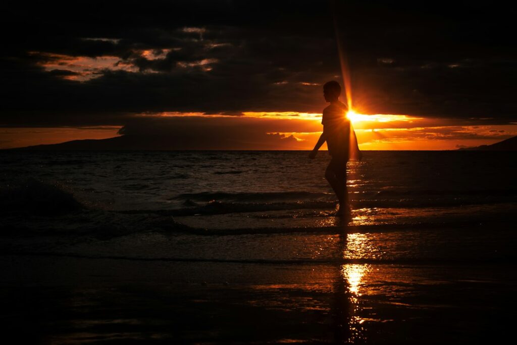
The loop draws relocating households researching quieter cultural walks on the Big Island. It is short, flat, free, and open to the public through resort grounds — with a specific quirk: the last hour of daylight, plus the 25 to 30 minutes of civil twilight after sunset, produces the light on the black pahoehoe and coconut groves that photographers plan trips around.
This guide covers the practical mechanics: where to park without paying, how the trail flows counterclockwise past the Eva Parker Woods cottage, what to know about the anchialine pools, why mosquito coverage matters after 5 p.m., and how to keep the federally mandated 50-foot buffer from any Hawaiian monk seal hauled out on the sand.
Location, Access, and Free Parking at the Fairmont Orchid
The Kalahuipua’a Historic Trail sits inside the Mauna Lani resort area, on the lava-flat coastline between the Mauna Lani Auberge and the Fairmont Orchid. The most reliable free public parking is at the Fairmont Orchid, where Hawaii’s shoreline access laws require a small allotment of complimentary spaces for non-guests visiting the coast.
Households renting a car from KOA can reach the trailhead in roughly 30 to 40 minutes via Queen Ka’ahumanu Highway. From Waikoloa Village, the drive is under 15 minutes. The Fairmont Orchid entrance is on Mauna Lani Drive, off the highway near mile marker 73. Follow signs for public shoreline access parking rather than the porte-cochère.
The public parking allotment is small — typically 10 to 20 marked stalls — and can fill by 4:30 p.m. on weekends. Arriving between 3:30 and 4:00 p.m. gives a comfortable window to walk the loop and still be near the fishponds during the golden hour. A backup lot exists at the Mauna Lani beach club shoreline access on Pauoa Road.
Rental cars parked in the public spaces do not need a permit. Do not park in guest-only stalls, which are actively enforced by the resort’s security staff. Bring cash for a possible tip if a valet directs you to the shoreline lot; there is no fee for the parking itself.
Driving conditions on Queen Ka’ahumanu Highway can shift quickly during Kona wind events or brush-fire closures. Current alerts and any lane restrictions are posted at the state Department of Transportation portal. General visitor orientation for the Kohala coast, including seasonal event calendars, is aggregated at the Hawaii Visitors and Convention Bureau site.
The 1.75-Mile Loop: Trail Layout and Terrain
The trail forms a loose loop that follows the shoreline south past the fishponds, cuts inland briefly through a kiawe grove, and returns along the coastal path. Total distance is signed at 1.75 miles, though GPS traces often log closer to 2.0 miles once wayside excursions to the cottage and the anchialine pools are added.
Elevation gain is negligible — under 30 feet across the whole loop. The surface alternates between compacted coral, packed dirt, exposed pahoehoe, and short crushed-lava sections. Sections near the Eva Parker Woods cottage are ADA-accessible on smooth boardwalk; other stretches near the shoreline require sturdier soles because of loose lava chunks and roots.
Walking counterclockwise from the Fairmont Orchid trailhead pulls a walker past the smaller fishponds first, then to the cottage, then out to the largest ponds and the coconut grove. This order sets up the best light on the return leg: the sun drops behind Hualalai to the southwest, backlighting the coconut fronds and the black lava walls of the ponds.
Distances Between Key Trail Landmarks
| Segment | Distance (mi) | Walk time | Surface |
|---|---|---|---|
| Fairmont trailhead to first fishpond | 0.20 | 5 min | Boardwalk |
| First fishpond to Eva Parker Woods cottage | 0.35 | 10 min | Packed dirt |
| Cottage to coconut grove overlook | 0.45 | 13 min | Pahoehoe/dirt |
| Coconut grove to Kalahuipua’a Fishpond | 0.30 | 9 min | Coral/dirt |
| Return loop through kiawe | 0.45 | 13 min | Dirt |
| Total loop | 1.75 | 50 min | Mixed |
Loko I’a: How the Ancient Fishponds Worked
Loko i’a are Hawaii’s engineered aquaculture ponds, some dating back more than 800 years. Kalahuipua’a preserves several distinct fishpond types: loko kuapa (walled coastal ponds), loko pu’uone (sand-berm ponds fed by brackish springs), and loko wai (freshwater ponds). The lava walls, called kuapa, still rise 2 to 4 feet above the water line in many places.
The system relied on makaha — sluice gates woven from wood or lashed rock — that admitted small ocean fish but trapped them once they grew too large to swim back through. Awa (milkfish), ‘ama’ama (mullet), and papio (juvenile trevally) were the primary targets. A well-run pond could produce roughly 300 to 500 pounds of fish per acre per year.
Kalahuipua’a’s ponds fed the household of a paramount ali’i in this district for generations. The largest, Kalahuipua’a itself, covers roughly 5 acres. Smaller ponds like Waipuhi, Manoku, and Kahinawao form a chain along the coast. Interpretive signs installed along the trail describe each pond’s Hawaiian name, function, and estimated construction period.
Comparison of Loko I’a Types on the Trail
| Pond type | Water source | Typical size | Example on trail |
|---|---|---|---|
| Loko kuapa | Ocean via sluice | 2–5 acres | Kalahuipua’a |
| Loko pu’uone | Brackish spring behind berm | 0.5–2 acres | Waipuhi |
| Loko wai | Freshwater spring | 0.25–1 acre | Manoku |
| Anchialine pool | Groundwater tidal seep | Under 0.1 acre | Multiple |
Anchialine pools — small coastal pools with no surface connection to the sea but a tidal signature from below — dot the pahoehoe near the shoreline. Kalahuipua’a hosts one of the higher densities on the Kohala coast. Endangered ‘opae ‘ula (Halocaridina rubra) shrimp live in some pools; sunscreen residue and dropped debris kill them, so keep hands and feet out.
Restoration work at Kalahuipua’a has continued in fits and starts since the 1980s. The resort’s cultural staff, working with lineal descendants and academic researchers, periodically dredges silt from key ponds and rebuilds sections of collapsed kuapa. Volunteers occasionally assist during community workdays; the resort posts these opportunities and requires a signed liability waiver on the day.
Compared with the more famous He’eia Fishpond on Oahu — an 88-acre loko kuapa restoration project — Kalahuipua’a’s smaller, chained pond system offers a different reading of the technology. Where He’eia demonstrates scale, Kalahuipua’a demonstrates variety, with each pond type adapted to its specific hydrology within a compact stretch of coast.
Eva Parker Woods Cottage Interpretive Stop
Midway around the loop, the trail passes the Eva Parker Woods cottage — a small green-painted board-and-batten structure that once served as a beach retreat for the Parker Ranch family. The building was moved to its current spot in the 1970s and now serves as a small interpretive museum operated by the Mauna Lani resort’s cultural staff.
Inside, docents display fishing implements, koa bowls, black-and-white photographs of the ponds in active use, and a hand-drawn map of the district. Admission is free. Hours vary but the cottage is typically open 11 a.m. to 3 p.m. Wednesday through Sunday. Twilight walkers arriving after 4 p.m. find the cottage closed but the exterior signage still readable.
The cottage is one of only a handful of pre-1920 wooden structures on the Kohala coast. Its shaded lanai is a natural pause point on the loop, roughly halfway around by distance. Water dispensers and restrooms are available at the adjacent resort service building — the only reliable water on the trail itself.
Kalahuipua’a’s Place in South Kohala History
The district of Kalahuipua’a has been continuously inhabited for at least 1,000 years. It served as a coastal food-production hub for ali’i whose upland residences sat higher on the slopes of Kohala. Trails linked the fishpond complex to salt-making beds, taro terraces, and ceremonial platforms, forming an integrated ahupua’a — the traditional Hawaiian land-and-sea management unit.
Written documentation from the 19th century records visits by Hawaiian monarchs to fish, rest, and hold council here. The Parker Ranch acquired substantial holdings in the area in the late 1800s, and the Eva Parker Woods cottage dates to that era. The Mauna Lani resort footprint was developed on former ranch land beginning in the 1970s under conservation-oriented easements that preserved the fishpond trail.
Petroglyph-Adjacent Twilight Segment and Timing
The Kalahuipua’a loop does not pass through the massive Puako petroglyph field itself — that separate site sits about 2.5 miles north near the Holoholokai Beach Park trailhead. But the ponds’ northern segment sits close enough that many walkers pair the two: park at Kalahuipua’a for the fishponds, then drive five minutes up Pauoa Road to the Puako petroglyphs before returning.
The petroglyph field contains more than 3,000 carvings — one of the densest concentrations in Hawaii. It is more exposed and less shaded than Kalahuipua’a, so most researchers recommend visiting Puako first (mid-afternoon) and finishing at the fishponds for twilight. Households curious about parallel sacred sites on other islands should compare with the interpretive circuit at Poliahu Heiau above Wailua on Kauai.
Twilight on the Kohala coast is short. Civil twilight — the window when petroglyphs remain legible and photographers get pastel skies — lasts roughly 25 to 30 minutes after sunset at this latitude. In June sunset falls near 7:15 p.m., in December closer to 5:45 p.m. Plan to be back at the Fairmont parking area within 40 minutes of sundown, before the pahoehoe darkens.
Twilight Windows Through the Year
| Month | Sunset (approx.) | End civil twilight | Recommended start |
|---|---|---|---|
| January | 6:00 p.m. | 6:25 p.m. | 4:45 p.m. |
| April | 6:45 p.m. | 7:08 p.m. | 5:30 p.m. |
| June | 7:15 p.m. | 7:42 p.m. | 6:00 p.m. |
| September | 6:35 p.m. | 6:57 p.m. | 5:20 p.m. |
| December | 5:45 p.m. | 6:10 p.m. | 4:30 p.m. |
Mosquito Repellent and Insect Load
Kalahuipua’a’s freshwater pools, brackish anchialine pockets, and coconut litter combine into ideal mosquito breeding habitat, particularly during the wetter months of October through April. Insect activity rises sharply from about 45 minutes before sunset. Anyone on the trail during the twilight photography window without repellent will experience heavy bites on ankles, wrists, and the back of the neck.
The Hawaii Department of Health recommends EPA-registered repellents containing 20 to 30 percent DEET, 20 percent picaridin, or oil of lemon eucalyptus for adults. Apply before leaving the car — the parking lot alone can host mosquitoes near landscaped hedges. Reapply after 90 minutes on longer paired outings that include the petroglyph field. State health guidance is posted at health.hawaii.gov.
Long sleeves in a light fabric help more than shorts plus heavier repellent. Kohala afternoons hover between 78°F and 85°F year-round, so a UPF-rated long-sleeve sun shirt covers both the sun and insect problems in one layer. Closed-toe shoes protect ankles and prevent minor cuts from loose pahoehoe fragments along the trail.
Mosquito coils and citronella candles are prohibited on the trail because open flames near dry coastal grass are a wildfire risk. Battery-powered clip-on repellent fans work but are not a full substitute for topical repellent in the twilight window. Households traveling with infants should reconsider the after-sunset segment or turn back before insect activity peaks.
Hawaiian Monk Seal Buffer and Wildlife Etiquette
Hawaiian monk seals (Neomonachus schauinslandi) haul out on the small pocket beaches and lava benches along the Kohala coast to rest. They are one of the most endangered marine mammals in the world — fewer than 1,600 remain in the wild. The federal Marine Mammal Protection Act sets a 50-foot minimum buffer; NOAA recommends 150 feet where beach geometry allows.
If a seal is on the sand near the trail, do not approach, photograph with a flash, or attempt to redirect it into the water. Volunteers from the Hawaii Marine Animal Response network sometimes rope off a resting area with yellow signs. Cross behind those signs. Violations carry federal penalties up to $50,000 and one year in prison under the MMPA.
Green sea turtles (honu) also bask on nearby beaches. State guidance sets a 10-foot buffer for honu, and the same no-touch rule applies. Report sightings that appear injured or entangled to the NOAA hotline at 1-888-256-9840, which is answered around the clock. The trail passes several likely haul-out spots, so leash small children through the coastal segments.
Wildlife Buffer Distances at a Glance
| Species | Minimum buffer | Recommended buffer | Report to |
|---|---|---|---|
| Hawaiian monk seal | 50 ft | 150 ft | NOAA 1-888-256-9840 |
| Green sea turtle (honu) | 10 ft | 20 ft | NOAA 1-888-256-9840 |
| Spinner dolphin (offshore) | 50 yd | 50 yd | NOAA 1-888-256-9840 |
| Humpback whale (in season) | 100 yd | 100 yd | NOAA 1-888-256-9840 |
What to Bring and Wear
Kalahuipua’a’s easy grade lulls some walkers into arriving underprepared. The trail sits at sea level on exposed lava, and the mid-afternoon UV index in Kohala routinely hits 11+ from March through October. Sun exposure, dehydration, and the twilight mosquito load are the three main discomforts to plan against. None require expensive gear.
A 1 to 1.5 liter water bottle per person covers the loop and any petroglyph field add-on. Refill stations exist at the Fairmont Orchid public restroom near the parking area but nowhere else on the trail. Reef-safe sunscreen is required under Hawaii state law (Act 104, 2018), which bans oxybenzone and octinoxate for sale statewide.
Recommended Pack List
- 1 to 1.5 liter water bottle per adult, refilled at trailhead
- Reef-safe SPF 30+ sunscreen (mineral zinc oxide preferred)
- DEET 25 to 30 percent or picaridin 20 percent repellent
- Wide-brim hat and polarized sunglasses for glare
- UPF-rated long-sleeve sun shirt in a light color
- Closed-toe walking shoes with a lugged sole
- Small headlamp for the return leg after sunset
- Phone with offline map downloaded before arrival
- Cash or card for the Fairmont cafe post-walk
Fitting Kalahuipua’a Into a Kohala Coast Itinerary
The 50-minute loop pairs naturally with several nearby Big Island activities. Households on a single-day Kohala circuit often stack Kalahuipua’a between a morning at Hapuna Beach and a sunset dinner at one of the resort restaurants. Longer stays add the Puako petroglyphs, Lapakahi State Historical Park to the north, or a drive up to the Onizuka acclimation stop before Mauna Kea’s summit.
For families with waning attention spans, the shorter interpretive walks at Kalahuipua’a work better than more demanding routes such as the crater floor loop described in the Kilauea Iki crater floor walk grade breakdown. The elevation, distance, and heat load are all substantially lower here than in Volcanoes National Park.
Travelers based on the wet Hilo side may find it a long day trip — the drive from Hilo to Mauna Lani runs 90 to 105 minutes via Saddle Road, or two hours plus via the Hamakua Coast. Households already touring waterfalls on the windward side often pair Kalahuipua’a with an overnight in Waimea rather than a same-day return, especially if they also stopped at the Akaka Falls overlook loop.
Other cultural and food stops that fit the same “concentrated interpretive walk plus meal” template include the Hulihee Palace docent circuit in Kailua-Kona for a rainy-day indoor pairing, and the Hilo Farmers Market on the vendor-heavy Wednesday rotation for a windward morning before crossing back to Kohala.
Timing Comparison with Other Short Cultural Walks
| Site | Loop distance | Elevation gain | Typical time | Best light |
|---|---|---|---|---|
| Kalahuipua’a fishponds | 1.75 mi | ~30 ft | 50 min | 60 min pre-sunset |
| Puako petroglyphs | 1.4 mi | ~40 ft | 40 min | Late morning |
| Mahaulepu heritage trail | 4.0 mi | ~120 ft | 110 min | Sunrise |
| Diamond Head crater | 1.6 mi | 560 ft | 75 min | Pre-dawn |
| Akaka Falls loop | 0.4 mi | ~100 ft | 20 min | Mid-morning |
The Kauai analog for a coastal cultural walk is described in the Mahaulepu heritage coastal walk length breakdown, which is longer and less shaded than Kalahuipua’a. Oahu’s closest counterpart in duration is the summit push mapped in the Diamond Head crater predawn ascent guide, though its 560-foot climb makes it a very different physical outing.
Post-Walk Amenities Within the Mauna Lani Complex
The Fairmont Orchid, Mauna Lani Auberge, and the shopping center at Mauna Lani each offer post-walk options. Casual snacks and cold drinks are available at the Fairmont’s poolside cafe, typically open until 6 p.m. Sit-down dinner reservations at either resort’s main restaurants can start at $60 to $120 per person before beverages.
The Mauna Lani shopping center — a five-minute drive from the trailhead — hosts a small grocery, a coffee shop, and several counter-service restaurants at more moderate prices. A poke bowl or plate lunch typically runs $16 to $22. Bathroom access here is easier than at the trailhead after resort restaurants close.
Fuel prices at the Waikoloa Village station five miles inland tend to run 30 to 50 cents per gallon below the resort-adjacent stations. Current Hawaii gasoline averages are published at the EIA petroleum data portal. Filling up before returning south to Kona saves noticeably on longer stays.
Safety, Etiquette, and Cultural Respect
Kalahuipua’a is a working cultural site as much as a walking trail. The rock walls of the loko i’a are structural, historic, and sacred; walking on top of a kuapa, moving rocks, or sitting on a wall can all cause damage that takes years to repair. Interpretive signage repeats the same guidance: stay on the marked trail, look but do not touch.
Do not fish, swim, or wade in the ponds — they are a protected cultural resource, and freshwater lens ecology is fragile. Drone use is prohibited over the resort property and shoreline without a permit. Dogs must be leashed at 6 feet or shorter under Hawaii County code; some sections of the trail post no-dog zones near active anchialine pools.
Ocean currents and shorebreak are strong along the outer beaches; the interior pond water is not for swimming. Slipping on wet lava causes most of the trail’s minor injuries — the black basalt looks textured but is glassy where sea spray coats it. Small children should be within arm’s reach on the coastal segments, especially near the sluice gates.
Cultural Do’s and Don’ts
- Do walk quietly through the pond areas; voices carry across water
- Do stop and read the interpretive signs; they were vetted by lineal descendants
- Do stay on the marked trail even for photography
- Don’t touch, move, or stack lava rocks anywhere on the trail
- Don’t feed fish or seabirds along the ponds
- Don’t approach or photograph monk seals within 50 feet
- Don’t fly drones without an FAA-compliant resort permit
Households researching similar site protocols on other islands can compare with the practical restrictions documented in the Volcano Winery interpretive tasting flight guide, which sits adjacent to Hawaii Volcanoes National Park boundaries and applies parallel cultural sensitivities.
Weather, Sun, and Seasonal Considerations
South Kohala is one of the driest coasts in the state, averaging under 10 inches of rain per year — a stark contrast to Hilo’s 130+ inches. That climate makes the trail walkable in nearly every month. The main seasonal variables are humidity, mosquito load, and the exact sunset time that anchors the twilight photography window.
Summer (June through September) brings the longest usable light, the warmest water in the anchialine pools, and the peak mosquito load. Winter (November through February) offers the shortest afternoons and the highest chance of a brief kona rain shower, but far fewer bugs. Whale season runs roughly December through April, so offshore spouts are visible from several trail vantage points.
Vog (volcanic smog) from Kilauea can drift up the coast during south wind episodes, reducing visibility and irritating asthma sufferers. Current air quality readings for South Kohala are published at the state’s air quality monitoring portal. Days when the index climbs above 100 warrant rescheduling if any walker in the group has reactive airways.
Cost of living context for households researching a Big Island relocation shows up on the drive in — resort landscaping and gas prices at the Waikoloa Village station both signal Kohala’s premium. Current Hawaii electricity and cost-of-living figures are tracked at the EIA state profile and the BLS Honolulu CPI release.
Frequently asked questions
Is the Kalahuipua’a Historic Trail free?
Yes. The trail, parking at the designated Fairmont Orchid public shoreline stalls, and admission to the Eva Parker Woods cottage during its open hours are all free of charge. There is no reservation system. Small tips for valet directions are optional. Food and drink at resort restaurants after the walk are separately priced and can be substantial.
How long does the 1.75-mile loop take to walk?
A steady walker completes the loop in about 45 to 55 minutes. Adding the Eva Parker Woods cottage stop, anchialine pool observation points, and a slower interpretive pace pushes total time to 75 to 90 minutes. Photographers targeting the twilight light window often plan for two hours total on the ground, including the return drive out.
Where do you park for free at Mauna Lani?
The Fairmont Orchid maintains a small allotment of complimentary public parking stalls at the shoreline access lot, as required by Hawaii’s beach access laws. Follow signs marked “public shoreline access” once inside the resort’s Mauna Lani Drive entrance. Backup parking exists at the Mauna Lani beach club shoreline lot on Pauoa Road, also free but often full.
Are the fishponds still stocked with fish?
Some ponds are actively restored by the resort’s cultural stewardship team and hold awa (milkfish) and ‘ama’ama (mullet) populations. Others are more ornamental. Fishing is prohibited across the entire site. Visitors sometimes spot small silver flashes near the sluice gates, especially at dawn and dusk, but the ponds are managed for cultural preservation rather than harvest.
Can you swim in the fishponds or anchialine pools?
No. Swimming, wading, and touching the water in any pond or anchialine pool are prohibited. The anchialine pools host endangered ‘opae ‘ula shrimp, which are killed by sunscreen residue and body oils. The larger fishponds are cultural resources with fragile masonry. Ocean swimming is permitted on the adjacent beaches only, subject to posted surf and current warnings.
Is the trail safe after dark?
The trail is not lit, and the resort does not staff it after sunset. A short segment during civil twilight — roughly 25 to 30 minutes after sundown — is generally safe with a headlamp. Full darkness brings tripping hazards on the loose pahoehoe and elevated mosquito activity. Most walkers finish the loop and reach the parking lot within 40 minutes of sunset.
What happens if a monk seal is on the trail?
Stop, back up, and take an alternate route around the animal while maintaining at least 50 feet of distance. If a volunteer has cordoned off the area, cross behind the yellow signs. Do not photograph with flash, do not attempt to redirect the seal into the water, and do not allow children or dogs to approach. Report the sighting to NOAA at 1-888-256-9840.
How does Kalahuipua’a compare with other cultural walks in Hawaii?
It sits at the shorter, flatter end of the spectrum. The 1.75-mile loop with under 30 feet of elevation gain is easier than Diamond Head’s summit, shorter than the Mahaulepu coastal walk, and more accessible than most heiau circuits. Its density of interpretive stops per mile is unusually high, which makes it a strong pick for households prioritizing content over cardio.


