Molokai’s western coast holds a shoreline that most Hawaii visitors never step onto. Papohaku Beach runs nearly three miles along the leeward Kaluakoi shore, an open sweep of coarse gold sand facing directly into Pacific swell. The island itself carries a population near 7,400, and its west end is quieter still — a stretch that reads less like a beach park and more like a wide, empty coastline pointed at the setting sun.
The practical question for mainland households researching a Hawaii move is how to actually see Papohaku without staying overnight. The answer runs through Honolulu, either on Mokulele Airlines or Southwest, into Hoolehua Airport (MKK), through a small rental counter, and west on Kaluakoi Road for roughly twenty minutes. Total ground time on Molokai can fit inside a single afternoon.
This piece frames Papohaku as a day-trip prospect for relocation researchers — an honest read on shorebreak hazards, the shuttered Kaluakoi resort context that keeps the sand uncrowded, sunset geometry, and the flight-plus-rental math. Nothing here assumes a personal visit; it assembles what agencies, airlines, and county sources publish so households can decide whether the round-trip effort pays back.
Why Papohaku matters for relocation research
Households comparing islands often skip Molokai entirely. The airport handles roughly a fifth of Kahului’s traffic on a typical day, and there is no resort district drawing package tourism. That absence is the point. Papohaku shows a version of the leeward Hawaiian coastline that predates the condo build-outs of Kaanapali and Poipu, and it gives a reasonable proxy for what quiet, low-density Hawaii living actually looks like.
For anyone weighing whether to base long-term on a small island, a day on the west end is worth more than a week of guidebook reading. The Papohaku shoreline is also useful as a reference point when comparing beach access, shorebreak rules, and county park facilities against sites like the Sandy Beach shorebreak on Oahu’s Ka Iwi coast or the Kekaha sunset pullout on Kauai’s leeward side.
What the U.S. Census says about the island
Molokai sits in Kalawao and Maui counties. Census QuickFacts put statewide population near 1.44 million, with Maui County at roughly 165,000 residents; Molokai contributes a small slice of that. Median household income on Molokai runs meaningfully below statewide medians, and the private-vehicle share is high because there is no fixed-route public bus that reaches Papohaku.
Flight access — Mokulele or Southwest into MKK
Two commercial options currently reach Hoolehua Airport (IATA code MKK) from Honolulu. Mokulele Airlines flies Cessna Grand Caravan 208s across the Kaiwi Channel on a walk-up-boarding schedule, and Southwest Airlines flies Boeing 737s on a smaller number of daily rotations. Choice between the two is largely about baggage fees, weight limits, and the tolerance a household has for a nine-seat single-engine turboprop versus a mainline jet.
Flight time from HNL to MKK is short — the great-circle distance is about 55 miles, and block time typically sits between 25 and 40 minutes depending on aircraft and winds. That short leg is why the round trip works as a day plan at all. For deeper detail on the Mokulele operation and skyway boarding process, the Molokai Hoolehua Mokulele flights guide covers weight rules and check-in cutoffs.
Baggage math on the two carriers
Baggage economics diverge sharply between the small-plane and mainline products. Southwest still allows two checked bags without a fee on most interisland fares, while Mokulele charges by weight and imposes a per-passenger weight limit that ties into seat balancing. The full breakdown on both is in the piece on interisland flight baggage and fee structure.
| Carrier | Aircraft | Typical HNL–MKK block time | Passenger weight limit | Included checked bags |
|---|---|---|---|---|
| Mokulele Airlines | Cessna 208 Caravan | 28–35 minutes | Combined passenger and bag weighed at check-in | 0 free; per-bag fees apply |
| Southwest Airlines | Boeing 737-800 | 25–30 minutes | Standard mainline rules | 2 free on most fares |
| Hawaiian (historical MKK) | ATR 42/72 | 25–35 minutes | Standard rules | Fee applies on interisland |
Hoolehua Airport (MKK) — what to expect on arrival
MKK is small. The terminal is a single-story building fronted by a covered lanai, and the runway (05/23) is 4,494 feet long, which is why turboprops and 737-700/800 variants can operate there but larger jets cannot. There is one baggage claim area, a lei stand that runs on flight schedules, and a compact rental counter row. Cell coverage on the property is generally usable on the major mainland carriers.
Ground services close early. Rental counters typically wind down before the last scheduled departure, and there is no all-night food inside the terminal. A day-tripper who books a late outbound should verify the counter’s after-hours drop procedure at pickup, not at return. This same “verify at pickup” logic applies to any late-night interisland turn — the Kahului red-eye rental return strategy covers the pattern in detail.
How MKK compares to the other neighbor-island fields
| Airport | Code | Runway length | Rental brands on-site | Distance to west-side sunset spot |
|---|---|---|---|---|
| Hoolehua (Molokai) | MKK | 4,494 ft | Alamo (primary) | ~17 miles to Papohaku |
| Kahului (Maui) | OGG | 6,995 ft | Alamo, Avis, Budget, Enterprise, Hertz, National, Thrifty | ~36 miles to Kaanapali |
| Lihue (Kauai) | LIH | 6,500 ft | Full major set | ~35 miles to Kekaha |
| Kona (Hawaii Island) | KOA | 11,000 ft | Full major set | ~9 miles to Kailua-Kona sunset piers |
Rental car pickup at the airport counter
Alamo runs the primary counter at MKK, and its inventory is thin compared to what a household would find at Kahului or Lihue. Vehicle classes are usually limited to a small SUV, a mid-size sedan, and a compact. Prices vary week to week, but a rough operating range for a same-day pickup during shoulder season sits between $75 and $160 including Hawaii’s rental surcharge and general excise passthrough.
Booking ahead matters more than at larger airports because absolute fleet count is small. On peak summer weekends, the lot has been known to run out of cars entirely. The Hawaii Department of Taxation publishes the state’s 11.25% rental motor vehicle surcharge structure, which stacks on top of the daily rate.
What to check at the counter
- Fuel policy — return full is almost always cheapest here.
- After-hours drop location and whether keys go in a lockbox.
- Whether the vehicle has a full-size spare, not a donut.
- Cell coverage limits on the west end for navigation apps.
- Any beach-access disclaimer about unpaved county roads.
Rental agreements sometimes restrict driving on unpaved roads. The paved run out to Papohaku Beach Park does not trigger this restriction, but the dirt spurs south of Kepuhi do, and a household planning to explore Ilio Point should confirm coverage before turning off pavement.
Driving Kaluakoi Road to Papohaku
The route out of Hoolehua is straightforward: south on Highway 460 briefly, right onto Maunaloa Highway (Route 460 west), then right onto Kaluakoi Road. The full run measures about 17 miles and takes roughly 20 minutes at posted speeds. There are no traffic lights on the leeward run, no gas station between Maunaloa town and the coast, and cell coverage thins out inside the last few miles.
Kaluakoi Road itself is paved but narrow in stretches, with a downhill grade that pulls toward the shoreline. Deer crossings are common — Molokai’s axis deer population is significant enough that the Hawaii Department of Agriculture has documented ongoing management efforts. Sunrise and sunset are the highest-risk hours for wildlife on the roadway.
Fuel planning for the round trip
Gasoline on Molokai runs higher than statewide averages, which are themselves higher than mainland numbers. The EIA weekly gasoline survey tracks Hawaii among its West Coast benchmark states. A day-tripper who picks up the rental with a full tank should be able to complete the round-trip to Papohaku, add a Kaunakakai loop, and return without refueling. Filling up in Kaunakakai before the west run is the safer play.
| Leg | Approx. distance | Approx. drive time | Notes |
|---|---|---|---|
| MKK to Kaunakakai | 7 miles | 12 minutes | Fuel, groceries, restroom stop |
| MKK to Maunaloa town | 10 miles | 15 minutes | Last inland waypoint |
| MKK to Papohaku Beach Park | 17 miles | 20 minutes | Via Kaluakoi Road |
| Papohaku to Kaunakakai for dinner | 24 miles | 35 minutes | Return route east |
The three-mile shoreline and its park facilities
Papohaku Beach Park anchors the south end of the sand. County facilities include restrooms, cold-water outdoor showers, picnic pavilions, and a small parking area shaded by ironwoods. Vehicle access is one small lot; there is no overflow. The sand itself stretches roughly three miles north from the park, ending near Kaiaka Rock, and averages 100 yards wide at low tide, which is unusually broad for a Hawaiian leeward beach.
The park is administered under Maui County. Camping is permitted with a county-issued permit, and rules cap stays at three consecutive nights. The detailed camping brief lives in a companion piece on Papohaku Molokai’s three-mile sand stretch, currents, and camping, which is the right reading for anyone considering an overnight rather than the day-trip framing here.
What the shoreline looks like on the ground
Sand color reads as coarse honey-gold, with grains large enough that they do not track as heavily onto rental upholstery as the finer sand at Waikiki. The dune line rises 15 to 30 feet in places, and vegetation behind the dunes is mostly kiawe and beach naupaka. Ironwoods (Casuarina) form the picnic canopy near the parking lot. There is no reef offshore, which is why the water reads as open ocean rather than a protected lagoon.
Swim hazards and shorebreak reality
Papohaku’s shorebreak is the single most important safety fact for anyone stepping onto the sand. There is no lifeguard tower. The beach faces west into Pacific swell with no offshore reef to break wave energy, which means shorebreak drops steeply onto sand and pulls back with authority. The Hawaii Department of Health and county sources categorize this shoreline as high-risk for drownings and neck injuries, particularly in winter months.
Wave heights vary sharply by season. Summer months (May through September) typically produce 1–3 foot faces on a calm day, still with real shorebreak. Winter months (November through March) commonly bring 6–12 foot Pacific swells that make swimming genuinely dangerous. A day-tripper should treat wading and photography as the default plan, not a swim.
Rip currents and the alongshore pull
- Alongshore currents run parallel to the beach at 1–3 knots.
- Rip cells form near sand bar gaps and are hardest to spot.
- Winter swells produce shorebreak that lands in inches of water.
- There is no lifeguard tower or emergency phone at the park.
- Cell coverage is unreliable for 911 calls at the sand’s north end.
For a household comparing shorebreak dynamics across islands, the Sandy Beach piece linked earlier is a useful side-by-side; Sandy has a lifeguard station and an ambulance-staging pattern that Papohaku does not. The other useful contrast is Kahekili on Maui’s Kaanapali coast, where a fringing reef entirely changes the swim calculus.
Sunset vantage direction and timing
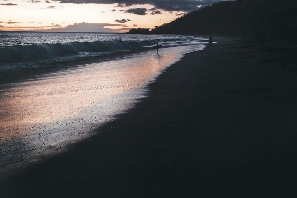
Papohaku faces due west with a slight northwest bias. That geometry puts the sun directly over the water for the entire evening in every month, and it means the shoreline is one of the more reliable sunset prospects in Hawaii. The horizon is uninterrupted; on very clear evenings the shape of Oahu’s east end is visible about 30 miles to the west across the Kaiwi Channel, and Lanai sits to the southwest.
Sunset times shift by roughly 90 minutes across the calendar year. In late June the sun sets near 7:15 p.m.; in late December it drops closer to 5:50 p.m. That range matters for day-trip planning because the last Mokulele departure from MKK does not accommodate a full December sunset in every schedule. May and June are the most forgiving months for a same-day return, as covered in the seasonal read on